
List of products by brand SHOM
There are 95 products.
-
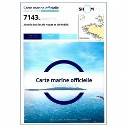
<p>SHOM marine chart 7143 L. Approaches to the islands of Houat and Hoëdic. Scale 1:20000</p>
available

-
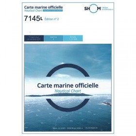
<p>Nautical chart SHOM 7145L. From Triballe to Pornichet. Scale: 1:25000.</p>
available
-
<h2>The SHOM marine chart 7146 L is the marine chart from the Pointe de Penmarc'h to the Pointe de Trévignon.</h2>
<p>Area covered: Le Guilvinec, Bénodet, Loctudy, Port la Forêt, Concarneau, Les Glénan. Scale 1:49,700.</p>
<h2>Characteristics of the SHOM 7146 L chart (folded version)</h2>
available
-
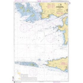
<h2>The SHOM marine chart 7147 L is the marine chart of the Chaussée de Sein to the Pointe de Penmarc'h and the Baie d'Audierne</h2>
<p>Area covered: Raz de Sein, Audierne, Pointe de Penmarc'h. Scale 1:29600.</p>
<h2>Characteristics of the SHOM 7147 L chart (folded version)</h2>
available
-
<h2>The SHOM marine chart 7148-CA is the marine chart from the Goulet de Brest to the Chaussée de Sein.</h2>
<p>Area covered: Le Conquet, Molène, Goulet de Brest, Camaret, Ile de Sein, raz de Sein, Audierne. Scale 1:49,300.</p>
<h2>Characteristics of the SHOM 7148-CA chart :</h2>
available
-
<h2>The SHOM marine chart 7148 L is the marine chart from the Goulet de Brest to the Chaussée de Sein.</h2>
<p>Area covered: Le Conquet, Molène, Goulet de Brest, Camaret, Ile de Sein, raz de Sein, Audierne. Scale 1:49,300.</p>
<h2>Characteristics of the SHOM 7148 L chart (folded version)</h2>
available
-
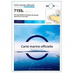
<h2>SHOM chart 7155L from Cap Fréhel to Pointe du Grouin and the approaches to Saint-Malo.</h2>
<p>Scale 1/48800.</p>
<p>Area covered: Cap Fréhel, Saint Cast, Lancieux, Approaches to Saint Malo, Dinard, Entrance to the Rance, Pointe du Grouin.</p>
available
-
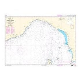
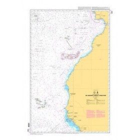
<p>Official SHOM chart - 7211 L - Bay of Biscay - from Brest to Cabo Finisterre.</p>
available
-
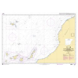
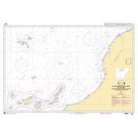
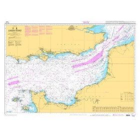
<p>Official SHOM chart - 7212 L - Cape Finisterre to Casablanca - Scale 1: 100000</p>
available
-
<p>Shom marine chart 6821L. Nice to Piombino. Scale: 1:250000.</p>
available
-
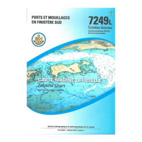
<p>Nautical chart SHOM 7249L. Ports and anchorages in South Finistère. Scale: 1:20000.</p>
available
-
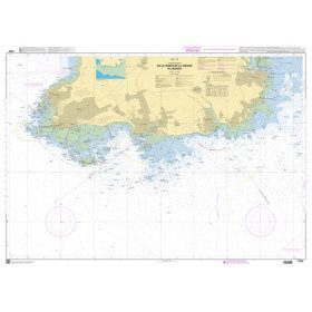
<h2>SHOM Marine Chart 7250 - From Pointe de la Torche to Loctudy</h2>
<ul>
<li>Scale 1:20000</li>
<li>Flat chart</li>
</ul>
available
-
<h2>SHOM Marine Chart 7250L - From Pointe de la Torche to Loctudy</h2>
<ul>
<li>Scale 1:20000</li>
<li>Folded</li>
</ul>
available

-
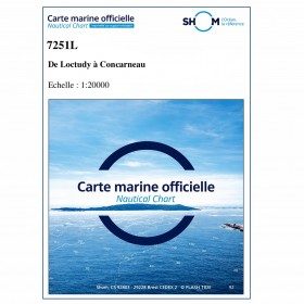
<p>SHOM marine chart 7251 L. From Loctudy to Concarneau. Scale 1:20 00.</p>
available
-
<p style="text-align:justify;">Marine chart shom 7270 for navigations between Casablanca and Cape Jubi, and in the Madeira and Canary Islands area. Ideal for the sailor who wishes to make a transatlantic crossing.</p>
available
-
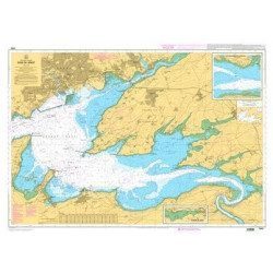
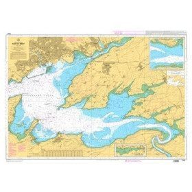
<p>Marine chart for coastal navigation. SHOM 7310 L - Bay of Saint Brieuc (eastern part) - from Dahouët to Cap Fréhel. Scale 1:25000.</p>
available
-
<p style="text-align:justify;">Shom 7311 nautical chart for cruising in the Channel : Scilly, Ouessant, Jersay, Guernsey, everything is there.</p>
available
-
<p style="text-align:justify;">Shom 7312 marine chart for your cruising or racing in the Eastern Channel. From Casquets to Pas-de-Calais. Scale 1:375000</p>
available

-
<p style="text-align:justify;">Shom 7394 marine chart for cruising around Noirmoutier. Scale: 1:50000.</p>
available

-
<h2 style="text-align:justify;">The SHOM 7395 L chart is the folded version of the chart for Le Croisic to Noirmoutier and the Loire Estuary.</h2>
<p style="text-align:justify;">Area covered: Le Croisic, Le Pouliguen, Pornichet, La Baule, Saint Nazaire, Saint Brévin, baie de Bourgneuf, L'Herbaudière. Scale 1:50300.</p>
available
-
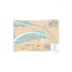
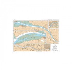
<p style="text-align:justify;">SHOM chart 7396 for navigation up the Loire River from St Nazaire bridge to Nantes. SHOM marine chart type Carte L folded to A4 format or flat, for pleasure boating. Scale: 1 : 20 000 to 1 : 15 000</p>
available
-
<p>Marine chart for coastal navigation. SHOM 7400 L - Rade de Brest - Scale 1:22500</p>
available
-
<p>Marine chart for coastal navigation. SHOM 7401 L - Access to the Rade de Brest - Scale 1:22500</p>
available
-
<p>Marine chart for navigations around the Ile de Ré. SHOM 7404 L - From the Pointe du Grouin du Cou to the Pointe de Chassiron</p>
available
-
<p>Nautical chart for navigations around the Ile de Ré. SHOM 7404 L - From Pointe du Grouin du Cou to Pointe de Chassiron</p>
available
-
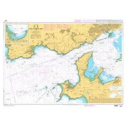
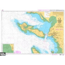
<h2>The SHOM 7406 L chart is the marine chart from Marseille to Toulon.</h2>
<p>Area covered: Marseille South, Cassis, Archipelago of Riou, La Ciotat, Bandol, Toulon. Scale 1/50000.</p>
<h2>Characteristics of the SHOM 7406L chart (folded version)</h2>
available
-
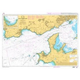
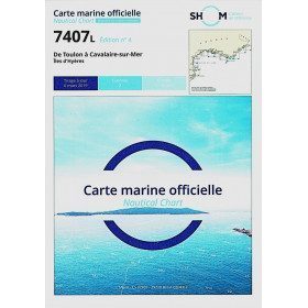
<h2>SHOM chart 7407 L is the nautical chart of Toulon Cavalaire sur Mer</h2>
<p>Area covered: Toulon, Saint Mandrier, Le Pradet, Port Cros, Porquerolles, Hyères, Le Lavandou. Scale 1/50200.</p>
<h2>Characteristics of the map 7407L (folded version) </h2>
available
-
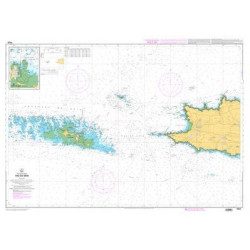
<p>Marine chart for coastal navigation. SHOM 7423L - Raz de Sein - scale 1:20000</p>
available
-
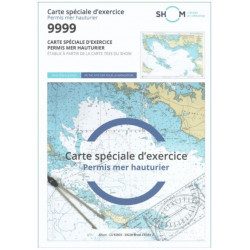
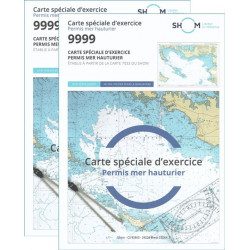
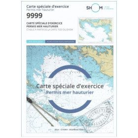
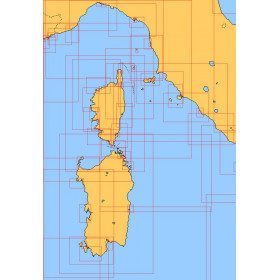
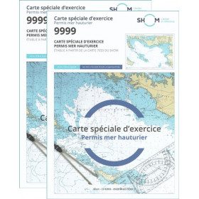
<h2 style="text-align:justify;">SHOM chart 9999 for the french offshore licence exam</h2>
<p style="text-align:justify;">The SHOM chart 9999 is the official chart for the offshore licence examination which allows you to navigate beyond 6 miles from a shelter. The 9999 chart is also used to do all the exercises to prepare for the exam.</p>
<h2 style="text-align:justify;">Training and preparation for the french offshore licence (theory test)</h2>
<p style="text-align:justify;">After passing the coastal licence (and perhaps also the inland waterway licence), you want to extend your navigation area to the "high seas"! To do this, you need to obtain a offshore licence to sail motorboats beyond 6 miles from a shelter (it is also very useful for sailing boats). You can read the article <a href="https://www.picksea.com/en/actualites-et-conseils/post/18-all-knowing-pass-license-holder">"Everything you need to know about the offshore licence"</a>.</p>
<p style="text-align:justify;">The chart 9999 is the official chart to take the offshore licence exam. Of course, this SHOM 9999 chart also allows you to work on all the exercises and mock exams in your school boat or as an independent candidate, to prepare for the tests for the offshore extension of the sea boat licence.</p>
<p style="text-align:justify;">The SHOM 9999 chart is a special marine chart but it contains all the information of a real navigation chart (scale of latitudes and longitudes, coasts, probes, dangers, beacons, lighthouses, currents, ...). You can plot routes and bearings and position points, or measure distances as on a real chart. See the article <a href="https://www.picksea.com/en/actualites-et-conseils/post/49-determine-route-direction-distance">"Determining a route in direction and distance" on our blog</a>.</p>
<p style="text-align:justify;">The SHOM (Services Hydrographique et Océanographique de la Marine) is the public organisation in charge of collecting data (soundings, currents, coastline, ...) and distributing this information, in particular in the form of nautical charts. Find here all our other SHOM charts.</p>
<h2 style="text-align:justify;">Characteristics of the SHOM 9999 Special Offshore Exam Chart</h2>
available
-
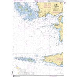
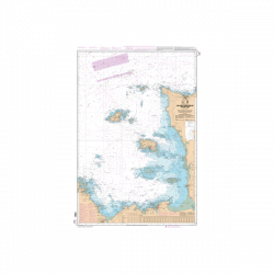
<h2>Marine charts 7126 L de l'Ile Balanec aux Heaux-de-Brehat : </h2>
<p>Scale 1:20 000 - Marine charts, SHOM : 7126L , from Ile Balanec to Heaux-de-Bréhat, and le cours du Jaudy.</p>
<h2>Features of marine charts 7126L : </h2>
available
-
<div class="fiche-txt">
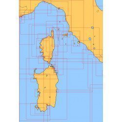
<h2>Choose from the list below a chart covering the Mediterranean</h2>
<p style="text-align:justify;">This set of charts covers all the navigation areas in the Mediterranean, with different scales allowing to cover either a large navigation area or to zoom in on a specific port or area. These Shom Marine charts are available in flat or folded format. The L type charts are more suitable for the yachtsman as they are folded to A4 size, easier to store in a chart table. These charts detail the navigation zones of all the sailing areas around Corsica, Sardinia and Italy. Choose from the list below the area you wish to explore by referring to the map number associated with the desired navigation area. Indicate the map number you have chosen and whether you want to sail folded or flat.</p>
<h2>List of chart references and areas covered</h2>
</div>
available
-
<p style="text-align:justify;">Shom marine chart essential to make a perfect transatlantic by following the great circle.</p>
available

-
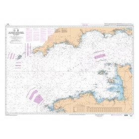
<p style="text-align:justify;">Shom 6624 nautical chart for sailing along the Portuguese and African coasts. Ideal for the sailor who wishes to make a transatlantic crossing.</p>
available
-
<p>Marine chart for coastal navigation. SHOM 6966L - Des Héaux-de-Bréhat au Cap Lévi - Shom paper chart - Scale : 1 : 155508</p>
available
-
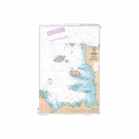
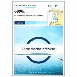
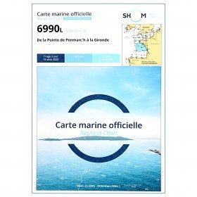
<p style="text-align:justify;">Shom 6990 marine chart for your navigations between Penmarc'h and the Gironde estuary. Scale: 1:355000</p>
available
-
<p style="text-align:justify;">Shom 7076 marine chart for cruising or racing from Saint Nazaire to Saint Malo. Scale: 1:350000</p>
available
-
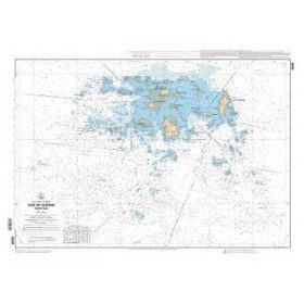
<p>SHOM marine chart 7252L. Les Glénans. Scale 1:20000</p>
available
-
<p style="text-align:justify;">Marine map 7428L for your coasters and your discoveries of the Arcachon basin.</p>
available
-
<p style="text-align:justify;">SHOM 7475L folded nautical chart. Centered on the Caribbean Arc area from Puerto Rico to Trinidad. Scale : 1:1000000</p>
available
-
<p>Shom marine chart 7663. From Barcelona to Cape Cerbere. Scale 1:175000.</p>
available
-
<div class="fiche-txt">
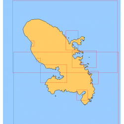
<h2>Choose in the list below a marine map of Martinique's surroundings</h2>
<p>This set of charts covers all the sailing areas of the island of Martinique in Shom marine charts of type L more adapted to the yachtsman because they are folded in A4 format, easier to store in a pleasure chart table. These maps detail precisely the navigation areas of the islands. Choose from the list below the area you wish to explore by referring to the chart number associated with the desired sailing area. Indicate the map number you have chosen in the comments of your order.</p>
<h2>List of chart references and areas covered:</h2>
</div>
available
-
<h2>Pack of 2 official 9999 marine charts from SHOM</h2>
<p style="text-align:justify;"><span>The nautical chart of SHOM 9999 is the official chart of the exam of the <strong>offshore sea permit</strong> which allows to navigate beyond 6 miles from a shelter. It is also on this chart that you will do all the exercises to prepare you for the exam </span></p>
<h2 style="text-align:justify;"><em>Why buy 2 charts?</em></h2>
<p style="text-align:justify;">The fact of doing many exercises on the chart (with a lot of deletion) often makes it unusable for the exam and this is why many exam centers require a new chart for the exam. It should be noted that the organising administration keeps the card as a copy of the exam (except in the case of failure).</p>
<h2>Training and preparation for the offshore licence (theoretical test)</h2>
<p style="text-align:justify;">After passing the coastal licence (and perhaps also the inland waterways licence), you wish to extend your navigation area to the "high seas"! To do this, you need to obtain a deep-sea licence to sail motor yachts beyond 6 miles from a shelter (but it is also very useful for sailing). Read our<a title="Tout savoir pour passer le permis hauturier" href="https://blog.picksea.com/tout-savoir-passer-permis-hauturier/" target="_blank" rel="noreferrer noopener"> article "Everything you need to know about the offshore licence"</a> to find out more.</p>
<p style="text-align:justify;">The chart SHOM 9999 is a special marine chart but it contains all the information of a real navigation chart (scale of latitudes and longitudes, coasts, probes, dangers, beacons, lighthouses, currents, ...). You can plot routes and bearings as well as position points, or measure distances as on a real chart <a title="Déterminer une route sur le carte marine" href="https://blog.picksea.com/determiner-route-direction-distance/" target="_blank" rel="noreferrer noopener">See the article "Determining a route in direction and distance" on our blog </a></p>
<h2 style="text-align:justify;">Characteristics of the Marine Chart 9999 from SHOM for the Offshore Permit</h2>
available
-
<div class="fiche-txt">
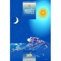
<h2>The tide in detail by SHOM</h2>
<p>This work is dedicated to any yachtsman who is particularly interested in the tide and all that can result from it. A very nice book filled with beautiful photos and landscapes, but also with relevant and quality information.</p>
<h2>General browsing on Picksea.com</h2>
<p>Many books on navigation in general are available on our site, do not hesitate to discover and enjoy them by browsing our categories. Such as the practical guides, the marine guides, or the youth section for your children!</p>
<h2>Features of this book</h2>
</div>
available
-
<div class="fiche-txt">
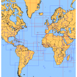
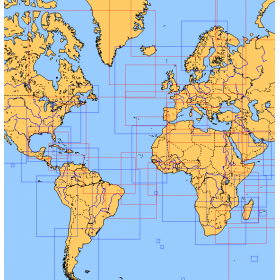
<h2>Choose from the list below an unfolded chart covering the sailing areas around the North and South Atlantic and the Indian Ocean</h2>
<p>These charts detail the sailing areas centered on the North and South Atlantic, the macro sailing areas of North and South America, Western Europe, Western Africa and the Indian Ocean. Delivered unfolded in a transport tube, these charts will serve as a support to trace your journey between continents. Choose from the list below the area you wish to explore by referring to the map number associated with the desired navigation area. Indicate the map number you have chosen in the comments of your order.</p>
<h2>List of chart references and areas covered:</h2>
</div>
available
-
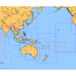
<div class="fiche-txt">
<h2>Choose from the list below an unfolded chart covering the sailing areas around Australia and South East Asia</h2>
<p>These maps detail the sailing areas of Australia, Oceania, and South East Asia. Frequently used as a decorative element or as a support to retrace a journey between continents. Choose from the list below the area you wish to explore by referring to the map number associated with the desired navigation area. Indicate the number of the map you have chosen in the comments of your order.</p>
<h2>List of chart references and areas covered:</h2>
</div>
available
-
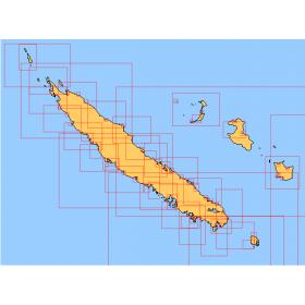
<div class="fiche-txt">
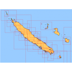
<h2>Choose from the list below an unfolded nautical chart covering the navigation areas around New Caledonia</h2>
<p>This set of charts covers the entire coastline of New Caledonia in unfolded Shom marine charts delivered in a tube. These maps detail precisely the navigation areas of the island. Choose in the list below the area you wish to explore by referring to the chart number associated with the desired navigation area. Indicate the map number you have chosen in the commentary of your order.</p>
<h2>List of chart references and areas covered:</h2>
</div>
available
-
<div class="fiche-txt">
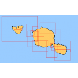
<h2>Choose from the list below an unfolded nautical chart of the sailing areas around Tahiti and the Society Islands</h2>
<p>This set of charts covers the whole of the Society Islands in unfolded Shom marine charts delivered in a tube. These charts detail the exact navigation areas of the islands. Choose from the list below the area you wish to explore by referring to the chart number associated with the desired navigation area. Indicate the map number you have chosen in the comments of your order.</p>
<h2>List of chart references and areas covered:</h2>
</div>
available


Showing 49-95 of 95 item(s)
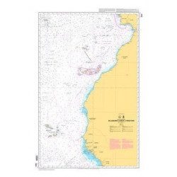
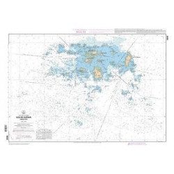
Les cartes SHOM établies par le Service Hydrographique et Océanographique de la Marine.
Les cartes officielles SHOM établies par le Service Hydrographique et Océanographique de la Marine. La référence en matière de cartographie.