

Necessary Documents
On board a pleasure boat, the regulations set out in Division 240 require a number of documents to be carried, which vary according to the distance from a shelter.
WHAT SHOULD YOU HAVE IN ALL CASES?
- The administrative documents concerning the boat: registration card or charter certificate and, if applicable, the rental contract with the special inspection register supplied by the rental company attached.
- For a motorboat: the coastal licence and possibly the offshore licence of the skipper and the persons likely to take the helm
- If the boat is equipped with a VHF: the radio licence and the CRR of the skipper if the boat is to enter international waters
IN THE BASIC ZONE (LESS THAN 2 MILES FROM A SHELTER)
In addition, there must be a method of knowing the tide information (times and height) for the navigation area. This can be found in the Marine Côtier or Plaisance & Réglementation blocks, but the NV-Charts packs also provide tidal information.
IN COASTAL AREAS (LESS THAN 6 MILES FROM A SHELTER), YOU MUST ADD
- The chart(s) of the navigation area: the picksea experts recommend you to have several charts at different scales in order to have an exhaustive information on the dangers, the buoys and the depths.
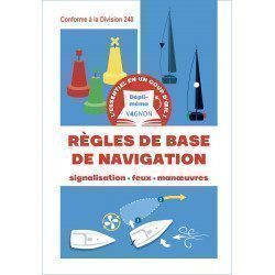
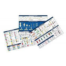
- COLREG (RIPAM): this is the International Regulations for Preventing Collisions at Sea (the marine code). It is possible to have it in its entirety as in the Marine or Yachting & Regulations block, but a summary in the form of a descriptive sheet, possibly self-adhesive, is also compliant.
- It is also possible to have a description of the maritime buoyage in the form of a descriptive sheet, possibly self-adhesive
IN THE SEMI-OFFSHORE AREA, THE FOLLOWING IS ALSO REQUIRED
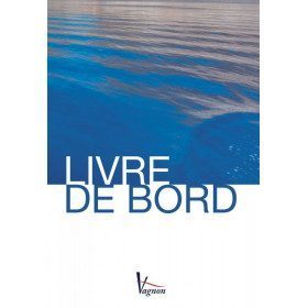
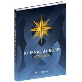
- A logbook, in which all the important information of the navigation will be reported: skipper, passengers, departure, destination, course and route followed, weather and sea conditions as well as all the important events during the navigation. Picksea offers several models from Bloc Marine or Vagnon.
- The light book which details all the lights (rhythm, colour, period...) of a navigation area. It can be found either in a specific SHOM book or in the Bloc Marine Atlantique or Méditerranée.
Read more
There are 30 products.
-
<div class="fiche-txt">
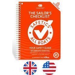
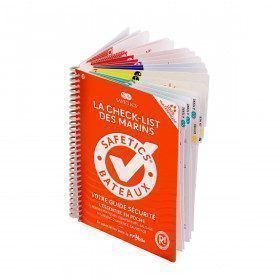
<h2>The Safetics safety guide New version: Sailboats and Motors</h2>
<p><span>All the<strong> good navigation practices</strong> are gathered in this book in the form of clear and easily accessible sheets for everyone. This waterproof guide is i</span><span>It is resistant to sea spray and tears, the guide <strong>SAFETICS</strong> is designed to be used in action and in the moment. It is filled with tips, emergency explanations, help and advice on how to use the<span>memories, of <strong>professional advice. </strong>You will quickly become dependent on this new companion.</span></span></p>
<p>This guide is the result of the work of enthusiasts who decided to create a simple and intuitive memo for pleasure boating. Its content is based on official recommendations, as well as on numerous feedbacks and experts' opinions, including in particular that of <strong>Armel Le Cléac'h </strong>a skipper and professional sailor. It has also been endorsed by the FFVoile, the SNSM, Météo France, the Gendarmerie Maritime, the French Navy and the Centre de Consultation Médicale Maritime. A real Sailor's Checklist for sailing and motor boats.</p>
<h2>Features of the Safetics Sailing Guide: Sailor's Checklist</h2>
</div>
available


-
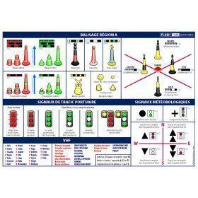
<h2>A5 adhesive marine code Maritime buoyage</h2>
<p style="text-align:justify;"><span>The A5 sticky marine code for ships Buoyage region A (Europe, Africa, Asia, Oceania) displays the essential navigation rules concerning the buoys in maritime navigation. It can replace the compulsory document on Buoyage</span>. <span style="color:#ff0000;"><strong>CONFORMS TO D240</strong></span></p>
<h2><span>Characteristics of the Marine Code Maritime buoyage </span></h2>
<p></p>
available

-
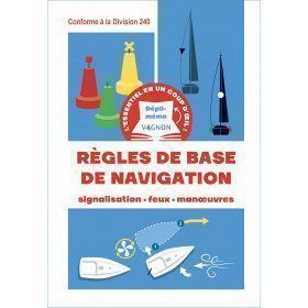
<h2>Adhesive Marine Code A5 Rules of Navigation (RIPAM)</h2>
<p><span>This A5 sticker marine code for ships displays the essential international maritime regulations on the rules of the road and helm in navigation. It can replace the mandatory document (Division 240) on the RIPAM in navigation. </span><span style="color:#ff0000;"><strong>CONFORMS TO D240</strong></span></p>
<h2><span>Features of the RIPAM Marine Code</span></h2>
<p></p>
available

-
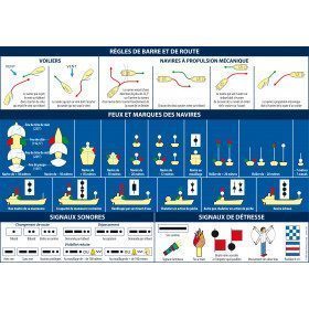
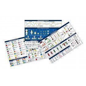
<h2>Code Marin réglementaire bateau : Pack of 3 A5 adhesive sheets</h2>
<p>The regulatory marine code in 3 self-adhesive sheets RIPAM / Buoyage / Flags gathers the essential of the international maritime regulations for pleasure boating. A5 format, easier to put on board. <span style="color:#ff0000;"><strong>CONFORMS TO D240</strong></span></p>
<h2>Characteristics of the Marine Code in a pack of 3 A5 sheets</h2>
available

-
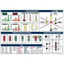
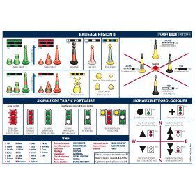
<h2>A5 adhesive marine code Region B</h2>
<p style="text-align:justify;">The A5 sticky marine code for boats in Region B (Americas, Japan, Korea) displays the essential navigation rules concerning the beacons in maritime navigation. It can replace the mandatory document on buoyage. <span style="color:#ff0000;"><strong>CONFORMS TO D240</strong></span></p>
<h2><span>Characteristics of the Marine Code Maritime buoyage Region B</span></h2>
<p></p>
available
-
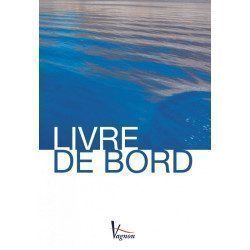
<h2>The indispensable logbook</h2>
<p><span>A practical board book at a low price!</span></p>
<h2>Characteristics of the manual: Vagnon logbook</h2>
available
-
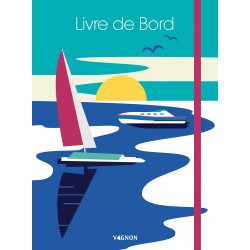
<h2>Logbook to write everything down!</h2>
<p><span>This premium version logbook <strong>Vagnon</strong> includes a cardboard cover with elastic band and a pocket to store your documents. It also contains a textbook, pages of notes and drawings as well as a lot of practical information (useful addresses, signals, rules of the road and helm, VHF, rescue and emergencies, RIPAM, etc.).</span></p>
<h2>Characteristics of the Vagnon logbook premium version</h2>
available
-
<div class="fiche-txt">
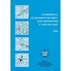
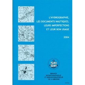
<h2>All the good uses of nautical documents in a dedicated book</h2>
<p>This book will give you a complete overview of hydrography and nautical records with their imperfections and proper use.</p>
<h2>All Shom's regulatory books on Picksea.com</h2>
You can find on our site all the regulatory works of the Shom, such as the International Regulations for Preventing Collisions at Sea 2A and 2B, or the work 3C on maritime signalling.</div>
available
-
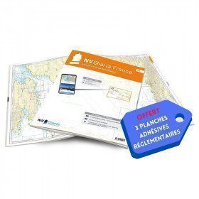
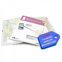
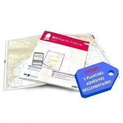
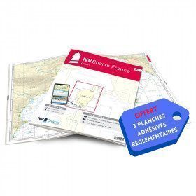
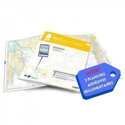
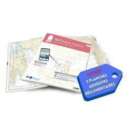
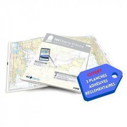
<h2>NV-CHARTS FR6 - 36 charts of South East Brittany (from Lorient to Noirmoutier) + the 3 regulatory adhesive sheets</h2>
<p><span style="font-size:10pt;">In this NV-Charts FR6 pack, you will find an Atlas of <span>36 charts of South Brittany from Lorient to Noirmoutier including 3 offshore charts, 13 coastal charts and 20 detailed charts</span>. With a personal download code, you will have access to all the maps in digital format as well as the <strong>NV Graphical Navigator light navigation software</strong> both freely usable on PC, tablets or smartphone!</span></p>
<p><span style="font-size:10pt;">The areas represented are: <strong>South Brittany - Lorient, Etel, Belle-Île, Baie de Quiberon, La Trinité, Golfe du Morbihan, Vannes, Auray, Houat, Hoedic, La Vilaine, Piriac, La Turballe, Le Croisic, La Baule, Pornichet, Saint Nazaire, Nantes, Pornic, Noirmoutier (FRANCE)</strong></span></p>
<p><strong><span style="font-size:10pt;"><span style="color:#ff0000;">Free with your FR6 pack:</span> 3 adhesive sheets containing the mandatory regulatory documentation (RIPAM, buoys and flags) for navigation in coastal areas (art 242-2.04 of Division 240). <span style="color:#ff0000;">When you buy your pack, you have all the regulatory documentation for sailing within 6 miles of a shelter.</span></span></strong></p>
<h2>Description of the FR6 card pack</h2>
available
-
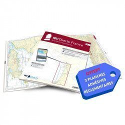
<h2>NV-CHARTS FR4 - 33 West Brittany Marine Charts (from the Seven Islands to Douarnenez) + the 3 regulatory adhesive sheets</h2>
<p><span style="font-size:10pt;">In this pack NV-Charts FR4, you will find an Atlas of 33 nautical charts from the Seven Islands to Douarnenez<span> including 2 offshore maps, 13 coastal maps and 18 detailed maps</span>. With a personal download code, you will have access to all the maps in digital format as well as the <strong>NV Graphical Navigator light navigation software</strong> both freely usable on PC, tablets or smartphone!</span></p>
<p><span style="font-size:10pt;">The areas represented are: <strong>Western Brittany - Roscoff, Morlaix, Ouessant, Molène, Brest, Camaret, Crozon, Morgat, Douarnenez, Sein (FRANCE).</strong></span></p>
<p><span style="font-size:10pt;"><span style="color:#ff0000;"><strong>Free with your FR4 pack:</strong></span> 3 adhesive sheets containing the mandatory regulatory documentation (RIPAM, buoys and flags) for navigation in coastal areas (art 242-2.04 of Division 240). <span style="color:#ff0000;"><strong>When you buy your pack, you have all the regulatory documentation for sailing within 6 miles of a shelter.</strong></span></span></p>
<h2>Description of the FR4 card pack</h2>
available
-
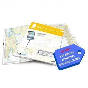
<h2>NV-CHARTS FR3 - 28 North Brittany Nautical Charts (Saint Malo aux Sept Îles) + the 3 regulatory adhesive sheets</h2>
<p><span style="font-size:10pt;">In this pack NV-Charts FR3, you will find an Atlas of 28 marine maps of <span>Saint Malo aux Sept Îles </span>including 3 offshore charts, 10 coastal charts and 15 detailed charts. With a personal download code, you will have access to all the maps in digital format as well as the <strong>NV Graphical Navigator light navigation software</strong> both freely usable on PC, tablets or smartphone!</span></p>
<p><span style="font-size:10pt;">The area represents the Channel (FRANCE), and more precisely the following areas: <strong>North Brittany - Saint Malo, Saint Cast, Baie de Saint Brieuc, Paimpol, Saint Quay, Perros Guirec, Trébeurden.</strong></span></p>
<p><span><span style="font-size:10pt;"><span style="color:#ff0000;"><strong>Free with your FR3 pack:</strong></span> 3 adhesive sheets containing the mandatory regulatory documentation (RIPAM, buoys and flags) for navigation in coastal areas (art 242-2.04 of Division 240). </span><span style="color:#ff0000;"><strong><span style="font-size:10pt;">When you buy your pack, you have all the regulatory documentation for sailing within 6 miles of a shelter</span>.</strong></span></span></p>
<h2>Description of the FR3 card pack</h2>
available
-
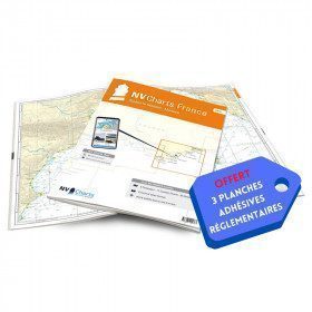
<h2>NV-CHARTS FR7 - 27 Vendée Nautical Charts (from Noirmoutier to La Rochelle) + the 3 statutory adhesive sheets</h2>
<p><span style="font-size:10pt;">In this NV-Charts FR7 pack, you will find an Atlas of <span>27 charts Vendée from Noirmoutier to La Rochelle including 3 offshore charts, 12 coastal charts and 12 detailed charts.</span> With a personal download code, you will have access to all the maps in digital format as well as the <strong>NV Graphical Navigator light navigation software</strong> both freely usable on PC, tablets or smartphone!</span></p>
<p><span style="font-size:10pt;">The areas represented are: <strong>Vendée - Noirmoutier, Ile d'Yeu, Saint Gilles Croix de Vie, Les Sables d'Olonne, Port Bourgenais, Jard sur Mer, Pointe de l'Aiguillon, Ile de Ré, La Rochelle (FRANCE).</strong></span></p>
<p><span style="font-size:10pt;"><span style="color:#ff0000;"><strong>Free with your FR7 pack:</strong></span> 3 adhesive sheets containing the mandatory regulatory documentation (RIPAM, buoys and flags) for navigation in coastal areas (art 242-2.04 of Division 240). <span style="color:#ff0000;"><strong>When you buy your pack, you have all the regulatory documentation for sailing within 6 miles of a shelter.</strong></span></span></p>
<h2>Description of the FR7 card pack</h2>
available
-
<h2>NV-CHARTS FR8 - 33 Aquitaine Marine Charts (from La Rochelle to San Sebastian) + the 3 regulatory adhesive sheets</h2>
<p><span style="font-size:10pt;">In this NV-Charts FR8 pack, you will find an Atlas of <span>33 Aquitaine charts from La Rochelle to San Sebastian including 3 offshore charts, 15 coastal charts and 15 detailed charts</span>. With a personal download code, you will have access to all the maps in digital format as well as the <strong>NV Graphical Navigator light navigation software</strong> both freely usable on PC, tablets or smartphone!</span></p>
<p><span style="font-size:10pt;">The areas represented are: <strong>Aquitaine - La Rochelle, Ré, Oléron, Rochefort, Royan, Gironde, Bordeaux, Arcachon, Bayonne, Biarritz, Saint Jean de Luz, San Sebastian (FRANCE)</strong></span></p>
<p><span style="font-size:10pt;"><span style="color:#ff0000;"><strong>Free with your FR8 pack:</strong> </span>3 adhesive sheets containing the mandatory regulatory documentation (RIPAM, buoys and flags) for navigation in coastal areas (art 242-2.04 of Division 240). <span style="color:#ff0000;"><strong>When you buy your pack, you have all the regulatory documentation for sailing within 6 miles of a shelter.</strong></span></span></p>
<h2>Description of the FR8 card pack</h2>
available
-
<h2>NV-CHARTS FR9 - 70 Mediterranean Sea charts (from Cap Creus to Toulon) + the 3 regulatory adhesive sheets</h2>
<p><span style="font-size:10pt;">In this NV-Charts FR9 pack, you will find an Atlas of <span>70 Mediterranean charts from Cap Creus to Toulon including 3 offshore charts, 14 coastal charts and 53 detailed charts</span>. With a personal download code, you will have access to all the maps in digital format as well as the <strong>NV Graphical Navigator light navigation software</strong> both freely usable on PC, tablets or smartphone!</span></p>
<p><span style="font-size:10pt;">The areas represented are: <strong>Mediterranean - Port Vendres, Leucate, Canet, Port La Nouvelle, Gruissan, Cap d'Agde, Palavas, Port Camargue, La Grande Motte, Martigue, Carry, Marseille, Calanques, Cassis, La Ciotat, Saint Cyr, Bandol, Toulon (FRANCE)</strong></span></p>
<p><span style="font-size:10pt;"><span style="color:#ff0000;"><strong>Free with your FR9 pack:</strong></span> 3 adhesive sheets containing the mandatory regulatory documentation (RIPAM, buoys and flags) for navigation in coastal areas (art 242-2.04 of Division 240). <span style="color:#ff0000;"><strong>When you buy your pack, you have all the regulatory documentation for sailing within 6 miles of a shelter.</strong></span></span></p>
<h2>Description of the FR9 card pack</h2>
available
-
<h2>NV-CHARTS FR10 - 45 Côte d'Azur Nautical Charts (from Toulon to Menton) + the 3 regulatory adhesive boards</h2>
<p><span style="font-size:10pt;">In this NV-Charts FR10 pack, you will find an Atlas of <span>45 Mediterranean Riviera charts from Toulon to Menton and Monaco including 2 offshore charts, 11 coastal charts and 32 detailed charts.</span> With a personal download code, you will have access to all the maps in digital format as well as the <strong>NV Graphical Navigator light navigation software</strong> both freely usable on PC, tablets or smartphone!</span></p>
<p><span style="font-size:10pt;">The areas represented are: <strong>Mediterranean Riviera - Toulon, Hyères, Port Cros, Porquerolles, Fréjus, Saint Raphaël, Cannes, Antibes, Nice, Monaco, Menton (FRANCE).</strong></span></p>
<p><span style="font-size:10pt;"><span style="color:#ff0000;"><strong>Free with your FR10 pack:</strong></span> 3 adhesive sheets containing the mandatory regulatory documentation (RIPAM, buoys and flags) for navigation in coastal areas (art 242-2.04 of Division 240). <span style="color:#ff0000;"><strong>When you buy your pack, you have all the regulatory documentation for sailing within 6 miles of a shelter.</strong></span></span></p>
<h2>Description of the FR10 card pack</h2>
available
-
<h2>NV-CHARTS FR11 - 42 nautical charts of Corsica + the 3 regulatory adhesive boards</h2>
<p><span style="font-size:10pt;">In this NV-Charts FR11 pack, you will find an Atlas of <span>42 nautical charts of the whole of Corsica including 2 deep-sea charts, 19 coastal charts and 21 detailed charts</span>. With a personal download code, you will have access to all the maps in digital format as well as the <strong>NV Graphical Navigator light navigation software</strong> both freely usable on PC, tablets or smartphone!</span></p>
<p><span style="font-size:10pt;">The areas represented are: <strong>Corsica - Ajaccio, Calvi, Ile Rousse, Bastia, Porto Vecchio, Bonifacio, Lavezzi, Propriano (FRANCE)</strong></span></p>
<p><span style="font-size:10pt;"><span style="color:#ff0000;"><strong>Free with your FR11 pack:</strong></span> 3 adhesive sheets containing the mandatory regulatory documentation (RIPAM, buoys and flags) for navigation in coastal areas (art 242-2.04 of Division 240). <span style="color:#ff0000;"><strong>When you buy your pack, you have all the regulatory documentation for sailing within 6 miles of a shelter.</strong></span></span></p>
<h2>Description of the FR11 card pack</h2>
available
-
<h2>NV-CHARTS FR5 - 29 South West Brittany nautical charts (from Douarnenez to Lorient) + the 3 statutory adhesive sheets</h2>
<p><span style="font-size:10pt;">In this NV-Charts FR5 pack, you will find an Atlas of <span>29 charts of South-West Brittany, from Douarnenez to Lorient, including 2 deep-sea charts, 11 coastal charts and 16 detailed charts</span>. With a personal download code, you will have access to all the maps in digital format as well as the <strong>NV Graphical Navigator light navigation software</strong> both freely usable on PC, tablets or smartphone!</span></p>
<p><span style="font-size:10pt;">The areas represented are: <strong>South West Brittany Douarnenez, Sein, Audierne, Guilvinec, Loctudy, Bénodet, Port La Forêt, Concarneau, Les Glénan, Aven Belon, Doëlan, Groix, Lorient(FRANCE).</strong></span></p>
<p><span style="font-size:10pt;"><span style="color:#ff0000;"><strong>Free with your FR5 pack:</strong></span> 3 adhesive sheets containing the mandatory regulatory documentation (RIPAM, buoys and flags) for navigation in coastal areas (art 242-2.04 of Division 240). <span style="color:#ff0000;"><strong>When you buy your pack, you have all the regulatory documentation for sailing within 6 miles of a shelter.</strong></span></span></p>
<h2>Description of the FR5 card pack</h2>
available
-
<h2>NV-CHARTS FR2 - 25 Western Channel Charts (from Cherbourg to St Malo) + the 3 regulatory adhesive sheets</h2>
<p><span style="font-size:10pt;">In this NV-Charts FR2 pack, you will find an atlas of 25 nautical charts from Cherbourg to St Malo, including 2 deep-sea charts, 14 coastal charts and 9 detailed charts. Thanks to a personal download code, you will have access to all the charts in digital format as well as to the <strong>NV Graphical Navigator light navigation software</strong> both freely usable on PC, tablets or smartphone!</span></p>
<p><span style="font-size:10pt;">The area represents the Channel (FRANCE), and more precisely the following areas: <strong>Channel Islands - Cherbourg, Granville, Chausey, Jersey, Guernsey, Cancale, Saint Malo.</strong></span></p>
<p><span style="font-size:10pt;"><span style="color:#ff0000;"><strong>Free with your FR2 pack:</strong></span> 3 adhesive sheets containing the mandatory regulatory documentation (RIPAM, buoys and flags) for navigation in coastal areas (art 242-2.04 of Division 240). <span style="color:#ff0000;"><strong>When you buy your pack, you have all the regulatory documentation for sailing within 6 miles of a shelter.</strong></span></span></p>
<h2>Description of the FR2 card pack</h2>
available
-
<h2>NV-CHARTS FR1 - 48 Channel Charts (Oostende to Cherbourg) + the 3 regulatory adhesive sheets</h2>
<p style="text-align:justify;"><span style="font-size:10pt;">In this NV-Charts FR1 pack, you will find an Atlas of 48 nautical charts from Oostende to Cherbourg including 4 offshore charts, 15 coastal charts and 29 detailed charts. Thanks to a personal download code, you will have access to all the charts in digital format as well as to the <strong>NV Graphical Navigator light navigation software</strong> both freely usable on PC, tablets or smartphone!</span></p>
<p style="text-align:justify;"><span style="font-size:10pt;">The area represents the Channel (FRANCE), and more precisely the following areas: <strong>Normandy - Zeebrugge, Dunkirk, Calais, Le Havre, Cherbourg.</strong></span></p>
<p style="text-align:justify;"><span style="font-size:10pt;"><span style="color:#ff0000;background-color:#ffffff;"><strong>Free with your FR1 pack:</strong></span> 3 adhesive sheets containing the mandatory regulatory documentation (RIPAM, buoys and flags) for navigation in coastal areas (art 242-2.04 of Division 240). <span style="color:#ff0000;"><strong>When you buy your pack, you have all the regulatory documentation for sailing within 6 miles of a shelter.</strong></span></span></p>
<h2>Description of the FR1 card pack</h2>
available
-
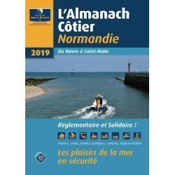
<div class="fiche-txt"><h2>The indispensable tool for the Breton sailor: The Normandy Coastal Almanac 2019</h2><p style="text-align: justify;">A true bible or Swiss Army knife for professional and amateur sailors. The Normandy Coastal Almanac contains all the necessary and indispensable information for the smooth running of your trips in this region. This reference book is very complete since it contains information on many ports <span>of the English Channel as well as meteorological information such as tide times. Much more than a simple navigation guide, this almanac has for main objective to help the families of sailors in need.</span></p><h2>Detailed features of the Normandy coastal almanac</h2></div>
available
-
<div class="fiche-txt">
<h2>The Safetics safety guide english version : Sailboats and Motors</h2>
<p style="text-align:justify;">Safetics® The Sailor’s Checklist is the first English-language navigation guide written in the form of aviation-style check-lists. Recommended by Coast guards and translated and adapted by English skipper Pip Hare, it compiles all major navigation rules as well as procedures validated by sea safety experts. Its universal and practical content has been designed for both skippers and crew members, and is suitable for sailboats and powerboats. Its waterproof and tear proof format allows an unrivalled durability.</p>
<p style="text-align:justify;">This guide is the result of the work of enthusiasts who decided to create a simple and intuitive memo for pleasure boating. Its content is based on official recommendations, as well as on numerous feedbacks and experts' opinions, including in particular that of <strong>Armel Le Cléac'h </strong>a skipper and professional sailor. A real Sailor's Checklist for sailing and motor boats.</p>
<h2>Features of the Safetics Sailing Guide: Sailor's Checklist</h2>
</div>
available
-
<div class="fiche-txt">
<h2>The logbook for your boat!</h2>
<p style="text-align:justify;">Here is the logbook / guestbook of the Bloc Marine brand, a luxury bound edition of 128 pages, printed in four-colour process on high quality paper. This logbook, which is compulsory on board for voyages beyond 6 miles from a shelter, is the essential element for noting and relating all the events of your navigation: safety, weather observations, route information, ship's conduct, positions and technical remarks, life on board. It also contains 12 pages of information and advice on navigation and weather.</p>
<p style="text-align:justify;">Its guest book allows you to keep all the memories of your navigations.</p>
<h2>Characteristic of the logbook of BLOC MARINE:</h2>
</div>
available
-
available
-
<div class="fiche-txt">
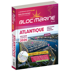
<h2>Indispensable on board your boat: the Atlantic 2025 marine block</h2>
<p style="text-align:justify;">The Atlantic 2024 Marine Block is no longer available. This book contains all the compulsory and regulatory elements on board a boat and offers you access to all the essential documents on board. For this edition, a complete update of the mandatory 2025 regulations has been carried out and you will find <span>in addition </span><span>a special section devoted to new technologies: "electronics - equipment - home automation".</span><span>. </span>Browse the descriptions of the ports and benefit from all the updated approach charts (these are made every year according to the SHOM information). This marine guide allows you to save precious time in order to arrive at the port in complete serenity. A real bible for sailors and yachtsmen, it contains essential information for coastal and deep-sea navigation.</p>
<h2>The marine block for the Atlantic : a navigation area from England to the Azores</h2>
<p style="text-align:justify;">Your marine block allows you to carry all the nautical documents required on board during your navigations. The Atlantic model (new edition 2022) is a great classic of the maritime bookshop and a reference book for sailors. Find our entire collection of coastal and marine pads on our Picksea shop, number one in nautical equipment on the internet.</p>
<h2>Detailed summary of the Atlantic 2025 Marine Block</h2>
</div>
available
-
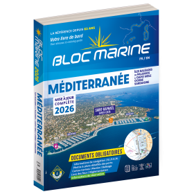
<div class="fiche-txt">
<h2>Indispensable on board : Bloc Marine Méditerranée 2025</h2>
<p style="text-align:justify;">Truly the bible of any sailor, the Mediterranean Marine Block 2025 edition allows you to have all the regulatory documents for the safety of the boat essential on board. A complete update of the mandatory 2025 regulations has been made. In this edition, you will also find <span>a special section devoted to new technologies: "electronics - equipment - home automation".</span>. The descriptions of the ports in WGS84 and the maps are updated every year and allow you to save precious time to reach the port safely. A complete atlas is also included in this Mediterranean 2025 Marine block. The marine and coastal blocks offer a real documentation for your sea excursions. So, find the whole collection of regulatory boat equipment on Picksea, your online shop for marine books.</p>
<h2>Detailed summary of the Mediterranean Sea Block 2025</h2>
</div>
available

-
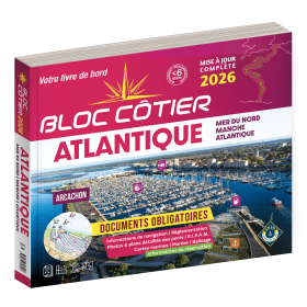
<div class="fiche-txt">
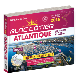
<h2>Indispensable for sailing within 6 miles from a shelter: the Atlantic 2025 Bloc Cotier !</h2>
<p style="text-align:justify;">The Atlantic 2025 bloc cotier is a smaller work than the Marine block, bringing together all the compulsory and regulatory elements on board a boat for coastal sailing, i.e. within 6 miles of a shelter according to the regulations in force. It also offers you access to all the essential documents on board, such as port descriptions and updated maps. With even more photos, the coastal block also includes a complete atlas. The mandatory regulations for 2025 have also been completely updated.</p>
<h2>Detailed summary of the Atlantic Bloc Cotier 2025</h2>
</div>
available
-
<div class="fiche-txt">
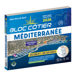
<h2>Indispensable for sailing within 6 miles of a shelter: the Mediterranean 2025 Bloc Cotier</h2>
<p style="text-align:justify;">The Mediterranean 2025 Bloc Cotier is a smaller work than the Marine block, bringing together all the compulsory and regulatory elements on board a boat for coastal sailing, i.e. within 6 miles of a shelter according to the regulations in force. It offers you wider access to all the essential documents on board, such as port descriptions and updated charts. With even more photos, the coastal block also includes a complete atlas. The mandatory 2025 regulations have also been completely updated.</p>
<h2>Detailed summary of the Mediterranean Coastal Block 2025</h2>
</div>
available
-
<div class="fiche-txt">
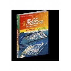
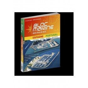
<h2>The essential guide for sailing around Spain and Portugal</h2>
<p>The Spain-Portugal Marine Block is the book to have on board! It allows you to have all the essential and mandatory documents on board your boat. The descriptions of ports and maps are updated every 2 or 3 years and allow you to save precious time to arrive safely and calmly at your destination. In this new edition, which was completely updated in June 2023, the Marine Block docks on the coasts of the Iberian Peninsula: Portugal, Spain, not forgetting the islands with the Balearic Islands, Madeira, the Canaries, the Azores... in total, there are more than 350 ports and as many opportunities for stopovers and cruises in perspective! In addition to general information on regulations, rescue and safety at sea, you will find, for each port, a maximum of information on the installations, the operation and the means of rescue as well as a location map. Several new features are included in this edition: a bilingual French/Spanish book a complete navigation atlas with more than 80 maps detailed plans in WGS84 for almost all the ports hundreds of aerial photos Everything you need to prepare for your navigations with complete peace of mind</p>
</div>
available
-
<div class="fiche-txt">
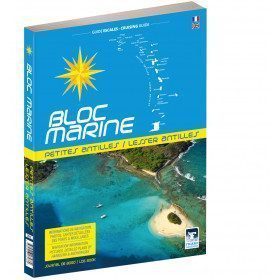
<h2>The Marine Block covering all the West Indies and updated</h2>
<p>The West Indies Marine block is the logbook for long distance cruising which allows you to have all the essential documents on board for a transatlantic navigation and once in the West Indies. The descriptions of the ports and the maps allow you to save precious time in order to discover these navigation areas in complete safety. Written in French and English, this guide covers an area from the Virgin Islands to Trinidad and Tobago.</p>
<h2>Detailed features of the Caribbean Marine Block</h2>
</div>
available

-
<h2>Code Marin réglementaire bateau : Pack of 3 A5 adhesive sheets</h2>
<p>The regulatory marine code in 3 self-adhesive sheets RIPAM / Buoyage / Flags gathers the essential of the international maritime regulations for pleasure boating. A5 format, easier to put on board. <span style="color:#ff0000;"><strong>CONFORMS TO D240</strong></span></p>
<h2>Characteristics of the Marine Code in a pack of 3 A5 sheets</h2>
available


Showing 1-30 of 30 item(s)