

Exam charts
In order to prepare and pass the navigation tests of the professional or recreational examinations, you must use charts specifically identified for this purpose. As a SHOMPicksea offers you the two official charts for the French exams. In both cases, the charts are available in a folded format or in a "flat" format: in this case, they are delivered rolled in a tube
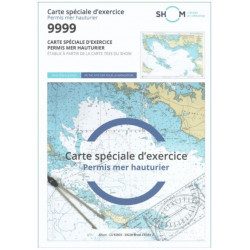
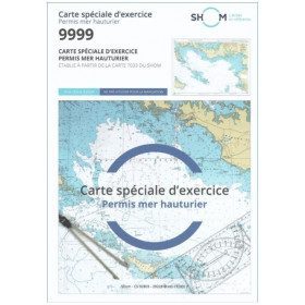
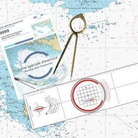
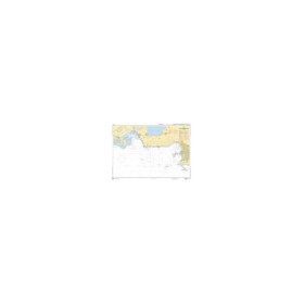
The card SHOM 9999 for the offshore licence
The 9999 card from SHOM is the map used for the examination of the offshore extension of the pleasure boat license (called "offshore license"): it is a map of the Bay of Quiberon at the scale 1/50000 (its "sailing" version is the 7033) which has not been updated since 2003. It is therefore unusable for real navigation and can only be used for exercises and indoor training. This chart is also available in a pack for offshore navigation with the essential tools to prepare the exam.
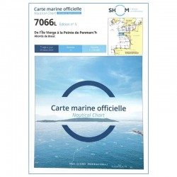
The chart SHOM 7066 for professional maritime exams
The chart 7066 from SHOM is a real navigation chart updated for the tip of Brittany which is used as a support for all professional navigation examinations for merchant navy certificates and diplomas: Captain 200, Chief Mate 500, Captain 3000 or unlimited, etc ...
HOW TO READ YOUR CHART
As you can see, the marine chart provides you with a lot of useful information to avoid the inherent risks during your boat trip. But to do this, you need to know how to read and use your nautical chart! It is true that reading a coastal or offshore chart may seem complicated at first glance. Don't panic, our teams have thought of you! Find all our explanations for how to read and use your nautical chart
MORE THAN 125 NAUTICAL CHARTS AVAILABLE ON PICKSEA.COM !
With more than 200 marks and 20,000 product references, find the best of marine equipment on Picksea.com! On the side marine chartside, our teams offer you a large selection of test cards, but also a complete range of offshore charts and laminated chartsThese are the ideal products to keep your chart dry while sailing! Looking for a chart on a specific area? From the north Sea through to the Mediterranean through the north breton coasts and southyou will find sea maps from whole world such as those fromoverseas or those of the atlantic coast
Read more
There are 8 products.
-
<h2 style="text-align:justify;">SHOM chart 9999 for the french offshore licence exam</h2>
<p style="text-align:justify;">The SHOM chart 9999 is the official chart for the offshore licence examination which allows you to navigate beyond 6 miles from a shelter. The 9999 chart is also used to do all the exercises to prepare for the exam.</p>
<h2 style="text-align:justify;">Training and preparation for the french offshore licence (theory test)</h2>
<p style="text-align:justify;">After passing the coastal licence (and perhaps also the inland waterway licence), you want to extend your navigation area to the "high seas"! To do this, you need to obtain a offshore licence to sail motorboats beyond 6 miles from a shelter (it is also very useful for sailing boats). You can read the article <a href="https://www.picksea.com/en/actualites-et-conseils/post/18-all-knowing-pass-license-holder">"Everything you need to know about the offshore licence"</a>.</p>
<p style="text-align:justify;">The chart 9999 is the official chart to take the offshore licence exam. Of course, this SHOM 9999 chart also allows you to work on all the exercises and mock exams in your school boat or as an independent candidate, to prepare for the tests for the offshore extension of the sea boat licence.</p>
<p style="text-align:justify;">The SHOM 9999 chart is a special marine chart but it contains all the information of a real navigation chart (scale of latitudes and longitudes, coasts, probes, dangers, beacons, lighthouses, currents, ...). You can plot routes and bearings and position points, or measure distances as on a real chart. See the article <a href="https://www.picksea.com/en/actualites-et-conseils/post/49-determine-route-direction-distance">"Determining a route in direction and distance" on our blog</a>.</p>
<p style="text-align:justify;">The SHOM (Services Hydrographique et Océanographique de la Marine) is the public organisation in charge of collecting data (soundings, currents, coastline, ...) and distributing this information, in particular in the form of nautical charts. Find here all our other SHOM charts.</p>
<h2 style="text-align:justify;">Characteristics of the SHOM 9999 Special Offshore Exam Chart</h2>
available

-
<h2 style="text-align:justify;">SHOM chart 7066 : from Ile Vierge to Penmarc'h</h2>
<p style="text-align:justify;">The SHOM 7066L chart is the marine chart of the tip of Brittany. It can be used for navigation but above all it is used as a support for professional maritime exams: Captain 200, Chief of the Watch 500, Captain 3000 or Unlimited. It exists in folded or flat version.</p>
<h2 style="text-align:justify;">Characteristics of the SHOM 7066 chart</h2>
available
-
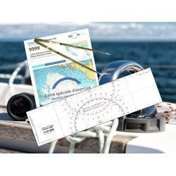
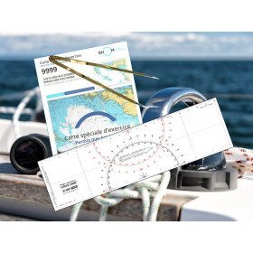
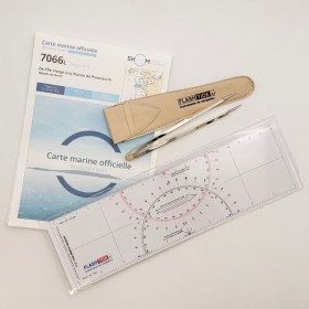
<h2><strong>The essential pack to prepare your offshore licence</strong></h2>
<p style="text-align:justify;">A set of quality tools to pass your offshore licence! Picksea is the owner of the Flash-Tide Instruments brand and our teams manufacture in France, in Lorient, all models of <a href="https://www.picksea.com/en/106806-cras-navigation-rules">rules cras</a> or Breton. Picksea is also a SHOM agent. We are therefore the best able to provide you with a pack composed of the best products at the best price.</p>
<h2>Composition of the offshore licence pack</h2>
available
-
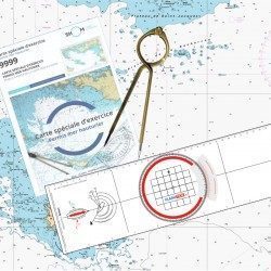
<h2><strong>The offshore licence pack with Breton plotter !</strong></h2>
<p>Pack of material to prepare the offshore licence including the official chart 9999, a plotter (Flash-Tide) and a one hand divider (Flash-Tide)</p>
<h2>Features of the Offshore Plus Pack</h2>
available
-
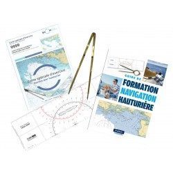
<h2><strong>Everything you need to prepare and pass your offshore licence!</strong></h2>
<p>Everything you need to prepare and pass your offshore licence: complete pack of materials, map and book</p>
<h2>Features of the Complete Offshore Pack</h2>
available
-
<h2><strong>The essential pack for passing professional maritime exams</strong></h2>
<p style="text-align:justify;">A set of quality tools to pass your professional maritime exams! Picksea is the owner of the Flash-Tide Instruments brand and our teams manufacture in France, in Lorient, all the models of cras or breton rulers. Picksea is also a SHOM agent. We are therefore the best able to provide you with a pack composed of the best products at the best price.</p>
<h2>Composition of the maritime exam pro pack</h2>
available

-
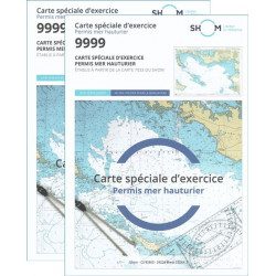
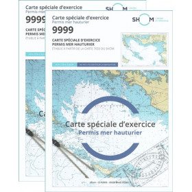
<h2>Pack of 2 official 9999 marine charts from SHOM</h2>
<p style="text-align:justify;"><span>The nautical chart of SHOM 9999 is the official chart of the exam of the <strong>offshore sea permit</strong> which allows to navigate beyond 6 miles from a shelter. It is also on this chart that you will do all the exercises to prepare you for the exam </span></p>
<h2 style="text-align:justify;"><em>Why buy 2 charts?</em></h2>
<p style="text-align:justify;">The fact of doing many exercises on the chart (with a lot of deletion) often makes it unusable for the exam and this is why many exam centers require a new chart for the exam. It should be noted that the organising administration keeps the card as a copy of the exam (except in the case of failure).</p>
<h2>Training and preparation for the offshore licence (theoretical test)</h2>
<p style="text-align:justify;">After passing the coastal licence (and perhaps also the inland waterways licence), you wish to extend your navigation area to the "high seas"! To do this, you need to obtain a deep-sea licence to sail motor yachts beyond 6 miles from a shelter (but it is also very useful for sailing). Read our<a title="Tout savoir pour passer le permis hauturier" href="https://blog.picksea.com/tout-savoir-passer-permis-hauturier/" target="_blank" rel="noreferrer noopener"> article "Everything you need to know about the offshore licence"</a> to find out more.</p>
<p style="text-align:justify;">The chart SHOM 9999 is a special marine chart but it contains all the information of a real navigation chart (scale of latitudes and longitudes, coasts, probes, dangers, beacons, lighthouses, currents, ...). You can plot routes and bearings as well as position points, or measure distances as on a real chart <a title="Déterminer une route sur le carte marine" href="https://blog.picksea.com/determiner-route-direction-distance/" target="_blank" rel="noreferrer noopener">See the article "Determining a route in direction and distance" on our blog </a></p>
<h2 style="text-align:justify;">Characteristics of the Marine Chart 9999 from SHOM for the Offshore Permit</h2>
available
-
<p class="t12px">Marine chart shom <span class="searchproduct-list-item-name">6767 </span>for navigations along the blue coast and in the roadstead of Marseille until the calanques<span class="t12px">. Nautical chart SHOM type Carte L folded in A4 format <span class="t12px">or flat</span> </span>, for pleasure boating. Up to date printing Scale <strong><strong>1 : 50 000</strong><br /></strong></p>
available


Showing 1-8 of 8 item(s)