available


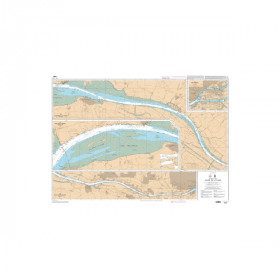
Marine chart 7405L : From La Rochelle to Pointe de La Coubre - Oléron Island

€38.05 Tax included
check_circle
Shipped within 24h
Une question ?
+33 2 97 11 80 95
Detailed features
Nautical chart for navigations around the Ile de Ré. SHOM 7404 L - From Pointe du Grouin du Cou to Pointe de Chassiron
SHOM chart number 7404 L
centered on the Ile de Ré
In the same category
4 other products seleted for you-
available


-
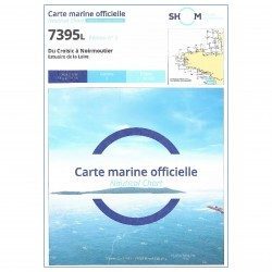
<h2 style="text-align:justify;">The SHOM 7395 L chart is the folded version of the chart for Le Croisic to Noirmoutier and the Loire Estuary.</h2>
<p style="text-align:justify;">Area covered: Le Croisic, Le Pouliguen, Pornichet, La Baule, Saint Nazaire, Saint Brévin, baie de Bourgneuf, L'Herbaudière. Scale 1:50300.</p>
available
-
<h2 style="text-align:justify;">Imray Characteristics of the Imray C42 map La Rochelle to Santander</h2>
<p>Plans included:Lajes das Flores (1:20 000)Horta (1:12 500)Lajes do Pico (1:10 000)Velas (1:7500)Vila da Praia (1:10 000)Praia da Vitória (1:20 000)Angra do Heroísmo (1:12 500)Ponta Delgada (1:10 000)Vila Franco do Campo (1:15 000)Vila do Porto (1:10 000)Imray-Iolaire charts for the Atlantic Islands are widely acknowledged as the best available for the cruising sailor. They combine the latest official survey data with first-hand information gathered over 60 years of research by Don Street Jr and his wide network of contributors. Like all Imray charts, they are printed on water resistant Pretex paper for durability, and they include many anchorages, facilities and inlets not included on official charts.This edition includes the latest official data combined with additional information sourced from Imray''s network to make it ideal for small craft. It includes the latest official bathymetric surveys. Completed harbour works at Porto das Velas (São Jorge) is included and extra Marine Reserves are shown. For this edition magnetic variation curves have been added. There has been general updating throughout.</p>
available

-
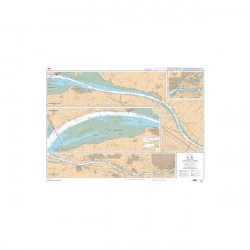
<p style="text-align:justify;">SHOM chart 7396 for navigation up the Loire River from St Nazaire bridge to Nantes. SHOM marine chart type Carte L folded to A4 format or flat, for pleasure boating. Scale: 1 : 20 000 to 1 : 15 000</p>
available