

World Charts
Explore the coasts of the world by boat! Folded maps, flat maps, or even packs of several maps, find the largest choice of navigation charts on our website. From the North Sea to the Mediterranean Sea through the atlantic coastYou just have to choose your next crossing with Picksea !
THE NAUTICAL CHART, AN ESSENTIAL NAVIGATION TOOL
For civilian or military sailors, commercial, fishing or pleasure sailors, safe sailing means having the best information to understand the maritime space in which they are located. Thus, they will be able to find their way easily and choose the most suitable route according to the hazards linked to weather conditions and traffic. The presence of a navigation chart is therefore essential on board the boat. To find out more about the use of a navigation chart, read the article on our site, "How to read and use your nautical chart?". Picksea has selected for you, a large choice of charts SHOM or NV-CHARTS of charts and maps from all over the world, including a good number of charts on north Brittany coast and the South as well as the outermost countries
LAMINATED CHARTS FOR COASTAL NAVIGATION
Coastal navigation, but also the practice of kayaking, catamaran or dinghy requires, as the offshore navigation, a navigation chart in order to locate and define its route in a simple and fast way. Navicarte the brand has understood that boaters who are passionate about coastal navigation are looking for easy-to-use marine charts that are not afraid of water. Thus, the brand offers you laminated navigation charts. Ideal for cruising and racing, these charts are less cumbersome than traditional charts, but just as visually appealing
OFFSHORE NAVIGATION CHARTS
The offshore charts allow you to plan, prepare and follow your crossing in a simple way on adapted maps. In folded or rolled versions, the maps cover a large area at scales ranging from 1:1,150,000 to 1:750,000. This type of map allows you to choose your routes and consider different options depending on the weather and traffic conditions. This type of chart also offers you the possibility to plan different shelters and diversion ports. Looking for a particular chart? Contact just ask our team! They will take care of the order for you
OFFICIAL CHARTS FOR LICENCES AND EXAMS
As an authorized agent of SHOM for many years, Picksea offers you the official charts for the different maritime licences and exams. For the most well known of them, the deep-sea licence, you need to refer to the chart 9999 from SHOM . For the different professional maritime exams such as the Captain 2000 or the Chief of the Quarter 500, it is the chart 7066For the various professional maritime exams such as the Captain 2000 or the Chief Mate 500, it is the chart from Ile Vierge to the Pointe de Penmarc'h that is used as a reference
Read more
There are 15 products.
-
<div class="fiche-txt">
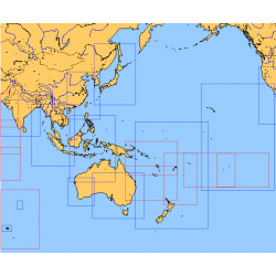
<h2>Choose from the list below an unfolded chart covering the sailing areas around Australia and South East Asia</h2>
<p>These maps detail the sailing areas of Australia, Oceania, and South East Asia. Frequently used as a decorative element or as a support to retrace a journey between continents. Choose from the list below the area you wish to explore by referring to the map number associated with the desired navigation area. Indicate the number of the map you have chosen in the comments of your order.</p>
<h2>List of chart references and areas covered:</h2>
</div>
available
-
<div class="fiche-txt">
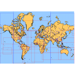
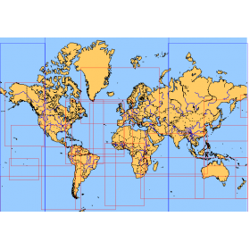
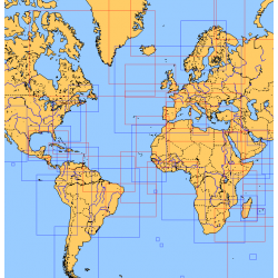
<h2>Choose from the list below an unfolded nautical chart covering the major sailing areas of the world</h2>
<p>These maps covering huge areas of navigation are frequently used as a decorative element or as a support to retrace a journey between continents. Choose in the list below the area you wish to explore by referring to the map number associated with the desired navigation area. Indicate the map number you have chosen in the comments of your order.</p>
<h2>List of references for charts and areas covered:</h2>
</div>
available

-
<div class="fiche-txt">
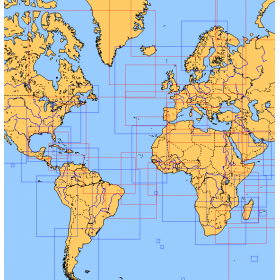
<h2>Choose from the list below an unfolded chart covering the sailing areas around the North and South Atlantic and the Indian Ocean</h2>
<p>These charts detail the sailing areas centered on the North and South Atlantic, the macro sailing areas of North and South America, Western Europe, Western Africa and the Indian Ocean. Delivered unfolded in a transport tube, these charts will serve as a support to trace your journey between continents. Choose from the list below the area you wish to explore by referring to the map number associated with the desired navigation area. Indicate the map number you have chosen in the comments of your order.</p>
<h2>List of chart references and areas covered:</h2>
</div>
available
-
<div class="fiche-txt">
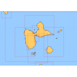
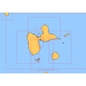
<h2>Choose in the list below a marine map of the surroundings of Guadeloupe</h2>
<p style="text-align:justify;">These SHOM charts cover all the navigation areas around Guadeloupe: from the Saintes to Marie-Galante and la Désirade as well as the Petit and Grand Cul de Sac Marin and the leeward coast, Saint François and Sainte Anne. If you need to reach Pointe à Pitre and the Gosier marina, you should choose the map of the Pointe a Pitre roadstead and the salt river. The Shom L type charts are more adapted to the yachtsman because they are folded in A4 format and thus easier to store in a chart table. They detail precisely the navigation areas of the coasts and islands surrounding Guadeloupe. To order, choose from the list below the area you wish to explore by referring to the map number associated with the desired navigation area. Indicate the map number you have chosen and the option "folded" or "flat".</p>
<h2>List of chart references and areas covered:</h2>
</div>
available
-
<div class="fiche-txt">
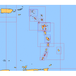
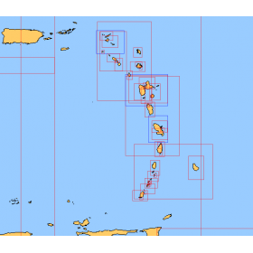
<h2>Choose from the list below a chart covering the sailing areas around the Caribbean Arc and the Caribbean Sea</h2>
<p>This set of charts covers all the sailing areas from Venezuela to Cuba, including all the islands of the Caribbean Arc. These Shom marine charts type L are more adapted to the yachtsman because they are folded in A4 format, easier to store in a yachting chart table. These charts detail precisely the sailing areas of the surrounding islands of the West Indies. Choose from the list below the area you wish to explore by referring to the chart number associated with the desired sailing area. Indicate the map number you have chosen and whether you want to sail flat or folded.</p>
<h2>List of chart references and areas covered:</h2>
</div>
available
-
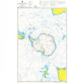
<h2 style="text-align:justify;">Admiralty Marine Map of the Antarctic Region</h2>
<p style="text-align:justify;">One of the only nautical chart references including the entire Antarctic. It will appeal to Vendée Globe fans who will be able to follow their favourite candidates around the Antarctic continent with a gnomonic projection instead of the classic Mercator projection which cannot be used in latitudes above 70° N or S.</p>
<h2 style="text-align:justify;">Characteristics of the Admiralty map of Antarctica</h2>
available

-
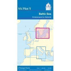
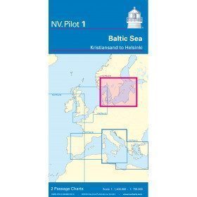
<h2>Baltic Sea Offshore Marine Chart</h2>
<p>The NV Pilot 1 offshore chart covers the Baltic Sea area from Kiel to Oslo on the front and the area from Skagerak (Flekkefjord) to Helsinki on the back.</p>
<h2>Details on the NV Pilot 1 - Baltic Sea map</h2>
available
-
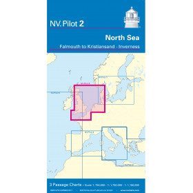
<h2>North Sea Offshore Marine Chart</h2>
<p><span>The NV Pilot 2 offshore chart covers the North Sea from Dover to Helgoland and Doggerbank in the North and the English Channel from Falmouth/Ushant to Dover on the front. On the reverse side, the area covers Great Yarmouth to Skagen, Inverness and the southern coast of Norway.</span></p>
<h2>Details on the NV Pilot 2 - North Sea map</h2>
available

-
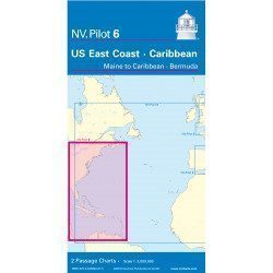
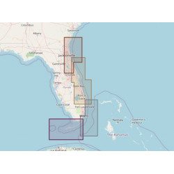
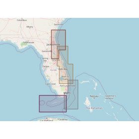
<h2>Offshore Caribbean and East Coast of America Marine Chart</h2>
<p style="text-align:justify;">The NV Pilot 6 offshore chart covers: on the front, the Caribbean with the Bahamas, the Caribbean, the North Coast of South America, Panama, the East Coast of the USA and on the back, the East Coast of the USA from Nova Scotia to Florida and Bermuda.</p>
<h2>NV Pilot 6 Map Details - Caribbean and Eastern Seaboard</h2>
available
-
<div class="fiche-txt">
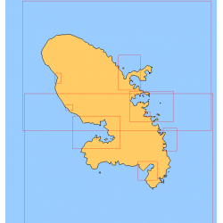
<h2>Choose in the list below a marine map of Martinique's surroundings</h2>
<p>This set of charts covers all the sailing areas of the island of Martinique in Shom marine charts of type L more adapted to the yachtsman because they are folded in A4 format, easier to store in a pleasure chart table. These maps detail precisely the navigation areas of the islands. Choose from the list below the area you wish to explore by referring to the chart number associated with the desired sailing area. Indicate the map number you have chosen in the comments of your order.</p>
<h2>List of chart references and areas covered:</h2>
</div>
available
-
<div class="fiche-txt">
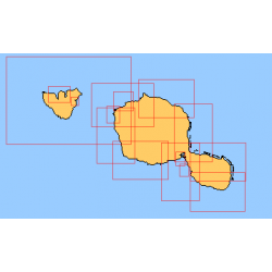
<h2>Choose from the list below an unfolded nautical chart of the sailing areas around Tahiti and the Society Islands</h2>
<p>This set of charts covers the whole of the Society Islands in unfolded Shom marine charts delivered in a tube. These charts detail the exact navigation areas of the islands. Choose from the list below the area you wish to explore by referring to the chart number associated with the desired navigation area. Indicate the map number you have chosen in the comments of your order.</p>
<h2>List of chart references and areas covered:</h2>
</div>
available
-
<div class="fiche-txt">
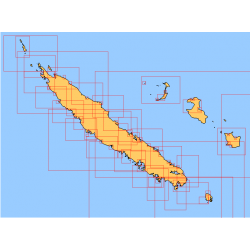
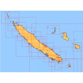
<h2>Choose from the list below an unfolded nautical chart covering the navigation areas around New Caledonia</h2>
<p>This set of charts covers the entire coastline of New Caledonia in unfolded Shom marine charts delivered in a tube. These maps detail precisely the navigation areas of the island. Choose in the list below the area you wish to explore by referring to the chart number associated with the desired navigation area. Indicate the map number you have chosen in the commentary of your order.</p>
<h2>List of chart references and areas covered:</h2>
</div>
available
-
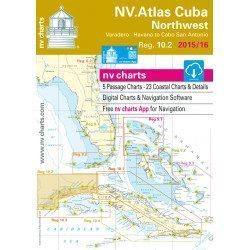
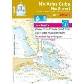
<h2>Marine Card Packs for the Caribbean and West Indies Zone</h2>
<p style="text-align:justify;"><span>The nv-charts are characterized by fine contours and easily distinguishable colour graduations of the depth lines: turquoise for coral reefs, red for the 2-metre line and blue for the 5-metre zones. </span><span>Presented in a practical and user-friendly format (A3 closed and A2 open), a thick plastic envelope protects the cards, making them easy to store. </span><span>The importance of a good graphic representation of the topography when navigating in the Caribbean is essential.</span><br /><br /><span>Well-marked rivers, towns and street maps all contribute to a clear overview of the islands' waterfront facilities. Red numbered waypoints with coordinates based on WGS 84 allow mariners to navigate with their GPS instruments. Heights and depths are shown in the internationally recognized metre format. Large-scale approaches and land contour markings simplify entry into anchorages.</span></p>
<h2 style="text-align:justify;"><span style="color:#ff0000;">Picksea is Premium Reseller of NV-Charts</span></h2>
<h2><span>Features of NV-Charts Caribbean Zone Packs</span></h2>
available
-
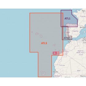
<h2>Atlantic Zone Sea Card Packs</h2>
<p>The nv-charts are characterized by fine contours and easy to distinguish colour graduations of the depth lines: turquoise for coral reefs, red for the 2-metre line and blue for the 5-metre zones. Presented in a practical and user-friendly format (A3 closed and A2 open), a thick plastic envelope protects the charts, making them easy to store. The importance of a good graphic representation of the topography when navigating the Atlantic is essential.<br /><br />Well-marked rivers, towns and street maps all contribute to a clear overview of the islands' waterfront facilities. Red numbered waypoints with coordinates based on WGS 84 allow mariners to navigate with their GPS instruments. Heights and depths are shown in the internationally recognized metre format. Large-scale approaches and land contour markings simplify entry into anchorages.</p>
<h2><span style="color:#ff0000;">Picksea is Premium Reseller of NV-Charts</span></h2>
<h2>NV-Charts Atlantic Zone Marine Card Packs Features</h2>
available

-
<h2>Marine Card Packs for the Caribbean and West Indies Zone</h2>
<p style="text-align:justify;"><span>The nv-charts are characterized by fine contours and easily distinguishable colour graduations of the depth lines: turquoise for coral reefs, red for the 2-metre line and blue for the 5-metre zones. </span><span>Presented in a practical and user-friendly format (A3 closed and A2 open), a thick plastic envelope protects the cards, making them easy to store. </span><span>The importance of a good graphic representation of the topography when navigating in the Caribbean is essential.</span><br /><br /><span>Well-marked rivers, towns and street maps all contribute to a clear overview of the islands' waterfront facilities. Red numbered waypoints with coordinates based on WGS 84 allow mariners to navigate with their GPS instruments. Heights and depths are shown in the internationally recognized metre format. Large-scale approaches and land contour markings simplify entry into anchorages.</span></p>
<h2 style="text-align:justify;"><span style="color:#ff0000;">Picksea is Premium Reseller of NV-Charts</span></h2>
<h2><span>Features of NV-Charts Caribbean Zone Packs</span></h2>
available


Showing 1-15 of 15 item(s)