available


Detailed features

Shom 6990 marine chart for your navigations between Penmarc'h and the Gironde estuary. Scale: 1:355000
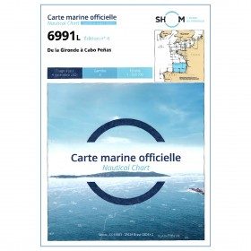
SHOM chart number 6990L. of the Atlantic coast.
In the same category
4 other products seleted for you-
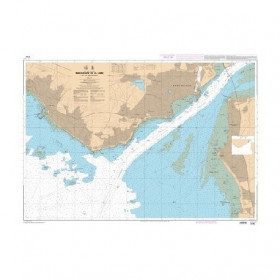
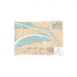
<p style="text-align:justify;">SHOM marine chart 6797 for navigation in the mouth of the Loire up to the bridge of St Nazaire. SHOM marine chart type L folded to A4 format or flat, for pleasure boating. Up to date edition Scale: 1 : 15 000</p>
available


-
available
 New
New -
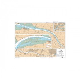
<p style="text-align:justify;">SHOM chart 7396 for navigation up the Loire River from St Nazaire bridge to Nantes. SHOM marine chart type Carte L folded to A4 format or flat, for pleasure boating. Scale: 1 : 20 000 to 1 : 15 000</p>
available
-
available