

Marine Bookshop
Picksea's maritime bookshop has a wide range of books on the world of the sea, boats and boating. If you want to learn about or explain sailing or the world of the sea to your child, brush up on your maritime knowledge or even give a gift to someone, you've come to the right place! Our marine bookstore offers several main categories:
Nautical charts
The Picksea crew offers a wide selection of nautical charts to help you find the right set of charts for your coastal, offshore or even transatlantic sailing. We have selected several publishers, starting with the SHOM (Service Hydrographique et Océanique de la Marine) which is the official organization that carries out all the surveys for the realization of the maritime charts. You will also find the charts of NV-Charts who edit very complete packs by navigation area including several charts at different scales with also the digital charts usable on any smartphone, tablet or PC. We have selected Navicarte plastic charts for those who practice light sailing and nautical activities such as kayaking and finally the Imray charts because they are very well known in the world of boating.
Boating licence code
A boating licence is compulsory to steer a motorboat of more than 6 horsepower, whether at sea or in inland waters. It should be noted that this obligation is not necessary for a sailboat even equipped with a motor, however it is strongly recommended to pass it because 95% of the program also concerns sailing. You will find on Picksea, all the necessary books and materials to prepare your boating licence whether it is the coastal licence and its offshore extension or the river licence to navigate on canals and inland waterways. You can also prepare for the maritime radiotelephone code called the Radiotelephone Operator's Restricted Certificate(RRC). All the boat licence codes offered by Vagnon have been written by Picksea experts who are also trainers of boat school instructors and authors of many other books for Vagnon.
Compulsory document for boating
On board a pleasure boat, the regulations defined in Division 240 require a certain number of documents to be carried, the presence of which varies according to the distance from a shelter: basic, coastal or semi-offshore navigation. This mandatory documentation on board includes the nautical chart(s) of the area visited, a tide book, a description of the buoyage or a summary on a sticky note, a description of the RIPAM or a summary on a sticky note, a logbook and a light book. All these compulsory documents can be found in books such as Plaisance & Réglementation for coastal navigation and Bloc Marine Atlantique or Méditerranée for offshore and deep-sea navigation.
Book for professional maritime training
For your professional maritime training, Picksea offers you Flash-Tide accessories and books designed and manufactured in France by our teams. Everything to pass your exams! Take a look at the cras rulers, Breton protractors and dry point compasses as well as the packs and kits. The SHOM books are the regulatory reference for maritime navigation.Book 2 RIPAM and Book 3 Maritime Signals are the official documents on navigation rules and buoyage.
Nautical Guide
If you are looking for guides on nature, you will surely find what you are looking for among topics such as underwater life, sea birds, mammals and seaweeds for example. You will also find in this category guides focused on maritime regulations with technical themes such as currents, tides, flagging or how to sail in heavy weather! Are you looking for the classics? We offer theAtlantic and Mediterranean marine and coastal blocks or the numerous Imray guides to the Channel Islands, Italy, the English Channel,Spain and Portugal..
Practical manuals
Find a large choice of books SHOM, Vagnon and FFV written by experts and specialists in boating. There is something for everyone: cruising, ecology, second-hand boats, safety and first aid, electricity, communication, knots, flags, lights, engines, surfing and foils, maintenance, multihulls, cooking, manoeuvres, weather, freediving, deep-sea sailing, tides, underwater hunting, regattas, transatlantic sailing, motorboats, deep-sea licences, you are bound to find what you need! You will also find mementos and checklists as well as a selection of books on fishing: fishing on foot, freshwater fishing, lure fishing, sea fishing, bait fishing, bass fishing...
Books for children and toddlers
Make your choice among the very useful Vagnon nature guides illustrated with photos of birds, seaweed, fish and mammals. You'll find lovely illustrated books such as theBoater's Primer, Understanding the Sea and Sailing or the book Let's Set Sail! You will also find several game books with animals and pirates adapted to the youngest.
Read more
There are 294 products.
-
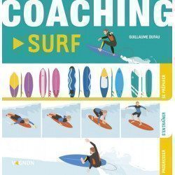
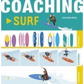
<h2 style="text-align:justify;">Vagnon Surfing Coaching</h2>
<p style="text-align:justify;">Are you ready to take the plunge and start surfing? You surf but you need to evolve in your learning ? Here is a simple and easy method, organized in three essential steps.</p>
<ul style="text-align:justify;"><li>Prepare for the right gestures to master the weather tools and the evolution of the forecasts, choose your surf spot, face the waves in a good physical condition and serenely.</li>
<li>Train with the different basic manoeuvres, from the first "foam" to the ducking technique, including paddling on the open sea, the take-off, the bottom-turn, and the roller.</li>
<li>Progress by experimenting with advanced maneuvers such as the late take-off, carving, tail-slide, cut-back, re-entry, floater, and sliding inside the tube, the queen of surfing.</li>
</ul><p style="text-align:justify;">And to go further, find out everything you need to know about surfing practices, equipment and material, regulations and priority rules, surfing ethics and eco-actions. Dare to go for it! Surf the wave!</p>
<h2 style="text-align:justify;">Details about the book Coaching surfing from Vagnon</h2>
available

-
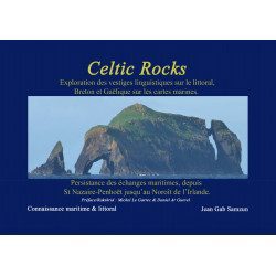
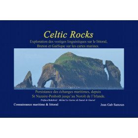
<h2>Celtic Rocks : an original discovery of the Celtic coast from Brittany to Ireland</h2>
<p style="text-align:justify;"><span>Celtic Rocks </span>is a search for the innumerable words of Celtic origin describing the shores, scrupulously reported on the marine maps which inevitably lead us to ask these questions: where do these words come from? What do they mean?</p>
<p style="text-align:justify;">From 250 photos and map extracts, Jean Gab Samzun offers you through this book to open your eyes in search of clues to read in the past and discover the origin of names, ports, anchorages, rocks of the whole coast from the Loire estuary to the north-west of Ireland through the Iroise and the Scilly.</p>
<p style="text-align:justify;"><span>Celtic Rocks</span> is both a beautiful and useful book: it will find its place in your living room as well as on board your boat, discovering the historical, geological and linguistic origins of all your Celtic sailing areas.</p>
<h2 style="text-align:justify;">Celtic Rocks Features</h2>
available
-
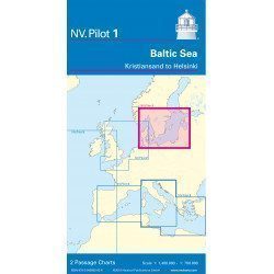
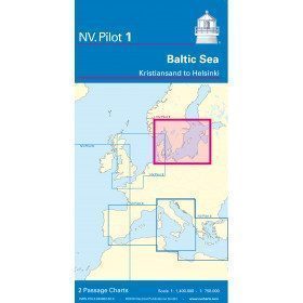
<h2>Baltic Sea Offshore Marine Chart</h2>
<p>The NV Pilot 1 offshore chart covers the Baltic Sea area from Kiel to Oslo on the front and the area from Skagerak (Flekkefjord) to Helsinki on the back.</p>
<h2>Details on the NV Pilot 1 - Baltic Sea map</h2>
available
-
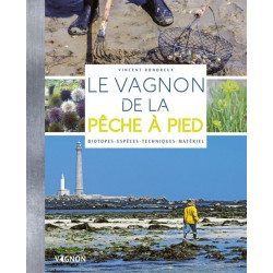
<h2>Make your fishing trips a success</h2>
<p><span>This manual explains everything you need to know to start fishing on foot and to improve your practice! You will learn to recognize the species, the techniques, the necessary equipment ...</span></p>
<h2>Characteristics of the manual : The fishing guide</h2>
available
-
<div class="fiche-txt">
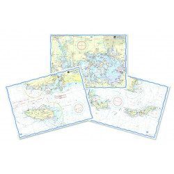
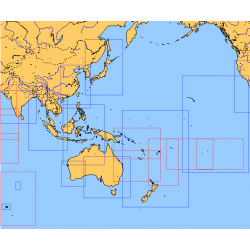
<h2>Choose from the list below an unfolded chart covering the sailing areas around Australia and South East Asia</h2>
<p>These maps detail the sailing areas of Australia, Oceania, and South East Asia. Frequently used as a decorative element or as a support to retrace a journey between continents. Choose from the list below the area you wish to explore by referring to the map number associated with the desired navigation area. Indicate the number of the map you have chosen in the comments of your order.</p>
<h2>List of chart references and areas covered:</h2>
</div>
available
-
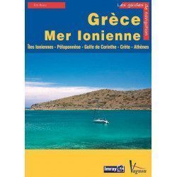
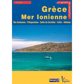
<p>Guide from the prestigious English publishing house IMRAY, world reference in the field of marine cartography. This guide covers the areas of Greece and the Ionian Sea, Ionian Islands, Peloponnese, Gulf of Corinth, Crete, Athens. Edition of 23/04/2012</p>
available
-
<p style="text-align:justify;">Shom 7311 nautical chart for cruising in the Channel : Scilly, Ouessant, Jersay, Guernsey, everything is there.</p>
available
-
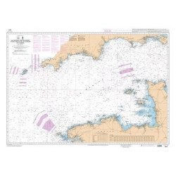
<p>Marine chart for coastal navigation. SHOM 7423L - Raz de Sein - scale 1:20000</p>
available
-
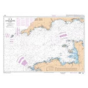
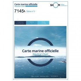
<p>Nautical chart SHOM 7145L. From Triballe to Pornichet. Scale: 1:25000.</p>
available
-
<h2>How to fit out your boat by Vagnon</h2>
<p style="text-align:justify;">The proper fitting out of a boat is essential, as the success of a voyage (especially if it is a long one) depends largely on the comfort on board and the organisation of daily life in a suitable, pleasant and functional environment. But managing to fit out a boat properly is not so simple: choice of materials, construction of made-to-measure furniture, tips to resist all the hazards of life at sea.... This book will guide you through the fitting out of your boat with the help of numerous photographs and well thought-out educational workshops.</p>
<h2 style="text-align:justify;">Details on "How to fit out your boat".</h2>
available

-
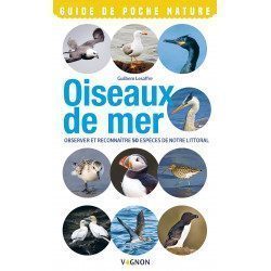
<h2>Vagnon's Pocket Nature Guide to Seabirds</h2>
<p><strong>Observe and recognize 50 species of our coastline</strong>. As the seasons change, many birds move along our coasts and in the sea. The species presented in this guide are among the most common and easiest to observe. They are identified thanks to a precise portrait and essential information: places and periods of presence, abundance, behaviour, diet and reproduction.</p>
<h2>Details on the <span style="font-family:'novecento_wide_medium', sans-serif;font-size:16px;">Nature Pocket Guide Seabirds </span></h2>
available
-
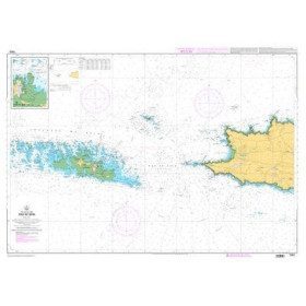
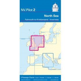
<h2>North Sea Offshore Marine Chart</h2>
<p><span>The NV Pilot 2 offshore chart covers the North Sea from Dover to Helgoland and Doggerbank in the North and the English Channel from Falmouth/Ushant to Dover on the front. On the reverse side, the area covers Great Yarmouth to Skagen, Inverness and the southern coast of Norway.</span></p>
<h2>Details on the NV Pilot 2 - North Sea map</h2>
available

-
<div class="fiche-txt">
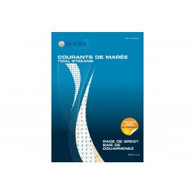
<h2>11 Atlas detailing tidal currents and water heights by Zone</h2>
<p>The tidal current atlases show the current fields at each hour of the tide, in average spring and neap tides. Essential for the safety of all sailors, they will also be an effective aid for your regattas.</p>
<h2>Details of the Shom Currents & Tides Atlas</h2>
</div>
available

-
<div class="fiche-txt">
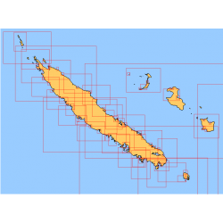
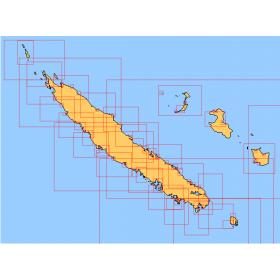
<h2>Choose from the list below an unfolded nautical chart covering the navigation areas around New Caledonia</h2>
<p>This set of charts covers the entire coastline of New Caledonia in unfolded Shom marine charts delivered in a tube. These maps detail precisely the navigation areas of the island. Choose in the list below the area you wish to explore by referring to the chart number associated with the desired navigation area. Indicate the map number you have chosen in the commentary of your order.</p>
<h2>List of chart references and areas covered:</h2>
</div>
available
-
<div class="fiche-txt">
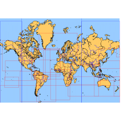
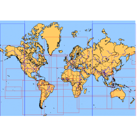
<h2>Choose from the list below an unfolded nautical chart covering the major sailing areas of the world</h2>
<p>These maps covering huge areas of navigation are frequently used as a decorative element or as a support to retrace a journey between continents. Choose in the list below the area you wish to explore by referring to the map number associated with the desired navigation area. Indicate the map number you have chosen in the comments of your order.</p>
<h2>List of references for charts and areas covered:</h2>
</div>
available
-
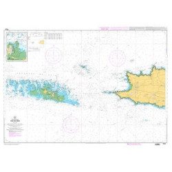
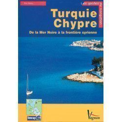
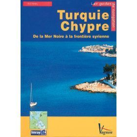
<p>A guide from the prestigious English publishing house IMRAY, a world reference in the field of marine cartography. This guide covers the areas of Turkey and Cyprus, from the Black Sea to the Syrian border. </p>
available
-
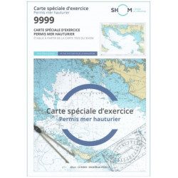
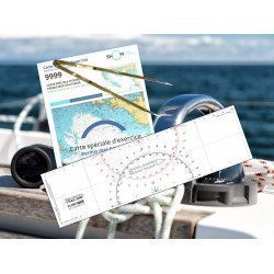
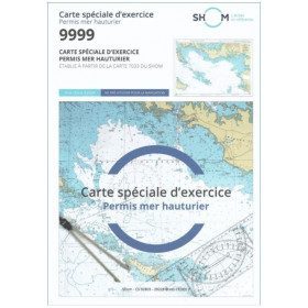
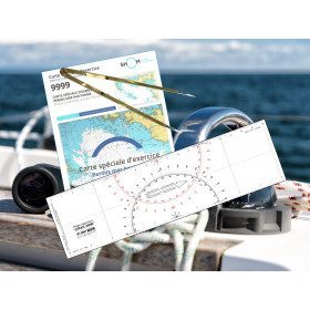
<h2 style="text-align:justify;">SHOM chart 9999 for the french offshore licence exam</h2>
<p style="text-align:justify;">The SHOM chart 9999 is the official chart for the offshore licence examination which allows you to navigate beyond 6 miles from a shelter. The 9999 chart is also used to do all the exercises to prepare for the exam.</p>
<h2 style="text-align:justify;">Training and preparation for the french offshore licence (theory test)</h2>
<p style="text-align:justify;">After passing the coastal licence (and perhaps also the inland waterway licence), you want to extend your navigation area to the "high seas"! To do this, you need to obtain a offshore licence to sail motorboats beyond 6 miles from a shelter (it is also very useful for sailing boats). You can read the article <a href="https://www.picksea.com/en/actualites-et-conseils/post/18-all-knowing-pass-license-holder">"Everything you need to know about the offshore licence"</a>.</p>
<p style="text-align:justify;">The chart 9999 is the official chart to take the offshore licence exam. Of course, this SHOM 9999 chart also allows you to work on all the exercises and mock exams in your school boat or as an independent candidate, to prepare for the tests for the offshore extension of the sea boat licence.</p>
<p style="text-align:justify;">The SHOM 9999 chart is a special marine chart but it contains all the information of a real navigation chart (scale of latitudes and longitudes, coasts, probes, dangers, beacons, lighthouses, currents, ...). You can plot routes and bearings and position points, or measure distances as on a real chart. See the article <a href="https://www.picksea.com/en/actualites-et-conseils/post/49-determine-route-direction-distance">"Determining a route in direction and distance" on our blog</a>.</p>
<p style="text-align:justify;">The SHOM (Services Hydrographique et Océanographique de la Marine) is the public organisation in charge of collecting data (soundings, currents, coastline, ...) and distributing this information, in particular in the form of nautical charts. Find here all our other SHOM charts.</p>
<h2 style="text-align:justify;">Characteristics of the SHOM 9999 Special Offshore Exam Chart</h2>
available
-
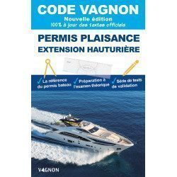
<p>This edition is the essential manual for the preparation of the Offshore course License, which authorizes the operation of a French motorized pleasure craft, day and night, without limitation of distance, tonnage or power.</p>
available
-
<p style="text-align:justify;">Shom 7312 marine chart for your cruising or racing in the Eastern Channel. From Casquets to Pas-de-Calais. Scale 1:375000</p>
available

-
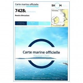
<p style="text-align:justify;">Marine map 7428L for your coasters and your discoveries of the Arcachon basin.</p>
available
-
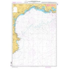
<p>Mediterranean shom marine map : From Fos sur Mer to Capo Mele. Scale: 1:250000.</p>
available
-
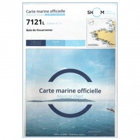
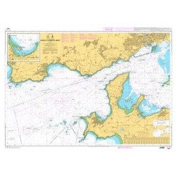
<p>Marine chart for coastal navigation. SHOM 7121 - Douarnenez Bay - scale 1:30000. Available in folded A4 format or in unfolded A0 format</p>
available

-
<p>Marine chart SHOM 7136L. From Mahé Bridge to Piriac sur Mer. Scale 1:15000.</p>
available
-
<h2 style="text-align:justify;">Waterproof nautical charts</h2>
<p style="text-align:justify;">Waterproof laminated nautical charts of the Atlantic that can be taken out in the cockpit. A3 format with a scale adapted to each sailing basin. Ideal for cruising or coastal regattas. Less cumbersome than traditional charts and very well thought out visually. Longer lasting for outdoor use in all conditions.</p>
<h2 style="text-align:justify;">Detailed characteristics of the charts</h2>
available

-
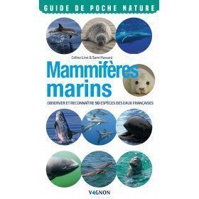
<h2>Vagnon Marine Mammals Pocket Guide</h2>
<p style="text-align:justify;"><strong>Observe and recognize 50 species of our coastline</strong>. Throughout the seasons, many marine mammals move along our coasts and in the sea. The species presented in this guide are among the most common and easiest to observe. They are identified by means of a precise portrait and essential information: places and periods of presence, abundance, behaviour, diet and reproduction.</p>
<h2 style="text-align:justify;">Details on the Nature Pocket Guide Marine Mammals</h2>
available

-
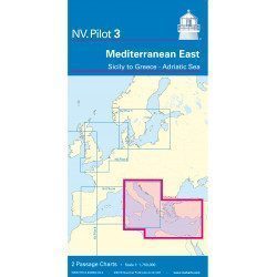
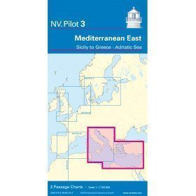
<h2>East Mediterranean Offshore Marine Chart</h2>
<p><span>The NV Pilot 3 offshore chart covers the Eastern Mediterranean: on the front side the Tyrrhenian Sea, the Adriatic Sea, the Ionian Sea and the region of Sicily up to the coast of Tunisia. The reverse side covers the Mediterranean Sea up to longitude 17°E</span></p>
<h2>Details on the NV Pilot 3 map - East Mediterranean</h2>
available
-
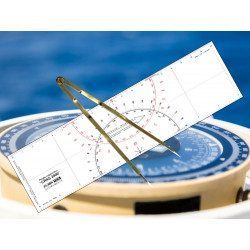
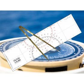
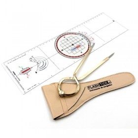
<h2 id="prod-h1" class="prod-name">Ruler and Compass Dry Point Kit</h2>
<p style="text-align:justify;"><span>Set of equipment to prepare for the offshore licence or to equip your boat, including a cras 2000 ruler (Flash-Tide) and a dry point compass (Flash-Tide)</span></p>
<h2 style="text-align:justify;"><span>Features of the Ruler and Compass Kit</span></h2>
available
-
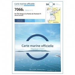
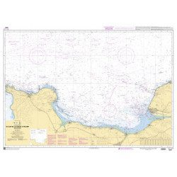
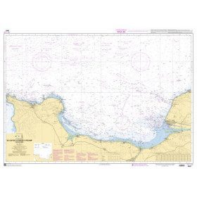
<h2 style="text-align:justify;">SHOM chart 7066 : from Ile Vierge to Penmarc'h</h2>
<p style="text-align:justify;">The SHOM 7066L chart is the marine chart of the tip of Brittany. It can be used for navigation but above all it is used as a support for professional maritime exams: Captain 200, Chief of the Watch 500, Captain 3000 or Unlimited. It exists in folded or flat version.</p>
<h2 style="text-align:justify;">Characteristics of the SHOM 7066 chart</h2>
available
-
<div class="fiche-txt">
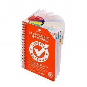
<h2>The Safetics safety guide New version: Sailboats and Motors</h2>
<p><span>All the<strong> good navigation practices</strong> are gathered in this book in the form of clear and easily accessible sheets for everyone. This waterproof guide is i</span><span>It is resistant to sea spray and tears, the guide <strong>SAFETICS</strong> is designed to be used in action and in the moment. It is filled with tips, emergency explanations, help and advice on how to use the<span>memories, of <strong>professional advice. </strong>You will quickly become dependent on this new companion.</span></span></p>
<p>This guide is the result of the work of enthusiasts who decided to create a simple and intuitive memo for pleasure boating. Its content is based on official recommendations, as well as on numerous feedbacks and experts' opinions, including in particular that of <strong>Armel Le Cléac'h </strong>a skipper and professional sailor. It has also been endorsed by the FFVoile, the SNSM, Météo France, the Gendarmerie Maritime, the French Navy and the Centre de Consultation Médicale Maritime. A real Sailor's Checklist for sailing and motor boats.</p>
<h2>Features of the Safetics Sailing Guide: Sailor's Checklist</h2>
</div>
available

-
<div class="fiche-txt">
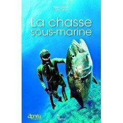
<h2>Underwater hunting is a true art</h2>
<p><strong>Pascal Catry</strong>a high level competitor and <strong>Jean Attard</strong>and the editor-in-chief of Apnea Magazine, offer a simple, practical and highly illustrated guide for all Apnea enthusiasts. <strong>submarine hunting</strong>. This guide will be of interest to those who want to discover underwater hunting without the benefit of advice from a senior, but also to those who would like to go further in a nascent passion and who lack certain technical bases, often essential to practice safely.</p>
<p>Without a doubt, the reference book for all underwater hunting enthusiasts and future enthusiasts.</p>
<h2>Picksea specialist of the sea and its seabed!</h2>
<p>Picksea has established itself as a leader in nautical equipment but also in documentation, with specialized books according to your desires and passions. Diving, boating, or even boating licenses.</p>
<h2>Characteristics of the book Underwater Hunting</h2>
</div>
available
-
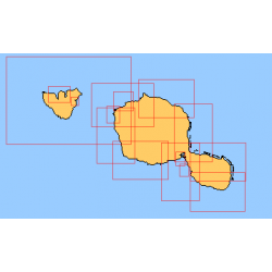
<div class="fiche-txt">
<h2>Choose from the list below an unfolded nautical chart of the sailing areas around Tahiti and the Society Islands</h2>
<p>This set of charts covers the whole of the Society Islands in unfolded Shom marine charts delivered in a tube. These charts detail the exact navigation areas of the islands. Choose from the list below the area you wish to explore by referring to the chart number associated with the desired navigation area. Indicate the map number you have chosen in the comments of your order.</p>
<h2>List of chart references and areas covered:</h2>
</div>
available
-
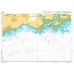
<p style="text-align:justify;">Shom marine chart for navigation from Oleron island to Arcachon basin. Scale: 1:167000.</p>
available
-
<p>Marine chart shom 7008. Cabo de San Sebastian to Fos sur Mer. Scale : 1:250000</p>
available
-
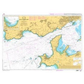
<p>Marine chart for coastal navigation. SHOM 7401 L - Access to the Rade de Brest - Scale 1:22500</p>
available
-
<p>Marine chart SHOM 7135 L. From the point of Saint Jacques to Damgan. Scale 1:15000.</p>
available
-
<h2>Waterproof nautical charts of the Mediterranean (France)</h2>
<p style="text-align:justify;">Waterproof nautical charts of the French Mediterranean coast that you can take out in the cockpit because they are waterproof. A3 format with a scale adapted to each sailing basin. Ideal for cruising or coastal regattas. Less cumbersome than traditional charts and very well thought out visually. Longer lasting for outdoor use in all conditions.</p>
<h2>Detailed characteristics of the charts</h2>
available
-
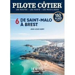
<h2>This Bénéteau Coast Pilot is truly the most useful nautical document on board a cruising boat after the nautical charts.</h2>
<p>It is often said that sailors who frequent the coasts of North Brittany never feel in real difficulty anywhere else on the seas of the globe. This is probably a little excessive but it is certain that these jagged shores, with rocks jagged by the harsh storms, where the channels are sometimes not wide enough to cross, where the tidal range which increases rapidly towards the East reaches in the bay of St Malo, a frightening record of 13.5 m, creating violent currents which raise dangerous breakers against the slightest swell, all these difficulties require from the navigators a perfect knowledge of the channels, of the alignments of the shoals, if one wants to discover all the small beaching ports which nestle in the bays, the creeks, the rias of these difficult shores. This is where the Pilote Côtier Bénéteau from Saint Malo to Brest proves to be invaluable with the multitude of information it has gathered from hundreds of professional sailors who are familiar with these areas.</p>
<h2>Features</h2>
available
-
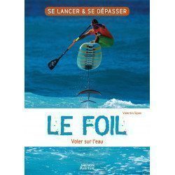
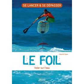
<h2>The foil: flying on the water, it's a guide to launch yourself and surpass yourself!</h2>
<p style="text-align:justify;">In this book Le foil : voler sur l'eau by <strong>Vagnon</strong>You will find a program to launch and surpass yourself in foil on light supports (windsurf, surf, dinghy, catamaran). <span>Today, the practice of foiling is revolutionizing navigation and nautical leisure. A strong interest for this new trend is linked to the gliding sensations it provides. </span>It includes advice, tips and good tips on equipment, "playgrounds", first steps, basic notions, mastering learning... As well as testimonies of amateur and professional practitioners.</p>
<h2>Features of this book The foil: flying on water</h2>
available
-
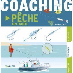
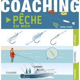
<h2>Sea fishing coaching: prepare, train and progress!</h2>
<p>Coaching sea fishing of <strong>Vagnon</strong> is a very visual guide thanks to its illustrations. With a relaxed approach, it will help you learn and progress during your sea fishing excursions.</p>
<h2>Characteristics of the Sea Fishing Coaching</h2>
available
-
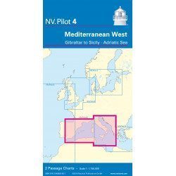
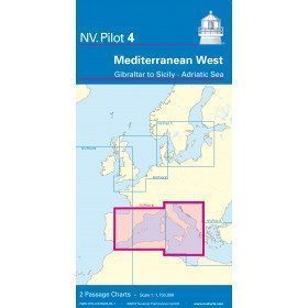
<h2>West Mediterranean Offshore Marine Chart</h2>
<p><span>The NV Pilot 4 offshore chart covers the western Mediterranean: the front side covers the Tyrrhenian Sea, the Adriatic Sea, the Ionian Sea and the region from Sicily to the coast of Tunisia. The reverse side covers the Mediterranean from Gibraltar to Palermo (Sicily)</span></p>
<h2>Details on the NV Pilot 4 map - West Mediterranean</h2>
available
-
<h2><strong>The essential pack to prepare your offshore licence</strong></h2>
<p style="text-align:justify;">A set of quality tools to pass your offshore licence! Picksea is the owner of the Flash-Tide Instruments brand and our teams manufacture in France, in Lorient, all models of <a href="https://www.picksea.com/en/106806-cras-navigation-rules">rules cras</a> or Breton. Picksea is also a SHOM agent. We are therefore the best able to provide you with a pack composed of the best products at the best price.</p>
<h2>Composition of the offshore licence pack</h2>
available
-
<h2 id="prod-h1" class="prod-name">Protractor Ruler and Compass Kit</h2>
<p style="text-align:justify;">Set of equipment to prepare for the offshore licence or to equip your boat, including a Brocémer ruler (Flash-Tide) and a dry point compass (Flash-Tide)</p>
<h2 style="text-align:justify;"><span>Features of the Protractor Ruler and Compass Kit</span></h2>
available

-
<p style="text-align:justify;">Shom 6857 marine chart for your cruising or racing in the Bay of Seine. From Cap de la Hague to Fécamp. Scale 1:150 000</p>
available
-
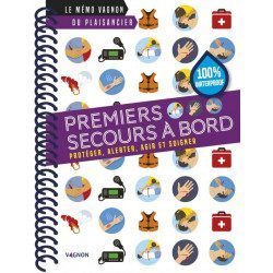
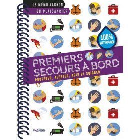
<h2>The first aid memo on board</h2>
<p>This very practical memo aims to remind you how to act in risky situations, to know everything about first aid to help victims of accidents on board a boat.</p>
<p>You will find the essential steps of first aid: protect, alert, act and treat</p>
<h2>Characteristics of the Vagnon Memo - First Aid on board</h2>
available
-
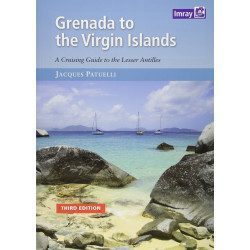
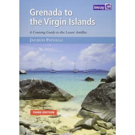
<h2>Prepare your navigation with this navigation guide!</h2>
<p>This navigation guide: "<strong>Grenada to the virgin islands</strong>" is the English edition of Jacques Patuelli's "Guide to the Lesser Antilles". It is a reference book for those who wish to discover the West Indies by boat. It describes with detail and precision the ports, marinas and numerous anchorages. The presentation of this navigation guide is clear and detailed, there are many photos that complement the maps and plans.</p>
<p>For each port, island or bay: description (location with waypoint, hazards, lights, maps, radio contacts, harbour master's office), cartography, approach (day and night), mooring and anchorage, equipment and services, shore visits, history.</p>
<h2>Detailed features of the "Grenada to the virgin islands" navigation guide</h2>
available
-
<div class="fiche-txt">
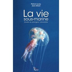
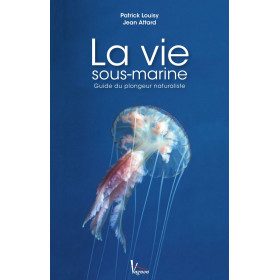
<h2>Underwater life by Vagnon</h2>
<p><strong>Patrick Louisy</strong> and <strong>Jean Attard</strong> have the ambition to offer you the keys of the <strong>underwater world</strong>. They did not want to make another book describing the fauna and flora, but an innovative work that accompanies you in your discovery and answers your questions. How does life at sea work and how is it organised? How do you find your way through the amazing diversity of marine organisms? What to see and do when you are curious about underwater life?</p>
<h2>Picksea specialist of the sea and its seabed!</h2>
<p>Picksea has established itself as a leader in nautical equipment but also in documentation, with specialized books according to your desires and passions. Boating, scuba diving, or even boating licenses.</p>
<h2>Features</h2>
</div>
unavailable
-
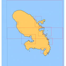
<div class="fiche-txt">
<h2>Choose in the list below a marine map of Martinique's surroundings</h2>
<p>This set of charts covers all the sailing areas of the island of Martinique in Shom marine charts of type L more adapted to the yachtsman because they are folded in A4 format, easier to store in a pleasure chart table. These maps detail precisely the navigation areas of the islands. Choose from the list below the area you wish to explore by referring to the chart number associated with the desired sailing area. Indicate the map number you have chosen in the comments of your order.</p>
<h2>List of chart references and areas covered:</h2>
</div>
available
-
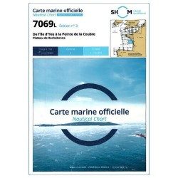
<p>Shom 7069 marine chart for cruising around Yeu, Ré and Oléron. Scale: 1:164800.</p>
available


Showing 1-48 of 294 item(s)