
List of products by brand SHOM
There are 95 products.
-
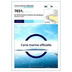
<p style="text-align:justify;">Shom marine chart for your cruises or regattas in Brittany. From Penfret island to the Birvideaux plateau via the outskirts of Lorient. Shom 7031. Scale: 1:50000.</p>
available
-
<div class="fiche-txt">
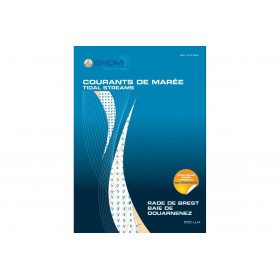
<h2>11 Atlas detailing tidal currents and water heights by Zone</h2>
<p>The tidal current atlases show the current fields at each hour of the tide, in average spring and neap tides. Essential for the safety of all sailors, they will also be an effective aid for your regattas.</p>
<h2>Details of the Shom Currents & Tides Atlas</h2>
</div>
available


-
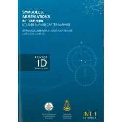
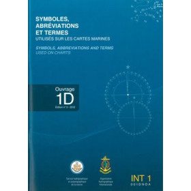
<p>A book published by SHOM listing all the symbols, abbreviations and terms used on SHOM charts. All these terms are declined in English and in French for a perfect reading and understanding of the charts.</p>
available
-
<div class="fiche-txt">
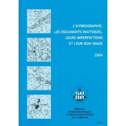
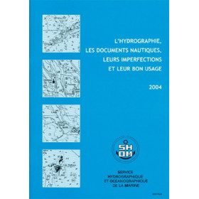
<h2>All the good uses of nautical documents in a dedicated book</h2>
<p>This book will give you a complete overview of hydrography and nautical records with their imperfections and proper use.</p>
<h2>All Shom's regulatory books on Picksea.com</h2>
You can find on our site all the regulatory works of the Shom, such as the International Regulations for Preventing Collisions at Sea 2A and 2B, or the work 3C on maritime signalling.</div>
available
-
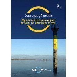
<div class="fiche-txt">
<h2>The International Regulations for Preventing Collisions at Sea. </h2>
<p>This book will help you to know the international regulations to prevent collisions at sea (or RIPAM in french). <span>This document contains all the rules set out in the International Regulations for Preventing Collisions at Sea, 1972, as amended from time to time.</span></p>
<h2>All the Shom's regulatory works on our website</h2>
You can find on Picksea.com all the regulatory books of the Shom, like the good uses of the nautical documents 1F, or the book on the maritime signalling 3C.</div>
available
-
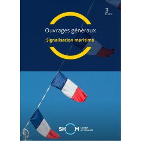
<div class="fiche-txt">
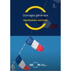
<h2>Marine Signage</h2>
<p>This book will allow you to know the maritime signage regulations and updated.</p>
<h2>All the Shom's regulatory works on our website</h2>
You can find on Picksea.com all the regulatory books of the Shom, like the good uses of the nautical documents 1F, or the book on the international regulation to prevent collisions at sea 2.</div>
available
-
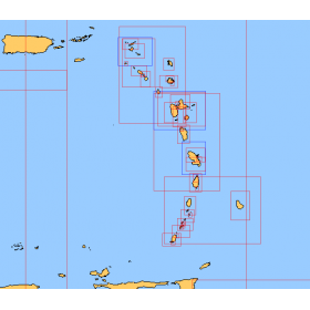
<div class="fiche-txt">
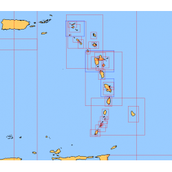
<h2>Choose from the list below a chart covering the sailing areas around the Caribbean Arc and the Caribbean Sea</h2>
<p>This set of charts covers all the sailing areas from Venezuela to Cuba, including all the islands of the Caribbean Arc. These Shom marine charts type L are more adapted to the yachtsman because they are folded in A4 format, easier to store in a yachting chart table. These charts detail precisely the sailing areas of the surrounding islands of the West Indies. Choose from the list below the area you wish to explore by referring to the chart number associated with the desired sailing area. Indicate the map number you have chosen and whether you want to sail flat or folded.</p>
<h2>List of chart references and areas covered:</h2>
</div>
available
-
<p><br /></p>
available

-
available
-
available
-
available
-
available
-
available
-
<div class="fiche-txt">
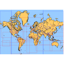
<h2>Choose from the list below an unfolded nautical chart covering the major sailing areas of the world</h2>
<p>These maps covering huge areas of navigation are frequently used as a decorative element or as a support to retrace a journey between continents. Choose in the list below the area you wish to explore by referring to the map number associated with the desired navigation area. Indicate the map number you have chosen in the comments of your order.</p>
<h2>List of references for charts and areas covered:</h2>
</div>
available
-
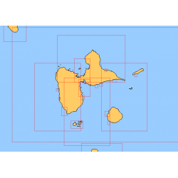
<div class="fiche-txt">
<h2>Choose in the list below a marine map of the surroundings of Guadeloupe</h2>
<p style="text-align:justify;">These SHOM charts cover all the navigation areas around Guadeloupe: from the Saintes to Marie-Galante and la Désirade as well as the Petit and Grand Cul de Sac Marin and the leeward coast, Saint François and Sainte Anne. If you need to reach Pointe à Pitre and the Gosier marina, you should choose the map of the Pointe a Pitre roadstead and the salt river. The Shom L type charts are more adapted to the yachtsman because they are folded in A4 format and thus easier to store in a chart table. They detail precisely the navigation areas of the coasts and islands surrounding Guadeloupe. To order, choose from the list below the area you wish to explore by referring to the map number associated with the desired navigation area. Indicate the map number you have chosen and the option "folded" or "flat".</p>
<h2>List of chart references and areas covered:</h2>
</div>
available
-
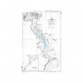
<p>Marine chart for coastal navigation. SHOM 4233 L - LA RANCE : from St Malo to the Chatelier lock - Scale 1:15000.</p>
available
-
<p class="t12px">Marine chart shom <span class="searchproduct-list-item-name">6767 </span>for navigations along the blue coast and in the roadstead of Marseille until the calanques<span class="t12px">. Nautical chart SHOM type Carte L folded in A4 format <span class="t12px">or flat</span> </span>, for pleasure boating. Up to date printing Scale <strong><strong>1 : 50 000</strong><br /></strong></p>
available
-
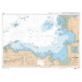
<p style="text-align:justify;">SHOM marine chart 6797 for navigation in the mouth of the Loire up to the bridge of St Nazaire. SHOM marine chart type L folded to A4 format or flat, for pleasure boating. Up to date edition Scale: 1 : 15 000</p>
available

-
<p style="text-align:justify;">Shom 6857 marine chart for your cruising or racing in the Bay of Seine. From Cap de la Hague to Fécamp. Scale 1:150 000</p>
available
-
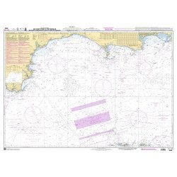
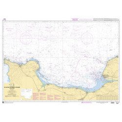
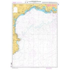
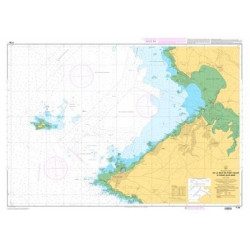
<p>Mediterranean shom marine map : From Fos sur Mer to Capo Mele. Scale: 1:250000.</p>
available
-
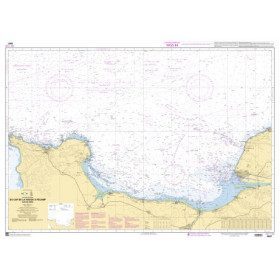
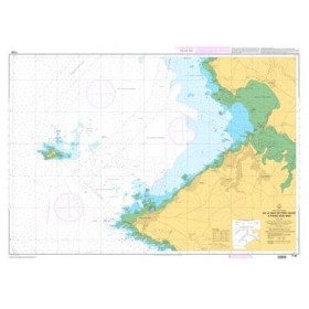
<p>Marine chart shom 7008. Cabo de San Sebastian to Fos sur Mer. Scale : 1:250000</p>
available
-
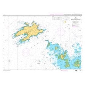
<p style="text-align:justify;">Marine map shom 7032 for your boat cruises. From Groix island and the outskirts of Lorient to Belle-Ile. Scale: 1:50000.</p>
available
-
<p style="text-align:justify;">Navigation chart shom 7033 type L (folded in A4 format) for cruising between Quiberon and Le Croisic. Scale: 1:50 000</p>
available
-
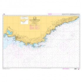
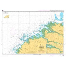
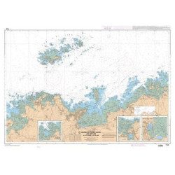
<h2 style="text-align:justify;">SHOM chart 7066 : from Ile Vierge to Penmarc'h</h2>
<p style="text-align:justify;">The SHOM 7066L chart is the marine chart of the tip of Brittany. It can be used for navigation but above all it is used as a support for professional maritime exams: Captain 200, Chief of the Watch 500, Captain 3000 or Unlimited. It exists in folded or flat version.</p>
<h2 style="text-align:justify;">Characteristics of the SHOM 7066 chart</h2>
available
-
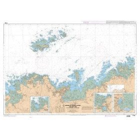
<p style="text-align:justify;">Shom 7067 marine chart available in folded A4 format or in flat A0 format (unfolded). Chart for navigations between the chaussée de Sein and Belle Ile. SHOM marine chart type Carte L, folded to A4 format, for yachting or flat format A0 (84 x 119 cm) for use in merchant marine. Updated print run: 2015 Scale: 1 : 160 900</p>
available
-
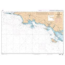
<p style="text-align:justify;">Shom 7068 navigation chart for cruising between Quiberon and Les Sables d'Olonne. Scale: 1:162400</p>
available
-
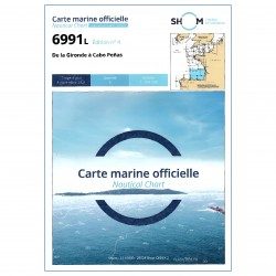
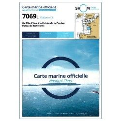
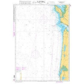
<p>Shom 7069 marine chart for cruising around Yeu, Ré and Oléron. Scale: 1:164800.</p>
available
-
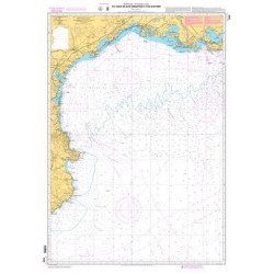
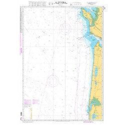
<p style="text-align:justify;">Shom marine chart for navigation from Oleron island to Arcachon basin. Scale: 1:167000.</p>
available
-
<p>Marine chart for coastal navigation. SHOM 7094 L - From the Four lighthouse to the Virgin Island - Aber Wrac'h Port - Scale 1:25000</p>
available
-
<p>Marine chart for coastal navigation. SHOM 7095 L - Morlaix Bay - from Batz Island to Primel Point - Scale 1:20000</p>
available
-
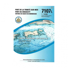
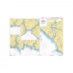
<p>SHOM marine chart 7107L : Harbour of la Trinité-Sur-Mer, harbour of Le Crouesty, entrée du Golfe du Morbihan. Scale 1:10000</p>
available
-
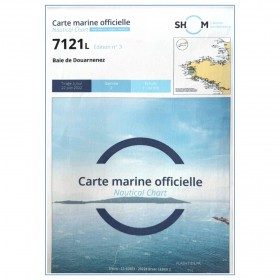
<p>Marine chart for coastal navigation. SHOM 7121 - Douarnenez Bay - scale 1:30000. Available in folded A4 format or in unfolded A0 format</p>
available

-
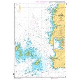
<p>Marine chart for coastal navigation. SHOM 7122 L - from Pointe Saint Mathieu to Four lighthouse - Scale 1:25000</p>
available

-
<p>Marine chart for coastal navigation. SHOM 7123 L - Molène Island - Ushant Island - Fromveur Passage - Scale 1:20000</p>
available

-
<p>Marine chart for coastal navigation. SHOM 7124 L - Bay of Lannion - from Pointe de Primel to Ile Grande - Scale 1:20000</p>
available
-
<p>Marine chart for coastal navigation. SHOM 7125 L - Approaches to Perros-Guirec - Scale 1:20000</p>
available
-
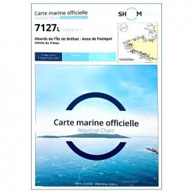
<p>Marine chart for coastal navigation. SHOM 7127 L - Bréhat Island - Paimpol Cove - Trieux Entrance. Scale 1:20000</p>
available
-
<p>Marine chart for coastal navigation. SHOM 7128 L - Bay of Saint Brieuc - from Pointe de la Tour to Yffiniac Cove. Scale 1:25000</p>
available
-
<p>Marine chart for coastal navigation. SHOM 7129 L - from Cap Fréhel to Saint Briac-sur-Mer - Scale 1:20000.</p>
available
-
<p>Marine chart for coastal navigation. SHOM 7130 L - Approaches to Saint Malo - from Hebihens Island to Pointe de la Varde - Scale 1:15000.</p>
available
-
<p>Marine chart SHOM 7135 L. From the point of Saint Jacques to Damgan. Scale 1:15000.</p>
available
-
<p>Marine chart SHOM 7136L. From Mahé Bridge to Piriac sur Mer. Scale 1:15000.</p>
available
-
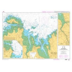
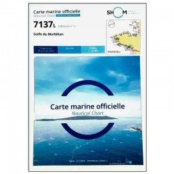
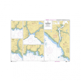
<p>SHOM marine chart 7137 L. Gulf of Morbihan. Scale 1:20000</p>
available
-
<p>Nautical chart SHOM 7145L. From Triballe to Pornichet. Scale: 1:25000.</p>
available
-
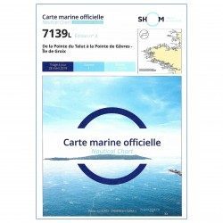
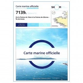
<p>SHOM marine chart 7139 L. Groix Island and Lorient roadstead. Scale 1:20000</p>
available
-
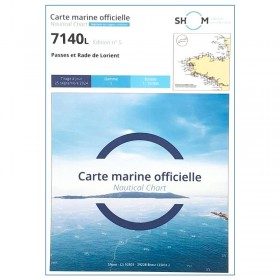
<p>SHOM marine chart 7140 L. Rade and passes of Lorient. Scale 1:10000</p>
available
-
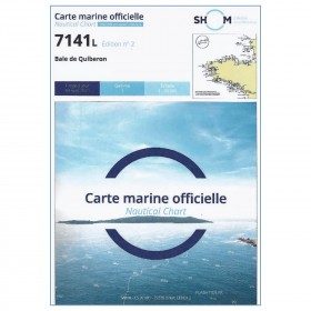
<p>SHOM marine chart 7141 L. Quiberon Bay. Scale 1:20000</p>
available

-
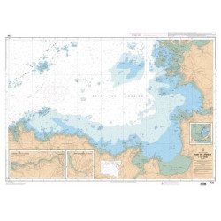
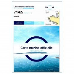
<p>SHOM marine chart 7142 L. Belle-Île. Scale 1:25000</p>
available


Showing 1-48 of 95 item(s)
Les cartes SHOM établies par le Service Hydrographique et Océanographique de la Marine.
Les cartes officielles SHOM établies par le Service Hydrographique et Océanographique de la Marine. La référence en matière de cartographie.