available


Detailed features

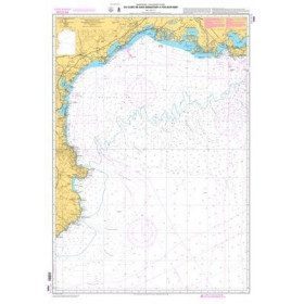
The SHOM 7406 L chart is the marine chart from Marseille to Toulon.
Area covered: Marseille South, Cassis, Archipelago of Riou, La Ciotat, Bandol, Toulon. Scale 1/50000.
Characteristics of the SHOM 7406L chart (folded version)
- Folded size A4 (297 x 210 cm)
- Open size A0 (84 x 119 cm)
You might also like 3 other products seleted for you
-
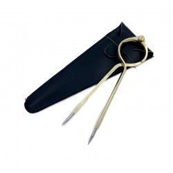
<h2>One Hand Brass Divider</h2>
<p style="text-align:justify;">One hand brass divider for aesthetics with fine stainless steel points for accuracy of measurement. The one hand divider is an indispensable marine instrument for measuring distances on a nautical chart whatever the scale, for determining its position in latitude and longitude or for positioning a point on the chart.</p>
<h2><span>Features of the One Hand Divider</span></h2>
available

-
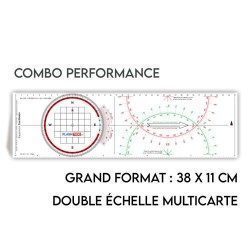
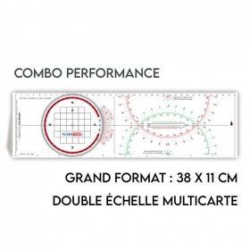
<h2>All the possibilities of the Cras rule and the Rappporteur Breton</h2>
<p style="text-align:justify;"><span>The Antares protractor ruler is both a tricolour Cras ruler AND a Breton protractor. It can be easily adapted to any skipper or sailor, whatever his or her initial training or practice habits. </span></p>
<h2>Features of the Antares rule</h2>
available
-
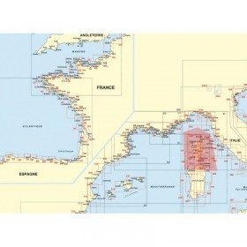
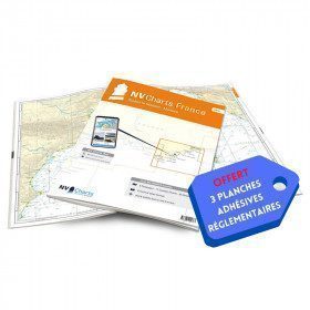
<h2>NV-CHARTS FR10 - 45 Côte d'Azur Nautical Charts (from Toulon to Menton) + the 3 regulatory adhesive boards</h2>
<p><span style="font-size:10pt;">In this NV-Charts FR10 pack, you will find an Atlas of <span>45 Mediterranean Riviera charts from Toulon to Menton and Monaco including 2 offshore charts, 11 coastal charts and 32 detailed charts.</span> With a personal download code, you will have access to all the maps in digital format as well as the <strong>NV Graphical Navigator light navigation software</strong> both freely usable on PC, tablets or smartphone!</span></p>
<p><span style="font-size:10pt;">The areas represented are: <strong>Mediterranean Riviera - Toulon, Hyères, Port Cros, Porquerolles, Fréjus, Saint Raphaël, Cannes, Antibes, Nice, Monaco, Menton (FRANCE).</strong></span></p>
<p><span style="font-size:10pt;"><span style="color:#ff0000;"><strong>Free with your FR10 pack:</strong></span> 3 adhesive sheets containing the mandatory regulatory documentation (RIPAM, buoys and flags) for navigation in coastal areas (art 242-2.04 of Division 240). <span style="color:#ff0000;"><strong>When you buy your pack, you have all the regulatory documentation for sailing within 6 miles of a shelter.</strong></span></span></p>
<h2>Description of the FR10 card pack</h2>
available


In the same category
4 other products seleted for you-
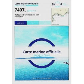
<h2>SHOM chart 7407 L is the nautical chart of Toulon Cavalaire sur Mer</h2>
<p>Area covered: Toulon, Saint Mandrier, Le Pradet, Port Cros, Porquerolles, Hyères, Le Lavandou. Scale 1/50200.</p>
<h2>Characteristics of the map 7407L (folded version) </h2>
available
-
available
-
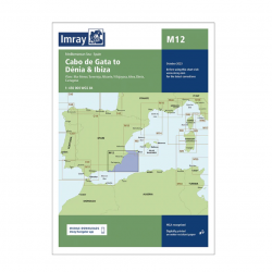
<h2>Imray Marine Chart M12 Cabo de Gata to Denia and Ibiza</h2>
<p>Plans included: Mar Menor (1:75 000) Torrevieja (1:20 000) Alicante (1:30 000) Villajoyosa (1:15 000) Altea (1:15 000) Dénia (1:25 000) Cartagena (1:15 000) This edition includes the latest official Instituto Hidrográfico de la Marina Digital, combined with additional information sourced from Imray's network to make it ideal for small craft. The chart has been fully revised throughout. The main panel has been rescaled to 1:450,000 for consistency with other M-Series charts in Mediterranean Spain. The plan of Mar Menor now provides coverage at an improved larger scale. A new plan of Cartagena has been added.</p>
<h2>Specifications of the Imray Marine Chart M12 Cabo de Gata to Denia and Ibiza</h2>
available
-
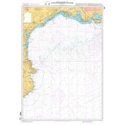
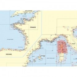
<p>Marine chart shom 7008. Cabo de San Sebastian to Fos sur Mer. Scale : 1:250000</p>
available