

Nautical Guides
In this category you will find the essential boating guides to learn about new topics or to update your knowledge. These guides are accessible to a wide range of people, so take a look at the Picksea expert selection! If you're looking for nature guides, you're sure to find something to please you with topics such as underwater life, seabirds, mammals and seaweed for example. You will also find in this category guides focusing on marine regulations with technical topics such as currents, tides, flagging or how to sail in heavy weather! Are you looking for the basics? We suggest the Atlantic and Mediterranean marine and coastal blocks or the numerous Imray guides to the Channel Islands, Italy, the English Channel, Spain and Portugal...
Read more
There are 36 products.
-
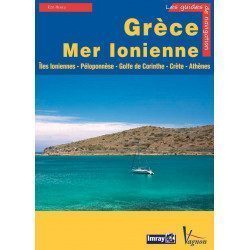
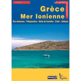
<p>Guide from the prestigious English publishing house IMRAY, world reference in the field of marine cartography. This guide covers the areas of Greece and the Ionian Sea, Ionian Islands, Peloponnese, Gulf of Corinth, Crete, Athens. Edition of 23/04/2012</p>
available

-
<div class="fiche-txt">
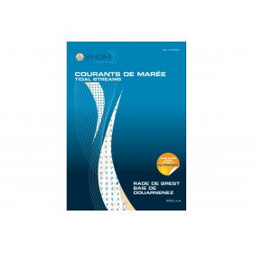
<h2>11 Atlas detailing tidal currents and water heights by Zone</h2>
<p>The tidal current atlases show the current fields at each hour of the tide, in average spring and neap tides. Essential for the safety of all sailors, they will also be an effective aid for your regattas.</p>
<h2>Details of the Shom Currents & Tides Atlas</h2>
</div>
available

-
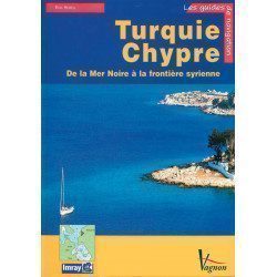
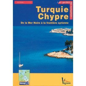
<p>A guide from the prestigious English publishing house IMRAY, a world reference in the field of marine cartography. This guide covers the areas of Turkey and Cyprus, from the Black Sea to the Syrian border. </p>
available
-
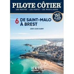
<h2>This Bénéteau Coast Pilot is truly the most useful nautical document on board a cruising boat after the nautical charts.</h2>
<p>It is often said that sailors who frequent the coasts of North Brittany never feel in real difficulty anywhere else on the seas of the globe. This is probably a little excessive but it is certain that these jagged shores, with rocks jagged by the harsh storms, where the channels are sometimes not wide enough to cross, where the tidal range which increases rapidly towards the East reaches in the bay of St Malo, a frightening record of 13.5 m, creating violent currents which raise dangerous breakers against the slightest swell, all these difficulties require from the navigators a perfect knowledge of the channels, of the alignments of the shoals, if one wants to discover all the small beaching ports which nestle in the bays, the creeks, the rias of these difficult shores. This is where the Pilote Côtier Bénéteau from Saint Malo to Brest proves to be invaluable with the multitude of information it has gathered from hundreds of professional sailors who are familiar with these areas.</p>
<h2>Features</h2>
available
-
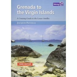
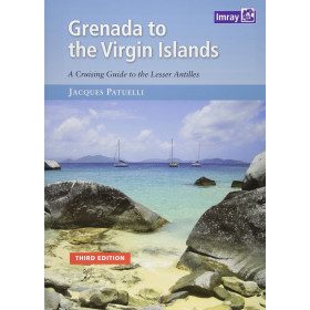
<h2>Prepare your navigation with this navigation guide!</h2>
<p>This navigation guide: "<strong>Grenada to the virgin islands</strong>" is the English edition of Jacques Patuelli's "Guide to the Lesser Antilles". It is a reference book for those who wish to discover the West Indies by boat. It describes with detail and precision the ports, marinas and numerous anchorages. The presentation of this navigation guide is clear and detailed, there are many photos that complement the maps and plans.</p>
<p>For each port, island or bay: description (location with waypoint, hazards, lights, maps, radio contacts, harbour master's office), cartography, approach (day and night), mooring and anchorage, equipment and services, shore visits, history.</p>
<h2>Detailed features of the "Grenada to the virgin islands" navigation guide</h2>
available
-
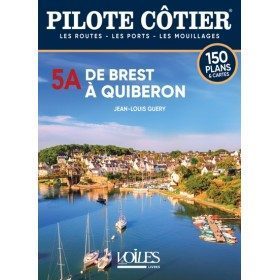
<h2>By following the information in this Pilote Côtier Bénéteau, even a beginner can venture from Concarneau into the numerous passes of the Glénan archipelago. </h2>
<p>This Bénéteau Coastal Pilot is not only for experienced sailors. Cabotage along the northern coast of Belle Ile does not present any real difficulties even if the currents are sometimes strong in the passage near the Teignouse and raise a rather rough sea. Similarly, the Lorient harbour offers a calm stretch of water, as do the rivers of Pouldu, Belon and Pont Aven, as well as the magnificent river Odet, whose ascent is a beautiful country walk in the heart of the Breton countryside. With a little attention and by following the information in this Pilote Côtier Bénéteau, even a beginner can venture from Concarneau into the numerous passes of the Glénan archipelago. </p>
<p>But it is true, going further N.W. than from Loctudy and the river of Pont l'Abbé, the coastline takes on an undeniably more severe character. You don't turn the tip of Penmarch like the one in Quiberon and at the Audierne anchorage, you can't improvise to cross the Raz de Sein where the violent currents raise breakers which can put an inexperienced crew in danger. Departure must be at a specific time, and routes must be followed on precise alignments. This is where this Bénéteau Coastal Pilot comes in handy, providing a wealth of information based on the experience of many sailors, so that you can face the dangers of the tip of Brittany in the safest possible conditions and take full advantage of the beauty of these wild shores. </p>
<h2>Features</h2>
available

-
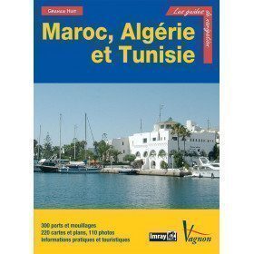
<p>Guide from the prestigious English publishing house IMRAY, a world reference in the field of marine cartography. This guide covers Morocco, Algeria, Tunisia, Gibraltar, Libya, Pantelleria, the Pelagie Islands and Malta. Edition of 03/12/2012</p>
available

-
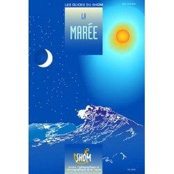
<div class="fiche-txt">
<h2>The tide in detail by SHOM</h2>
<p>This work is dedicated to any yachtsman who is particularly interested in the tide and all that can result from it. A very nice book filled with beautiful photos and landscapes, but also with relevant and quality information.</p>
<h2>General browsing on Picksea.com</h2>
<p>Many books on navigation in general are available on our site, do not hesitate to discover and enjoy them by browsing our categories. Such as the practical guides, the marine guides, or the youth section for your children!</p>
<h2>Features of this book</h2>
</div>
available
-
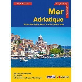
<h2>Prepare your navigation with this navigation guide!</h2>
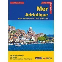
<p>This navigation guide: "Adriatic Sea - Albania, Montenegro, Bosnia, Croatia, Slovenia, Italy" describes the ports, marinas and numerous anchorages in detail. The presentation of this navigation guide is clear and detailed, with many photos to complement the maps and plans.</p>
<p>For each port, island or bay: description (location with waypoint, hazards, lights, maps, radio contacts, harbourmaster's office), cartography, approach (day and night), mooring and anchorage, equipment and services, shore visits, history.</p>
<p>The guide covers the coasts of Albania, the Dalmatian coast, the coasts of Montenegro, Croatia and Slovenia, and the east coast of Italy from the Slovenian border to Santa Marica di Leuca.</p>
<h2>Detailed features of the Channel Islands Sailing Guide</h2>
available
-
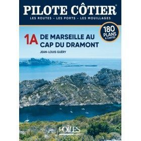
<h2>The Pilote Côtier guide offers precise documentation on ports and anchorages</h2>
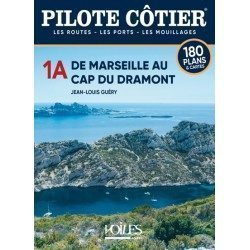
<p>Some yachtsmen from the north like to criticise the coasts of Provence and the Riviera, which in their eyes are nothing more than a continuous front of built-up areas and large marinas, in a word a real concrete wall. They have never really sailed along these shores from Marseille to Menton. One can only be amazed at the sun-bleached stone cliffs carved out by the deep creeks of Marseille and overflowing with totally deserted islets. Then come the Cyclops wall of Cassis, the highest cliffs in France, the imposing promontory of Cap Sicié, totally inaccessible by land, and all the charming little ports between the large harbour of Toulon and the marshes of the Giens peninsula where pink flamingos nest. The pine-shaded shores of Porquerolles Island have also remained unchanged for centuries and the southern coast is just as wild as many of the Corsican shores.</p>
<p>To say that the area around Saint Tropez is overrun with rich villas with their feet in the water is to ignore the reddish rocky escarpments, the great fleeces of pine trees which descend to the sea from the Capes Lardier and Camarat. The multitude of small creeks of the Trayas coast between St Raphaël and Cannes, can also only make you love Mediterranean landscapes. And even in the vicinity of the big cities of Nice and Monaco, one can still find, as in the bay of Villefranche, some quiet anchorages in a nature preserved from concrete. The Italian coast is undoubtedly one of the most urbanised, but its coastline remains mountainous and the atmosphere of its ports is always lively and attractive.</p>
<h2>Features</h2>
available
-
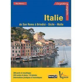
<p>Guide from the prestigious English publishing house IMRAY, a world reference in the field of marine cartography. This guide covers the areas of Italy: From San Remo to Brindisi, Sicily and Malta. Edition of 03/12/2012</p>
available

-
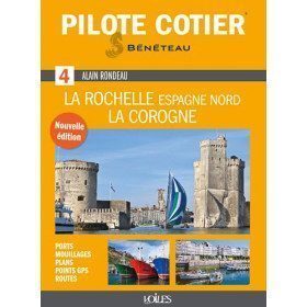
<h2>Indispensable for successful cruising from La Rochelle to La Coruña!</h2>
<p>An indispensable tool for pleasure boating, this Coastal Pilot n°4, modernised and updated by Jean-Louis Guéry, is a reference book for anyone wishing to sail in the Atlantic, in the area between La Rochelle and La Corogne. It has been given a clearer and more practical presentation. It contains all the information and advice needed to enter ports, reach an anchorage, avoid pitfalls, navigate a difficult passage, find a service at the port of call, etc. Illustrated with numerous photos and aerial views to easily identify the landscape, it also includes maps of ports and anchorages, lists of waypoints, addresses and useful telephone numbers. A must-have!</p>
<h2>Features</h2>
available

-
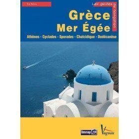
<p>Guide from the prestigious English publishing house IMRAY, world reference in the field of marine cartography. This guide covers the areas of Greece and the Aegean Sea, Athenes, Cyclades, Sporades, Chalkidiki, Dodecanesia. Edition of 23/04/2012</p>
available

-
<h2>Prepare your navigation with this navigation guide!</h2>
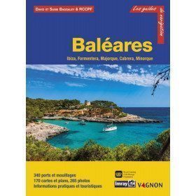
<p>This sailing guide: "Balearic Islands - Ibiza, Formentera, Mallorca, Cabrera, Menorca" describes the ports, marinas and numerous anchorages in detail and with precision. The presentation of this navigation guide is clear and detailed, with many photos to complement the maps and plans.</p>
<p>For each port, island or bay: description (location with waypoint, hazards, lights, maps, radio contacts, harbour master's office), cartography, approach (day and night), mooring and anchorage, equipment and services, visits on land, history.</p>
<p>This guide covers the coasts of Ibiza, Formentera, Majorca, Cabrera and Menorca.</p>
<h2>Detailed features of the Balearic Sailing Guide</h2>
available

-
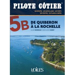
<h2>The essential guide to the most beautiful cruises in Southern Brittany and the Vendée to sail safely </h2>
<p>The coasts of Southern Brittany and the Vendée are among the most beautiful in France. For yachtsmen, it is an exceptional sailing area, with islands to explore, rivers to sail up, creeks to take shelter in, points to go around and picturesque little ports to discover. But it is also a complex sailing area, with many traps, between shoals, currents, passes and channels. And simply reading the map does not always allow you to navigate in complete safety. This Coastal Pilot, entirely revised and corrected, is the essential tool for experienced and inexperienced sailors alike. It contains all the information and advice needed to navigate, day or night, and to create the most beautiful cruises.</p>
<p>For this new edition, we have modernised the presentation with even more photos and plans, with clear and precise comments, perfectly documented information and up to date with the latest modifications. This work has been carried out by authors whose knowledge of these coasts is the fruit of their countless navigations. It is this competence and seriousness that have made the Pilote côtier collection a success with all yachtsmen for over 40 years.</p>
<h2>Features</h2>
available
-
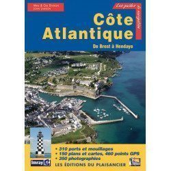
<p>Guide from the prestigious English publishing house IMRAY, world reference in the field of marine cartography. This guide covers the areas from Brest to Hendaye. </p>
unavailable
-
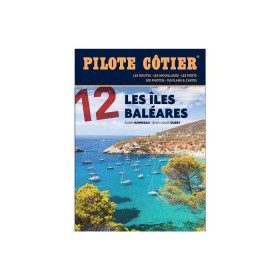
<h2>From the calas of Menorca to the great beaches of Formentera, the essential guide to the Balearic Islands!</h2>
<p>Just a day's sail from the French Mediterranean coast, the Balearic Islands are a dream destination. Four islands which have in common a remarkably sunny climate, moderate summer breezes, easily accessible ports and indented coasts where a multitude of coves, each more beautiful than the next, are hidden. Minorca, the most northerly, is also the wildest. Its real little fjords, the roadsteads of Fornells and Port Mahon, offer well-sheltered waters. Mallorca is more grandiose with a very contrasting coastline, from the impressive cliffs of the west coast to the small coves of the east coast, not forgetting the small pearls that are the islands of Cabrera and Dragonera. Ibiza and Formentera are even more sunny and carefree. If their coves and beaches are an invitation to drop anchor, their harbours are always buzzing with life. All the information you need to sail safely. An indispensable book, in addition to the nautical chart and the GPS.</p>
<h2>Features</h2>
available

-
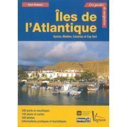
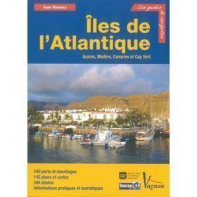
<p>Guide from the prestigious English publishing house IMRAY, a world reference in the field of marine cartography. This guide covers the Azores, Madeira, the Canaries and Cape Verde.</p>
unavailable
-
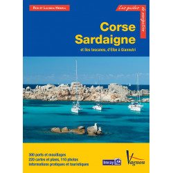
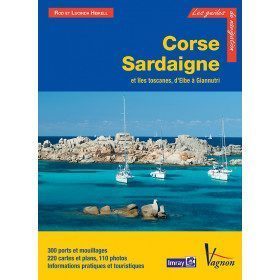
<p>Guide from the prestigious English publishing house IMRAY, world reference in the field of marine cartography. This guide covers the areas of Corsica, Sardinia, the Tuscan Islands, from Elba to Giannutri. Edition of 23/04/2012</p>
available
-
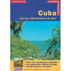
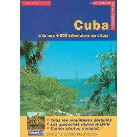
<p>Guide from the prestigious English publishing house IMRAY, a world reference in the field of marine cartography. This guide covers the Cuba areas. Edition of 01/01/2001</p>
available
-
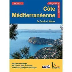
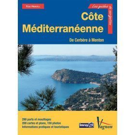
<p>New edition of the famous IMRAY Guide to the Mediterranean coast. This guide covers the areas from Cerbére to Menton. July 2013 edition</p>
unavailable
-
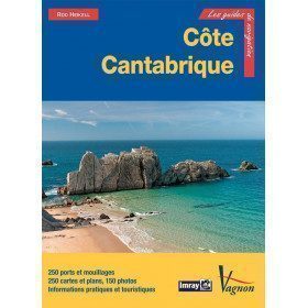
<div class="fiche-txt">
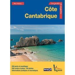
<h2>The famous Imray work along the Cantabrian coast</h2>
<p>A guide from the prestigious English publishing house IMRAY, a world reference in the field of marine cartography. This guide covers the areas from the south-west of France to the north Spanish coast. You can only be amazed by the beauty of the photos and the accuracy of the information given.</p>
<h2>Detailed features of the Imray Cantabrian Coast Guide</h2>
</div>
available
-
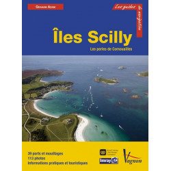
<h2>Prepare your navigation with this navigation guide!</h2>
<p>This sailing guide: "The Scilly Islands - Pearls of Cornwall" describes in detail the ports, marinas and numerous anchorages. The presentation of this sailing guide is clear and detailed, with many photos to complement the maps and charts.</p>
<p>For each port, island or bay: description (location with waypoint, hazards, lights, maps, radio contacts, harbour master's office), cartography, approach (day and night), mooring and anchorage, equipment and services, shore visits, history.</p>
<h2>Detailed features of the Isles of Scilly Navigation Guide</h2>
available
-
<div class="fiche-txt">
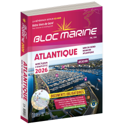
<h2>Indispensable on board your boat: the Atlantic 2025 marine block</h2>
<p style="text-align:justify;">The Atlantic 2024 Marine Block is no longer available. This book contains all the compulsory and regulatory elements on board a boat and offers you access to all the essential documents on board. For this edition, a complete update of the mandatory 2025 regulations has been carried out and you will find <span>in addition </span><span>a special section devoted to new technologies: "electronics - equipment - home automation".</span><span>. </span>Browse the descriptions of the ports and benefit from all the updated approach charts (these are made every year according to the SHOM information). This marine guide allows you to save precious time in order to arrive at the port in complete serenity. A real bible for sailors and yachtsmen, it contains essential information for coastal and deep-sea navigation.</p>
<h2>The marine block for the Atlantic : a navigation area from England to the Azores</h2>
<p style="text-align:justify;">Your marine block allows you to carry all the nautical documents required on board during your navigations. The Atlantic model (new edition 2022) is a great classic of the maritime bookshop and a reference book for sailors. Find our entire collection of coastal and marine pads on our Picksea shop, number one in nautical equipment on the internet.</p>
<h2>Detailed summary of the Atlantic 2025 Marine Block</h2>
</div>
available
-
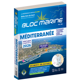
<div class="fiche-txt">
<h2>Indispensable on board : Bloc Marine Méditerranée 2025</h2>
<p style="text-align:justify;">Truly the bible of any sailor, the Mediterranean Marine Block 2025 edition allows you to have all the regulatory documents for the safety of the boat essential on board. A complete update of the mandatory 2025 regulations has been made. In this edition, you will also find <span>a special section devoted to new technologies: "electronics - equipment - home automation".</span>. The descriptions of the ports in WGS84 and the maps are updated every year and allow you to save precious time to reach the port safely. A complete atlas is also included in this Mediterranean 2025 Marine block. The marine and coastal blocks offer a real documentation for your sea excursions. So, find the whole collection of regulatory boat equipment on Picksea, your online shop for marine books.</p>
<h2>Detailed summary of the Mediterranean Sea Block 2025</h2>
</div>
available

-
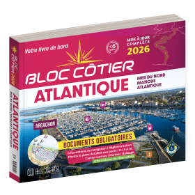
<div class="fiche-txt">
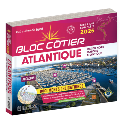
<h2>Indispensable for sailing within 6 miles from a shelter: the Atlantic 2025 Bloc Cotier !</h2>
<p style="text-align:justify;">The Atlantic 2025 bloc cotier is a smaller work than the Marine block, bringing together all the compulsory and regulatory elements on board a boat for coastal sailing, i.e. within 6 miles of a shelter according to the regulations in force. It also offers you access to all the essential documents on board, such as port descriptions and updated maps. With even more photos, the coastal block also includes a complete atlas. The mandatory regulations for 2025 have also been completely updated.</p>
<h2>Detailed summary of the Atlantic Bloc Cotier 2025</h2>
</div>
available
-
<div class="fiche-txt">
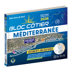
<h2>Indispensable for sailing within 6 miles of a shelter: the Mediterranean 2025 Bloc Cotier</h2>
<p style="text-align:justify;">The Mediterranean 2025 Bloc Cotier is a smaller work than the Marine block, bringing together all the compulsory and regulatory elements on board a boat for coastal sailing, i.e. within 6 miles of a shelter according to the regulations in force. It offers you wider access to all the essential documents on board, such as port descriptions and updated charts. With even more photos, the coastal block also includes a complete atlas. The mandatory 2025 regulations have also been completely updated.</p>
<h2>Detailed summary of the Mediterranean Coastal Block 2025</h2>
</div>
available
-
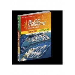
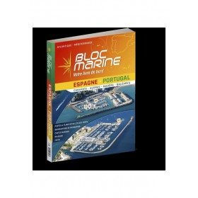
<div class="fiche-txt">
<h2>The essential guide for sailing around Spain and Portugal</h2>
<p>The Spain-Portugal Marine Block is the book to have on board! It allows you to have all the essential and mandatory documents on board your boat. The descriptions of ports and maps are updated every 2 or 3 years and allow you to save precious time to arrive safely and calmly at your destination. In this new edition, which was completely updated in June 2023, the Marine Block docks on the coasts of the Iberian Peninsula: Portugal, Spain, not forgetting the islands with the Balearic Islands, Madeira, the Canaries, the Azores... in total, there are more than 350 ports and as many opportunities for stopovers and cruises in perspective! In addition to general information on regulations, rescue and safety at sea, you will find, for each port, a maximum of information on the installations, the operation and the means of rescue as well as a location map. Several new features are included in this edition: a bilingual French/Spanish book a complete navigation atlas with more than 80 maps detailed plans in WGS84 for almost all the ports hundreds of aerial photos Everything you need to prepare for your navigations with complete peace of mind</p>
</div>
available
-
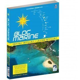
<div class="fiche-txt">
<h2>The Marine Block covering all the West Indies and updated</h2>
<p>The West Indies Marine block is the logbook for long distance cruising which allows you to have all the essential documents on board for a transatlantic navigation and once in the West Indies. The descriptions of the ports and the maps allow you to save precious time in order to discover these navigation areas in complete safety. Written in French and English, this guide covers an area from the Virgin Islands to Trinidad and Tobago.</p>
<h2>Detailed features of the Caribbean Marine Block</h2>
</div>
available

-
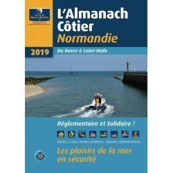
<div class="fiche-txt"><h2>The indispensable tool for the Breton sailor: The Normandy Coastal Almanac 2019</h2><p style="text-align: justify;">A true bible or Swiss Army knife for professional and amateur sailors. The Normandy Coastal Almanac contains all the necessary and indispensable information for the smooth running of your trips in this region. This reference book is very complete since it contains information on many ports <span>of the English Channel as well as meteorological information such as tide times. Much more than a simple navigation guide, this almanac has for main objective to help the families of sailors in need.</span></p><h2>Detailed features of the Normandy coastal almanac</h2></div>
available
-
available

-
available
-
available
-
available
-
available
-
available


Showing 1-36 of 36 item(s)