

Atlantic coast charts
For civilian or military sailors, whether they are commercial, fishing or pleasure craft, safe navigation requires the best information to understand the maritime space from a nautical point of view. Thus, a nautical chart will allow you to find your way in space and to choose your route, taking into account the weather conditions and the traffic. Find our large selection of special Atlantic coastline charts
FROM VENDÉE TO BASQUE COUNTRY
Find a wide choice of navigation charts of the Atlantic coast, from the Vendée to the Basque Country for all your cruises between France and Spain. Need to escape? Picksea has thought of you! Find the nautical charts of the whole world like those of the Outermers, those of the Mediterranean Sea, but also the north coast and South of Brittany. Particularly appreciated by coastal sailing enthusiasts, the pack FR8 from NV-CHARTS. This pack contains 33 charts, from La Rochelle to San Sebastian, including 3 offshore charts, 15 coastal charts and 15 detailed charts. The advantage of this pack is that it provides you with all the regulatory documentation for navigation within 6 miles of a shelter. Indeed, in addition to the 22 navigation charts, our teams offer you 3 adhesive boards containing the compulsory documentation (RIPAM, buoyage and flags) for navigation in coastal areas
A LARGE CHOICE OF NAUTICAL CHARTS SHOM
Authorized agent of the SHOM for many years now, Picksea offers you a large selection of documentation, charts and current charts from this establishment. For charts SHOM, the map 9999 and the chart 7066 represent respectively, the official test charts for the offshore licence and for the professional maritime exams. Like the chart 9999 of SHOM, this type of chart also helps to prepare for the exams. Although defined as an official chart, it also contains all the information of a real navigation chart (scale of latitudes and longitudes, coasts, probes, dangers....). It is quite possible to trace routes and bearings as well as to position points, or to measure distances as on a real chart. To learn more about this subject, we invite you to discover our article "How to read and use your navigation chart?"
LAMINATED CHARTS DESIGNED FOR COASTAL NAVIGATION
Navicarte as you can see, pleasure boating or coastal navigation requires just as much information on the navigation area as offshore navigation. It is therefore essential, regardless of the distance separating you from a shelter and the type of boat you are sailing on, to have a nautical chart. Thus, the brand Navicarte offers a wide range of laminated navigation charts designed specifically for kayaking, catamaran sailing and coastal navigation in general
OUR SELECTION OF OFFSHORE CHARTS FOR OFFSHORE NAVIGATION
Offshore sailing or crossings require planning, organisation and identification of all the possible hazards that you may encounter, often linked to weather conditions. Our teams have selected for you a complete selection of offshore charts. This type of map allows you to choose your routes and to consider the different options available to you. These maps contain the important traffic lights as well as the distances between the different stopovers you can make. In folded or rolled version, these maps are in A1 format and can be reduced to 15*30 cm. Concerning the Atlantic zone, the brand NV CHARTS offers you the nV PILOT 5 chart. This offshore map covers the North Atlantic, from Europe to the Caribbean and on the reverse side, a zone covering the Atlantic islands (Cape Verde, the Canaries, Madeira or the Azores). This is the perfect map to prepare you to follow a Transatlantic
Read more
There are 19 products.
-
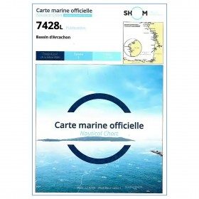
<p style="text-align:justify;">Marine map 7428L for your coasters and your discoveries of the Arcachon basin.</p>
available
-
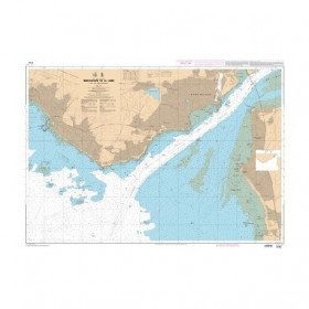
<p style="text-align:justify;">Shom marine chart for navigation from Oleron island to Arcachon basin. Scale: 1:167000.</p>
available
-
<p>Shom 7069 marine chart for cruising around Yeu, Ré and Oléron. Scale: 1:164800.</p>
available

-
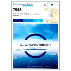
<p style="text-align:justify;">Shom 7068 navigation chart for cruising between Quiberon and Les Sables d'Olonne. Scale: 1:162400</p>
available
-
<p style="text-align:justify;">Shom 6990 marine chart for your navigations between Penmarc'h and the Gironde estuary. Scale: 1:355000</p>
available
-
<h2 style="text-align:justify;">The SHOM 7395 L chart is the folded version of the chart for Le Croisic to Noirmoutier and the Loire Estuary.</h2>
<p style="text-align:justify;">Area covered: Le Croisic, Le Pouliguen, Pornichet, La Baule, Saint Nazaire, Saint Brévin, baie de Bourgneuf, L'Herbaudière. Scale 1:50300.</p>
available
-
<p style="text-align:justify;">Shom 7394 marine chart for cruising around Noirmoutier. Scale: 1:50000.</p>
available

-
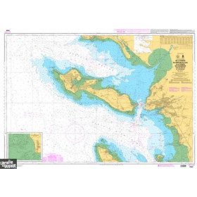
<p>Marine chart for navigations around the Ile de Ré. SHOM 7404 L - From the Pointe du Grouin du Cou to the Pointe de Chassiron</p>
available
-
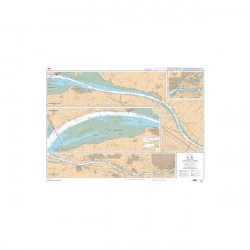
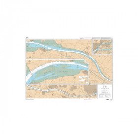
<p style="text-align:justify;">SHOM chart 7396 for navigation up the Loire River from St Nazaire bridge to Nantes. SHOM marine chart type Carte L folded to A4 format or flat, for pleasure boating. Scale: 1 : 20 000 to 1 : 15 000</p>
available
-
<p style="text-align:justify;">SHOM marine chart 6797 for navigation in the mouth of the Loire up to the bridge of St Nazaire. SHOM marine chart type L folded to A4 format or flat, for pleasure boating. Up to date edition Scale: 1 : 15 000</p>
available

-
<p>Nautical chart for navigations around the Ile de Ré. SHOM 7404 L - From Pointe du Grouin du Cou to Pointe de Chassiron</p>
available
-
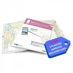
<h2>NV-CHARTS FR7 - 27 Vendée Nautical Charts (from Noirmoutier to La Rochelle) + the 3 statutory adhesive sheets</h2>
<p><span style="font-size:10pt;">In this NV-Charts FR7 pack, you will find an Atlas of <span>27 charts Vendée from Noirmoutier to La Rochelle including 3 offshore charts, 12 coastal charts and 12 detailed charts.</span> With a personal download code, you will have access to all the maps in digital format as well as the <strong>NV Graphical Navigator light navigation software</strong> both freely usable on PC, tablets or smartphone!</span></p>
<p><span style="font-size:10pt;">The areas represented are: <strong>Vendée - Noirmoutier, Ile d'Yeu, Saint Gilles Croix de Vie, Les Sables d'Olonne, Port Bourgenais, Jard sur Mer, Pointe de l'Aiguillon, Ile de Ré, La Rochelle (FRANCE).</strong></span></p>
<p><span style="font-size:10pt;"><span style="color:#ff0000;"><strong>Free with your FR7 pack:</strong></span> 3 adhesive sheets containing the mandatory regulatory documentation (RIPAM, buoys and flags) for navigation in coastal areas (art 242-2.04 of Division 240). <span style="color:#ff0000;"><strong>When you buy your pack, you have all the regulatory documentation for sailing within 6 miles of a shelter.</strong></span></span></p>
<h2>Description of the FR7 card pack</h2>
available
-
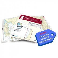
<h2>NV-CHARTS FR8 - 33 Aquitaine Marine Charts (from La Rochelle to San Sebastian) + the 3 regulatory adhesive sheets</h2>
<p><span style="font-size:10pt;">In this NV-Charts FR8 pack, you will find an Atlas of <span>33 Aquitaine charts from La Rochelle to San Sebastian including 3 offshore charts, 15 coastal charts and 15 detailed charts</span>. With a personal download code, you will have access to all the maps in digital format as well as the <strong>NV Graphical Navigator light navigation software</strong> both freely usable on PC, tablets or smartphone!</span></p>
<p><span style="font-size:10pt;">The areas represented are: <strong>Aquitaine - La Rochelle, Ré, Oléron, Rochefort, Royan, Gironde, Bordeaux, Arcachon, Bayonne, Biarritz, Saint Jean de Luz, San Sebastian (FRANCE)</strong></span></p>
<p><span style="font-size:10pt;"><span style="color:#ff0000;"><strong>Free with your FR8 pack:</strong> </span>3 adhesive sheets containing the mandatory regulatory documentation (RIPAM, buoys and flags) for navigation in coastal areas (art 242-2.04 of Division 240). <span style="color:#ff0000;"><strong>When you buy your pack, you have all the regulatory documentation for sailing within 6 miles of a shelter.</strong></span></span></p>
<h2>Description of the FR8 card pack</h2>
available
-
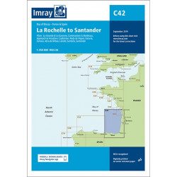
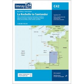
<h2 style="text-align:justify;">Imray C42 Marine Chart La Rochelle to Santander</h2>
<p style="text-align:justify;">In this edition, the latest survey information has been included where available. The shooting practice areas of the Landes test centre have been updated and the port developments of Bilbao and Santoña are shown. The map specification has been improved to show coloured light flashes. A general update has been made.</p>
<p style="text-align:justify;">Maps included:</p>
<ul><li>Arcachon Approach (1:50 000)</li>
<li>Capbreton (1:20 000)</li>
<li>Rada de Higuer (1:25 000)</li>
<li>Getaria (1:15,000)</li>
<li>Zumaia (1:15 000)</li>
<li>Abra de Bilbao (1:25 000)</li>
<li>Laredo (1:20 000)</li>
<li>Santoña (1:20 000)</li>
<li>Santander (1:25 000)</li>
<li>The Gironde & The Garonne (1:200 000)</li>
<li>Continuation to Bordeaux (1:200 000)</li>
</ul><h2 style="text-align:justify;">Characteristics of the Imray C42 map La Rochelle to Santander</h2>
unavailable
-
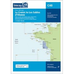
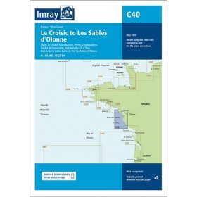
<h2 style="text-align:justify;">Imray C40 marine chart from Croisic to Sables d'Olonne</h2>
<p style="text-align:justify;">In this edition, the map specification has been improved to show coloured light flashes. The latest depth readings have been included where available and the shooting range has been updated. Additional tidal current data is included for Bourgneuf Bay. The plan of the L'Herbaudière marina has been revised to show its new configuration. A general update has been made throughout.</p>
<p style="text-align:justify;">Plans included:</p>
<ul><li>Le Croisic (1:15 000)</li>
<li>Saint-Nazaire (1:25 000)</li>
<li>Pornic (1:12 500)</li>
<li>L'Herbaudière (1:12 500)</li>
<li>Goulet de Fromentine (1:30 000)</li>
<li>Port-Joinville (Île d'Yeu) (1:10 500)</li>
<li>Port de Saint-Gilles-Croix-de-Vie (1:15 000)</li>
<li>Les Sables d'Olonne (1:20 000)</li>
</ul><h2 style="text-align:justify;">Characteristics of the Imray C40 map from Croisic to Sables d'Olonne</h2>
unavailable
-
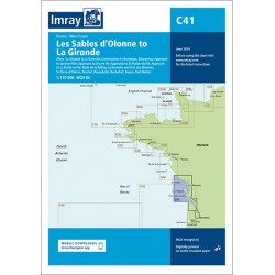
<h2 style="text-align:justify;">Imray C41 marine chart Sables d'Olonne to Gironde</h2>
<p style="text-align:justify;">In this edition, the latest depth readings have been applied where available. The development of ports and marinas at Port Minimes and La Pallice is included as well as the latest information on nature and marine reserves. The map of the Gironde at Bordeaux is more detailed and easier to use. The map specification has been improved to show coloured flashes of light. A general update has been made.</p>
<p style="text-align:justify;">Maps included:</p>
<ul><li>Bourgenay (1:10 000)</li>
<li>Approach to Jard-sur-Mer (1:17 500)</li>
<li>Approach to Ars-en-Ré (1:40 000)</li>
<li>Approach to St Martin-de-Ré (1:15 000)</li>
<li>Approach to La Flotte-en-Ré (1:15 000)</li>
<li>Rade de la Pallice (1:40 000)</li>
<li>La Rochelle and the Port des Minimes (1:15 000)</li>
<li>St-Denis-d'Oléron (1:10 000)</li>
<li>Douhet (1:7500)</li>
<li>Boyardville (1:10 000)</li>
<li>Rochefort (1:10 000)</li>
<li>Royan (1:7500)</li>
<li>Port Médoc (1:12 500)</li>
<li>The Gironde & The Garonne (1:200 000)</li>
<li>Continuation to Bordeaux (1:200 000)</li>
</ul><h2 style="text-align:justify;">Characteristics of the Imray C41 map from Sables d'Olonne to Gironde</h2>
unavailable
-
available

-
<h2 style="text-align:justify;">Imray Characteristics of the Imray C42 map La Rochelle to Santander</h2>
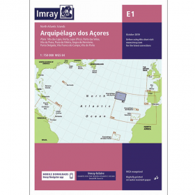
<p>Plans included:Lajes das Flores (1:20 000)Horta (1:12 500)Lajes do Pico (1:10 000)Velas (1:7500)Vila da Praia (1:10 000)Praia da Vitória (1:20 000)Angra do Heroísmo (1:12 500)Ponta Delgada (1:10 000)Vila Franco do Campo (1:15 000)Vila do Porto (1:10 000)Imray-Iolaire charts for the Atlantic Islands are widely acknowledged as the best available for the cruising sailor. They combine the latest official survey data with first-hand information gathered over 60 years of research by Don Street Jr and his wide network of contributors. Like all Imray charts, they are printed on water resistant Pretex paper for durability, and they include many anchorages, facilities and inlets not included on official charts.This edition includes the latest official data combined with additional information sourced from Imray''s network to make it ideal for small craft. It includes the latest official bathymetric surveys. Completed harbour works at Porto das Velas (São Jorge) is included and extra Marine Reserves are shown. For this edition magnetic variation curves have been added. There has been general updating throughout.</p>
available

-
available


Showing 1-19 of 19 item(s)