

North Brittany Charts
The North Brittany nautical charts cover a large area from Saint Malo to the Raz de Sein via Bréhat, Aber-Wrach and Brest. According to your needs, you will choose maps SHOM to work on large scales and the maps NV-Charts, Navicarte or Imray for smaller areas on smaller scales. Discover our selection on Picksea.com!
THE MARINE CHART, AN ESSENTIAL NAVIGATION TOOL
It is important to remember that nautical charts give more or less detailed indications depending on the scale and the use according to the type of navigation you are planning: the larger the scale, the less details the chart gives and vice versa. It is often very useful to complete the charts with a nautical guide such as the Atlantic Marine Block. In order to know how to read and use your navigation chartFind all our advice!
CHARTS FROM ST-MALO TO POINTE DU RAZ
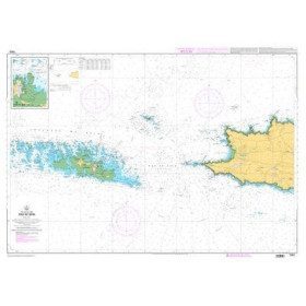
Find a complete range of navigation charts including the French coasts and ports from Saint Malo to the Pointe du Raz It covers more exactly the coasts of North and West Brittany. You will find all the details of the most important Traffic Separation Scheme in France which is the famous Ushant Rail. You will also find all the information on the surroundings of Saint Malo and Cancale, the Bay of Saint-Brieuc, Paimpol and the archipelago of Bréhat, the entrances of Trieux and Tréguier, the Sept-ïles and the surrounding ports such as Perros-Guirec or Trebeurden. Further west, the Bay of Lannion , Roscoff, the Aber-Wrach, the Four and Fromveur channels, the magnificent islands of Ushant and Molène as well as the Rade de Brest or the douarnenez bay will no longer hold any secrets for you. For the lovers of the Breton coasts, find also our navigation maps South Brittany.
A LARGE CHOICE OF NAUTICAL CHARTS ON PICKSEA.COM
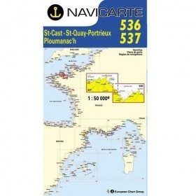
Overseas, Atlantic coast, Mediterranean Sea... Sail to the four corners of the world with nautical charts of the whole world. Discover our wide selection of maps for navigation and choose from the most popular brands on the market such as SHOM, NV-CHARTS or even Navicarte
THE LAMINATED NAUTICAL CHART FOR COASTAL NAVIGATION
Space-saving and water-safe, the laminated navigation chart is ideal for coastal navigation. Kayak, Dinghy, or Catamaran... Use your marine chart on your boat without fear! Just as visually appealing as a traditional chart, the laminated navigation chart can also be attached to the bottom of dinghies, on small chart tables or even on the cockpit
THE DEEP-SEA CHART FOR OFFSHORE NAVIGATION
When you decide to sail offshore, it is important to plan your navigation in advance in order to anticipate possible hazards linked to weather conditions and to plan the boat's route according to the direction of the wind and the swell. The offshore charts are specially designed to allow you to plan and prepare your navigation but also to consider different options during your crossing thanks to its course lights as well as the indication of the distances between the different potential stopovers.
CHARTS SHOM FOR LICENCES AND PROFESSIONAL EXAMS
For several years now, Picksea has been an Authorised Agent of the Shom. We can therefore offer you a complete range of RIPAMs, current charts or official nautical charts for the different permits and professional exams. The shom chart 9999 is the reference chart for the offshore licence while the shom chart 7066 is intended as a support for the different professional maritime exams. These two official charts are available on Picksea in folded or flat version. The choice is yours!
Read more
There are 27 products.
-
<p>Marine chart for coastal navigation. SHOM 7423L - Raz de Sein - scale 1:20000</p>
available

-
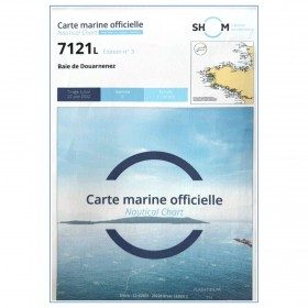
<p>Marine chart for coastal navigation. SHOM 7121 - Douarnenez Bay - scale 1:30000. Available in folded A4 format or in unfolded A0 format</p>
available

-
<p>Marine chart for coastal navigation. SHOM 7401 L - Access to the Rade de Brest - Scale 1:22500</p>
available
-
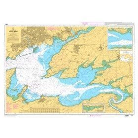
<p>Marine chart for coastal navigation. SHOM 7400 L - Rade de Brest - Scale 1:22500</p>
available
-
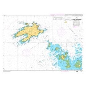
<p>Marine chart for coastal navigation. SHOM 7123 L - Molène Island - Ushant Island - Fromveur Passage - Scale 1:20000</p>
available

-
<p>Marine chart for coastal navigation. SHOM 7094 L - From the Four lighthouse to the Virgin Island - Aber Wrac'h Port - Scale 1:25000</p>
available
-
<p>Marine chart for coastal navigation. SHOM 7122 L - from Pointe Saint Mathieu to Four lighthouse - Scale 1:25000</p>
available

-
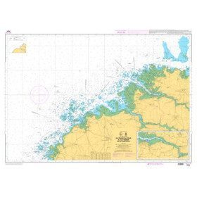
<p>Marine chart for coastal navigation. SHOM 7124 L - Bay of Lannion - from Pointe de Primel to Ile Grande - Scale 1:20000</p>
available
-
<p>Marine chart for coastal navigation. SHOM 7095 L - Morlaix Bay - from Batz Island to Primel Point - Scale 1:20000</p>
available
-
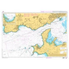
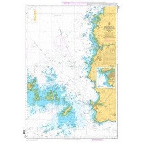
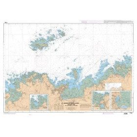
<p>Marine chart for coastal navigation. SHOM 7127 L - Bréhat Island - Paimpol Cove - Trieux Entrance. Scale 1:20000</p>
available
-
<p>Marine chart for coastal navigation. SHOM 7125 L - Approaches to Perros-Guirec - Scale 1:20000</p>
available
-
<p>Marine chart for coastal navigation. SHOM 7310 L - Bay of Saint Brieuc (eastern part) - from Dahouët to Cap Fréhel. Scale 1:25000.</p>
available
-
<p>Marine chart for coastal navigation. SHOM 7128 L - Bay of Saint Brieuc - from Pointe de la Tour to Yffiniac Cove. Scale 1:25000</p>
available
-
<p>Marine chart for coastal navigation. SHOM 7129 L - from Cap Fréhel to Saint Briac-sur-Mer - Scale 1:20000.</p>
available
-
<p>Marine chart for coastal navigation. SHOM 7130 L - Approaches to Saint Malo - from Hebihens Island to Pointe de la Varde - Scale 1:15000.</p>
available
-
<p>Marine chart for coastal navigation. SHOM 4233 L - LA RANCE : from St Malo to the Chatelier lock - Scale 1:15000.</p>
available
-
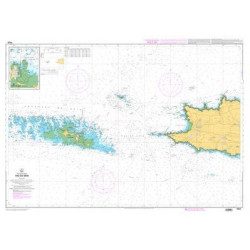
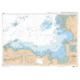
<p>Marine chart for coastal navigation. SHOM 6966L - Des Héaux-de-Bréhat au Cap Lévi - Shom paper chart - Scale : 1 : 155508</p>
available
-
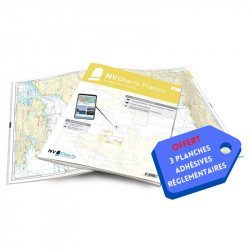
<h2>NV-CHARTS FR4 - 33 West Brittany Marine Charts (from the Seven Islands to Douarnenez) + the 3 regulatory adhesive sheets</h2>
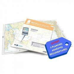
<p><span style="font-size:10pt;">In this pack NV-Charts FR4, you will find an Atlas of 33 nautical charts from the Seven Islands to Douarnenez<span> including 2 offshore maps, 13 coastal maps and 18 detailed maps</span>. With a personal download code, you will have access to all the maps in digital format as well as the <strong>NV Graphical Navigator light navigation software</strong> both freely usable on PC, tablets or smartphone!</span></p>
<p><span style="font-size:10pt;">The areas represented are: <strong>Western Brittany - Roscoff, Morlaix, Ouessant, Molène, Brest, Camaret, Crozon, Morgat, Douarnenez, Sein (FRANCE).</strong></span></p>
<p><span style="font-size:10pt;"><span style="color:#ff0000;"><strong>Free with your FR4 pack:</strong></span> 3 adhesive sheets containing the mandatory regulatory documentation (RIPAM, buoys and flags) for navigation in coastal areas (art 242-2.04 of Division 240). <span style="color:#ff0000;"><strong>When you buy your pack, you have all the regulatory documentation for sailing within 6 miles of a shelter.</strong></span></span></p>
<h2>Description of the FR4 card pack</h2>
available
-
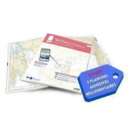
<h2>NV-CHARTS FR3 - 28 North Brittany Nautical Charts (Saint Malo aux Sept Îles) + the 3 regulatory adhesive sheets</h2>
<p><span style="font-size:10pt;">In this pack NV-Charts FR3, you will find an Atlas of 28 marine maps of <span>Saint Malo aux Sept Îles </span>including 3 offshore charts, 10 coastal charts and 15 detailed charts. With a personal download code, you will have access to all the maps in digital format as well as the <strong>NV Graphical Navigator light navigation software</strong> both freely usable on PC, tablets or smartphone!</span></p>
<p><span style="font-size:10pt;">The area represents the Channel (FRANCE), and more precisely the following areas: <strong>North Brittany - Saint Malo, Saint Cast, Baie de Saint Brieuc, Paimpol, Saint Quay, Perros Guirec, Trébeurden.</strong></span></p>
<p><span><span style="font-size:10pt;"><span style="color:#ff0000;"><strong>Free with your FR3 pack:</strong></span> 3 adhesive sheets containing the mandatory regulatory documentation (RIPAM, buoys and flags) for navigation in coastal areas (art 242-2.04 of Division 240). </span><span style="color:#ff0000;"><strong><span style="font-size:10pt;">When you buy your pack, you have all the regulatory documentation for sailing within 6 miles of a shelter</span>.</strong></span></span></p>
<h2>Description of the FR3 card pack</h2>
available
-
<h2>NV-CHARTS FR2 - 25 Western Channel Charts (from Cherbourg to St Malo) + the 3 regulatory adhesive sheets</h2>
<p><span style="font-size:10pt;">In this NV-Charts FR2 pack, you will find an atlas of 25 nautical charts from Cherbourg to St Malo, including 2 deep-sea charts, 14 coastal charts and 9 detailed charts. Thanks to a personal download code, you will have access to all the charts in digital format as well as to the <strong>NV Graphical Navigator light navigation software</strong> both freely usable on PC, tablets or smartphone!</span></p>
<p><span style="font-size:10pt;">The area represents the Channel (FRANCE), and more precisely the following areas: <strong>Channel Islands - Cherbourg, Granville, Chausey, Jersey, Guernsey, Cancale, Saint Malo.</strong></span></p>
<p><span style="font-size:10pt;"><span style="color:#ff0000;"><strong>Free with your FR2 pack:</strong></span> 3 adhesive sheets containing the mandatory regulatory documentation (RIPAM, buoys and flags) for navigation in coastal areas (art 242-2.04 of Division 240). <span style="color:#ff0000;"><strong>When you buy your pack, you have all the regulatory documentation for sailing within 6 miles of a shelter.</strong></span></span></p>
<h2>Description of the FR2 card pack</h2>
available
-
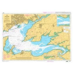
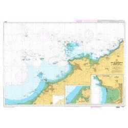
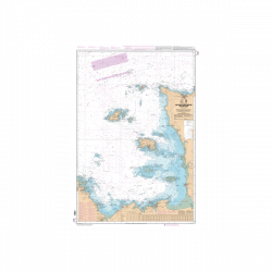
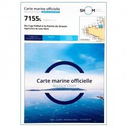
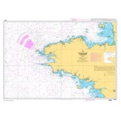
<h2>SHOM chart 7155L from Cap Fréhel to Pointe du Grouin and the approaches to Saint-Malo.</h2>
<p>Scale 1/48800.</p>
<p>Area covered: Cap Fréhel, Saint Cast, Lancieux, Approaches to Saint Malo, Dinard, Entrance to the Rance, Pointe du Grouin.</p>
available
-
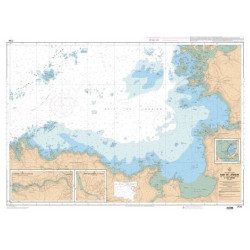
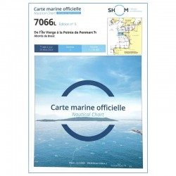
<h2 style="text-align:justify;">SHOM chart 7066 : from Ile Vierge to Penmarc'h</h2>
<p style="text-align:justify;">The SHOM 7066L chart is the marine chart of the tip of Brittany. It can be used for navigation but above all it is used as a support for professional maritime exams: Captain 200, Chief of the Watch 500, Captain 3000 or Unlimited. It exists in folded or flat version.</p>
<h2 style="text-align:justify;">Characteristics of the SHOM 7066 chart</h2>
available
-
<p style="text-align:justify;">Shom 7076 marine chart for cruising or racing from Saint Nazaire to Saint Malo. Scale: 1:350000</p>
available
-
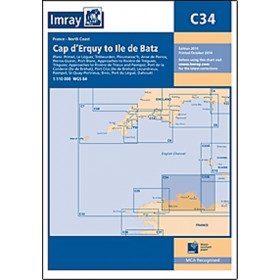
<h2 style="text-align:justify;">Imray C34 marine chart Cap d'Erquy to Ile de Batz </h2>
<p style="text-align:justify;">For this 2014 edition, the chart has been fully updated. Revised depths have been applied where necessary and the accuracy of the position relative to the WGS84 datum has been improved. The plan of the Port du Légué has been replaced with a plan to the correct scale.</p>
<p style="text-align:justify;">Plans included:</p>
<ul><li>Primel (1:15 000)</li>
<li>Le Léguer (1:42 500)</li>
<li>Trébeurden (1:25 000)</li>
<li>Ploumanac'h (1:10 000)</li>
<li>Anse de Perros (1:30 000)</li>
<li>Perros-Guirec (1:15 000)</li>
<li>Port-Blanc (1:25 000)</li>
<li>Approaches to the River of Tréguier (1:45 000)</li>
<li>Tréguier (1:15 000)</li>
<li>Approaches to the River Trieux and Paimpol (1:50 000)</li>
<li>Port de la Corderie (Ile de Bréhat) (1:15 000)</li>
<li>Port Clos (Ile de Bréhat) (1:10 000)</li>
<li>Lézardrieux (1:15 000)</li>
<li>Paimpol (1:15 000)</li>
<li>St-Quay-Portrieux (1:25 000)</li>
<li>Binic (1:12 500)</li>
<li>Port du Légué (1:20 000)</li>
<li>Dahouët (1:10 000)</li>
</ul><h2 style="text-align:justify;">Characteristics of the Imray C34 marine chart Cap d'Erquy to Ile de Batz </h2>
unavailable
-
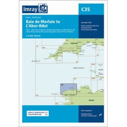
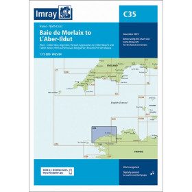
<h2 style="text-align:justify;">Imray C35 chart Morlaix to Aber-Ildut</h2>
<p style="text-align:justify;">In this edition, the chart specification has been improved to show coloured light flashes. Updated depth readings have been included where appropriate. Plans for the ports of Aber-Ildut and Argenton are now drawn at 1:25,000 scale. The plan showing the approaches to Roscoff has been extended eastwards to include better coverage of the approaches to Bloscon Marina. A general update has been carried out.</p>
<p style="text-align:justify;">Plans included:</p>
<ul><li>Aber-Ildut (1:25 000)</li>
<li>Argenton (1:25 000)</li>
<li>Portsall (1:20 000)</li>
<li>Approaches to Aber Wrac'h & Aber Benoît (1:30 000)</li>
<li>Port du Pontusval (1:15 000)</li>
<li>Moguériec (1:32 000)</li>
<li>Roscoff (1:20 000)</li>
<li>Port of Morlaix (1:15 000)</li>
</ul><h2 style="text-align:justify;">Characteristics of the Imray C35 chart from Morlaix to Aber-Ildut</h2>
unavailable
-
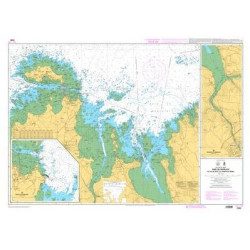
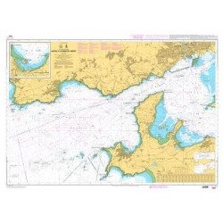
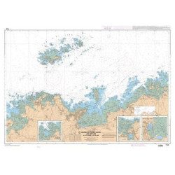
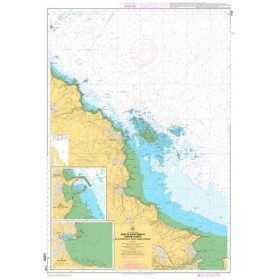
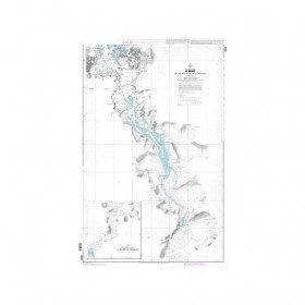
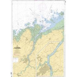
<h2>Marine charts 7126 L de l'Ile Balanec aux Heaux-de-Brehat : </h2>
<p>Scale 1:20 000 - Marine charts, SHOM : 7126L , from Ile Balanec to Heaux-de-Bréhat, and le cours du Jaudy.</p>
<h2>Features of marine charts 7126L : </h2>
available
-
available


Showing 1-27 of 27 item(s)