

Marine Bookshop
There are 294 products.
-
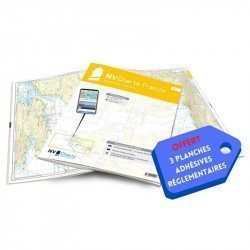
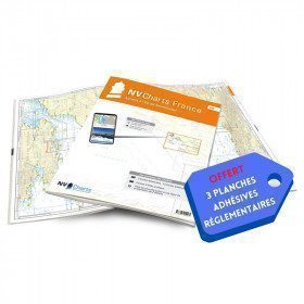
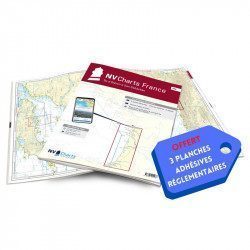
<h2>NV-CHARTS FR5 - 29 South West Brittany nautical charts (from Douarnenez to Lorient) + the 3 statutory adhesive sheets</h2>
<p><span style="font-size:10pt;">In this NV-Charts FR5 pack, you will find an Atlas of <span>29 charts of South-West Brittany, from Douarnenez to Lorient, including 2 deep-sea charts, 11 coastal charts and 16 detailed charts</span>. With a personal download code, you will have access to all the maps in digital format as well as the <strong>NV Graphical Navigator light navigation software</strong> both freely usable on PC, tablets or smartphone!</span></p>
<p><span style="font-size:10pt;">The areas represented are: <strong>South West Brittany Douarnenez, Sein, Audierne, Guilvinec, Loctudy, Bénodet, Port La Forêt, Concarneau, Les Glénan, Aven Belon, Doëlan, Groix, Lorient(FRANCE).</strong></span></p>
<p><span style="font-size:10pt;"><span style="color:#ff0000;"><strong>Free with your FR5 pack:</strong></span> 3 adhesive sheets containing the mandatory regulatory documentation (RIPAM, buoys and flags) for navigation in coastal areas (art 242-2.04 of Division 240). <span style="color:#ff0000;"><strong>When you buy your pack, you have all the regulatory documentation for sailing within 6 miles of a shelter.</strong></span></span></p>
<h2>Description of the FR5 card pack</h2>
available
-
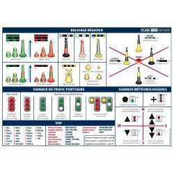
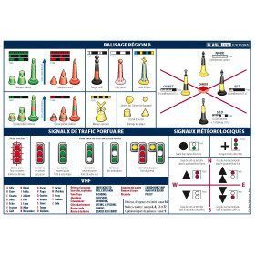
<h2>A5 adhesive marine code Region B</h2>
<p style="text-align:justify;">The A5 sticky marine code for boats in Region B (Americas, Japan, Korea) displays the essential navigation rules concerning the beacons in maritime navigation. It can replace the mandatory document on buoyage. <span style="color:#ff0000;"><strong>CONFORMS TO D240</strong></span></p>
<h2><span>Characteristics of the Marine Code Maritime buoyage Region B</span></h2>
<p></p>
available

-
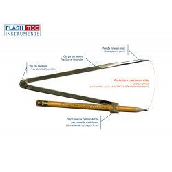
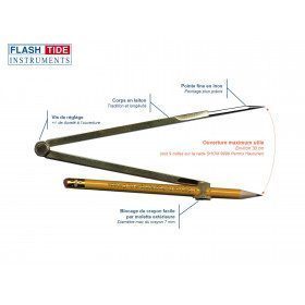
<h2>Marine Plotter Compass</h2>
<p><span>Brass marine compass with fine stainless steel tip for navigation. Pencil fastening by screw (adjustable height).</span></p>
<h2><span>Features of the Flash-Tide compass</span></h2>
available
-
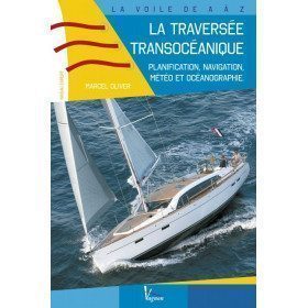
<h2>Prepare your Atlantic crossing</h2>
<p><span>This is a very practical guide for experienced boaters wishing to cross the Atlantic. You will find planning, meteorology and oceanography... A unique book on the market, which adventurous sailors are eagerly awaiting! It also includes examples of routes to the West Indies.</span></p>
<h2>Features of the guide : The trans-oceanic crossing.</h2>
available

-
<p style="text-align:justify;">SHOM marine chart 6797 for navigation in the mouth of the Loire up to the bridge of St Nazaire. SHOM marine chart type L folded to A4 format or flat, for pleasure boating. Up to date edition Scale: 1 : 15 000</p>
available

-
available
-
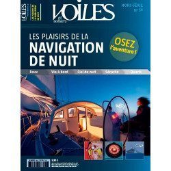
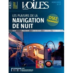
<h2>Dare the adventure of night sailing thanks to the wise and learned advice of Jean-Louis Guéry</h2>
<p>For many yachtsmen, night sailing is still forbidden, because it is too frightening, too risky or too mysterious. But we must beware, because if the yachtsmen who have not yet dared to sail under the stars knew all the pleasures and advantages that can be gained, they would have already cast off and sent the canvas!</p>
<p>That's the world we're taking you into with this new special edition. We give you all the advice you need to sail safely, teach you how to recognise lighthouses, help you to navigate properly, and invite you to avoid the traps of other boats and their little headlights that waddle under the pale, icy light of the moon. A special edition that gives you a clear idea of which route to take. You will also learn about the marvellous world of the stars and the stars that enchant these nocturnal navigations.</p>
<p>This special issue is also very practical and will introduce you to all the latest equipment that is essential for the boat and its crew. So why not make your nights even more beautiful than your days? It's up to you to cast off the canvas, we've lit up the stars!</p>
<h2>Features</h2>
unavailable
-
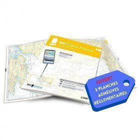
<h2>NV-CHARTS FR6 - 36 charts of South East Brittany (from Lorient to Noirmoutier) + the 3 regulatory adhesive sheets</h2>
<p><span style="font-size:10pt;">In this NV-Charts FR6 pack, you will find an Atlas of <span>36 charts of South Brittany from Lorient to Noirmoutier including 3 offshore charts, 13 coastal charts and 20 detailed charts</span>. With a personal download code, you will have access to all the maps in digital format as well as the <strong>NV Graphical Navigator light navigation software</strong> both freely usable on PC, tablets or smartphone!</span></p>
<p><span style="font-size:10pt;">The areas represented are: <strong>South Brittany - Lorient, Etel, Belle-Île, Baie de Quiberon, La Trinité, Golfe du Morbihan, Vannes, Auray, Houat, Hoedic, La Vilaine, Piriac, La Turballe, Le Croisic, La Baule, Pornichet, Saint Nazaire, Nantes, Pornic, Noirmoutier (FRANCE)</strong></span></p>
<p><strong><span style="font-size:10pt;"><span style="color:#ff0000;">Free with your FR6 pack:</span> 3 adhesive sheets containing the mandatory regulatory documentation (RIPAM, buoys and flags) for navigation in coastal areas (art 242-2.04 of Division 240). <span style="color:#ff0000;">When you buy your pack, you have all the regulatory documentation for sailing within 6 miles of a shelter.</span></span></strong></p>
<h2>Description of the FR6 card pack</h2>
available
-
<h2>A5 adhesive marine code Maritime buoyage</h2>
<p style="text-align:justify;"><span>The A5 sticky marine code for ships Buoyage region A (Europe, Africa, Asia, Oceania) displays the essential navigation rules concerning the buoys in maritime navigation. It can replace the compulsory document on Buoyage</span>. <span style="color:#ff0000;"><strong>CONFORMS TO D240</strong></span></p>
<h2><span>Characteristics of the Marine Code Maritime buoyage </span></h2>
<p></p>
available

-
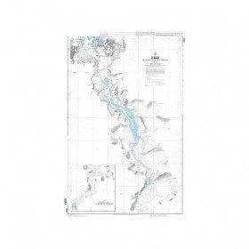
<p>Nautical chart for navigations around the Ile de Ré. SHOM 7404 L - From Pointe du Grouin du Cou to Pointe de Chassiron</p>
available
-
<p>Marine chart for coastal navigation. SHOM 4233 L - LA RANCE : from St Malo to the Chatelier lock - Scale 1:15000.</p>
available
-
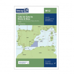
<h2>Imray Marine Chart M12 Cabo de Gata to Denia and Ibiza</h2>
<p>Plans included: Mar Menor (1:75 000) Torrevieja (1:20 000) Alicante (1:30 000) Villajoyosa (1:15 000) Altea (1:15 000) Dénia (1:25 000) Cartagena (1:15 000) This edition includes the latest official Instituto Hidrográfico de la Marina Digital, combined with additional information sourced from Imray's network to make it ideal for small craft. The chart has been fully revised throughout. The main panel has been rescaled to 1:450,000 for consistency with other M-Series charts in Mediterranean Spain. The plan of Mar Menor now provides coverage at an improved larger scale. A new plan of Cartagena has been added.</p>
<h2>Specifications of the Imray Marine Chart M12 Cabo de Gata to Denia and Ibiza</h2>
available
-
<h2>NV-CHARTS FR7 - 27 Vendée Nautical Charts (from Noirmoutier to La Rochelle) + the 3 statutory adhesive sheets</h2>
<p><span style="font-size:10pt;">In this NV-Charts FR7 pack, you will find an Atlas of <span>27 charts Vendée from Noirmoutier to La Rochelle including 3 offshore charts, 12 coastal charts and 12 detailed charts.</span> With a personal download code, you will have access to all the maps in digital format as well as the <strong>NV Graphical Navigator light navigation software</strong> both freely usable on PC, tablets or smartphone!</span></p>
<p><span style="font-size:10pt;">The areas represented are: <strong>Vendée - Noirmoutier, Ile d'Yeu, Saint Gilles Croix de Vie, Les Sables d'Olonne, Port Bourgenais, Jard sur Mer, Pointe de l'Aiguillon, Ile de Ré, La Rochelle (FRANCE).</strong></span></p>
<p><span style="font-size:10pt;"><span style="color:#ff0000;"><strong>Free with your FR7 pack:</strong></span> 3 adhesive sheets containing the mandatory regulatory documentation (RIPAM, buoys and flags) for navigation in coastal areas (art 242-2.04 of Division 240). <span style="color:#ff0000;"><strong>When you buy your pack, you have all the regulatory documentation for sailing within 6 miles of a shelter.</strong></span></span></p>
<h2>Description of the FR7 card pack</h2>
available
-
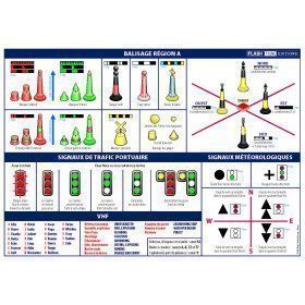
<h2>Code Marin réglementaire bateau : Pack of 3 A5 adhesive sheets</h2>
<p>The regulatory marine code in 3 self-adhesive sheets RIPAM / Buoyage / Flags gathers the essential of the international maritime regulations for pleasure boating. A5 format, easier to put on board. <span style="color:#ff0000;"><strong>CONFORMS TO D240</strong></span></p>
<h2>Characteristics of the Marine Code in a pack of 3 A5 sheets</h2>
available
-
<p>Marine chart for coastal navigation. SHOM 6966L - Des Héaux-de-Bréhat au Cap Lévi - Shom paper chart - Scale : 1 : 155508</p>
available
-
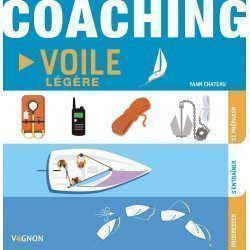
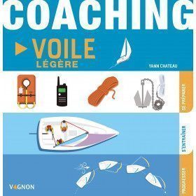
<h2>Coaching to prepare, train and progress</h2>
<p>This manual Coaching light sail of <strong>Vagnon</strong> proposes a learning method thanks to a very visual, well explained and easy to understand guide to progress in light sailing. In three major stages: getting ready (the right moves), training (taking your first steps) and progressing (becoming an expert), you'll become an expert on the subject!</p>
<div class="productStrates__column productStrates__column--fixed">
<div class="productStrate advertisingStrate">
<div id="ad_9d1d5e22f27440" class="js-ad-slot f-ad"></div>
</div>
</div>
<h2>Characteristics of the Light Sailing Coaching</h2>
available
-
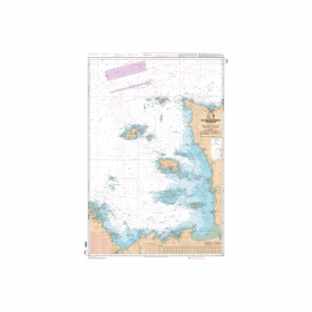
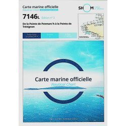
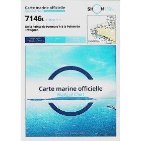
<h2>The SHOM marine chart 7146 L is the marine chart from the Pointe de Penmarc'h to the Pointe de Trévignon.</h2>
<p>Area covered: Le Guilvinec, Bénodet, Loctudy, Port la Forêt, Concarneau, Les Glénan. Scale 1:49,700.</p>
<h2>Characteristics of the SHOM 7146 L chart (folded version)</h2>
available
-
<h2>NV-CHARTS FR8 - 33 Aquitaine Marine Charts (from La Rochelle to San Sebastian) + the 3 regulatory adhesive sheets</h2>
<p><span style="font-size:10pt;">In this NV-Charts FR8 pack, you will find an Atlas of <span>33 Aquitaine charts from La Rochelle to San Sebastian including 3 offshore charts, 15 coastal charts and 15 detailed charts</span>. With a personal download code, you will have access to all the maps in digital format as well as the <strong>NV Graphical Navigator light navigation software</strong> both freely usable on PC, tablets or smartphone!</span></p>
<p><span style="font-size:10pt;">The areas represented are: <strong>Aquitaine - La Rochelle, Ré, Oléron, Rochefort, Royan, Gironde, Bordeaux, Arcachon, Bayonne, Biarritz, Saint Jean de Luz, San Sebastian (FRANCE)</strong></span></p>
<p><span style="font-size:10pt;"><span style="color:#ff0000;"><strong>Free with your FR8 pack:</strong> </span>3 adhesive sheets containing the mandatory regulatory documentation (RIPAM, buoys and flags) for navigation in coastal areas (art 242-2.04 of Division 240). <span style="color:#ff0000;"><strong>When you buy your pack, you have all the regulatory documentation for sailing within 6 miles of a shelter.</strong></span></span></p>
<h2>Description of the FR8 card pack</h2>
available
-
<h2>NV-CHARTS FR4 - 33 West Brittany Marine Charts (from the Seven Islands to Douarnenez) + the 3 regulatory adhesive sheets</h2>
<p><span style="font-size:10pt;">In this pack NV-Charts FR4, you will find an Atlas of 33 nautical charts from the Seven Islands to Douarnenez<span> including 2 offshore maps, 13 coastal maps and 18 detailed maps</span>. With a personal download code, you will have access to all the maps in digital format as well as the <strong>NV Graphical Navigator light navigation software</strong> both freely usable on PC, tablets or smartphone!</span></p>
<p><span style="font-size:10pt;">The areas represented are: <strong>Western Brittany - Roscoff, Morlaix, Ouessant, Molène, Brest, Camaret, Crozon, Morgat, Douarnenez, Sein (FRANCE).</strong></span></p>
<p><span style="font-size:10pt;"><span style="color:#ff0000;"><strong>Free with your FR4 pack:</strong></span> 3 adhesive sheets containing the mandatory regulatory documentation (RIPAM, buoys and flags) for navigation in coastal areas (art 242-2.04 of Division 240). <span style="color:#ff0000;"><strong>When you buy your pack, you have all the regulatory documentation for sailing within 6 miles of a shelter.</strong></span></span></p>
<h2>Description of the FR4 card pack</h2>
available
-
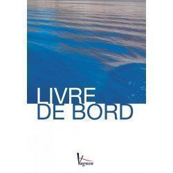
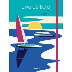
<h2>The indispensable logbook</h2>
<p><span>A practical board book at a low price!</span></p>
<h2>Characteristics of the manual: Vagnon logbook</h2>
available
-
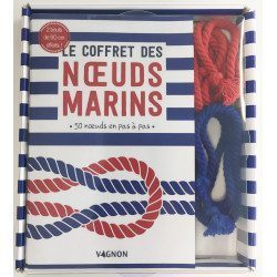
<h2>Learn how to tie a knot with the Coffret des noeux marins</h2>
<p style="text-align:justify;">Skill and precision are necessary to make different knots from the easiest to the most complicated. Follow the steps and drawings in the manual to learn how to make more than 50 fun sailor knots and go to sea with peace of mind!</p>
<h2>Characteristics of the coffret des noeux marins</h2>
available
-
<div class="fiche-txt">
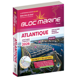
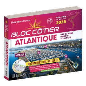
<h2>Indispensable on board your boat: the Atlantic 2025 marine block</h2>
<p style="text-align:justify;">The Atlantic 2024 Marine Block is no longer available. This book contains all the compulsory and regulatory elements on board a boat and offers you access to all the essential documents on board. For this edition, a complete update of the mandatory 2025 regulations has been carried out and you will find <span>in addition </span><span>a special section devoted to new technologies: "electronics - equipment - home automation".</span><span>. </span>Browse the descriptions of the ports and benefit from all the updated approach charts (these are made every year according to the SHOM information). This marine guide allows you to save precious time in order to arrive at the port in complete serenity. A real bible for sailors and yachtsmen, it contains essential information for coastal and deep-sea navigation.</p>
<h2>The marine block for the Atlantic : a navigation area from England to the Azores</h2>
<p style="text-align:justify;">Your marine block allows you to carry all the nautical documents required on board during your navigations. The Atlantic model (new edition 2022) is a great classic of the maritime bookshop and a reference book for sailors. Find our entire collection of coastal and marine pads on our Picksea shop, number one in nautical equipment on the internet.</p>
<h2>Detailed summary of the Atlantic 2025 Marine Block</h2>
</div>
available
-
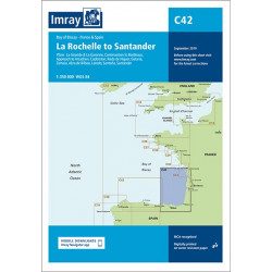
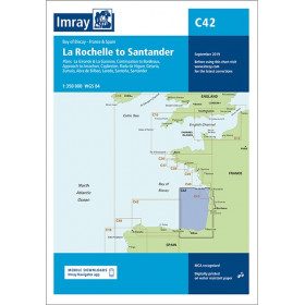
<h2 style="text-align:justify;">Imray C42 Marine Chart La Rochelle to Santander</h2>
<p style="text-align:justify;">In this edition, the latest survey information has been included where available. The shooting practice areas of the Landes test centre have been updated and the port developments of Bilbao and Santoña are shown. The map specification has been improved to show coloured light flashes. A general update has been made.</p>
<p style="text-align:justify;">Maps included:</p>
<ul><li>Arcachon Approach (1:50 000)</li>
<li>Capbreton (1:20 000)</li>
<li>Rada de Higuer (1:25 000)</li>
<li>Getaria (1:15,000)</li>
<li>Zumaia (1:15 000)</li>
<li>Abra de Bilbao (1:25 000)</li>
<li>Laredo (1:20 000)</li>
<li>Santoña (1:20 000)</li>
<li>Santander (1:25 000)</li>
<li>The Gironde & The Garonne (1:200 000)</li>
<li>Continuation to Bordeaux (1:200 000)</li>
</ul><h2 style="text-align:justify;">Characteristics of the Imray C42 map La Rochelle to Santander</h2>
unavailable
-
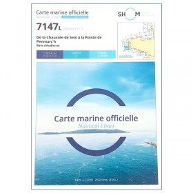
<h2>The SHOM marine chart 7147 L is the marine chart of the Chaussée de Sein to the Pointe de Penmarc'h and the Baie d'Audierne</h2>
<p>Area covered: Raz de Sein, Audierne, Pointe de Penmarc'h. Scale 1:29600.</p>
<h2>Characteristics of the SHOM 7147 L chart (folded version)</h2>
available
-
<h2>NV-CHARTS FR3 - 28 North Brittany Nautical Charts (Saint Malo aux Sept Îles) + the 3 regulatory adhesive sheets</h2>
<p><span style="font-size:10pt;">In this pack NV-Charts FR3, you will find an Atlas of 28 marine maps of <span>Saint Malo aux Sept Îles </span>including 3 offshore charts, 10 coastal charts and 15 detailed charts. With a personal download code, you will have access to all the maps in digital format as well as the <strong>NV Graphical Navigator light navigation software</strong> both freely usable on PC, tablets or smartphone!</span></p>
<p><span style="font-size:10pt;">The area represents the Channel (FRANCE), and more precisely the following areas: <strong>North Brittany - Saint Malo, Saint Cast, Baie de Saint Brieuc, Paimpol, Saint Quay, Perros Guirec, Trébeurden.</strong></span></p>
<p><span><span style="font-size:10pt;"><span style="color:#ff0000;"><strong>Free with your FR3 pack:</strong></span> 3 adhesive sheets containing the mandatory regulatory documentation (RIPAM, buoys and flags) for navigation in coastal areas (art 242-2.04 of Division 240). </span><span style="color:#ff0000;"><strong><span style="font-size:10pt;">When you buy your pack, you have all the regulatory documentation for sailing within 6 miles of a shelter</span>.</strong></span></span></p>
<h2>Description of the FR3 card pack</h2>
available
-
<h2>New Breton Reporter</h2>
<p style="text-align:justify;">The New Breton Reporter retains all the features that have made it so successful over the past 40 years, but it has been completely redesigned by Nautic Training instructors to improve its readability and usability.</p>
<h2 style="text-align:justify;">Features of the New Breton Reporter</h2>
available
-
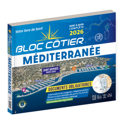
<div class="fiche-txt">
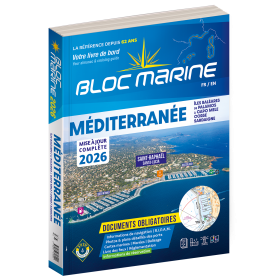
<h2>Indispensable on board : Bloc Marine Méditerranée 2025</h2>
<p style="text-align:justify;">Truly the bible of any sailor, the Mediterranean Marine Block 2025 edition allows you to have all the regulatory documents for the safety of the boat essential on board. A complete update of the mandatory 2025 regulations has been made. In this edition, you will also find <span>a special section devoted to new technologies: "electronics - equipment - home automation".</span>. The descriptions of the ports in WGS84 and the maps are updated every year and allow you to save precious time to reach the port safely. A complete atlas is also included in this Mediterranean 2025 Marine block. The marine and coastal blocks offer a real documentation for your sea excursions. So, find the whole collection of regulatory boat equipment on Picksea, your online shop for marine books.</p>
<h2>Detailed summary of the Mediterranean Sea Block 2025</h2>
</div>
available

-
available

-
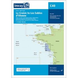
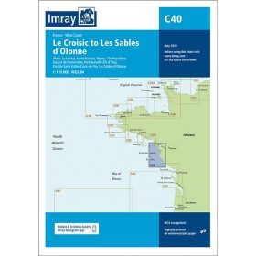
<h2 style="text-align:justify;">Imray C40 marine chart from Croisic to Sables d'Olonne</h2>
<p style="text-align:justify;">In this edition, the map specification has been improved to show coloured light flashes. The latest depth readings have been included where available and the shooting range has been updated. Additional tidal current data is included for Bourgneuf Bay. The plan of the L'Herbaudière marina has been revised to show its new configuration. A general update has been made throughout.</p>
<p style="text-align:justify;">Plans included:</p>
<ul><li>Le Croisic (1:15 000)</li>
<li>Saint-Nazaire (1:25 000)</li>
<li>Pornic (1:12 500)</li>
<li>L'Herbaudière (1:12 500)</li>
<li>Goulet de Fromentine (1:30 000)</li>
<li>Port-Joinville (Île d'Yeu) (1:10 500)</li>
<li>Port de Saint-Gilles-Croix-de-Vie (1:15 000)</li>
<li>Les Sables d'Olonne (1:20 000)</li>
</ul><h2 style="text-align:justify;">Characteristics of the Imray C40 map from Croisic to Sables d'Olonne</h2>
unavailable
-
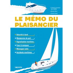
<h2>The boater's memo: a practical memo of the ABCs of navigation</h2>
<p style="text-align:justify;">The boater's memo of the edition <strong>Vagnon</strong> is a practical and very visual memo which makes it easy to understand and remember. The aim of this memo is to guide you through the stages of a successful trip at sea. Harbour manoeuvres, signs, lights, markings, radio messages, accidents, safety rules: everything is explained to help you adopt the right gestures to avoid endangering your own life and that of your crew.</p>
<h2>Features of the Boater's Memo</h2>
available

-
<h2>The SHOM marine chart 7148 L is the marine chart from the Goulet de Brest to the Chaussée de Sein.</h2>
<p>Area covered: Le Conquet, Molène, Goulet de Brest, Camaret, Ile de Sein, raz de Sein, Audierne. Scale 1:49,300.</p>
<h2>Characteristics of the SHOM 7148 L chart (folded version)</h2>
available
-
<h2>Logbook to write everything down!</h2>
<p><span>This premium version logbook <strong>Vagnon</strong> includes a cardboard cover with elastic band and a pocket to store your documents. It also contains a textbook, pages of notes and drawings as well as a lot of practical information (useful addresses, signals, rules of the road and helm, VHF, rescue and emergencies, RIPAM, etc.).</span></p>
<h2>Characteristics of the Vagnon logbook premium version</h2>
available
-
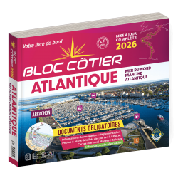
<div class="fiche-txt">
<h2>Indispensable for sailing within 6 miles from a shelter: the Atlantic 2025 Bloc Cotier !</h2>
<p style="text-align:justify;">The Atlantic 2025 bloc cotier is a smaller work than the Marine block, bringing together all the compulsory and regulatory elements on board a boat for coastal sailing, i.e. within 6 miles of a shelter according to the regulations in force. It also offers you access to all the essential documents on board, such as port descriptions and updated maps. With even more photos, the coastal block also includes a complete atlas. The mandatory regulations for 2025 have also been completely updated.</p>
<h2>Detailed summary of the Atlantic Bloc Cotier 2025</h2>
</div>
available
-
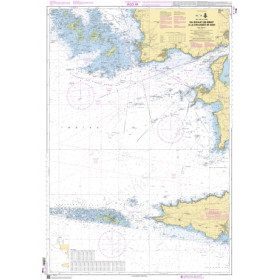
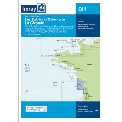
<h2 style="text-align:justify;">Imray C41 marine chart Sables d'Olonne to Gironde</h2>
<p style="text-align:justify;">In this edition, the latest depth readings have been applied where available. The development of ports and marinas at Port Minimes and La Pallice is included as well as the latest information on nature and marine reserves. The map of the Gironde at Bordeaux is more detailed and easier to use. The map specification has been improved to show coloured flashes of light. A general update has been made.</p>
<p style="text-align:justify;">Maps included:</p>
<ul><li>Bourgenay (1:10 000)</li>
<li>Approach to Jard-sur-Mer (1:17 500)</li>
<li>Approach to Ars-en-Ré (1:40 000)</li>
<li>Approach to St Martin-de-Ré (1:15 000)</li>
<li>Approach to La Flotte-en-Ré (1:15 000)</li>
<li>Rade de la Pallice (1:40 000)</li>
<li>La Rochelle and the Port des Minimes (1:15 000)</li>
<li>St-Denis-d'Oléron (1:10 000)</li>
<li>Douhet (1:7500)</li>
<li>Boyardville (1:10 000)</li>
<li>Rochefort (1:10 000)</li>
<li>Royan (1:7500)</li>
<li>Port Médoc (1:12 500)</li>
<li>The Gironde & The Garonne (1:200 000)</li>
<li>Continuation to Bordeaux (1:200 000)</li>
</ul><h2 style="text-align:justify;">Characteristics of the Imray C41 map from Sables d'Olonne to Gironde</h2>
unavailable
-
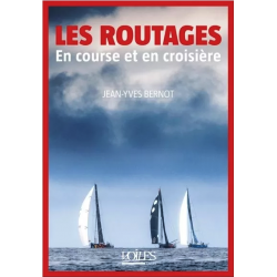
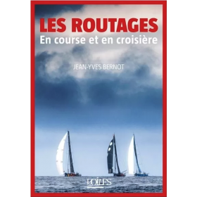
<h2>Learn how to master the routing in racing and cruising with this book written by meteorologist Jean-Yves Bernot</h2>
<p>This guide allows you to master the various computer tools used for pleasure boating or during competitions and to better interpret meteorological and oceanographic data. The aim is not to present defined routes, but to help the yachtsman to plot and adapt his own. The website offers additional illustrations and further information.</p>
<h2>Features</h2>
available
-
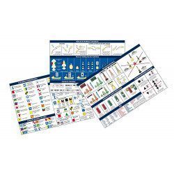
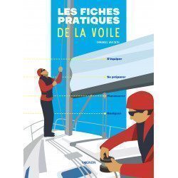
<h2>The practical sailing sheets to equip yourself, prepare, manoeuvre and sail!</h2>
<p>This manual <strong>Vagnon</strong> includes 65 illustrated sheets to guide the "sailor" and help him or her progress in the discovery and practice of sailing.</p>
<h2>Characteristics of the practical sailing cards</h2>
available
-
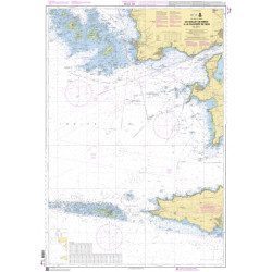
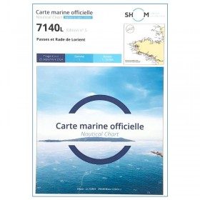
<p>SHOM marine chart 7140 L. Rade and passes of Lorient. Scale 1:10000</p>
available
-
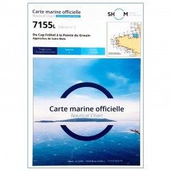
<h2>SHOM chart 7155L from Cap Fréhel to Pointe du Grouin and the approaches to Saint-Malo.</h2>
<p>Scale 1/48800.</p>
<p>Area covered: Cap Fréhel, Saint Cast, Lancieux, Approaches to Saint Malo, Dinard, Entrance to the Rance, Pointe du Grouin.</p>
available
-
<div class="fiche-txt">
<h2>Indispensable for sailing within 6 miles of a shelter: the Mediterranean 2025 Bloc Cotier</h2>
<p style="text-align:justify;">The Mediterranean 2025 Bloc Cotier is a smaller work than the Marine block, bringing together all the compulsory and regulatory elements on board a boat for coastal sailing, i.e. within 6 miles of a shelter according to the regulations in force. It offers you wider access to all the essential documents on board, such as port descriptions and updated charts. With even more photos, the coastal block also includes a complete atlas. The mandatory 2025 regulations have also been completely updated.</p>
<h2>Detailed summary of the Mediterranean Coastal Block 2025</h2>
</div>
available
-
available

-
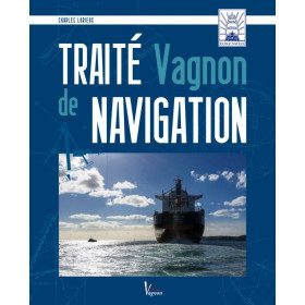
<h2>Learn more about marine navigation with the Vagnon de navigation</h2>
<p><span>Maritime navigation requires a vast knowledge of the sea, ships and sailors. You will learn about <span>the contribution of the most recent technologies but also on the digital turn taken by the field of navigation. <span>This educational book has been written for the students of the Naval School. It is also intended for sailors and industrialists. It provides them with knowledge of the maritime environment and exposes the techniques and logic necessary to conduct a serene navigation.</span></span></span></p>
<h2>Characteristics of the Vagnon Navigation Treaty</h2>
available

-
<div class="fiche-txt">
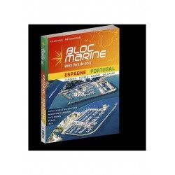
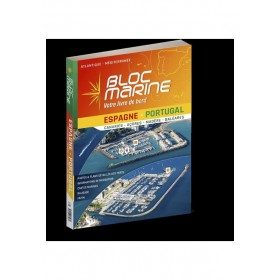
<h2>The essential guide for sailing around Spain and Portugal</h2>
<p>The Spain-Portugal Marine Block is the book to have on board! It allows you to have all the essential and mandatory documents on board your boat. The descriptions of ports and maps are updated every 2 or 3 years and allow you to save precious time to arrive safely and calmly at your destination. In this new edition, which was completely updated in June 2023, the Marine Block docks on the coasts of the Iberian Peninsula: Portugal, Spain, not forgetting the islands with the Balearic Islands, Madeira, the Canaries, the Azores... in total, there are more than 350 ports and as many opportunities for stopovers and cruises in perspective! In addition to general information on regulations, rescue and safety at sea, you will find, for each port, a maximum of information on the installations, the operation and the means of rescue as well as a location map. Several new features are included in this edition: a bilingual French/Spanish book a complete navigation atlas with more than 80 maps detailed plans in WGS84 for almost all the ports hundreds of aerial photos Everything you need to prepare for your navigations with complete peace of mind</p>
</div>
available
-
<h2>The guide to living well on board to deal with all situations</h2>
<p style="text-align:justify;">The guide to living well on board <strong>Vagnon</strong> offers technical advice (how to optimize your space and equip yourself well) but also psychological advice to avoid crisis situations and to live well on board with your crew or alone. You will find themes such as equipment and material, managing emotions, stress, solitude, fear...</p>
<h2>Features of the Guide to living well on board</h2>
available
-
<h2 style="text-align:justify;">Imray Characteristics of the Imray C42 map La Rochelle to Santander</h2>
<p>Plans included:Lajes das Flores (1:20 000)Horta (1:12 500)Lajes do Pico (1:10 000)Velas (1:7500)Vila da Praia (1:10 000)Praia da Vitória (1:20 000)Angra do Heroísmo (1:12 500)Ponta Delgada (1:10 000)Vila Franco do Campo (1:15 000)Vila do Porto (1:10 000)Imray-Iolaire charts for the Atlantic Islands are widely acknowledged as the best available for the cruising sailor. They combine the latest official survey data with first-hand information gathered over 60 years of research by Don Street Jr and his wide network of contributors. Like all Imray charts, they are printed on water resistant Pretex paper for durability, and they include many anchorages, facilities and inlets not included on official charts.This edition includes the latest official data combined with additional information sourced from Imray''s network to make it ideal for small craft. It includes the latest official bathymetric surveys. Completed harbour works at Porto das Velas (São Jorge) is included and extra Marine Reserves are shown. For this edition magnetic variation curves have been added. There has been general updating throughout.</p>
available

-
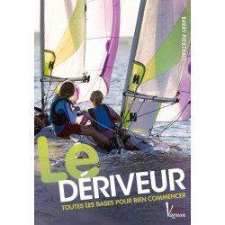
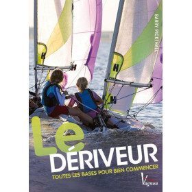
<h2>All the basics to get started</h2>
<p><span>The dinghy is the ideal boat for beginners, especially for children. This very clear and practical guide, largely illustrated, is there to accompany them in their learning. It covers all the essential notions: where to sail, how to choose your boat, how to take your first steps on the water and on the boat, how to leave and return, how to take care of the weather, how to manage your safety...</span></p>
<h2>Characteristics of the manual : The dinghy</h2>
available
-
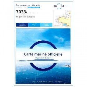
<p style="text-align:justify;">Navigation chart shom 7033 type L (folded in A4 format) for cruising between Quiberon and Le Croisic. Scale: 1:50 000</p>
available
-
available
-
<div class="fiche-txt">
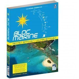
<h2>The Marine Block covering all the West Indies and updated</h2>
<p>The West Indies Marine block is the logbook for long distance cruising which allows you to have all the essential documents on board for a transatlantic navigation and once in the West Indies. The descriptions of the ports and the maps allow you to save precious time in order to discover these navigation areas in complete safety. Written in French and English, this guide covers an area from the Virgin Islands to Trinidad and Tobago.</p>
<h2>Detailed features of the Caribbean Marine Block</h2>
</div>
available


Showing 193-240 of 294 item(s)