unavailable


Detailed features

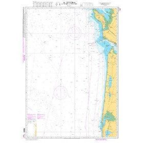
Imray C41 marine chart Sables d'Olonne to Gironde
In this edition, the latest depth readings have been applied where available. The development of ports and marinas at Port Minimes and La Pallice is included as well as the latest information on nature and marine reserves. The map of the Gironde at Bordeaux is more detailed and easier to use. The map specification has been improved to show coloured flashes of light. A general update has been made.
Maps included:
- Bourgenay (1:10 000)
- Approach to Jard-sur-Mer (1:17 500)
- Approach to Ars-en-Ré (1:40 000)
- Approach to St Martin-de-Ré (1:15 000)
- Approach to La Flotte-en-Ré (1:15 000)
- Rade de la Pallice (1:40 000)
- La Rochelle and the Port des Minimes (1:15 000)
- St-Denis-d'Oléron (1:10 000)
- Douhet (1:7500)
- Boyardville (1:10 000)
- Rochefort (1:10 000)
- Royan (1:7500)
- Port Médoc (1:12 500)
- The Gironde & The Garonne (1:200 000)
- Continuation to Bordeaux (1:200 000)
Characteristics of the Imray C41 map from Sables d'Olonne to Gironde
- Publisher Imray
- Edition date 2017
- Scale 1/110000 WGS84
- Printed and corrected in February 2021
- Map size 787 x 1118mm.
- Waterproof.
- Folded in a plastic pocket
In the same category
4 other products seleted for you-
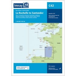
<h2 style="text-align:justify;">Imray C42 Marine Chart La Rochelle to Santander</h2>
<p style="text-align:justify;">In this edition, the latest survey information has been included where available. The shooting practice areas of the Landes test centre have been updated and the port developments of Bilbao and Santoña are shown. The map specification has been improved to show coloured light flashes. A general update has been made.</p>
<p style="text-align:justify;">Maps included:</p>
<ul><li>Arcachon Approach (1:50 000)</li>
<li>Capbreton (1:20 000)</li>
<li>Rada de Higuer (1:25 000)</li>
<li>Getaria (1:15,000)</li>
<li>Zumaia (1:15 000)</li>
<li>Abra de Bilbao (1:25 000)</li>
<li>Laredo (1:20 000)</li>
<li>Santoña (1:20 000)</li>
<li>Santander (1:25 000)</li>
<li>The Gironde & The Garonne (1:200 000)</li>
<li>Continuation to Bordeaux (1:200 000)</li>
</ul><h2 style="text-align:justify;">Characteristics of the Imray C42 map La Rochelle to Santander</h2>
unavailable

-
available
 New
New -
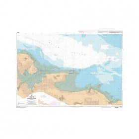
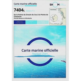
<p>Marine chart for navigations around the Ile de Ré. SHOM 7404 L - From the Pointe du Grouin du Cou to the Pointe de Chassiron</p>
available
-
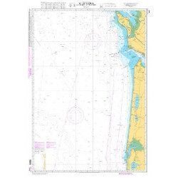
<p style="text-align:justify;">Shom marine chart for navigation from Oleron island to Arcachon basin. Scale: 1:167000.</p>
available