available


Detailed features

Coaching to prepare, train and progress
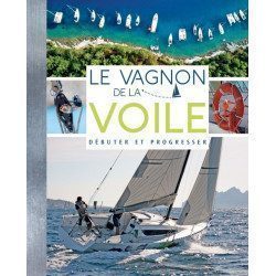
This manual Coaching light sail of Vagnon proposes a learning method thanks to a very visual, well explained and easy to understand guide to progress in light sailing. In three major stages: getting ready (the right moves), training (taking your first steps) and progressing (becoming an expert), you'll become an expert on the subject!
Characteristics of the Light Sailing Coaching
- Edition Vagnon
- Author Yann Chateau
- Illustration Lorenzo Timon
- Format 17,5 x 18cm
- 128 pages
You might also like 2 other products seleted for you
-
<h2><strong>The essential pack to prepare your offshore licence</strong></h2>
<p style="text-align:justify;">A set of quality tools to pass your offshore licence! Picksea is the owner of the Flash-Tide Instruments brand and our teams manufacture in France, in Lorient, all models of <a href="https://www.picksea.com/en/106806-cras-navigation-rules">rules cras</a> or Breton. Picksea is also a SHOM agent. We are therefore the best able to provide you with a pack composed of the best products at the best price.</p>
<h2>Composition of the offshore licence pack</h2>
available

-
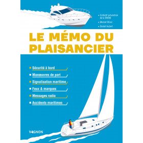
<h2>The boater's memo: a practical memo of the ABCs of navigation</h2>
<p style="text-align:justify;">The boater's memo of the edition <strong>Vagnon</strong> is a practical and very visual memo which makes it easy to understand and remember. The aim of this memo is to guide you through the stages of a successful trip at sea. Harbour manoeuvres, signs, lights, markings, radio messages, accidents, safety rules: everything is explained to help you adopt the right gestures to avoid endangering your own life and that of your crew.</p>
<h2>Features of the Boater's Memo</h2>
available

In the same category
4 other products seleted for you-
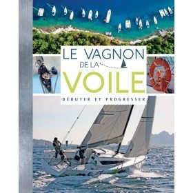
<h2>Make your first sailing trips a success</h2>
<p>This beginner's sailing manual covers all the essential basics for your first outings. You will find safety, the organization of life on board and the crew, basic maneuvers, the fundamentals of navigation, the weather...</p>
<h2>Characteristics of the manual : The beginner's guide to sailing</h2>
available
-
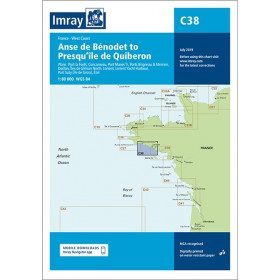
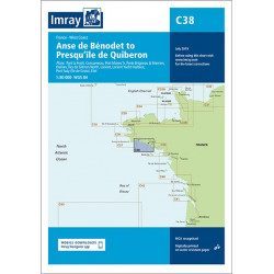
<h2 style="text-align:justify;">Imray C38 marine chart from Anse de Benodet to Presqu'île de Quiberon</h2>
<p style="text-align:justify;">On this edition, the latest survey information has been included where available. The port developments of Lorient and Concarneau and the Glénan Islands are included. The map specification has been improved to show coloured light flashes. A general update has been made.</p>
<p style="text-align:justify;">Maps included:</p>
<ul><li>Port la Forêt (1:15 000)</li>
<li>Concarneau (1:15 000)</li>
<li>Port Manec'h (1:35 000)</li>
<li>Brigneau & Merrien Ports (1:20 000)</li>
<li>Doëlan (1:15 000)</li>
<li>Glénan North Islands (1:30 000)</li>
<li>Lorient (1:35 000)</li>
<li>Lorient Yacht Harbour (1:10 000)</li>
<li>Port Tudy (Island of Groix) (1:10 000)</li>
<li>Étel (1:35 000)</li>
</ul><h2 style="text-align:justify;">Characteristics of the Imray C38 marine chart from Benodet to Quiberon</h2>
unavailable
-
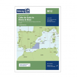
<h2>Imray Marine Chart M12 Cabo de Gata to Denia and Ibiza</h2>
<p>Plans included: Mar Menor (1:75 000) Torrevieja (1:20 000) Alicante (1:30 000) Villajoyosa (1:15 000) Altea (1:15 000) Dénia (1:25 000) Cartagena (1:15 000) This edition includes the latest official Instituto Hidrográfico de la Marina Digital, combined with additional information sourced from Imray's network to make it ideal for small craft. The chart has been fully revised throughout. The main panel has been rescaled to 1:450,000 for consistency with other M-Series charts in Mediterranean Spain. The plan of Mar Menor now provides coverage at an improved larger scale. A new plan of Cartagena has been added.</p>
<h2>Specifications of the Imray Marine Chart M12 Cabo de Gata to Denia and Ibiza</h2>
available
-
<div class="fiche-txt">
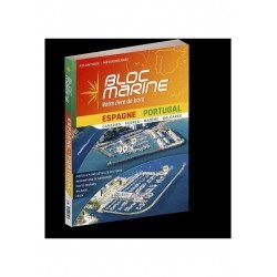
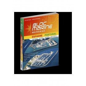
<h2>The essential guide for sailing around Spain and Portugal</h2>
<p>The Spain-Portugal Marine Block is the book to have on board! It allows you to have all the essential and mandatory documents on board your boat. The descriptions of ports and maps are updated every 2 or 3 years and allow you to save precious time to arrive safely and calmly at your destination. In this new edition, which was completely updated in June 2023, the Marine Block docks on the coasts of the Iberian Peninsula: Portugal, Spain, not forgetting the islands with the Balearic Islands, Madeira, the Canaries, the Azores... in total, there are more than 350 ports and as many opportunities for stopovers and cruises in perspective! In addition to general information on regulations, rescue and safety at sea, you will find, for each port, a maximum of information on the installations, the operation and the means of rescue as well as a location map. Several new features are included in this edition: a bilingual French/Spanish book a complete navigation atlas with more than 80 maps detailed plans in WGS84 for almost all the ports hundreds of aerial photos Everything you need to prepare for your navigations with complete peace of mind</p>
</div>
available