

Marine Bookshop
There are 294 products.
-
available

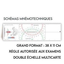
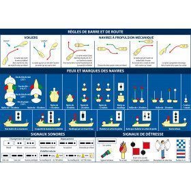
 FLASH-TIDE
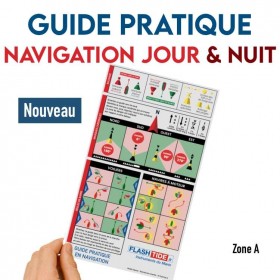
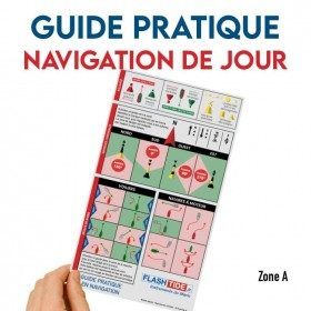
Guide pratique en PVC - Balisage, Cardinales & Règles de barre
- €22.99
- -15%
- €19.54
-
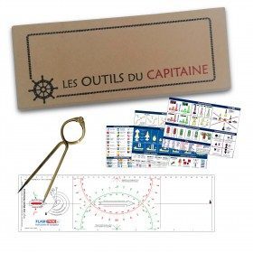
<h2>Captain's Tools" set</h2>
<p>Set of instruments to be used during navigation or for exams (deep-sea licence, professional navigation, ...). "The captain's tools" is the ideal gift for those who are passionate about navigation.</p>
<h2>Characteristics of the box</h2>
available

-
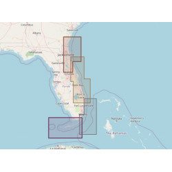
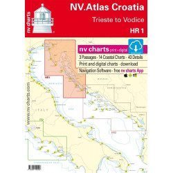
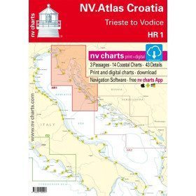
<h2>Atlantic Zone Sea Card Packs</h2>
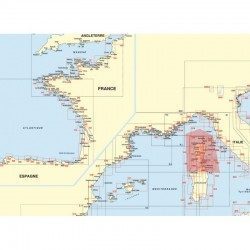
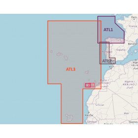
<p>The nv-charts are characterized by fine contours and easy to distinguish colour graduations of the depth lines: turquoise for coral reefs, red for the 2-metre line and blue for the 5-metre zones. Presented in a practical and user-friendly format (A3 closed and A2 open), a thick plastic envelope protects the charts, making them easy to store. The importance of a good graphic representation of the topography when navigating the Atlantic is essential.<br /><br />Well-marked rivers, towns and street maps all contribute to a clear overview of the islands' waterfront facilities. Red numbered waypoints with coordinates based on WGS 84 allow mariners to navigate with their GPS instruments. Heights and depths are shown in the internationally recognized metre format. Large-scale approaches and land contour markings simplify entry into anchorages.</p>
<h2><span style="color:#ff0000;">Picksea is Premium Reseller of NV-Charts</span></h2>
<h2>NV-Charts Atlantic Zone Marine Card Packs Features</h2>
available

-
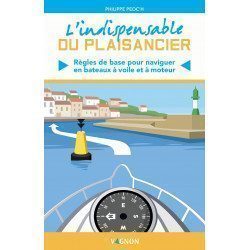
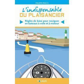
<p><span>All the basic rules you need to know to sail and powerboat properly</span></p>
<h2>Details on "L'indispensable du Plaisancier" by Vagnon</h2>
available
-
<div class="fiche-txt">
<h2>Les animaux de la mer Playbook 5/7 years old from Vagnon</h2>
<p>A book of 38 games and activities for 5/7 year olds on the theme of marine animals: illustrations, varied and amusing games, logic games and colouring. A book full of discoveries!</p>
<h2>In this book</h2>
</div>
available

-
<div class="fiche-txt">
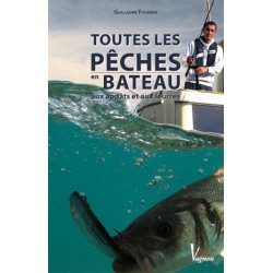
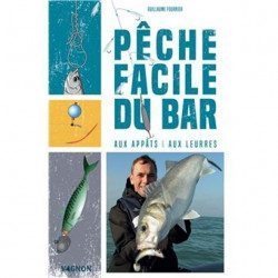
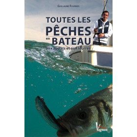
<h2>All boat fishing with bait and lures</h2>
<p>This clear and extensively illustrated manual presents all the <strong>fishing methods</strong> and the appropriate equipment. Each species of fish is presented in the form of a practical sheet as well as the <strong>bait and lures</strong> for the captured ones. It will also help you choose the right boat and the right onboard electronics for your needs.</p>
<h2>Picksea specialist of the sea, its seabed, and fishing!</h2>
<p>Picksea has established itself as a leader in the <strong>nautical equipment</strong> but also in the documentation, with specialized works according to your passions and your desires. Diving, boating, boating licenses, or fishing are some of the topics covered.</p>
<h2>Features</h2>
</div>
unavailable
-
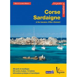
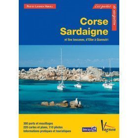
<p>Guide from the prestigious English publishing house IMRAY, world reference in the field of marine cartography. This guide covers the areas of Corsica, Sardinia, the Tuscan Islands, from Elba to Giannutri. Edition of 23/04/2012</p>
available
-
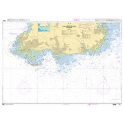
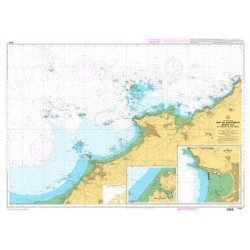
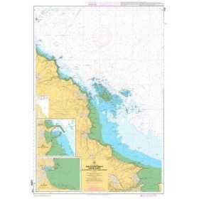
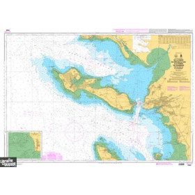
<p>Marine chart for coastal navigation. SHOM 7310 L - Bay of Saint Brieuc (eastern part) - from Dahouët to Cap Fréhel. Scale 1:25000.</p>
available
-
available
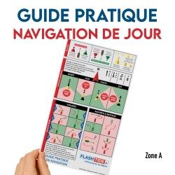 FLASH-TIDE
Guide pratique en PVC - Balisage, Cardinales & Règles de barre
- €22.99
- -15%
- €19.54
-
available
-
<div class="fiche-txt">
<h2>Bass fishing with bait and lures</h2>
<p>Of a very pragmatic approach, this guide written by a young but already great specialist known by the media, goes to the essential and presents a detailed chapter on the hope (habitat, reproduction, food, behavior...) and all the techniques of fishing (of the edge or in boat). You will also find the presentation of the material to be used as well as the regulation concerning the practice of this fishing.</p>
<p>Widely illustrated with photos and diagrams, this manual will help you understand everything you need to know to practice this emblematic fishery.</p>
<h2>Picksea specialist of the sea, its seabed, and fishing!</h2>
<p>Picksea has established itself as a leader in nautical equipment but also in documentation, with specialized books according to your desires and passions. Diving, boating, boating licenses, or fishing.</p>
<h2>Features</h2>
</div>
available
-
<div class="fiche-txt">
<h2>My first Origami boats by Vagnon</h2>
<p>40 detachable sheets to learn how to make your first Origami folded boats: easy to make, pretty and colorful with marine motifs. Bonus: a detachable booklet to learn step by step the art of Japanese folding and make beautiful boats!</p>
<h2>In this book</h2>
</div>
available

-
<h2>Standard Cras Rule</h2>
<p style="text-align:justify;"><span>This black ruler is very popular with boaters and boat license applicants because it is more practical and easier to read than other brands of rulers.</span></p>
<h2><span>Features of the Standard Cras rule</span></h2>
available
-
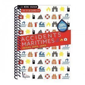
<h2>Marine Accident Memo</h2>
<p>This very practical memo aims to remind you of the essential actions to take in the event of accidents at sea.</p>
<p>You will find: how to prevent a maritime accident but also how to react and save.</p>
<h2>Characteristics of the Vagnon Memo - Safety on board</h2>
available

-
<div class="fiche-txt">
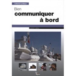
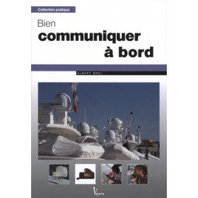
<h2>Communicating well on board: Albert Brel</h2>
<p>The means of communication at sea have greatly evolved in recent years. This manual covers all the possible techniques to simplify calling procedures, facilitate contact with the land and thus ensure safety.</p>
<p>VHF, mobile phone, Inmarsat Standard-C telex, SSB... Albert Brel, an electronics engineer and graduate of the Ecole Pratique des Hautes Etudes, gives you all the keys to choosing and mastering your communication systems.</p>
</div>
available
-
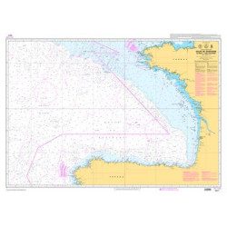
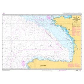
<p>Official SHOM chart - 7211 L - Bay of Biscay - from Brest to Cabo Finisterre.</p>
available
-
<p>Marine chart for coastal navigation. SHOM 7128 L - Bay of Saint Brieuc - from Pointe de la Tour to Yffiniac Cove. Scale 1:25000</p>
available
-
<h2>SHOM Marine Chart 7250 - From Pointe de la Torche to Loctudy</h2>
<ul>
<li>Scale 1:20000</li>
<li>Flat chart</li>
</ul>
available
-
<h2>Marine Card Packs for the Caribbean and West Indies Zone</h2>
<p style="text-align:justify;"><span>The nv-charts are characterized by fine contours and easily distinguishable colour graduations of the depth lines: turquoise for coral reefs, red for the 2-metre line and blue for the 5-metre zones. </span><span>Presented in a practical and user-friendly format (A3 closed and A2 open), a thick plastic envelope protects the cards, making them easy to store. </span><span>The importance of a good graphic representation of the topography when navigating in the Caribbean is essential.</span><br /><br /><span>Well-marked rivers, towns and street maps all contribute to a clear overview of the islands' waterfront facilities. Red numbered waypoints with coordinates based on WGS 84 allow mariners to navigate with their GPS instruments. Heights and depths are shown in the internationally recognized metre format. Large-scale approaches and land contour markings simplify entry into anchorages.</span></p>
<h2 style="text-align:justify;"><span style="color:#ff0000;">Picksea is Premium Reseller of NV-Charts</span></h2>
<h2><span>Features of NV-Charts Caribbean Zone Packs</span></h2>
available
-
<div class="fiche-txt">
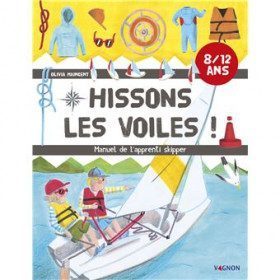
<h2>Hissons les Voiles: the Apprentice Skipper's Manual by Vagnon</h2>
<p>A manual of the essentials to succeed in the first steps in the practice of light sailing and understand how to steer a sailboat. Advice, information to start on the water, always accompanied by an experienced sailor! A bonus: find the testimonies of famous skippers on their beginnings as young sailors.</p>
<h2>In this book</h2>
</div>
available

-
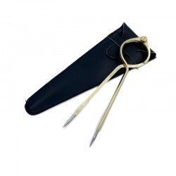
<h2>One Hand Brass Divider</h2>
<p style="text-align:justify;">One hand brass divider for aesthetics with fine stainless steel points for accuracy of measurement. The one hand divider is an indispensable marine instrument for measuring distances on a nautical chart whatever the scale, for determining its position in latitude and longitude or for positioning a point on the chart.</p>
<h2><span>Features of the One Hand Divider</span></h2>
available
-
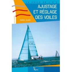
<h2>Learn how to trim and adjust your sails</h2>
<p><span>Knowing how to trim and adjust your sails according to the boat, the wind, the course, the weather, the risks... It's not easy! And yet, there are very few publications on the subject. This small practical manual is here to provide the reader with all the essential information to know. This book is aimed at experienced sailors.</span></p>
<h2>Manual features: Ajuster et régler des voiles</h2>
available
-
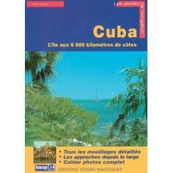
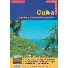
<p>Guide from the prestigious English publishing house IMRAY, a world reference in the field of marine cartography. This guide covers the Cuba areas. Edition of 01/01/2001</p>
available
-
<p>Marine chart for coastal navigation. SHOM 7129 L - from Cap Fréhel to Saint Briac-sur-Mer - Scale 1:20000.</p>
available
-
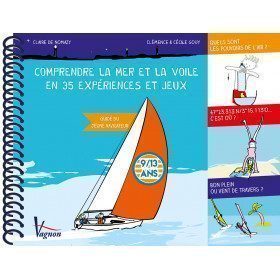
<p style="text-align:justify;"><span>35 easy and amusing experiments and games, which can be carried out with the means of the boat, which make it possible to understand the sail and all the phenomena which surround us at sea.</span></p>
<h2>Details about "Understanding the sea and sailing in 35 experiments and games"</h2>
available
-
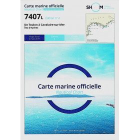
<h2>SHOM chart 7407 L is the nautical chart of Toulon Cavalaire sur Mer</h2>
<p>Area covered: Toulon, Saint Mandrier, Le Pradet, Port Cros, Porquerolles, Hyères, Le Lavandou. Scale 1/50200.</p>
<h2>Characteristics of the map 7407L (folded version) </h2>
available
-
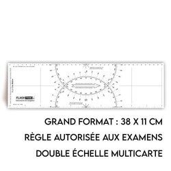
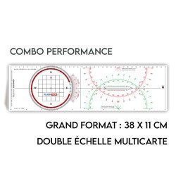
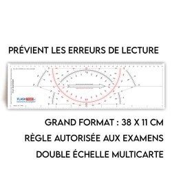
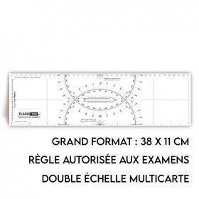
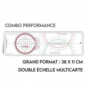
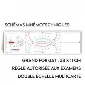
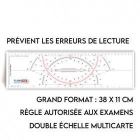
<h2>All the possibilities of the Cras rule and the Rappporteur Breton</h2>
<p style="text-align:justify;"><span>The Antares protractor ruler is both a tricolour Cras ruler AND a Breton protractor. It can be easily adapted to any skipper or sailor, whatever his or her initial training or practice habits. </span></p>
<h2>Features of the Antares rule</h2>
available
-
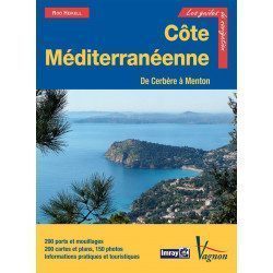
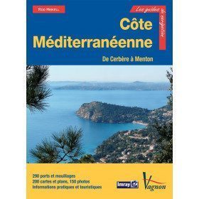
<p>New edition of the famous IMRAY Guide to the Mediterranean coast. This guide covers the areas from Cerbére to Menton. July 2013 edition</p>
unavailable
-
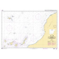
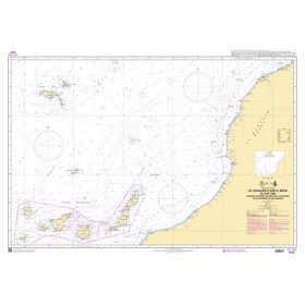
<p style="text-align:justify;">Marine chart shom 7270 for navigations between Casablanca and Cape Jubi, and in the Madeira and Canary Islands area. Ideal for the sailor who wishes to make a transatlantic crossing.</p>
available
-
<p>Marine chart for coastal navigation. SHOM 7130 L - Approaches to Saint Malo - from Hebihens Island to Pointe de la Varde - Scale 1:15000.</p>
available
-
<h2>Sea Cards Packs for the Mediterranean Area</h2>
<p>The nv-charts are characterized by fine contours and easy to distinguish colour graduations of the depth lines: turquoise for coral reefs, red for the 2-metre line and blue for the 5-metre zones. Presented in a practical and user-friendly format (A3 closed and A2 open), a thick plastic envelope protects the charts, making them easy to store. The importance of a good graphic representation of the topography when navigating the Mediterranean is essential.<br /><br />Well-marked rivers, towns and street maps all contribute to a clear overview of the islands' waterfront facilities. Red numbered waypoints with coordinates based on WGS 84 allow mariners to navigate with their GPS instruments. Heights and depths are shown in the internationally recognized metre format. Large-scale approaches and land contour markings simplify entry into anchorages.</p>
<h2><span style="color:#ff0000;">Picksea is Premium Reseller of NV-Charts</span></h2>
<h2>Features of NV-Charts Packs - Mediterranean Zone</h2>
available
-
<h2>Polaris Tricolour Ruler</h2>
<p style="text-align:justify;">The three-colour red, green and black cras ruler is very popular with boaters and boat licence applicants because it is more practical and easier to read than traditional cras rulers.</p>
<h2>Features of the Polaris Ruler</h2>
available
-
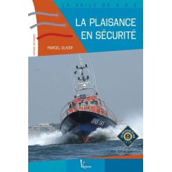
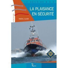
<h2>A beginner sailor? Sail safely!</h2>
<p>Taking to the sea, the first times, when you are a beginner, is not so simple. <span>With this book, published in partnership with the SNSM, the novice yachtsman will have all the keys to ensure his safety on board in the event of a major problem. In this manual, all the major themes are covered: man overboard, fire, collision, grounding, water ingress, evacuation.</span></p>
<h2>Manual Features: La plaisance en sécurité</h2>
available
-
<h2>The radio message memo</h2>
<p>This very practical memo aims to remind you of all the information you need to know for a safety, emergency or distress call.</p>
<p>You will find distress, emergency and safety messages.</p>
<h2>Features of the Vagnon Memo - Radio messages</h2>
available

-
<div class="fiche-txt">
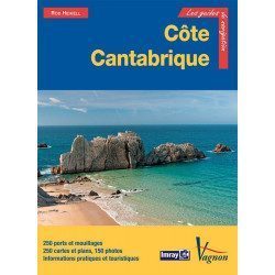
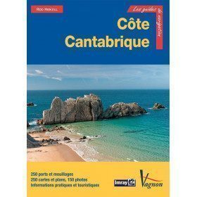
<h2>The famous Imray work along the Cantabrian coast</h2>
<p>A guide from the prestigious English publishing house IMRAY, a world reference in the field of marine cartography. This guide covers the areas from the south-west of France to the north Spanish coast. You can only be amazed by the beauty of the photos and the accuracy of the information given.</p>
<h2>Detailed features of the Imray Cantabrian Coast Guide</h2>
</div>
available
-
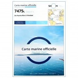
<p style="text-align:justify;">SHOM 7475L folded nautical chart. Centered on the Caribbean Arc area from Puerto Rico to Trinidad. Scale : 1:1000000</p>
available
-
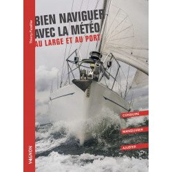
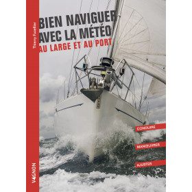
<h2>Sailing well with the weather offshore and in port: driving, manoeuvring and adjusting</h2>
<p>Sailing well with the weather offshore and in port <strong>Vagnon</strong> is a guide that brings together all the manoeuvres and conduct in port and at sea that are essential for good sailing in the weather.</p>
<h2>Features of the book Sailing Well with the Weather Offshore and in Port</h2>
available
-
<h2>Rule Type Cras</h2>
<p style="text-align:justify;">A two-coloured red and black cras ruler with a special design that makes it easier to read than other cras rulers.</p>
<h2>Characteristics of the Cras Type Rule</h2>
available
-
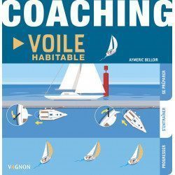
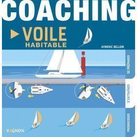
<h2>Improve your sailing skills with this manual!</h2>
<p>This sailing manual offers a coaching program adapted to all generations of "sailors", to acquire and master the skills of sailing. You will find several headings: getting ready, training, improving.</p>
<h2>Characteristics of the manual : Coaching voile habitable</h2>
available
-
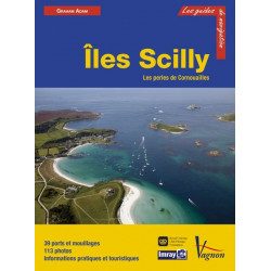
<h2>Prepare your navigation with this navigation guide!</h2>
<p>This sailing guide: "The Scilly Islands - Pearls of Cornwall" describes in detail the ports, marinas and numerous anchorages. The presentation of this sailing guide is clear and detailed, with many photos to complement the maps and charts.</p>
<p>For each port, island or bay: description (location with waypoint, hazards, lights, maps, radio contacts, harbour master's office), cartography, approach (day and night), mooring and anchorage, equipment and services, shore visits, history.</p>
<h2>Detailed features of the Isles of Scilly Navigation Guide</h2>
available
-
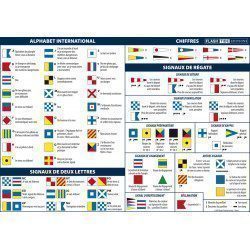
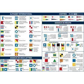
<h2>Adhesive Marine Code A5 Maritime Flags and Regattas</h2>
<p>The flags for boats adhesive sheet displays the essential international maritime flag signage in the rules of navigation. It also contains all the official flags used in regattas.</p>
<h2>Characteristics of the Maritime Flags and Regattas Code</h2>
available
-
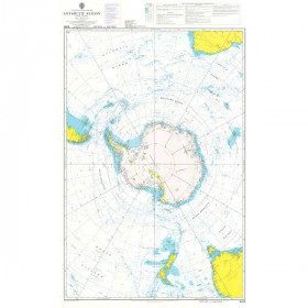
<h2 style="text-align:justify;">Admiralty Marine Map of the Antarctic Region</h2>
<p style="text-align:justify;">One of the only nautical chart references including the entire Antarctic. It will appeal to Vendée Globe fans who will be able to follow their favourite candidates around the Antarctic continent with a gnomonic projection instead of the classic Mercator projection which cannot be used in latitudes above 70° N or S.</p>
<h2 style="text-align:justify;">Characteristics of the Admiralty map of Antarctica</h2>
available

-
<p>Marine chart for navigations around the Ile de Ré. SHOM 7404 L - From the Pointe du Grouin du Cou to the Pointe de Chassiron</p>
available
-
available
-
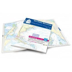
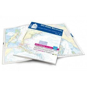
<h2>Atlas of Bermuda and Transatlantic charts return</h2>
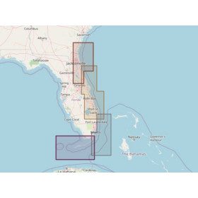
<p style="text-align:justify;">Discover the pink beaches of Bermuda and prepare your transatlantic return with this atlas! Nautical charts for Bermuda and transatlantic sailing to Europe. 4 general charts, 4 coastal charts and 4 detailed charts are included. Size 30x42cm, bound in atlas form. In English language. The set includes a download code for all digital maps of the region. The digital maps can be used on our NV Charts app with a smartphone and tablet (Apple, iOS/MacOSX, Android, Windows 7/8).</p>
<h2 style="text-align:justify;">Features of the NV-Charts 16.1 Atlas</h2>
available
-
<h2>Adhesive Marine Code A5 Rules of Navigation (RIPAM)</h2>
<p><span>This A5 sticker marine code for ships displays the essential international maritime regulations on the rules of the road and helm in navigation. It can replace the mandatory document (Division 240) on the RIPAM in navigation. </span><span style="color:#ff0000;"><strong>CONFORMS TO D240</strong></span></p>
<h2><span>Features of the RIPAM Marine Code</span></h2>
<p></p>
available

-
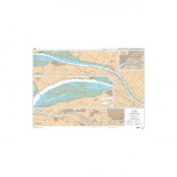
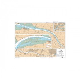
<p style="text-align:justify;">SHOM chart 7396 for navigation up the Loire River from St Nazaire bridge to Nantes. SHOM marine chart type Carte L folded to A4 format or flat, for pleasure boating. Scale: 1 : 20 000 to 1 : 15 000</p>
available
-
available


Showing 145-192 of 294 item(s)