

Marine Bookshop
There are 294 products.
-
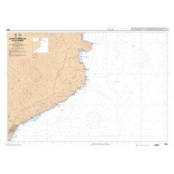
<p>Shom marine chart 7663. From Barcelona to Cape Cerbere. Scale 1:175000.</p>
available
-
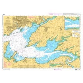
<p>Marine chart for coastal navigation. SHOM 7400 L - Rade de Brest - Scale 1:22500</p>
available

-
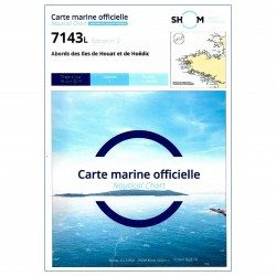
<p>SHOM marine chart 7143 L. Approaches to the islands of Houat and Hoëdic. Scale 1:20000</p>
available
-
<h2>Waterproof nautical charts of Italy</h2>
<p style="text-align:justify;">Waterproof nautical charts of the Italian Mediterranean coast that you can take out in the cockpit because they are waterproof. A3 format with a scale adapted to each navigation basin. Ideal for cruising or coastal regattas. Less cumbersome than traditional charts and very well thought out visually. Longer lasting for outdoor use in all conditions.</p>
<h2>Detailed characteristics of the charts</h2>
available
-
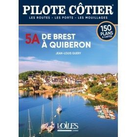
<h2>By following the information in this Pilote Côtier Bénéteau, even a beginner can venture from Concarneau into the numerous passes of the Glénan archipelago. </h2>
<p>This Bénéteau Coastal Pilot is not only for experienced sailors. Cabotage along the northern coast of Belle Ile does not present any real difficulties even if the currents are sometimes strong in the passage near the Teignouse and raise a rather rough sea. Similarly, the Lorient harbour offers a calm stretch of water, as do the rivers of Pouldu, Belon and Pont Aven, as well as the magnificent river Odet, whose ascent is a beautiful country walk in the heart of the Breton countryside. With a little attention and by following the information in this Pilote Côtier Bénéteau, even a beginner can venture from Concarneau into the numerous passes of the Glénan archipelago. </p>
<p>But it is true, going further N.W. than from Loctudy and the river of Pont l'Abbé, the coastline takes on an undeniably more severe character. You don't turn the tip of Penmarch like the one in Quiberon and at the Audierne anchorage, you can't improvise to cross the Raz de Sein where the violent currents raise breakers which can put an inexperienced crew in danger. Departure must be at a specific time, and routes must be followed on precise alignments. This is where this Bénéteau Coastal Pilot comes in handy, providing a wealth of information based on the experience of many sailors, so that you can face the dangers of the tip of Brittany in the safest possible conditions and take full advantage of the beauty of these wild shores. </p>
<h2>Features</h2>
available

-
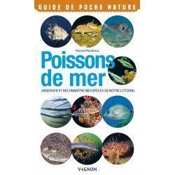
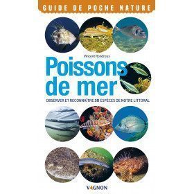
<h2>Vagnon's Pocket Guide to Sea Fish</h2>
<p style="text-align:justify;"><strong>Observe and recognize 50 species of our coastline</strong>. Throughout the seasons, many fish evolve along our coasts and seashores. The species presented in this guide are among the most common and easiest to observe. They are identified by means of a precise portrait and essential information: habitat and geographical distribution, abundance, description, behaviour and reproduction.</p>
<h2>Details on the Nature Pocket Guide<span style="font-family:'novecento_wide_medium', sans-serif;font-size:16px;"> </span>Sea fish</h2>
available
-
<div class="fiche-txt">
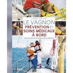
<h2>The essential onboard medical guide for all cruises</h2>
<p style="text-align:justify;">In this book, you will find all the information you need to sail your yacht in the best conditions to prevent the most frequent accidents. It details all the preventive measures to be taken to avoid these accidents, as well as the procedures and measures to be taken to act effectively when they occur. With all the advice and illustrated practical sheets, you will be able to quickly find the most appropriate solution if necessary.</p>
<p style="text-align:justify;">This book covers many of the topics covered in the World Sailing courses that competitors must attend in order to enter official races.</p>
<p style="text-align:justify;">An indispensable book in your on-board library for safe sailing.</p>
<h2 style="text-align:justify;">Practical...safety, very important on board a boat</h2>
<p style="text-align:justify;">Several points are very important to take into account during a trip on the sea: preparing the boat, before embarking, sailing carefully, and in case of problems. You can find all kinds of useful books on our website Picksea.com.</p>
<h2 style="text-align:justify;">Characteristics of the Vagnon of Prevention and Medical Care on board</h2>
</div>
available
-
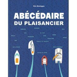
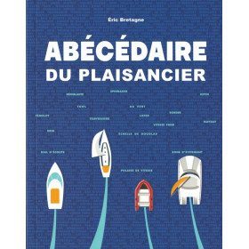
<h2>All about the world of boating - <span style="color:#ff0000;">Written and designed by the experts at Picksea!</span></h2>
<p style="text-align:justify;">From A for "Shoot" to Z for "Avoidance Zone", this <em>"Abécédaire du plaisancier" </em>offers definitions of more than 300 key words that are essential for acquiring a solid nautical culture that is useful for any outing at sea, in a motorboat or under sail.</p>
<p style="text-align:justify;">The book is enriched with visual plates to identify and remember at a glance the essentials about the design and operation of a boat, basic manoeuvres, markings and markings, safety equipment, rigging, sails, etc...</p>
<h2><span style="font-family:'novecento_wide_medium', sans-serif;font-size:16px;">Details on the Abécédaire du plaisancier</span></h2>
available
-
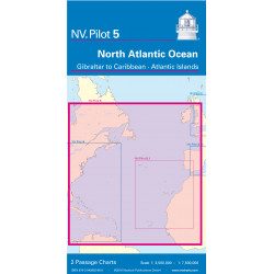
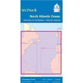
<h2>North Atlantic Offshore Marine Chart | Transatlantic</h2>
<p><span>The NV Pilot 5 offshore chart covers the North Atlantic from Europe to the Caribbean and on the reverse side, an area covering the Atlantic islands: Cape Verde Islands, Canary Islands, Madeira and Azores. The ideal map to prepare a transatlantic voyage.</span></p>
<h2>Details on the NV Pilot 5 map - North Atlantic | Transatlantic</h2>
available
-
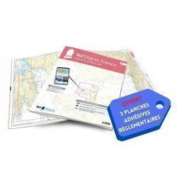
<h2>NV-CHARTS FR1 - 48 Channel Charts (Oostende to Cherbourg) + the 3 regulatory adhesive sheets</h2>
<p style="text-align:justify;"><span style="font-size:10pt;">In this NV-Charts FR1 pack, you will find an Atlas of 48 nautical charts from Oostende to Cherbourg including 4 offshore charts, 15 coastal charts and 29 detailed charts. Thanks to a personal download code, you will have access to all the charts in digital format as well as to the <strong>NV Graphical Navigator light navigation software</strong> both freely usable on PC, tablets or smartphone!</span></p>
<p style="text-align:justify;"><span style="font-size:10pt;">The area represents the Channel (FRANCE), and more precisely the following areas: <strong>Normandy - Zeebrugge, Dunkirk, Calais, Le Havre, Cherbourg.</strong></span></p>
<p style="text-align:justify;"><span style="font-size:10pt;"><span style="color:#ff0000;background-color:#ffffff;"><strong>Free with your FR1 pack:</strong></span> 3 adhesive sheets containing the mandatory regulatory documentation (RIPAM, buoys and flags) for navigation in coastal areas (art 242-2.04 of Division 240). <span style="color:#ff0000;"><strong>When you buy your pack, you have all the regulatory documentation for sailing within 6 miles of a shelter.</strong></span></span></p>
<h2>Description of the FR1 card pack</h2>
available
-
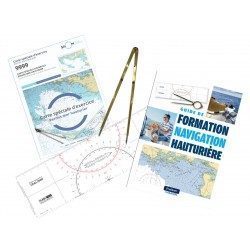
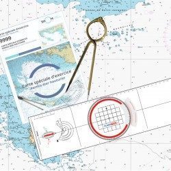
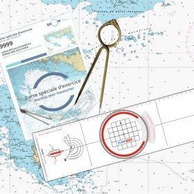
<h2><strong>The offshore licence pack with Breton plotter !</strong></h2>
<p>Pack of material to prepare the offshore licence including the official chart 9999, a plotter (Flash-Tide) and a one hand divider (Flash-Tide)</p>
<h2>Features of the Offshore Plus Pack</h2>
available
-
<div class="fiche-txt">
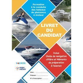
<h2>Boating Licence Candidate Booklet by Vagnon</h2>
<p>In accordance with the regulations, this set of 2 booklets is compulsory to follow the training to drive motorized pleasure boats, coastal option or inland water option, but it is above all a real training tool:</p>
<p><strong>It is a practical manual</strong> which details the objectives 1 to 18 of the practical training and the manoeuvres to be learned with access to explanatory videos</p>
<p><strong>It's a reminder</strong> for you: everything you need to remember for the coastal exam and for sailing</p>
<p><strong>It is the official regulatory support</strong> referenced and validated by the Direction des Affaires Maritimes</p>
<h2>Find out everything about the boating licence on our website</h2>
<p>You can find on Picksea.com everything related to the boating license, such as the boating license test and codes published by the prestigious brand Vagnon.</p>
<h2>Features</h2>
</div>
available

-
<div class="fiche-txt">
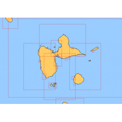
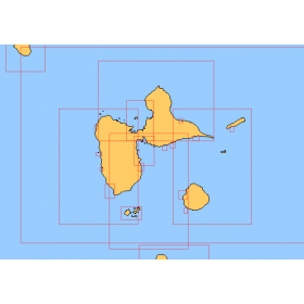
<h2>Choose in the list below a marine map of the surroundings of Guadeloupe</h2>
<p style="text-align:justify;">These SHOM charts cover all the navigation areas around Guadeloupe: from the Saintes to Marie-Galante and la Désirade as well as the Petit and Grand Cul de Sac Marin and the leeward coast, Saint François and Sainte Anne. If you need to reach Pointe à Pitre and the Gosier marina, you should choose the map of the Pointe a Pitre roadstead and the salt river. The Shom L type charts are more adapted to the yachtsman because they are folded in A4 format and thus easier to store in a chart table. They detail precisely the navigation areas of the coasts and islands surrounding Guadeloupe. To order, choose from the list below the area you wish to explore by referring to the map number associated with the desired navigation area. Indicate the map number you have chosen and the option "folded" or "flat".</p>
<h2>List of chart references and areas covered:</h2>
</div>
available
-
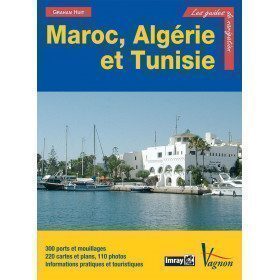
<p>Guide from the prestigious English publishing house IMRAY, a world reference in the field of marine cartography. This guide covers Morocco, Algeria, Tunisia, Gibraltar, Libya, Pantelleria, the Pelagie Islands and Malta. Edition of 03/12/2012</p>
available

-
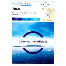
<p style="text-align:justify;">Shom 7068 navigation chart for cruising between Quiberon and Les Sables d'Olonne. Scale: 1:162400</p>
available
-
<p>Marine chart for coastal navigation. SHOM 7123 L - Molène Island - Ushant Island - Fromveur Passage - Scale 1:20000</p>
available

-
<p>SHOM marine chart 7142 L. Belle-Île. Scale 1:25000</p>
available
-
<div class="fiche-txt">
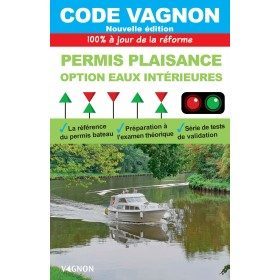
<h2>Code Vagnon Pleasure Craft Licence inland waterways option</h2>
<p>For more than thirty years, this code has been the instrument of your success in the examination for the pleasure craft licence, inland waterways option, and the precious advisor for safe navigation.</p>
<h2>Find out everything about the inland waterways option on our website</h2>
<p>You can find on Picksea.com everything related to the inland waterways licence, such as the Inland Waterways Licence Test published by the prestigious brand Vagnon, or the DVD associated with the inland waterways option.</p>
<h2>Detailed features</h2>
</div>
available

-
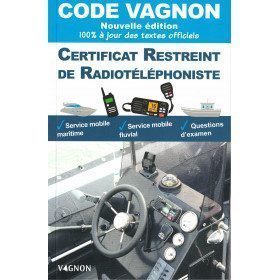
<h2>The Vagnon code for the French Radiotelephone Operator's Certificate</h2>
<p>The Radiotelephone Operator's Certificate validates a navigator's ability to use the VHF, both from the point of view of technical functions and calling procedures. The possession of this certificate is mandatory to use a VHF when navigating outside French territorial waters.</p>
<h2>Find all the maritime radiotelephony on Picksea.com</h2>
<p>You can find on our website everything related to marine radiotelephony and in particular a wide range of <a href="https://www.picksea.com/en/53-vhf-and-walkie-talkie">VHF</a> and <a href="https://www.picksea.com/en/82-emergency-beacon">distress beacons</a>.</p>
<h2>More information on the Vagnon CRR manual</h2>
available
-
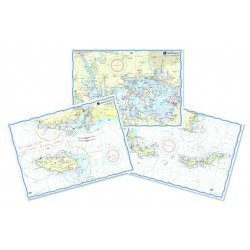
<h2>Waterproof nautical charts of Spain</h2>
<p style="text-align:justify;">Waterproof nautical charts of the Spanish Mediterranean coast that can be taken out in the cockpit because they are waterproof. A3 format with a scale adapted to each sailing basin. Ideal for cruising or coastal regattas. Less cumbersome than traditional charts and very well thought out visually. Longer lasting for outdoor use in all conditions.</p>
<h2>Detailed characteristics of the charts</h2>
available

-
<h2>Réussir sa sortie en mer: preparing, sailing and above all progressing!</h2>
<h2><span style="color:#ff0000;">Written and designed by the experts at Picksea!</span></h2>
<p style="text-align:justify;">Successful Sea Trips is an illustrated guide from the <strong>Vagnon</strong> which accompanies the sailor in all the stages of his sea trip. You will find a<span> unwound <strong>step by step</strong> which follows the chronology of a sea trip (before, during, after) with important themes such as managing the unexpected or sailing at night.</span></p>
<h2>Characteristics of the book Réussir sa sortie en mer</h2>
available
-
<h2>Offshore Caribbean and East Coast of America Marine Chart</h2>
<p style="text-align:justify;">The NV Pilot 6 offshore chart covers: on the front, the Caribbean with the Bahamas, the Caribbean, the North Coast of South America, Panama, the East Coast of the USA and on the back, the East Coast of the USA from Nova Scotia to Florida and Bermuda.</p>
<h2>NV Pilot 6 Map Details - Caribbean and Eastern Seaboard</h2>
available
-
<h2>NV-CHARTS FR2 - 25 Western Channel Charts (from Cherbourg to St Malo) + the 3 regulatory adhesive sheets</h2>
<p><span style="font-size:10pt;">In this NV-Charts FR2 pack, you will find an atlas of 25 nautical charts from Cherbourg to St Malo, including 2 deep-sea charts, 14 coastal charts and 9 detailed charts. Thanks to a personal download code, you will have access to all the charts in digital format as well as to the <strong>NV Graphical Navigator light navigation software</strong> both freely usable on PC, tablets or smartphone!</span></p>
<p><span style="font-size:10pt;">The area represents the Channel (FRANCE), and more precisely the following areas: <strong>Channel Islands - Cherbourg, Granville, Chausey, Jersey, Guernsey, Cancale, Saint Malo.</strong></span></p>
<p><span style="font-size:10pt;"><span style="color:#ff0000;"><strong>Free with your FR2 pack:</strong></span> 3 adhesive sheets containing the mandatory regulatory documentation (RIPAM, buoys and flags) for navigation in coastal areas (art 242-2.04 of Division 240). <span style="color:#ff0000;"><strong>When you buy your pack, you have all the regulatory documentation for sailing within 6 miles of a shelter.</strong></span></span></p>
<h2>Description of the FR2 card pack</h2>
available
-
<h2><strong>Everything you need to prepare and pass your offshore licence!</strong></h2>
<p>Everything you need to prepare and pass your offshore licence: complete pack of materials, map and book</p>
<h2>Features of the Complete Offshore Pack</h2>
available
-
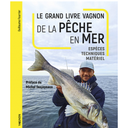
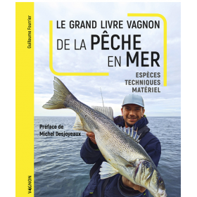
<h2>Make your sea fishing trips a success</h2>
<p><span>This manual is written by Guillaume Fourrier, holder of 19 fishing records. He explains to us <span>all the modern techniques of sea fishing, the necessary equipment and the assemblies through diagrams and photographs. </span></span></p>
<h2>Characteristics of the manual : The sea fishing guide</h2>
available
-
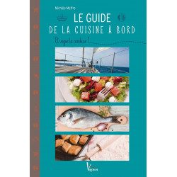
<h2>Learn to cook at sea like a chef!</h2>
<p><span>This cooking guide explains how to set up a boat kitchen, but it also contains a multitude of generous recipe ideas that will delight your taste buds, such as c<span>grilled coconut rabe, barbecued lobster but also the<span>soft spinach flanks, fried potatoes. In short, there is something for everyone! </span></span></span></p>
<h2>Features of the Onboard Cooking Guide</h2>
available
-
<div class="fiche-txt">
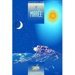
<h2>The tide in detail by SHOM</h2>
<p>This work is dedicated to any yachtsman who is particularly interested in the tide and all that can result from it. A very nice book filled with beautiful photos and landscapes, but also with relevant and quality information.</p>
<h2>General browsing on Picksea.com</h2>
<p>Many books on navigation in general are available on our site, do not hesitate to discover and enjoy them by browsing our categories. Such as the practical guides, the marine guides, or the youth section for your children!</p>
<h2>Features of this book</h2>
</div>
available
-
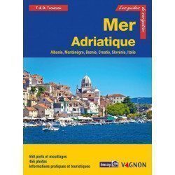
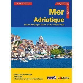
<h2>Prepare your navigation with this navigation guide!</h2>
<p>This navigation guide: "Adriatic Sea - Albania, Montenegro, Bosnia, Croatia, Slovenia, Italy" describes the ports, marinas and numerous anchorages in detail. The presentation of this navigation guide is clear and detailed, with many photos to complement the maps and plans.</p>
<p>For each port, island or bay: description (location with waypoint, hazards, lights, maps, radio contacts, harbourmaster's office), cartography, approach (day and night), mooring and anchorage, equipment and services, shore visits, history.</p>
<p>The guide covers the coasts of Albania, the Dalmatian coast, the coasts of Montenegro, Croatia and Slovenia, and the east coast of Italy from the Slovenian border to Santa Marica di Leuca.</p>
<h2>Detailed features of the Channel Islands Sailing Guide</h2>
available
-
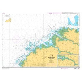
<p style="text-align:justify;">Shom 6990 marine chart for your navigations between Penmarc'h and the Gironde estuary. Scale: 1:355000</p>
available
-
<p>Marine chart for coastal navigation. SHOM 7094 L - From the Four lighthouse to the Virgin Island - Aber Wrac'h Port - Scale 1:25000</p>
available
-
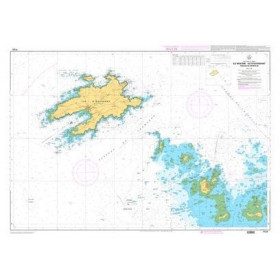
<p>SHOM marine chart 7141 L. Quiberon Bay. Scale 1:20000</p>
available

-
available
-
<h2>The edible nature of the seaside</h2>
<p>Vagnon Editions make our mouths water: 50 seaside species to pick , fish or cook. <span style="background-color:#ffffff;color:#333333;font-family:'Open Sans', sans-serif;font-size:13px;">On the seashore, nature abounds with many edible species, which are within easy reach. </span>Thanks to its clear illustrated sheets, this book will help you to recognize more than 40 plants, seaweeds, shellfish and crustaceans, and to pick and fish them according to the usual precautions and in respect of their environment. And as there is only one step from nature to the plate, you will also discover 40 simple and tasty recipes to cook with your gleaned treasures.</p>
available
-
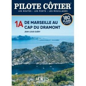
<h2>The Pilote Côtier guide offers precise documentation on ports and anchorages</h2>
<p>Some yachtsmen from the north like to criticise the coasts of Provence and the Riviera, which in their eyes are nothing more than a continuous front of built-up areas and large marinas, in a word a real concrete wall. They have never really sailed along these shores from Marseille to Menton. One can only be amazed at the sun-bleached stone cliffs carved out by the deep creeks of Marseille and overflowing with totally deserted islets. Then come the Cyclops wall of Cassis, the highest cliffs in France, the imposing promontory of Cap Sicié, totally inaccessible by land, and all the charming little ports between the large harbour of Toulon and the marshes of the Giens peninsula where pink flamingos nest. The pine-shaded shores of Porquerolles Island have also remained unchanged for centuries and the southern coast is just as wild as many of the Corsican shores.</p>
<p>To say that the area around Saint Tropez is overrun with rich villas with their feet in the water is to ignore the reddish rocky escarpments, the great fleeces of pine trees which descend to the sea from the Capes Lardier and Camarat. The multitude of small creeks of the Trayas coast between St Raphaël and Cannes, can also only make you love Mediterranean landscapes. And even in the vicinity of the big cities of Nice and Monaco, one can still find, as in the bay of Villefranche, some quiet anchorages in a nature preserved from concrete. The Italian coast is undoubtedly one of the most urbanised, but its coastline remains mountainous and the atmosphere of its ports is always lively and attractive.</p>
<h2>Features</h2>
available
-
<h2>From the lazarette to the plate: how to organize your kitchen on board?</h2>
<p style="text-align:justify;">From Shack to Plate is a manual of the <strong>Vagnon</strong> which helps you to organize your kitchen on board your boat with topics such as equipment, furnishings, provisioning as well as easy and tasty recipe ideas.</p>
<h2>Characteristics of the book From the lazarette to the plate</h2>
available

-
<h2>North Sea Zone Sea Card Packs</h2>
<p>The nv-charts are characterized by fine contours and easy to distinguish colour graduations of the depth lines: turquoise for coral reefs, red for the 2-metre line and blue for the 5-metre zones. Presented in a practical and user-friendly format (A3 closed and A2 open), a thick plastic envelope protects the charts, making them easy to store. The importance of a good graphic representation of the topography when navigating the North Sea is essential.<br /><br />Well-marked rivers, towns and street maps all contribute to a clear overview of the islands' waterfront facilities. Red numbered waypoints with coordinates based on WGS 84 allow mariners to navigate with their GPS instruments. Heights and depths are shown in the internationally recognized metre format. Large-scale approaches and land contour markings simplify entry into anchorages.</p>
<h2><span style="color:#ff0000;">Picksea is Premium Reseller of NV-Charts</span></h2>
<h2>NV-Charts North Sea Zone Marine Card Packs Features</h2>
available
-
<h2><strong>The essential pack for passing professional maritime exams</strong></h2>
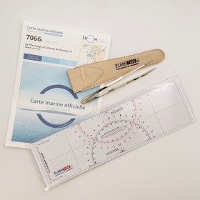
<p style="text-align:justify;">A set of quality tools to pass your professional maritime exams! Picksea is the owner of the Flash-Tide Instruments brand and our teams manufacture in France, in Lorient, all the models of cras or breton rulers. Picksea is also a SHOM agent. We are therefore the best able to provide you with a pack composed of the best products at the best price.</p>
<h2>Composition of the maritime exam pro pack</h2>
available

-
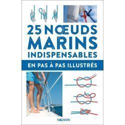
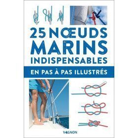
<h2>The essentials of marine knots</h2>
<p>With this practical guide you will learn how to tie the main knots!</p>
<h2>Features of the "Essential Marine Knots" Guide</h2>
available
-
<div class="fiche-txt">
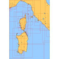
<h2>Choose from the list below a chart covering the Mediterranean</h2>
<p style="text-align:justify;">This set of charts covers all the navigation areas in the Mediterranean, with different scales allowing to cover either a large navigation area or to zoom in on a specific port or area. These Shom Marine charts are available in flat or folded format. The L type charts are more suitable for the yachtsman as they are folded to A4 size, easier to store in a chart table. These charts detail the navigation zones of all the sailing areas around Corsica, Sardinia and Italy. Choose from the list below the area you wish to explore by referring to the map number associated with the desired navigation area. Indicate the map number you have chosen and whether you want to sail folded or flat.</p>
<h2>List of chart references and areas covered</h2>
</div>
available
-
<div class="fiche-txt">
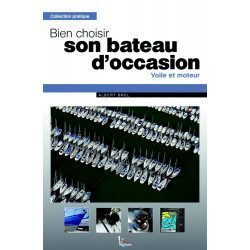
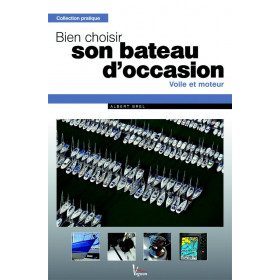
<h2>How to choose your second-hand boat : Albert Brel</h2>
<p>The aim of this book by Albert BREL is to provide boaters with all the advice they need to acquire a second-hand boat, whether sailing or motor. The advice is given according to the budget and the sailing program.</p>
<p>In this manual, you will learn :</p>
<ul><li>To make the choice of<span>The boat's performance depends on the sailing program, the sailing areas, the parking mode and the hull.</span></li>
<li><span><span>Building materials.</span></span></li>
<li><span><span>To examine the vessel afloat</span></span></li>
<li><span><span>To do the dry dock examination</span></span></li>
<li><span><span>The purchase of the boat </span></span></li>
<li><span><span>Do-it-yourself repairs</span></span></li>
</ul><h2>Detailed characteristics of the Vagnon manual: Choosing your second-hand boat</h2>
</div>
available
-
<div class="fiche-txt">
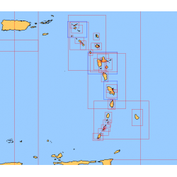
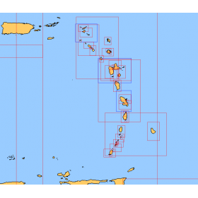
<h2>Choose from the list below a chart covering the sailing areas around the Caribbean Arc and the Caribbean Sea</h2>
<p>This set of charts covers all the sailing areas from Venezuela to Cuba, including all the islands of the Caribbean Arc. These Shom marine charts type L are more adapted to the yachtsman because they are folded in A4 format, easier to store in a yachting chart table. These charts detail precisely the sailing areas of the surrounding islands of the West Indies. Choose from the list below the area you wish to explore by referring to the chart number associated with the desired sailing area. Indicate the map number you have chosen and whether you want to sail flat or folded.</p>
<h2>List of chart references and areas covered:</h2>
</div>
available
-
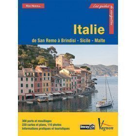
<p>Guide from the prestigious English publishing house IMRAY, a world reference in the field of marine cartography. This guide covers the areas of Italy: From San Remo to Brindisi, Sicily and Malta. Edition of 03/12/2012</p>
available

-
<p style="text-align:justify;">Shom 7076 marine chart for cruising or racing from Saint Nazaire to Saint Malo. Scale: 1:350000</p>
available
-
<p>Marine chart for coastal navigation. SHOM 7122 L - from Pointe Saint Mathieu to Four lighthouse - Scale 1:25000</p>
available

-
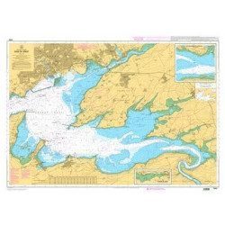
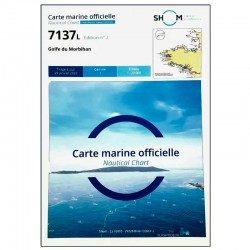
<p>SHOM marine chart 7137 L. Gulf of Morbihan. Scale 1:20000</p>
available
-
available
-
available
-
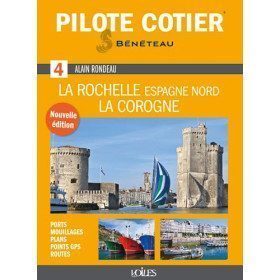
<h2>Indispensable for successful cruising from La Rochelle to La Coruña!</h2>
<p>An indispensable tool for pleasure boating, this Coastal Pilot n°4, modernised and updated by Jean-Louis Guéry, is a reference book for anyone wishing to sail in the Atlantic, in the area between La Rochelle and La Corogne. It has been given a clearer and more practical presentation. It contains all the information and advice needed to enter ports, reach an anchorage, avoid pitfalls, navigate a difficult passage, find a service at the port of call, etc. Illustrated with numerous photos and aerial views to easily identify the landscape, it also includes maps of ports and anchorages, lists of waypoints, addresses and useful telephone numbers. A must-have!</p>
<h2>Features</h2>
available


Showing 49-96 of 294 item(s)