available


Detailed features

All about the world of boating - Written and designed by the experts at Picksea!
From A for "Shoot" to Z for "Avoidance Zone", this "Abécédaire du plaisancier" offers definitions of more than 300 key words that are essential for acquiring a solid nautical culture that is useful for any outing at sea, in a motorboat or under sail.
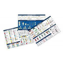
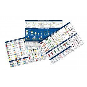
The book is enriched with visual plates to identify and remember at a glance the essentials about the design and operation of a boat, basic manoeuvres, markings and markings, safety equipment, rigging, sails, etc...
Details on the Abécédaire du plaisancier
- Format 16 x 22 cm 128 pages
- 50 descriptive plates
- Over 300 definitions
You might also like 1 other product seleted for you
-
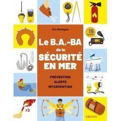
<h2>Code Marin réglementaire bateau : Pack of 3 A5 adhesive sheets</h2>
<p>The regulatory marine code in 3 self-adhesive sheets RIPAM / Buoyage / Flags gathers the essential of the international maritime regulations for pleasure boating. A5 format, easier to put on board. <span style="color:#ff0000;"><strong>CONFORMS TO D240</strong></span></p>
<h2>Characteristics of the Marine Code in a pack of 3 A5 sheets</h2>
available

In the same category
4 other products seleted for you-
available
-
<div class="fiche-txt">
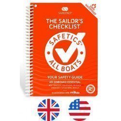
<h2>The Safetics safety guide english version : Sailboats and Motors</h2>
<p style="text-align:justify;">Safetics® The Sailor’s Checklist is the first English-language navigation guide written in the form of aviation-style check-lists. Recommended by Coast guards and translated and adapted by English skipper Pip Hare, it compiles all major navigation rules as well as procedures validated by sea safety experts. Its universal and practical content has been designed for both skippers and crew members, and is suitable for sailboats and powerboats. Its waterproof and tear proof format allows an unrivalled durability.</p>
<p style="text-align:justify;">This guide is the result of the work of enthusiasts who decided to create a simple and intuitive memo for pleasure boating. Its content is based on official recommendations, as well as on numerous feedbacks and experts' opinions, including in particular that of <strong>Armel Le Cléac'h </strong>a skipper and professional sailor. A real Sailor's Checklist for sailing and motor boats.</p>
<h2>Features of the Safetics Sailing Guide: Sailor's Checklist</h2>
</div>
available
-
available
-
available