

Marine Bookshop
There are 294 products.
-
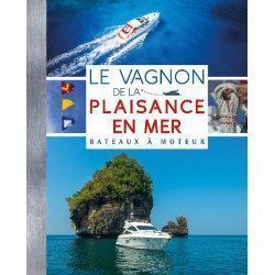
<p style="text-align:justify;"><span>The Vagnon of boating at sea is the Bible of the motor sailor! This book gathers all the knowledge in manoeuvres, navigation, safety, regulations, etc... which will help you to improve your nautical skills.</span></p>
<h2 style="text-align:justify;">The Motor Boating Bible !</h2>
available

-
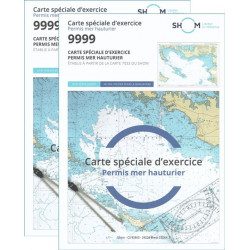
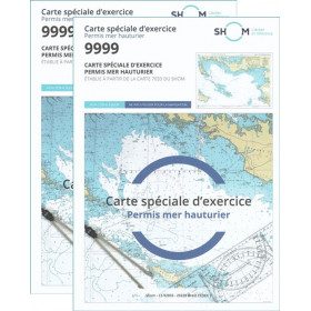
<h2>Pack of 2 official 9999 marine charts from SHOM</h2>
<p style="text-align:justify;"><span>The nautical chart of SHOM 9999 is the official chart of the exam of the <strong>offshore sea permit</strong> which allows to navigate beyond 6 miles from a shelter. It is also on this chart that you will do all the exercises to prepare you for the exam </span></p>
<h2 style="text-align:justify;"><em>Why buy 2 charts?</em></h2>
<p style="text-align:justify;">The fact of doing many exercises on the chart (with a lot of deletion) often makes it unusable for the exam and this is why many exam centers require a new chart for the exam. It should be noted that the organising administration keeps the card as a copy of the exam (except in the case of failure).</p>
<h2>Training and preparation for the offshore licence (theoretical test)</h2>
<p style="text-align:justify;">After passing the coastal licence (and perhaps also the inland waterways licence), you wish to extend your navigation area to the "high seas"! To do this, you need to obtain a deep-sea licence to sail motor yachts beyond 6 miles from a shelter (but it is also very useful for sailing). Read our<a title="Tout savoir pour passer le permis hauturier" href="https://blog.picksea.com/tout-savoir-passer-permis-hauturier/" target="_blank" rel="noreferrer noopener"> article "Everything you need to know about the offshore licence"</a> to find out more.</p>
<p style="text-align:justify;">The chart SHOM 9999 is a special marine chart but it contains all the information of a real navigation chart (scale of latitudes and longitudes, coasts, probes, dangers, beacons, lighthouses, currents, ...). You can plot routes and bearings as well as position points, or measure distances as on a real chart <a title="Déterminer une route sur le carte marine" href="https://blog.picksea.com/determiner-route-direction-distance/" target="_blank" rel="noreferrer noopener">See the article "Determining a route in direction and distance" on our blog </a></p>
<h2 style="text-align:justify;">Characteristics of the Marine Chart 9999 from SHOM for the Offshore Permit</h2>
available
-
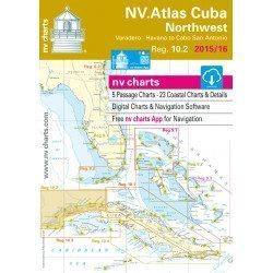
<h2>Marine Card Packs for the Caribbean and West Indies Zone</h2>
<p style="text-align:justify;"><span>The nv-charts are characterized by fine contours and easily distinguishable colour graduations of the depth lines: turquoise for coral reefs, red for the 2-metre line and blue for the 5-metre zones. </span><span>Presented in a practical and user-friendly format (A3 closed and A2 open), a thick plastic envelope protects the cards, making them easy to store. </span><span>The importance of a good graphic representation of the topography when navigating in the Caribbean is essential.</span><br /><br /><span>Well-marked rivers, towns and street maps all contribute to a clear overview of the islands' waterfront facilities. Red numbered waypoints with coordinates based on WGS 84 allow mariners to navigate with their GPS instruments. Heights and depths are shown in the internationally recognized metre format. Large-scale approaches and land contour markings simplify entry into anchorages.</span></p>
<h2 style="text-align:justify;"><span style="color:#ff0000;">Picksea is Premium Reseller of NV-Charts</span></h2>
<h2><span>Features of NV-Charts Caribbean Zone Packs</span></h2>
available
-
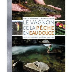
<h2>Make your freshwater fishing trips a success</h2>
<p><span>Discover the diversity of freshwater environments and the main species of fish that inhabit them; learn and master the fishing techniques of the various large families of fish over the seasons thanks to targeted set-ups and appropriate equipment and bait; learn about the organisation of fishing and its regulations for responsible fishing... </span></p>
<p><span>You will find: descriptive sheets of more than 40 species of fish; illustrated assemblies and animations; tips and advice; the different types of fishing.</span></p>
<h2>Characteristics of the manual : The freshwater fishing guide</h2>
available
-
<h2>The on-board safety memo</h2>
<p>This very practical memo aims to remind you of the often complex regulatory environment of water sports, and the basic principles for calm and responsible navigation.</p>
<p>You will find the obligations of the skipper, the equipment, the maintenance but also the good gestures.</p>
<h2>Characteristics of the Vagnon Memo - Safety on board</h2>
available

-
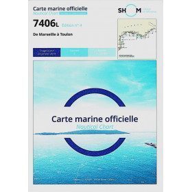
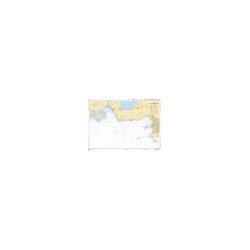
<h2>The SHOM 7406 L chart is the marine chart from Marseille to Toulon.</h2>
<p>Area covered: Marseille South, Cassis, Archipelago of Riou, La Ciotat, Bandol, Toulon. Scale 1/50000.</p>
<h2>Characteristics of the SHOM 7406L chart (folded version)</h2>
available
-
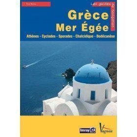
<p>Guide from the prestigious English publishing house IMRAY, world reference in the field of marine cartography. This guide covers the areas of Greece and the Aegean Sea, Athenes, Cyclades, Sporades, Chalkidiki, Dodecanesia. Edition of 23/04/2012</p>
available

-
<h2>Prepare your navigation with this navigation guide!</h2>
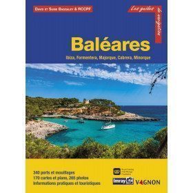
<p>This sailing guide: "Balearic Islands - Ibiza, Formentera, Mallorca, Cabrera, Menorca" describes the ports, marinas and numerous anchorages in detail and with precision. The presentation of this navigation guide is clear and detailed, with many photos to complement the maps and plans.</p>
<p>For each port, island or bay: description (location with waypoint, hazards, lights, maps, radio contacts, harbour master's office), cartography, approach (day and night), mooring and anchorage, equipment and services, visits on land, history.</p>
<p>This guide covers the coasts of Ibiza, Formentera, Majorca, Cabrera and Menorca.</p>
<h2>Detailed features of the Balearic Sailing Guide</h2>
available

-
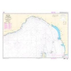
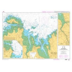
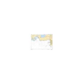
<p>Shom marine chart 6821L. Nice to Piombino. Scale: 1:250000.</p>
available
-
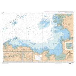
<p>Marine chart for coastal navigation. SHOM 7124 L - Bay of Lannion - from Pointe de Primel to Ile Grande - Scale 1:20000</p>
available
-
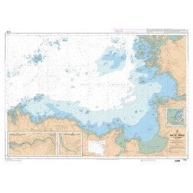
<p>SHOM marine chart 7139 L. Groix Island and Lorient roadstead. Scale 1:20000</p>
available
-
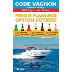
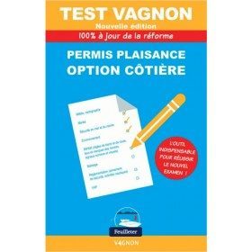
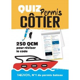
<h2><strong>The essential Vagnon code for coastal boating licences to prepare your licence: </strong></h2>
<h2><strong><span style="color:#ff0000;">Written and designed by the experts at Picksea!</span></strong></h2>
<p>Discover the new edition of the Vagnon code - coastal option boating licence! More coherent teaching, content structured according to the chronology of a sea trip, 10 tests to validate your knowledge and learning, around 200 questions... What is the objective? A 100% success rate % and more competent boat license candidates!</p>
<h2>Characteristics of the Code Vagnon boating license coastal option</h2>
available
-
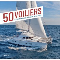
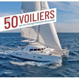
<h2>The 50 sailboats that changed the history of sailing </h2>
<p>An illustrated book tracing the major developments in sailing from 1970 to the present day, through more than 50 exceptional boats. A book to dream, escape, and learn the history of monohulls and multihulls emblematic. Author Emmanuel Van Deth- Editions Vagnon . 208 pages </p>
<h2>Characteristics of the book </h2>
available
-
<p class="t12px">Marine chart shom <span class="searchproduct-list-item-name">6767 </span>for navigations along the blue coast and in the roadstead of Marseille until the calanques<span class="t12px">. Nautical chart SHOM type Carte L folded in A4 format <span class="t12px">or flat</span> </span>, for pleasure boating. Up to date printing Scale <strong><strong>1 : 50 000</strong><br /></strong></p>
available
-
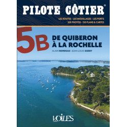
<h2>The essential guide to the most beautiful cruises in Southern Brittany and the Vendée to sail safely </h2>
<p>The coasts of Southern Brittany and the Vendée are among the most beautiful in France. For yachtsmen, it is an exceptional sailing area, with islands to explore, rivers to sail up, creeks to take shelter in, points to go around and picturesque little ports to discover. But it is also a complex sailing area, with many traps, between shoals, currents, passes and channels. And simply reading the map does not always allow you to navigate in complete safety. This Coastal Pilot, entirely revised and corrected, is the essential tool for experienced and inexperienced sailors alike. It contains all the information and advice needed to navigate, day or night, and to create the most beautiful cruises.</p>
<p>For this new edition, we have modernised the presentation with even more photos and plans, with clear and precise comments, perfectly documented information and up to date with the latest modifications. This work has been carried out by authors whose knowledge of these coasts is the fruit of their countless navigations. It is this competence and seriousness that have made the Pilote côtier collection a success with all yachtsmen for over 40 years.</p>
<h2>Features</h2>
available
-
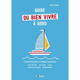
<h2>The guide to living well on board to deal with all situations</h2>
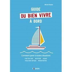
<p style="text-align:justify;">The guide to living well on board <strong>Vagnon</strong> offers technical advice (how to optimize your space and equip yourself well) but also psychological advice to avoid crisis situations and to live well on board with your crew or alone. You will find themes such as equipment and material, managing emotions, stress, solitude, fear...</p>
<h2>Features of the Guide to living well on board</h2>
available
-
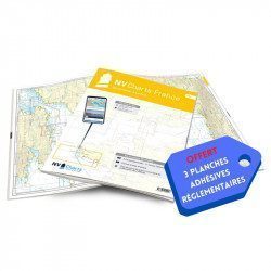
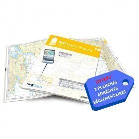
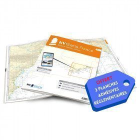
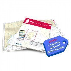
<h2>NV-CHARTS FR9 - 70 Mediterranean Sea charts (from Cap Creus to Toulon) + the 3 regulatory adhesive sheets</h2>
<p><span style="font-size:10pt;">In this NV-Charts FR9 pack, you will find an Atlas of <span>70 Mediterranean charts from Cap Creus to Toulon including 3 offshore charts, 14 coastal charts and 53 detailed charts</span>. With a personal download code, you will have access to all the maps in digital format as well as the <strong>NV Graphical Navigator light navigation software</strong> both freely usable on PC, tablets or smartphone!</span></p>
<p><span style="font-size:10pt;">The areas represented are: <strong>Mediterranean - Port Vendres, Leucate, Canet, Port La Nouvelle, Gruissan, Cap d'Agde, Palavas, Port Camargue, La Grande Motte, Martigue, Carry, Marseille, Calanques, Cassis, La Ciotat, Saint Cyr, Bandol, Toulon (FRANCE)</strong></span></p>
<p><span style="font-size:10pt;"><span style="color:#ff0000;"><strong>Free with your FR9 pack:</strong></span> 3 adhesive sheets containing the mandatory regulatory documentation (RIPAM, buoys and flags) for navigation in coastal areas (art 242-2.04 of Division 240). <span style="color:#ff0000;"><strong>When you buy your pack, you have all the regulatory documentation for sailing within 6 miles of a shelter.</strong></span></span></p>
<h2>Description of the FR9 card pack</h2>
available
-
<h2>Fishermen, stay up to date!</h2>
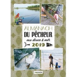
<p><span>With the Almanac de la pêche en eau douce et en mer, discover seasonal activities: techniques and objects from yesterday and today, tasty anecdotes, tips and tricks from experts, points on regulations, good fishing spots, ecological advice, focus on fish. Not forgetting: quizzes, gourmet recipes, unusual news, portraits of fishermen...</span></p>
<p>You can browse through the pages by clicking on this link: <span style="color:#3366ff;"><a href="https://issuu.com/feuilletagefleurus/docs/9791027102174_ext" target="_blank" rel="noreferrer noopener"><span style="color:#3366ff;">https://issuu.com/feuilletagefleurus/docs/9791027102174_ext</span></a></span></p>
<h2>Features of the freshwater & marine angler's almanac 2019</h2>
available
-
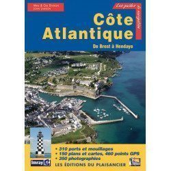
<p>Guide from the prestigious English publishing house IMRAY, world reference in the field of marine cartography. This guide covers the areas from Brest to Hendaye. </p>
unavailable
-
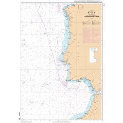
<p>Official SHOM chart - 7212 L - Cape Finisterre to Casablanca - Scale 1: 100000</p>
available
-
<p>Marine chart for coastal navigation. SHOM 7095 L - Morlaix Bay - from Batz Island to Primel Point - Scale 1:20000</p>
available
-
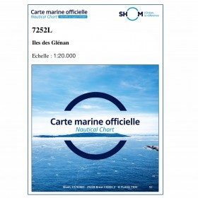
<p>SHOM marine chart 7252L. Les Glénans. Scale 1:20000</p>
available

-
available
-
available
-
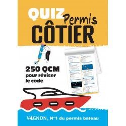
<h2>Vagnon test - coastal option boating licence 2022 :</h2>
<p><span>This Vagnon test 2022 is the complement to the Vagnon Code for coastal boating licence. All the questions of the official exam 2022 are classified by thems and the answers are at the end of each chapter. You will find the </span><span>following topics : </span><span>Beaconing - Cartography, weather - Tides - Lights and ship's marks - Port and sound signals - Rules of the road and helm - Speed, autonomy, fishing - Ecology - Nautical leisure - Safety equipment and safety of the ship - VHF... 100% up to date with the official exam 2022 </span></p>
<h2>Characteristics of the Vagnon test for the coastal option 2022 :</h2>
available

-
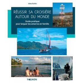
<h2>The practical guide to setting sail with your family! </h2>
<p style="text-align:justify;">A very complete illustrated guide which gives all the essential keys to succeed in this great adventure of leaving around the world, with your family, by boat.</p>
<p style="text-align:justify;">Choice, preparation and equipment of the boat, logistics, the basics of life on board with children, psychological management, health, stopovers, etc... so many subjects to prepare before the big departure. An ideal guide to make the complete turn of the question, and to benefit as well as possible from this experience of life </p>
<p></p>
available

-
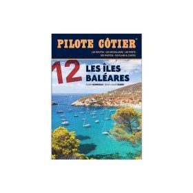
<h2>From the calas of Menorca to the great beaches of Formentera, the essential guide to the Balearic Islands!</h2>
<p>Just a day's sail from the French Mediterranean coast, the Balearic Islands are a dream destination. Four islands which have in common a remarkably sunny climate, moderate summer breezes, easily accessible ports and indented coasts where a multitude of coves, each more beautiful than the next, are hidden. Minorca, the most northerly, is also the wildest. Its real little fjords, the roadsteads of Fornells and Port Mahon, offer well-sheltered waters. Mallorca is more grandiose with a very contrasting coastline, from the impressive cliffs of the west coast to the small coves of the east coast, not forgetting the small pearls that are the islands of Cabrera and Dragonera. Ibiza and Formentera are even more sunny and carefree. If their coves and beaches are an invitation to drop anchor, their harbours are always buzzing with life. All the information you need to sail safely. An indispensable book, in addition to the nautical chart and the GPS.</p>
<h2>Features</h2>
available

-
<div class="fiche-txt">
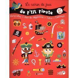
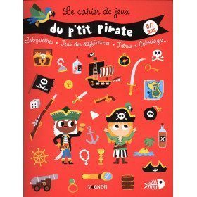
<h2>Vagnon's Petit Pirate Playbook 5/7 years old</h2>
<p>A book of games and activities for 5/7 year olds who are fans of pirates: illustrations, varied and amusing games, logic games and colouring. Immediate boarding in search of the pirate treasure!</p>
<h2>In this book</h2>
</div>
available
-
<h2>NV-CHARTS FR10 - 45 Côte d'Azur Nautical Charts (from Toulon to Menton) + the 3 regulatory adhesive boards</h2>
<p><span style="font-size:10pt;">In this NV-Charts FR10 pack, you will find an Atlas of <span>45 Mediterranean Riviera charts from Toulon to Menton and Monaco including 2 offshore charts, 11 coastal charts and 32 detailed charts.</span> With a personal download code, you will have access to all the maps in digital format as well as the <strong>NV Graphical Navigator light navigation software</strong> both freely usable on PC, tablets or smartphone!</span></p>
<p><span style="font-size:10pt;">The areas represented are: <strong>Mediterranean Riviera - Toulon, Hyères, Port Cros, Porquerolles, Fréjus, Saint Raphaël, Cannes, Antibes, Nice, Monaco, Menton (FRANCE).</strong></span></p>
<p><span style="font-size:10pt;"><span style="color:#ff0000;"><strong>Free with your FR10 pack:</strong></span> 3 adhesive sheets containing the mandatory regulatory documentation (RIPAM, buoys and flags) for navigation in coastal areas (art 242-2.04 of Division 240). <span style="color:#ff0000;"><strong>When you buy your pack, you have all the regulatory documentation for sailing within 6 miles of a shelter.</strong></span></span></p>
<h2>Description of the FR10 card pack</h2>
available
-
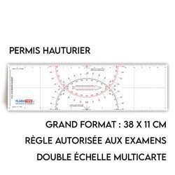
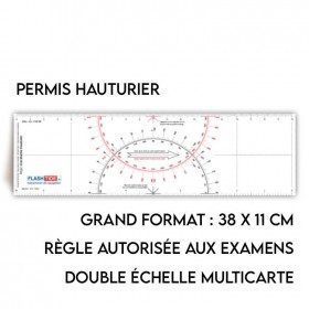
<h2>Flash-Tide - Cras 2000 two-tone ruler</h2>
<p style="text-align:justify;">The Flash-Tide Crash Ruler 2000 is a two-tone red and black crashed ruler that is very popular with boaters and offshore license applicants because it is more practical and easier to read than traditional crashed rulers.</p>
<h2>Details of the Cras 2000 rule</h2>
available
-
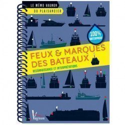
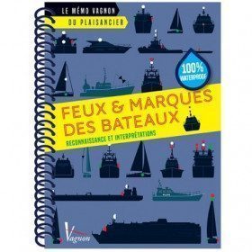
<h2>Memo of Lights & Ship's Marks</h2>
<p>This handy memo is intended to provide a complete overview of ship's lights and marks. It contains day marks, ship's lights and privileges.</p>
<p>You will learn: how to recognize the lights and marks of the boats but also how to interpret them</p>
<h2>Characteristics of the Vagnon Memo - Lights & Marks of boats</h2>
available
-
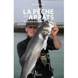
<div class="fiche-txt">
<h2>The Vagnon guide to bait fishing</h2>
<p>This clear and practical book offers all the necessary keys to master the <strong>bait fishing</strong>It is practiced more or less intensively or expertly by thousands of enthusiasts. From the simple amateur to the <strong>experienced fisherman w</strong>ith the help of the advice, information and techniques provided in the manual, all of which are amply illustrated, everyone will find something to their liking.</p>
<p>Author, <strong>Guillaume Fourrier d</strong>espite his young age, he is a particularly experienced and well-known fisherman. His catches, fished in the four corners of the world, were on several occasions approved as French or world records.</p>
<h2>Picksea specialist of the sea, its seabed, and fishing!</h2>
<p><strong>Picksea.com</strong> has established itself as a leader in nautical equipment but also in documentation, with specialized books according to your desires and your passions. Diving, boating, boating permits, or fishing.</p>
<h2>Features</h2>
</div>
available
-
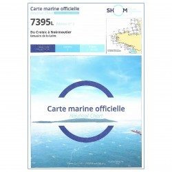
<h2 style="text-align:justify;">The SHOM 7395 L chart is the folded version of the chart for Le Croisic to Noirmoutier and the Loire Estuary.</h2>
<p style="text-align:justify;">Area covered: Le Croisic, Le Pouliguen, Pornichet, La Baule, Saint Nazaire, Saint Brévin, baie de Bourgneuf, L'Herbaudière. Scale 1:50300.</p>
available
-
<p style="text-align:justify;">Shom marine chart essential to make a perfect transatlantic by following the great circle.</p>
available

-
<p>Marine chart for coastal navigation. SHOM 7127 L - Bréhat Island - Paimpol Cove - Trieux Entrance. Scale 1:20000</p>
available
-
<p>SHOM marine chart 7251 L. From Loctudy to Concarneau. Scale 1:20 00.</p>
available
-
available

-
available
-
available
-
<div class="fiche-txt">
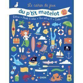
<h2>Vagnon's Petit Matelot Playbook 5/7 years old</h2>
<p>A book of 38 games and activities for 5/7 year olds, budding sailors: illustrations, varied and fun games, connect the dots and colouring! The sailors will be ready to embark on beautiful adventures by the sea!</p>
<h2>In this book</h2>
</div>
available

-
<h2>NV-CHARTS FR11 - 42 nautical charts of Corsica + the 3 regulatory adhesive boards</h2>
<p><span style="font-size:10pt;">In this NV-Charts FR11 pack, you will find an Atlas of <span>42 nautical charts of the whole of Corsica including 2 deep-sea charts, 19 coastal charts and 21 detailed charts</span>. With a personal download code, you will have access to all the maps in digital format as well as the <strong>NV Graphical Navigator light navigation software</strong> both freely usable on PC, tablets or smartphone!</span></p>
<p><span style="font-size:10pt;">The areas represented are: <strong>Corsica - Ajaccio, Calvi, Ile Rousse, Bastia, Porto Vecchio, Bonifacio, Lavezzi, Propriano (FRANCE)</strong></span></p>
<p><span style="font-size:10pt;"><span style="color:#ff0000;"><strong>Free with your FR11 pack:</strong></span> 3 adhesive sheets containing the mandatory regulatory documentation (RIPAM, buoys and flags) for navigation in coastal areas (art 242-2.04 of Division 240). <span style="color:#ff0000;"><strong>When you buy your pack, you have all the regulatory documentation for sailing within 6 miles of a shelter.</strong></span></span></p>
<h2>Description of the FR11 card pack</h2>
available
-
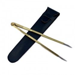
<h2><strong>Straight Brass Divider</strong></h2>
<p><strong></strong>Brass compass for esthetics with fine stainless steel tips for accuracy of measurement.</p>
<p>Interactive instructions online at <a href="https://www.youtube.com/user/PickseaVideo" target="_blank" rel="noreferrer noopener">PickseaVideo</a></p>
<h2>Features of the Flash-Tide Straight Brass Divider</h2>
available
-
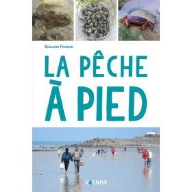
<h2>Learn more about fishing on foot!</h2>
<p><span>Fishing on foot is a very popular activity. But don't be surprised by its apparent ease: to be effective and respect the environment, the fisherman must be able to identify the species, know their habitat and the appropriate fishing techniques. Fortunately, this practical and educational manual is here to help you!</span></p>
<p><span>Thanks to illustrated summary sheets, discover more than 60 species of shellfish, crustaceans, cephalopods and various fish, as well as the essentials on the regulations and the right harvesting tools.</span></p>
<h2>Features of the Foot Fishing Manual</h2>
available

-
<div class="fiche-txt">
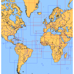
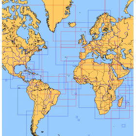
<h2>Choose from the list below an unfolded chart covering the sailing areas around the North and South Atlantic and the Indian Ocean</h2>
<p>These charts detail the sailing areas centered on the North and South Atlantic, the macro sailing areas of North and South America, Western Europe, Western Africa and the Indian Ocean. Delivered unfolded in a transport tube, these charts will serve as a support to trace your journey between continents. Choose from the list below the area you wish to explore by referring to the map number associated with the desired navigation area. Indicate the map number you have chosen in the comments of your order.</p>
<h2>List of chart references and areas covered:</h2>
</div>
available
-
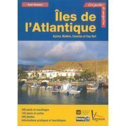
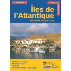
<p>Guide from the prestigious English publishing house IMRAY, a world reference in the field of marine cartography. This guide covers the Azores, Madeira, the Canaries and Cape Verde.</p>
unavailable
-
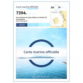
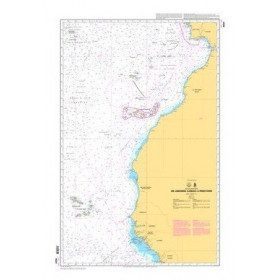
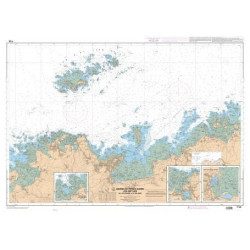
<p style="text-align:justify;">Shom 7394 marine chart for cruising around Noirmoutier. Scale: 1:50000.</p>
available

-
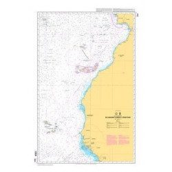
<p style="text-align:justify;">Shom 6624 nautical chart for sailing along the Portuguese and African coasts. Ideal for the sailor who wishes to make a transatlantic crossing.</p>
available
-
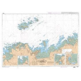
<p>Marine chart for coastal navigation. SHOM 7125 L - Approaches to Perros-Guirec - Scale 1:20000</p>
available


Showing 97-144 of 294 item(s)