available


Detailed features

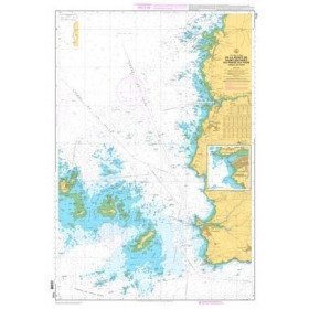
Marine chart for coastal navigation. SHOM 7123 L - Molène Island - Ushant Island - Fromveur Passage - Scale 1:20000
SHOM chart number 7123L.
In the same category
4 other products seleted for you-
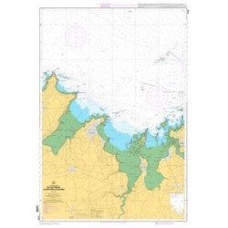
<p>Marine chart for coastal navigation. SHOM 7129 L - from Cap Fréhel to Saint Briac-sur-Mer - Scale 1:20000.</p>
available
-
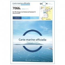
<h2 style="text-align:justify;">SHOM chart 7066 : from Ile Vierge to Penmarc'h</h2>
<p style="text-align:justify;">The SHOM 7066L chart is the marine chart of the tip of Brittany. It can be used for navigation but above all it is used as a support for professional maritime exams: Captain 200, Chief of the Watch 500, Captain 3000 or Unlimited. It exists in folded or flat version.</p>
<h2 style="text-align:justify;">Characteristics of the SHOM 7066 chart</h2>
available
-
<p>Marine chart for coastal navigation. SHOM 7122 L - from Pointe Saint Mathieu to Four lighthouse - Scale 1:25000</p>
available


-
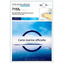
<h2>SHOM chart 7155L from Cap Fréhel to Pointe du Grouin and the approaches to Saint-Malo.</h2>
<p>Scale 1/48800.</p>
<p>Area covered: Cap Fréhel, Saint Cast, Lancieux, Approaches to Saint Malo, Dinard, Entrance to the Rance, Pointe du Grouin.</p>
available