
List of products by brand IMRAY
There are 23 products.
-
<h2>Prepare your navigation with this navigation guide!</h2>
<p>This navigation guide: "<strong>Grenada to the virgin islands</strong>" is the English edition of Jacques Patuelli's "Guide to the Lesser Antilles". It is a reference book for those who wish to discover the West Indies by boat. It describes with detail and precision the ports, marinas and numerous anchorages. The presentation of this navigation guide is clear and detailed, there are many photos that complement the maps and plans.</p>
<p>For each port, island or bay: description (location with waypoint, hazards, lights, maps, radio contacts, harbour master's office), cartography, approach (day and night), mooring and anchorage, equipment and services, shore visits, history.</p>
<h2>Detailed features of the "Grenada to the virgin islands" navigation guide</h2>
available
-
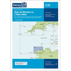
<h2 style="text-align:justify;">Imray C35 chart Morlaix to Aber-Ildut</h2>
<p style="text-align:justify;">In this edition, the chart specification has been improved to show coloured light flashes. Updated depth readings have been included where appropriate. Plans for the ports of Aber-Ildut and Argenton are now drawn at 1:25,000 scale. The plan showing the approaches to Roscoff has been extended eastwards to include better coverage of the approaches to Bloscon Marina. A general update has been carried out.</p>
<p style="text-align:justify;">Plans included:</p>
<ul><li>Aber-Ildut (1:25 000)</li>
<li>Argenton (1:25 000)</li>
<li>Portsall (1:20 000)</li>
<li>Approaches to Aber Wrac'h & Aber Benoît (1:30 000)</li>
<li>Port du Pontusval (1:15 000)</li>
<li>Moguériec (1:32 000)</li>
<li>Roscoff (1:20 000)</li>
<li>Port of Morlaix (1:15 000)</li>
</ul><h2 style="text-align:justify;">Characteristics of the Imray C35 chart from Morlaix to Aber-Ildut</h2>
unavailable

-
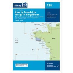
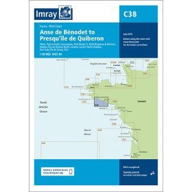
<h2 style="text-align:justify;">Imray C38 marine chart from Anse de Benodet to Presqu'île de Quiberon</h2>
<p style="text-align:justify;">On this edition, the latest survey information has been included where available. The port developments of Lorient and Concarneau and the Glénan Islands are included. The map specification has been improved to show coloured light flashes. A general update has been made.</p>
<p style="text-align:justify;">Maps included:</p>
<ul><li>Port la Forêt (1:15 000)</li>
<li>Concarneau (1:15 000)</li>
<li>Port Manec'h (1:35 000)</li>
<li>Brigneau & Merrien Ports (1:20 000)</li>
<li>Doëlan (1:15 000)</li>
<li>Glénan North Islands (1:30 000)</li>
<li>Lorient (1:35 000)</li>
<li>Lorient Yacht Harbour (1:10 000)</li>
<li>Port Tudy (Island of Groix) (1:10 000)</li>
<li>Étel (1:35 000)</li>
</ul><h2 style="text-align:justify;">Characteristics of the Imray C38 marine chart from Benodet to Quiberon</h2>
unavailable
-
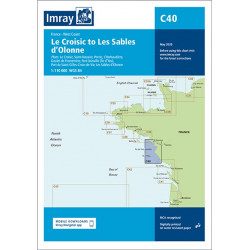
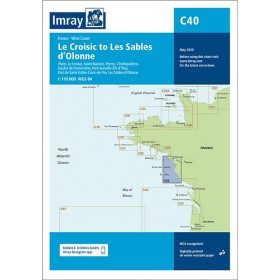
<h2 style="text-align:justify;">Imray C40 marine chart from Croisic to Sables d'Olonne</h2>
<p style="text-align:justify;">In this edition, the map specification has been improved to show coloured light flashes. The latest depth readings have been included where available and the shooting range has been updated. Additional tidal current data is included for Bourgneuf Bay. The plan of the L'Herbaudière marina has been revised to show its new configuration. A general update has been made throughout.</p>
<p style="text-align:justify;">Plans included:</p>
<ul><li>Le Croisic (1:15 000)</li>
<li>Saint-Nazaire (1:25 000)</li>
<li>Pornic (1:12 500)</li>
<li>L'Herbaudière (1:12 500)</li>
<li>Goulet de Fromentine (1:30 000)</li>
<li>Port-Joinville (Île d'Yeu) (1:10 500)</li>
<li>Port de Saint-Gilles-Croix-de-Vie (1:15 000)</li>
<li>Les Sables d'Olonne (1:20 000)</li>
</ul><h2 style="text-align:justify;">Characteristics of the Imray C40 map from Croisic to Sables d'Olonne</h2>
unavailable
-
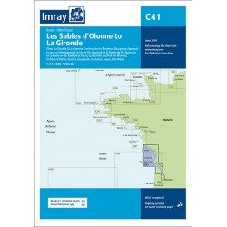
<h2 style="text-align:justify;">Imray C41 marine chart Sables d'Olonne to Gironde</h2>
<p style="text-align:justify;">In this edition, the latest depth readings have been applied where available. The development of ports and marinas at Port Minimes and La Pallice is included as well as the latest information on nature and marine reserves. The map of the Gironde at Bordeaux is more detailed and easier to use. The map specification has been improved to show coloured flashes of light. A general update has been made.</p>
<p style="text-align:justify;">Maps included:</p>
<ul><li>Bourgenay (1:10 000)</li>
<li>Approach to Jard-sur-Mer (1:17 500)</li>
<li>Approach to Ars-en-Ré (1:40 000)</li>
<li>Approach to St Martin-de-Ré (1:15 000)</li>
<li>Approach to La Flotte-en-Ré (1:15 000)</li>
<li>Rade de la Pallice (1:40 000)</li>
<li>La Rochelle and the Port des Minimes (1:15 000)</li>
<li>St-Denis-d'Oléron (1:10 000)</li>
<li>Douhet (1:7500)</li>
<li>Boyardville (1:10 000)</li>
<li>Rochefort (1:10 000)</li>
<li>Royan (1:7500)</li>
<li>Port Médoc (1:12 500)</li>
<li>The Gironde & The Garonne (1:200 000)</li>
<li>Continuation to Bordeaux (1:200 000)</li>
</ul><h2 style="text-align:justify;">Characteristics of the Imray C41 map from Sables d'Olonne to Gironde</h2>
unavailable
-
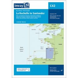
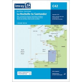
<h2 style="text-align:justify;">Imray C42 Marine Chart La Rochelle to Santander</h2>
<p style="text-align:justify;">In this edition, the latest survey information has been included where available. The shooting practice areas of the Landes test centre have been updated and the port developments of Bilbao and Santoña are shown. The map specification has been improved to show coloured light flashes. A general update has been made.</p>
<p style="text-align:justify;">Maps included:</p>
<ul><li>Arcachon Approach (1:50 000)</li>
<li>Capbreton (1:20 000)</li>
<li>Rada de Higuer (1:25 000)</li>
<li>Getaria (1:15,000)</li>
<li>Zumaia (1:15 000)</li>
<li>Abra de Bilbao (1:25 000)</li>
<li>Laredo (1:20 000)</li>
<li>Santoña (1:20 000)</li>
<li>Santander (1:25 000)</li>
<li>The Gironde & The Garonne (1:200 000)</li>
<li>Continuation to Bordeaux (1:200 000)</li>
</ul><h2 style="text-align:justify;">Characteristics of the Imray C42 map La Rochelle to Santander</h2>
unavailable
-
<h2 style="text-align:justify;">Imray Characteristics of the Imray C42 map La Rochelle to Santander</h2>
<p>Plans included:Lajes das Flores (1:20 000)Horta (1:12 500)Lajes do Pico (1:10 000)Velas (1:7500)Vila da Praia (1:10 000)Praia da Vitória (1:20 000)Angra do Heroísmo (1:12 500)Ponta Delgada (1:10 000)Vila Franco do Campo (1:15 000)Vila do Porto (1:10 000)Imray-Iolaire charts for the Atlantic Islands are widely acknowledged as the best available for the cruising sailor. They combine the latest official survey data with first-hand information gathered over 60 years of research by Don Street Jr and his wide network of contributors. Like all Imray charts, they are printed on water resistant Pretex paper for durability, and they include many anchorages, facilities and inlets not included on official charts.This edition includes the latest official data combined with additional information sourced from Imray''s network to make it ideal for small craft. It includes the latest official bathymetric surveys. Completed harbour works at Porto das Velas (São Jorge) is included and extra Marine Reserves are shown. For this edition magnetic variation curves have been added. There has been general updating throughout.</p>
available

-
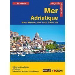
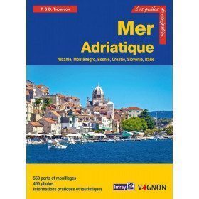
<h2>Prepare your navigation with this navigation guide!</h2>
<p>This navigation guide: "Adriatic Sea - Albania, Montenegro, Bosnia, Croatia, Slovenia, Italy" describes the ports, marinas and numerous anchorages in detail. The presentation of this navigation guide is clear and detailed, with many photos to complement the maps and plans.</p>
<p>For each port, island or bay: description (location with waypoint, hazards, lights, maps, radio contacts, harbourmaster's office), cartography, approach (day and night), mooring and anchorage, equipment and services, shore visits, history.</p>
<p>The guide covers the coasts of Albania, the Dalmatian coast, the coasts of Montenegro, Croatia and Slovenia, and the east coast of Italy from the Slovenian border to Santa Marica di Leuca.</p>
<h2>Detailed features of the Channel Islands Sailing Guide</h2>
available
-
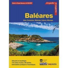
<h2>Prepare your navigation with this navigation guide!</h2>
<p>This sailing guide: "Balearic Islands - Ibiza, Formentera, Mallorca, Cabrera, Menorca" describes the ports, marinas and numerous anchorages in detail and with precision. The presentation of this navigation guide is clear and detailed, with many photos to complement the maps and plans.</p>
<p>For each port, island or bay: description (location with waypoint, hazards, lights, maps, radio contacts, harbour master's office), cartography, approach (day and night), mooring and anchorage, equipment and services, visits on land, history.</p>
<p>This guide covers the coasts of Ibiza, Formentera, Majorca, Cabrera and Menorca.</p>
<h2>Detailed features of the Balearic Sailing Guide</h2>
available

-
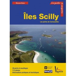
<h2>Prepare your navigation with this navigation guide!</h2>
<p>This sailing guide: "The Scilly Islands - Pearls of Cornwall" describes in detail the ports, marinas and numerous anchorages. The presentation of this sailing guide is clear and detailed, with many photos to complement the maps and charts.</p>
<p>For each port, island or bay: description (location with waypoint, hazards, lights, maps, radio contacts, harbour master's office), cartography, approach (day and night), mooring and anchorage, equipment and services, shore visits, history.</p>
<h2>Detailed features of the Isles of Scilly Navigation Guide</h2>
available
-
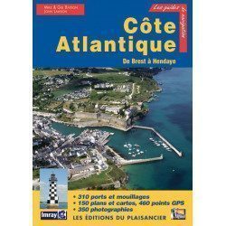
<p>Guide from the prestigious English publishing house IMRAY, world reference in the field of marine cartography. This guide covers the areas from Brest to Hendaye. </p>
unavailable
-
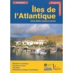
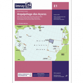
<p>Guide from the prestigious English publishing house IMRAY, a world reference in the field of marine cartography. This guide covers the Azores, Madeira, the Canaries and Cape Verde.</p>
unavailable
-
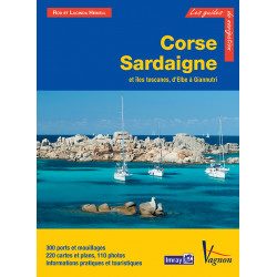
<p>Guide from the prestigious English publishing house IMRAY, world reference in the field of marine cartography. This guide covers the areas of Corsica, Sardinia, the Tuscan Islands, from Elba to Giannutri. Edition of 23/04/2012</p>
available
-
<p>Guide from the prestigious English publishing house IMRAY, world reference in the field of marine cartography. This guide covers the areas of Greece and the Aegean Sea, Athenes, Cyclades, Sporades, Chalkidiki, Dodecanesia. Edition of 23/04/2012</p>
available

-
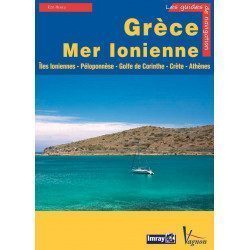
<p>Guide from the prestigious English publishing house IMRAY, world reference in the field of marine cartography. This guide covers the areas of Greece and the Ionian Sea, Ionian Islands, Peloponnese, Gulf of Corinth, Crete, Athens. Edition of 23/04/2012</p>
available
-
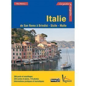
<p>Guide from the prestigious English publishing house IMRAY, a world reference in the field of marine cartography. This guide covers the areas of Italy: From San Remo to Brindisi, Sicily and Malta. Edition of 03/12/2012</p>
available

-
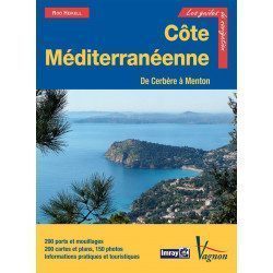
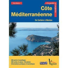
<p>New edition of the famous IMRAY Guide to the Mediterranean coast. This guide covers the areas from Cerbére to Menton. July 2013 edition</p>
unavailable
-
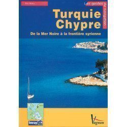
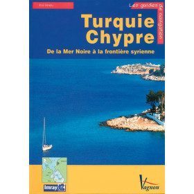
<p>A guide from the prestigious English publishing house IMRAY, a world reference in the field of marine cartography. This guide covers the areas of Turkey and Cyprus, from the Black Sea to the Syrian border. </p>
available
-
<div class="fiche-txt">
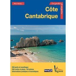
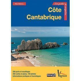
<h2>The famous Imray work along the Cantabrian coast</h2>
<p>A guide from the prestigious English publishing house IMRAY, a world reference in the field of marine cartography. This guide covers the areas from the south-west of France to the north Spanish coast. You can only be amazed by the beauty of the photos and the accuracy of the information given.</p>
<h2>Detailed features of the Imray Cantabrian Coast Guide</h2>
</div>
available
-
<p>Guide from the prestigious English publishing house IMRAY, a world reference in the field of marine cartography. This guide covers the Cuba areas. Edition of 01/01/2001</p>
available
-
<p>Guide from the prestigious English publishing house IMRAY, a world reference in the field of marine cartography. This guide covers Morocco, Algeria, Tunisia, Gibraltar, Libya, Pantelleria, the Pelagie Islands and Malta. Edition of 03/12/2012</p>
available

-
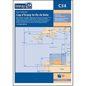
<h2 style="text-align:justify;">Imray C34 marine chart Cap d'Erquy to Ile de Batz </h2>
<p style="text-align:justify;">For this 2014 edition, the chart has been fully updated. Revised depths have been applied where necessary and the accuracy of the position relative to the WGS84 datum has been improved. The plan of the Port du Légué has been replaced with a plan to the correct scale.</p>
<p style="text-align:justify;">Plans included:</p>
<ul><li>Primel (1:15 000)</li>
<li>Le Léguer (1:42 500)</li>
<li>Trébeurden (1:25 000)</li>
<li>Ploumanac'h (1:10 000)</li>
<li>Anse de Perros (1:30 000)</li>
<li>Perros-Guirec (1:15 000)</li>
<li>Port-Blanc (1:25 000)</li>
<li>Approaches to the River of Tréguier (1:45 000)</li>
<li>Tréguier (1:15 000)</li>
<li>Approaches to the River Trieux and Paimpol (1:50 000)</li>
<li>Port de la Corderie (Ile de Bréhat) (1:15 000)</li>
<li>Port Clos (Ile de Bréhat) (1:10 000)</li>
<li>Lézardrieux (1:15 000)</li>
<li>Paimpol (1:15 000)</li>
<li>St-Quay-Portrieux (1:25 000)</li>
<li>Binic (1:12 500)</li>
<li>Port du Légué (1:20 000)</li>
<li>Dahouët (1:10 000)</li>
</ul><h2 style="text-align:justify;">Characteristics of the Imray C34 marine chart Cap d'Erquy to Ile de Batz </h2>
unavailable
-
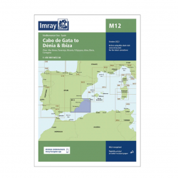
<h2>Imray Marine Chart M12 Cabo de Gata to Denia and Ibiza</h2>
<p>Plans included: Mar Menor (1:75 000) Torrevieja (1:20 000) Alicante (1:30 000) Villajoyosa (1:15 000) Altea (1:15 000) Dénia (1:25 000) Cartagena (1:15 000) This edition includes the latest official Instituto Hidrográfico de la Marina Digital, combined with additional information sourced from Imray's network to make it ideal for small craft. The chart has been fully revised throughout. The main panel has been rescaled to 1:450,000 for consistency with other M-Series charts in Mediterranean Spain. The plan of Mar Menor now provides coverage at an improved larger scale. A new plan of Cartagena has been added.</p>
<h2>Specifications of the Imray Marine Chart M12 Cabo de Gata to Denia and Ibiza</h2>
available


Showing 1-23 of 23 item(s)
Imray is a well known manufacturer of UK nautical charts and guides in the international maritime community. The charts include numerous cartridges with precise details on certain areas or ports and are perfectly suited for both coastal and offshore boating. Thanks to Imray guides, learn all about your destination and choose your ports of call. Imray Guides are available in French.