

Nautical Charts
There are 138 products.
-
available

-
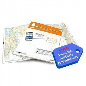
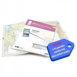
<h2>NV-CHARTS FR6 - 36 charts of South East Brittany (from Lorient to Noirmoutier) + the 3 regulatory adhesive sheets</h2>
<p><span style="font-size:10pt;">In this NV-Charts FR6 pack, you will find an Atlas of <span>36 charts of South Brittany from Lorient to Noirmoutier including 3 offshore charts, 13 coastal charts and 20 detailed charts</span>. With a personal download code, you will have access to all the maps in digital format as well as the <strong>NV Graphical Navigator light navigation software</strong> both freely usable on PC, tablets or smartphone!</span></p>
<p><span style="font-size:10pt;">The areas represented are: <strong>South Brittany - Lorient, Etel, Belle-Île, Baie de Quiberon, La Trinité, Golfe du Morbihan, Vannes, Auray, Houat, Hoedic, La Vilaine, Piriac, La Turballe, Le Croisic, La Baule, Pornichet, Saint Nazaire, Nantes, Pornic, Noirmoutier (FRANCE)</strong></span></p>
<p><strong><span style="font-size:10pt;"><span style="color:#ff0000;">Free with your FR6 pack:</span> 3 adhesive sheets containing the mandatory regulatory documentation (RIPAM, buoys and flags) for navigation in coastal areas (art 242-2.04 of Division 240). <span style="color:#ff0000;">When you buy your pack, you have all the regulatory documentation for sailing within 6 miles of a shelter.</span></span></strong></p>
<h2>Description of the FR6 card pack</h2>
available
-
<p>Nautical chart for navigations around the Ile de Ré. SHOM 7404 L - From Pointe du Grouin du Cou to Pointe de Chassiron</p>
available
-
<p>Marine chart for coastal navigation. SHOM 4233 L - LA RANCE : from St Malo to the Chatelier lock - Scale 1:15000.</p>
available
-
<h2>Imray Marine Chart M12 Cabo de Gata to Denia and Ibiza</h2>
<p>Plans included: Mar Menor (1:75 000) Torrevieja (1:20 000) Alicante (1:30 000) Villajoyosa (1:15 000) Altea (1:15 000) Dénia (1:25 000) Cartagena (1:15 000) This edition includes the latest official Instituto Hidrográfico de la Marina Digital, combined with additional information sourced from Imray's network to make it ideal for small craft. The chart has been fully revised throughout. The main panel has been rescaled to 1:450,000 for consistency with other M-Series charts in Mediterranean Spain. The plan of Mar Menor now provides coverage at an improved larger scale. A new plan of Cartagena has been added.</p>
<h2>Specifications of the Imray Marine Chart M12 Cabo de Gata to Denia and Ibiza</h2>
available
-
<h2>NV-CHARTS FR7 - 27 Vendée Nautical Charts (from Noirmoutier to La Rochelle) + the 3 statutory adhesive sheets</h2>
<p><span style="font-size:10pt;">In this NV-Charts FR7 pack, you will find an Atlas of <span>27 charts Vendée from Noirmoutier to La Rochelle including 3 offshore charts, 12 coastal charts and 12 detailed charts.</span> With a personal download code, you will have access to all the maps in digital format as well as the <strong>NV Graphical Navigator light navigation software</strong> both freely usable on PC, tablets or smartphone!</span></p>
<p><span style="font-size:10pt;">The areas represented are: <strong>Vendée - Noirmoutier, Ile d'Yeu, Saint Gilles Croix de Vie, Les Sables d'Olonne, Port Bourgenais, Jard sur Mer, Pointe de l'Aiguillon, Ile de Ré, La Rochelle (FRANCE).</strong></span></p>
<p><span style="font-size:10pt;"><span style="color:#ff0000;"><strong>Free with your FR7 pack:</strong></span> 3 adhesive sheets containing the mandatory regulatory documentation (RIPAM, buoys and flags) for navigation in coastal areas (art 242-2.04 of Division 240). <span style="color:#ff0000;"><strong>When you buy your pack, you have all the regulatory documentation for sailing within 6 miles of a shelter.</strong></span></span></p>
<h2>Description of the FR7 card pack</h2>
available
-
<p>Marine chart for coastal navigation. SHOM 6966L - Des Héaux-de-Bréhat au Cap Lévi - Shom paper chart - Scale : 1 : 155508</p>
available
-
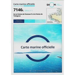
<h2>The SHOM marine chart 7146 L is the marine chart from the Pointe de Penmarc'h to the Pointe de Trévignon.</h2>
<p>Area covered: Le Guilvinec, Bénodet, Loctudy, Port la Forêt, Concarneau, Les Glénan. Scale 1:49,700.</p>
<h2>Characteristics of the SHOM 7146 L chart (folded version)</h2>
available
-
<h2>NV-CHARTS FR8 - 33 Aquitaine Marine Charts (from La Rochelle to San Sebastian) + the 3 regulatory adhesive sheets</h2>
<p><span style="font-size:10pt;">In this NV-Charts FR8 pack, you will find an Atlas of <span>33 Aquitaine charts from La Rochelle to San Sebastian including 3 offshore charts, 15 coastal charts and 15 detailed charts</span>. With a personal download code, you will have access to all the maps in digital format as well as the <strong>NV Graphical Navigator light navigation software</strong> both freely usable on PC, tablets or smartphone!</span></p>
<p><span style="font-size:10pt;">The areas represented are: <strong>Aquitaine - La Rochelle, Ré, Oléron, Rochefort, Royan, Gironde, Bordeaux, Arcachon, Bayonne, Biarritz, Saint Jean de Luz, San Sebastian (FRANCE)</strong></span></p>
<p><span style="font-size:10pt;"><span style="color:#ff0000;"><strong>Free with your FR8 pack:</strong> </span>3 adhesive sheets containing the mandatory regulatory documentation (RIPAM, buoys and flags) for navigation in coastal areas (art 242-2.04 of Division 240). <span style="color:#ff0000;"><strong>When you buy your pack, you have all the regulatory documentation for sailing within 6 miles of a shelter.</strong></span></span></p>
<h2>Description of the FR8 card pack</h2>
available
-
<h2>NV-CHARTS FR4 - 33 West Brittany Marine Charts (from the Seven Islands to Douarnenez) + the 3 regulatory adhesive sheets</h2>
<p><span style="font-size:10pt;">In this pack NV-Charts FR4, you will find an Atlas of 33 nautical charts from the Seven Islands to Douarnenez<span> including 2 offshore maps, 13 coastal maps and 18 detailed maps</span>. With a personal download code, you will have access to all the maps in digital format as well as the <strong>NV Graphical Navigator light navigation software</strong> both freely usable on PC, tablets or smartphone!</span></p>
<p><span style="font-size:10pt;">The areas represented are: <strong>Western Brittany - Roscoff, Morlaix, Ouessant, Molène, Brest, Camaret, Crozon, Morgat, Douarnenez, Sein (FRANCE).</strong></span></p>
<p><span style="font-size:10pt;"><span style="color:#ff0000;"><strong>Free with your FR4 pack:</strong></span> 3 adhesive sheets containing the mandatory regulatory documentation (RIPAM, buoys and flags) for navigation in coastal areas (art 242-2.04 of Division 240). <span style="color:#ff0000;"><strong>When you buy your pack, you have all the regulatory documentation for sailing within 6 miles of a shelter.</strong></span></span></p>
<h2>Description of the FR4 card pack</h2>
available
-
<h2 style="text-align:justify;">Imray C42 Marine Chart La Rochelle to Santander</h2>
<p style="text-align:justify;">In this edition, the latest survey information has been included where available. The shooting practice areas of the Landes test centre have been updated and the port developments of Bilbao and Santoña are shown. The map specification has been improved to show coloured light flashes. A general update has been made.</p>
<p style="text-align:justify;">Maps included:</p>
<ul><li>Arcachon Approach (1:50 000)</li>
<li>Capbreton (1:20 000)</li>
<li>Rada de Higuer (1:25 000)</li>
<li>Getaria (1:15,000)</li>
<li>Zumaia (1:15 000)</li>
<li>Abra de Bilbao (1:25 000)</li>
<li>Laredo (1:20 000)</li>
<li>Santoña (1:20 000)</li>
<li>Santander (1:25 000)</li>
<li>The Gironde & The Garonne (1:200 000)</li>
<li>Continuation to Bordeaux (1:200 000)</li>
</ul><h2 style="text-align:justify;">Characteristics of the Imray C42 map La Rochelle to Santander</h2>
unavailable
-
<h2>The SHOM marine chart 7147 L is the marine chart of the Chaussée de Sein to the Pointe de Penmarc'h and the Baie d'Audierne</h2>
<p>Area covered: Raz de Sein, Audierne, Pointe de Penmarc'h. Scale 1:29600.</p>
<h2>Characteristics of the SHOM 7147 L chart (folded version)</h2>
available
-
<h2>NV-CHARTS FR3 - 28 North Brittany Nautical Charts (Saint Malo aux Sept Îles) + the 3 regulatory adhesive sheets</h2>
<p><span style="font-size:10pt;">In this pack NV-Charts FR3, you will find an Atlas of 28 marine maps of <span>Saint Malo aux Sept Îles </span>including 3 offshore charts, 10 coastal charts and 15 detailed charts. With a personal download code, you will have access to all the maps in digital format as well as the <strong>NV Graphical Navigator light navigation software</strong> both freely usable on PC, tablets or smartphone!</span></p>
<p><span style="font-size:10pt;">The area represents the Channel (FRANCE), and more precisely the following areas: <strong>North Brittany - Saint Malo, Saint Cast, Baie de Saint Brieuc, Paimpol, Saint Quay, Perros Guirec, Trébeurden.</strong></span></p>
<p><span><span style="font-size:10pt;"><span style="color:#ff0000;"><strong>Free with your FR3 pack:</strong></span> 3 adhesive sheets containing the mandatory regulatory documentation (RIPAM, buoys and flags) for navigation in coastal areas (art 242-2.04 of Division 240). </span><span style="color:#ff0000;"><strong><span style="font-size:10pt;">When you buy your pack, you have all the regulatory documentation for sailing within 6 miles of a shelter</span>.</strong></span></span></p>
<h2>Description of the FR3 card pack</h2>
available
-
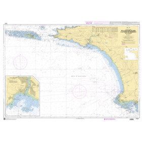
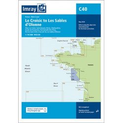
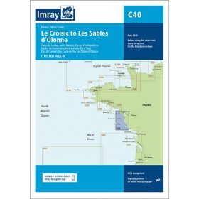
<h2 style="text-align:justify;">Imray C40 marine chart from Croisic to Sables d'Olonne</h2>
<p style="text-align:justify;">In this edition, the map specification has been improved to show coloured light flashes. The latest depth readings have been included where available and the shooting range has been updated. Additional tidal current data is included for Bourgneuf Bay. The plan of the L'Herbaudière marina has been revised to show its new configuration. A general update has been made throughout.</p>
<p style="text-align:justify;">Plans included:</p>
<ul><li>Le Croisic (1:15 000)</li>
<li>Saint-Nazaire (1:25 000)</li>
<li>Pornic (1:12 500)</li>
<li>L'Herbaudière (1:12 500)</li>
<li>Goulet de Fromentine (1:30 000)</li>
<li>Port-Joinville (Île d'Yeu) (1:10 500)</li>
<li>Port de Saint-Gilles-Croix-de-Vie (1:15 000)</li>
<li>Les Sables d'Olonne (1:20 000)</li>
</ul><h2 style="text-align:justify;">Characteristics of the Imray C40 map from Croisic to Sables d'Olonne</h2>
unavailable
-
<h2>The SHOM marine chart 7148 L is the marine chart from the Goulet de Brest to the Chaussée de Sein.</h2>
<p>Area covered: Le Conquet, Molène, Goulet de Brest, Camaret, Ile de Sein, raz de Sein, Audierne. Scale 1:49,300.</p>
<h2>Characteristics of the SHOM 7148 L chart (folded version)</h2>
available
-
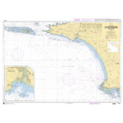
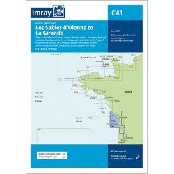
<h2 style="text-align:justify;">Imray C41 marine chart Sables d'Olonne to Gironde</h2>
<p style="text-align:justify;">In this edition, the latest depth readings have been applied where available. The development of ports and marinas at Port Minimes and La Pallice is included as well as the latest information on nature and marine reserves. The map of the Gironde at Bordeaux is more detailed and easier to use. The map specification has been improved to show coloured flashes of light. A general update has been made.</p>
<p style="text-align:justify;">Maps included:</p>
<ul><li>Bourgenay (1:10 000)</li>
<li>Approach to Jard-sur-Mer (1:17 500)</li>
<li>Approach to Ars-en-Ré (1:40 000)</li>
<li>Approach to St Martin-de-Ré (1:15 000)</li>
<li>Approach to La Flotte-en-Ré (1:15 000)</li>
<li>Rade de la Pallice (1:40 000)</li>
<li>La Rochelle and the Port des Minimes (1:15 000)</li>
<li>St-Denis-d'Oléron (1:10 000)</li>
<li>Douhet (1:7500)</li>
<li>Boyardville (1:10 000)</li>
<li>Rochefort (1:10 000)</li>
<li>Royan (1:7500)</li>
<li>Port Médoc (1:12 500)</li>
<li>The Gironde & The Garonne (1:200 000)</li>
<li>Continuation to Bordeaux (1:200 000)</li>
</ul><h2 style="text-align:justify;">Characteristics of the Imray C41 map from Sables d'Olonne to Gironde</h2>
unavailable
-
<p>SHOM marine chart 7140 L. Rade and passes of Lorient. Scale 1:10000</p>
available
-
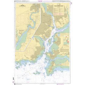
<h2>SHOM chart 7155L from Cap Fréhel to Pointe du Grouin and the approaches to Saint-Malo.</h2>
<p>Scale 1/48800.</p>
<p>Area covered: Cap Fréhel, Saint Cast, Lancieux, Approaches to Saint Malo, Dinard, Entrance to the Rance, Pointe du Grouin.</p>
available
-
available

-
<h2 style="text-align:justify;">Imray Characteristics of the Imray C42 map La Rochelle to Santander</h2>
<p>Plans included:Lajes das Flores (1:20 000)Horta (1:12 500)Lajes do Pico (1:10 000)Velas (1:7500)Vila da Praia (1:10 000)Praia da Vitória (1:20 000)Angra do Heroísmo (1:12 500)Ponta Delgada (1:10 000)Vila Franco do Campo (1:15 000)Vila do Porto (1:10 000)Imray-Iolaire charts for the Atlantic Islands are widely acknowledged as the best available for the cruising sailor. They combine the latest official survey data with first-hand information gathered over 60 years of research by Don Street Jr and his wide network of contributors. Like all Imray charts, they are printed on water resistant Pretex paper for durability, and they include many anchorages, facilities and inlets not included on official charts.This edition includes the latest official data combined with additional information sourced from Imray''s network to make it ideal for small craft. It includes the latest official bathymetric surveys. Completed harbour works at Porto das Velas (São Jorge) is included and extra Marine Reserves are shown. For this edition magnetic variation curves have been added. There has been general updating throughout.</p>
available

-
<p style="text-align:justify;">Navigation chart shom 7033 type L (folded in A4 format) for cruising between Quiberon and Le Croisic. Scale: 1:50 000</p>
available
-
available
-
<h2 style="text-align:justify;">Imray C34 marine chart Cap d'Erquy to Ile de Batz </h2>
<p style="text-align:justify;">For this 2014 edition, the chart has been fully updated. Revised depths have been applied where necessary and the accuracy of the position relative to the WGS84 datum has been improved. The plan of the Port du Légué has been replaced with a plan to the correct scale.</p>
<p style="text-align:justify;">Plans included:</p>
<ul><li>Primel (1:15 000)</li>
<li>Le Léguer (1:42 500)</li>
<li>Trébeurden (1:25 000)</li>
<li>Ploumanac'h (1:10 000)</li>
<li>Anse de Perros (1:30 000)</li>
<li>Perros-Guirec (1:15 000)</li>
<li>Port-Blanc (1:25 000)</li>
<li>Approaches to the River of Tréguier (1:45 000)</li>
<li>Tréguier (1:15 000)</li>
<li>Approaches to the River Trieux and Paimpol (1:50 000)</li>
<li>Port de la Corderie (Ile de Bréhat) (1:15 000)</li>
<li>Port Clos (Ile de Bréhat) (1:10 000)</li>
<li>Lézardrieux (1:15 000)</li>
<li>Paimpol (1:15 000)</li>
<li>St-Quay-Portrieux (1:25 000)</li>
<li>Binic (1:12 500)</li>
<li>Port du Légué (1:20 000)</li>
<li>Dahouët (1:10 000)</li>
</ul><h2 style="text-align:justify;">Characteristics of the Imray C34 marine chart Cap d'Erquy to Ile de Batz </h2>
unavailable
-
<p style="text-align:justify;">Shom marine chart for your cruises or regattas in Brittany. From Penfret island to the Birvideaux plateau via the outskirts of Lorient. Shom 7031. Scale: 1:50000.</p>
available
-
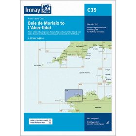
<h2 style="text-align:justify;">Imray C35 chart Morlaix to Aber-Ildut</h2>
<p style="text-align:justify;">In this edition, the chart specification has been improved to show coloured light flashes. Updated depth readings have been included where appropriate. Plans for the ports of Aber-Ildut and Argenton are now drawn at 1:25,000 scale. The plan showing the approaches to Roscoff has been extended eastwards to include better coverage of the approaches to Bloscon Marina. A general update has been carried out.</p>
<p style="text-align:justify;">Plans included:</p>
<ul><li>Aber-Ildut (1:25 000)</li>
<li>Argenton (1:25 000)</li>
<li>Portsall (1:20 000)</li>
<li>Approaches to Aber Wrac'h & Aber Benoît (1:30 000)</li>
<li>Port du Pontusval (1:15 000)</li>
<li>Moguériec (1:32 000)</li>
<li>Roscoff (1:20 000)</li>
<li>Port of Morlaix (1:15 000)</li>
</ul><h2 style="text-align:justify;">Characteristics of the Imray C35 chart from Morlaix to Aber-Ildut</h2>
unavailable
-
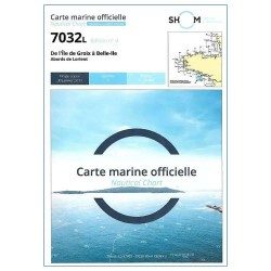
<p style="text-align:justify;">Marine map shom 7032 for your boat cruises. From Groix island and the outskirts of Lorient to Belle-Ile. Scale: 1:50000.</p>
available
-
<h2>Marine charts 7126 L de l'Ile Balanec aux Heaux-de-Brehat : </h2>
<p>Scale 1:20 000 - Marine charts, SHOM : 7126L , from Ile Balanec to Heaux-de-Bréhat, and le cours du Jaudy.</p>
<h2>Features of marine charts 7126L : </h2>
available
-
<p style="text-align:justify;">Shom 7067 marine chart available in folded A4 format or in flat A0 format (unfolded). Chart for navigations between the chaussée de Sein and Belle Ile. SHOM marine chart type Carte L, folded to A4 format, for yachting or flat format A0 (84 x 119 cm) for use in merchant marine. Updated print run: 2015 Scale: 1 : 160 900</p>
available
-
available

-
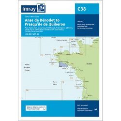
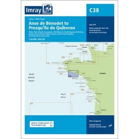
<h2 style="text-align:justify;">Imray C38 marine chart from Anse de Benodet to Presqu'île de Quiberon</h2>
<p style="text-align:justify;">On this edition, the latest survey information has been included where available. The port developments of Lorient and Concarneau and the Glénan Islands are included. The map specification has been improved to show coloured light flashes. A general update has been made.</p>
<p style="text-align:justify;">Maps included:</p>
<ul><li>Port la Forêt (1:15 000)</li>
<li>Concarneau (1:15 000)</li>
<li>Port Manec'h (1:35 000)</li>
<li>Brigneau & Merrien Ports (1:20 000)</li>
<li>Doëlan (1:15 000)</li>
<li>Glénan North Islands (1:30 000)</li>
<li>Lorient (1:35 000)</li>
<li>Lorient Yacht Harbour (1:10 000)</li>
<li>Port Tudy (Island of Groix) (1:10 000)</li>
<li>Étel (1:35 000)</li>
</ul><h2 style="text-align:justify;">Characteristics of the Imray C38 marine chart from Benodet to Quiberon</h2>
unavailable
-
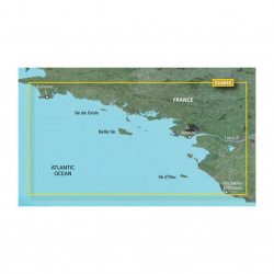
<p>Marine cartography on SD/MicroSD card compatible with all Garmin portable GPS with mapping. Local delimitation centred on South Brittany.</p>
unavailable
-
<h2>The SHOM marine chart 7148-CA is the marine chart from the Goulet de Brest to the Chaussée de Sein.</h2>
<p>Area covered: Le Conquet, Molène, Goulet de Brest, Camaret, Ile de Sein, raz de Sein, Audierne. Scale 1:49,300.</p>
<h2>Characteristics of the SHOM 7148-CA chart :</h2>
available
-
available
-
<p>Nautical chart SHOM 7145L. From Triballe to Pornichet. Scale: 1:25000.</p>
available
-
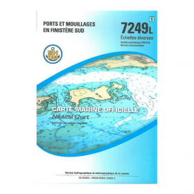
<p>Nautical chart SHOM 7249L. Ports and anchorages in South Finistère. Scale: 1:20000.</p>
available
-
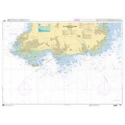
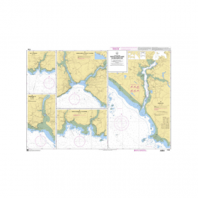
<h2>SHOM Marine Chart 7250L - From Pointe de la Torche to Loctudy</h2>
<ul>
<li>Scale 1:20000</li>
<li>Folded</li>
</ul>
available
-
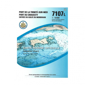
<p>SHOM marine chart 7107L : Harbour of la Trinité-Sur-Mer, harbour of Le Crouesty, entrée du Golfe du Morbihan. Scale 1:10000</p>
available
-
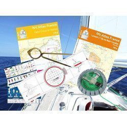
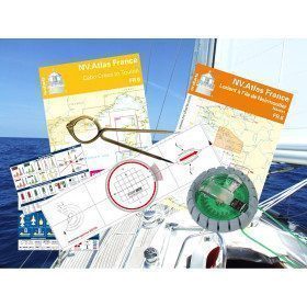
<h2 id="prod-h1" class="prod-name">Navigator's Equipment Pack</h2>
<p style="text-align:justify;"><span>Whether you are sailing on your own boat or on a charter boat, this pack provides you with all the equipment you need to prepare and manage a coastal, offshore or even deep-sea cruise.</span></p>
<h2 style="text-align:justify;">Features of the Navigator's Equipment Pack</h2>
available
-
available
-
<p><br /></p>
available

-
available
-
available


Showing 97-138 of 138 item(s)