available


In the same category
4 other products seleted for you-
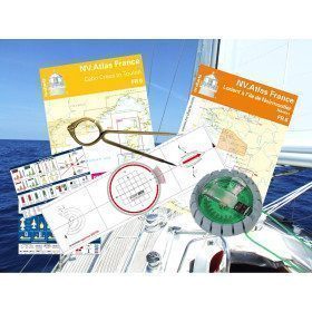
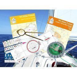
<h2 id="prod-h1" class="prod-name">Navigator's Equipment Pack</h2>
<p style="text-align:justify;"><span>Whether you are sailing on your own boat or on a charter boat, this pack provides you with all the equipment you need to prepare and manage a coastal, offshore or even deep-sea cruise.</span></p>
<h2 style="text-align:justify;">Features of the Navigator's Equipment Pack</h2>
available

-
<div class="fiche-txt">
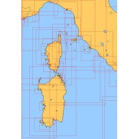
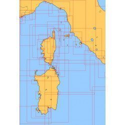
<h2>Choose from the list below a chart covering the Mediterranean</h2>
<p style="text-align:justify;">This set of charts covers all the navigation areas in the Mediterranean, with different scales allowing to cover either a large navigation area or to zoom in on a specific port or area. These Shom Marine charts are available in flat or folded format. The L type charts are more suitable for the yachtsman as they are folded to A4 size, easier to store in a chart table. These charts detail the navigation zones of all the sailing areas around Corsica, Sardinia and Italy. Choose from the list below the area you wish to explore by referring to the map number associated with the desired navigation area. Indicate the map number you have chosen and whether you want to sail folded or flat.</p>
<h2>List of chart references and areas covered</h2>
</div>
available
-
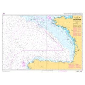
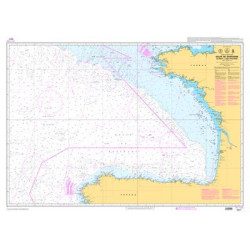
<p>Official SHOM chart - 7211 L - Bay of Biscay - from Brest to Cabo Finisterre.</p>
available
-
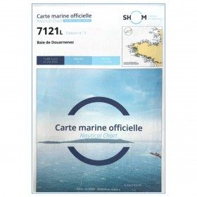
<p>Marine chart for coastal navigation. SHOM 7121 - Douarnenez Bay - scale 1:30000. Available in folded A4 format or in unfolded A0 format</p>
available