

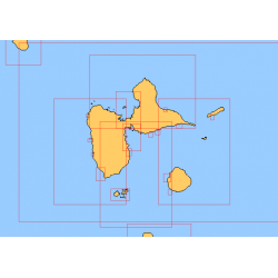
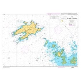
Nautical Charts
The nautical chart of your navigation area is an essential element to use on board to navigate safely. Whether you are sailing inshore or offshore, it will first help you choose the most suitable route for the forecasted conditions (weather, tides, current). Once at sea, the chart helps to monitor and manage the navigation: determine the position, note any deviations and correct the route. In "sensitive" coastal areas (rocks, sandbanks) or at the entrance to harbours, a more detailed chart gives the necessary indications to follow a safe route using buoyage or alignments: this is called coastal pilotage Mandatory on board as soon as you get to the coastal area, a chart can be in paper or electronic form, but we strongly recommend that you have both. Picksea offers two types of charts: the SHOM and the NV-Charts :
NAUTICAL CHARTS OF THE SHOM
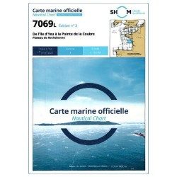
The SHOM is the French Naval Hydrographic and Oceanographic Service. For 300 years, it is the service that establishes hydrographic surveys and publishes nautical charts for France and many areas in the World. The SHOM offers two formats of paper charts, folded charts and flat charts. The L-chart collection (folded version) is a selection of nautical charts perfectly adapted for pleasure boating. They provide boaters with exactly the same information as conventional charts and are updated at regular intervals. Picksea has a selection of the top 20 best selling and most popular L SHOM navigation charts used by boaters as well as the charts dedicated to the SHOM dedicated to exams pleasure Craft (Offshore licence) or merchant marine. The SHOM also offers a number of "flat" charts that can be delivered rolled.
NAUTICAL CHARTS PACKS NV-CHARTS
NV-Charts is a German publisher who has designed and developed a concept of chart packs combining the traditional paper form with modern electronics. The concept is to propose for a navigation area (for example "from Lorient to Noirmoutier" or "from Toulon to Menton") in the same pack the paper charts at different scales (from the map of the covered area to the detailed maps of the ports) and the same charts in electronic format that it is possible to use with the NVapp application, i.e. the navigation software of NV-Charts whose standard version (sufficient for yachting) is free and usable on any support (Windows, Android, MacOS or Iphone).
AREAS COVERED BY THE OFFER PICKSEA
Picksea offers you a choice of nautical charts for the whole world thanks to its quality of Authorized Agent of SHOM. Find all the charts at different scales for the areas of English Channel, the North Brittany and South Brittanyand atlantic coast, the Mediterranean or the overseas areas.
Read more
There are 138 products.
-
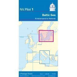
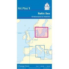
<h2>Baltic Sea Offshore Marine Chart</h2>
<p>The NV Pilot 1 offshore chart covers the Baltic Sea area from Kiel to Oslo on the front and the area from Skagerak (Flekkefjord) to Helsinki on the back.</p>
<h2>Details on the NV Pilot 1 - Baltic Sea map</h2>
available

-
<div class="fiche-txt">
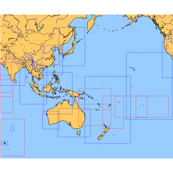
<h2>Choose from the list below an unfolded chart covering the sailing areas around Australia and South East Asia</h2>
<p>These maps detail the sailing areas of Australia, Oceania, and South East Asia. Frequently used as a decorative element or as a support to retrace a journey between continents. Choose from the list below the area you wish to explore by referring to the map number associated with the desired navigation area. Indicate the number of the map you have chosen in the comments of your order.</p>
<h2>List of chart references and areas covered:</h2>
</div>
available
-
<p style="text-align:justify;">Shom 7311 nautical chart for cruising in the Channel : Scilly, Ouessant, Jersay, Guernsey, everything is there.</p>
available
-
<p>Marine chart for coastal navigation. SHOM 7423L - Raz de Sein - scale 1:20000</p>
available
-
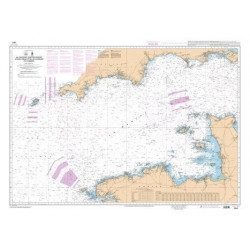
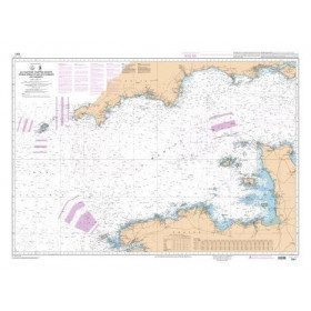
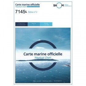
<p>Nautical chart SHOM 7145L. From Triballe to Pornichet. Scale: 1:25000.</p>
available
-
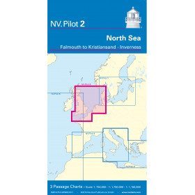
<h2>North Sea Offshore Marine Chart</h2>
<p><span>The NV Pilot 2 offshore chart covers the North Sea from Dover to Helgoland and Doggerbank in the North and the English Channel from Falmouth/Ushant to Dover on the front. On the reverse side, the area covers Great Yarmouth to Skagen, Inverness and the southern coast of Norway.</span></p>
<h2>Details on the NV Pilot 2 - North Sea map</h2>
available

-
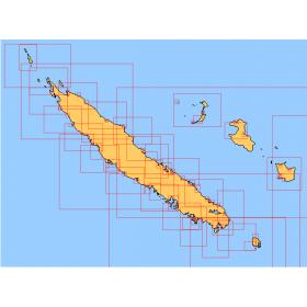
<div class="fiche-txt">
<h2>Choose from the list below an unfolded nautical chart covering the navigation areas around New Caledonia</h2>
<p>This set of charts covers the entire coastline of New Caledonia in unfolded Shom marine charts delivered in a tube. These maps detail precisely the navigation areas of the island. Choose in the list below the area you wish to explore by referring to the chart number associated with the desired navigation area. Indicate the map number you have chosen in the commentary of your order.</p>
<h2>List of chart references and areas covered:</h2>
</div>
available
-
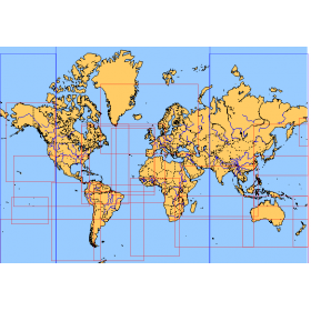
<div class="fiche-txt">
<h2>Choose from the list below an unfolded nautical chart covering the major sailing areas of the world</h2>
<p>These maps covering huge areas of navigation are frequently used as a decorative element or as a support to retrace a journey between continents. Choose in the list below the area you wish to explore by referring to the map number associated with the desired navigation area. Indicate the map number you have chosen in the comments of your order.</p>
<h2>List of references for charts and areas covered:</h2>
</div>
available
-
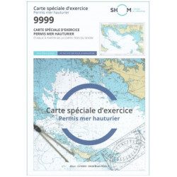
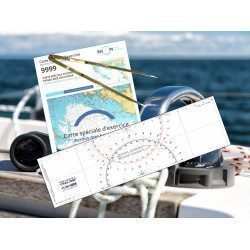
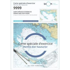
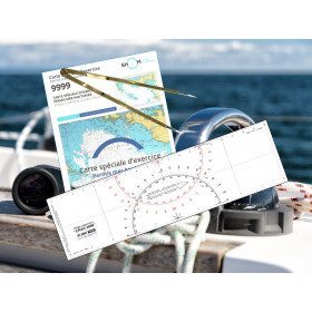
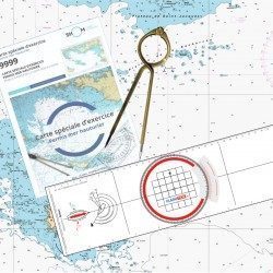
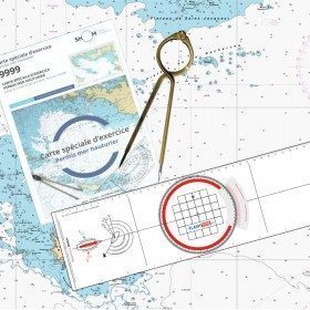
<h2 style="text-align:justify;">SHOM chart 9999 for the french offshore licence exam</h2>
<p style="text-align:justify;">The SHOM chart 9999 is the official chart for the offshore licence examination which allows you to navigate beyond 6 miles from a shelter. The 9999 chart is also used to do all the exercises to prepare for the exam.</p>
<h2 style="text-align:justify;">Training and preparation for the french offshore licence (theory test)</h2>
<p style="text-align:justify;">After passing the coastal licence (and perhaps also the inland waterway licence), you want to extend your navigation area to the "high seas"! To do this, you need to obtain a offshore licence to sail motorboats beyond 6 miles from a shelter (it is also very useful for sailing boats). You can read the article <a href="https://www.picksea.com/en/actualites-et-conseils/post/18-all-knowing-pass-license-holder">"Everything you need to know about the offshore licence"</a>.</p>
<p style="text-align:justify;">The chart 9999 is the official chart to take the offshore licence exam. Of course, this SHOM 9999 chart also allows you to work on all the exercises and mock exams in your school boat or as an independent candidate, to prepare for the tests for the offshore extension of the sea boat licence.</p>
<p style="text-align:justify;">The SHOM 9999 chart is a special marine chart but it contains all the information of a real navigation chart (scale of latitudes and longitudes, coasts, probes, dangers, beacons, lighthouses, currents, ...). You can plot routes and bearings and position points, or measure distances as on a real chart. See the article <a href="https://www.picksea.com/en/actualites-et-conseils/post/49-determine-route-direction-distance">"Determining a route in direction and distance" on our blog</a>.</p>
<p style="text-align:justify;">The SHOM (Services Hydrographique et Océanographique de la Marine) is the public organisation in charge of collecting data (soundings, currents, coastline, ...) and distributing this information, in particular in the form of nautical charts. Find here all our other SHOM charts.</p>
<h2 style="text-align:justify;">Characteristics of the SHOM 9999 Special Offshore Exam Chart</h2>
available
-
<p style="text-align:justify;">Shom 7312 marine chart for your cruising or racing in the Eastern Channel. From Casquets to Pas-de-Calais. Scale 1:375000</p>
available

-
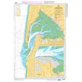
<p style="text-align:justify;">Marine map 7428L for your coasters and your discoveries of the Arcachon basin.</p>
available
-
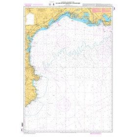
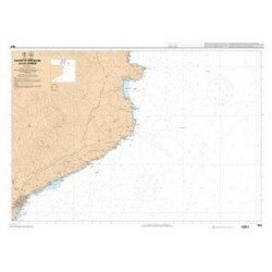
<p>Mediterranean shom marine map : From Fos sur Mer to Capo Mele. Scale: 1:250000.</p>
available
-
<p>Marine chart for coastal navigation. SHOM 7121 - Douarnenez Bay - scale 1:30000. Available in folded A4 format or in unfolded A0 format</p>
available
-
<p>Marine chart SHOM 7136L. From Mahé Bridge to Piriac sur Mer. Scale 1:15000.</p>
available
-
<h2 style="text-align:justify;">Waterproof nautical charts</h2>
<p style="text-align:justify;">Waterproof laminated nautical charts of the Atlantic that can be taken out in the cockpit. A3 format with a scale adapted to each sailing basin. Ideal for cruising or coastal regattas. Less cumbersome than traditional charts and very well thought out visually. Longer lasting for outdoor use in all conditions.</p>
<h2 style="text-align:justify;">Detailed characteristics of the charts</h2>
available

-
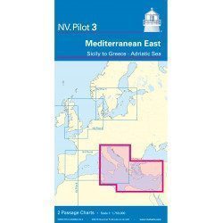
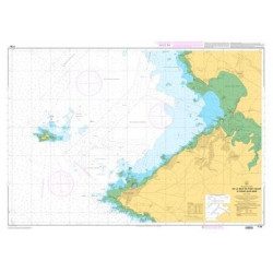
<h2>East Mediterranean Offshore Marine Chart</h2>
<p><span>The NV Pilot 3 offshore chart covers the Eastern Mediterranean: on the front side the Tyrrhenian Sea, the Adriatic Sea, the Ionian Sea and the region of Sicily up to the coast of Tunisia. The reverse side covers the Mediterranean Sea up to longitude 17°E</span></p>
<h2>Details on the NV Pilot 3 map - East Mediterranean</h2>
available
-
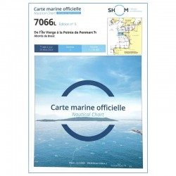
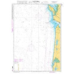
<h2 style="text-align:justify;">SHOM chart 7066 : from Ile Vierge to Penmarc'h</h2>
<p style="text-align:justify;">The SHOM 7066L chart is the marine chart of the tip of Brittany. It can be used for navigation but above all it is used as a support for professional maritime exams: Captain 200, Chief of the Watch 500, Captain 3000 or Unlimited. It exists in folded or flat version.</p>
<h2 style="text-align:justify;">Characteristics of the SHOM 7066 chart</h2>
available
-
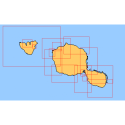
<div class="fiche-txt">
<h2>Choose from the list below an unfolded nautical chart of the sailing areas around Tahiti and the Society Islands</h2>
<p>This set of charts covers the whole of the Society Islands in unfolded Shom marine charts delivered in a tube. These charts detail the exact navigation areas of the islands. Choose from the list below the area you wish to explore by referring to the chart number associated with the desired navigation area. Indicate the map number you have chosen in the comments of your order.</p>
<h2>List of chart references and areas covered:</h2>
</div>
available
-
<p style="text-align:justify;">Shom marine chart for navigation from Oleron island to Arcachon basin. Scale: 1:167000.</p>
available
-
<p>Marine chart shom 7008. Cabo de San Sebastian to Fos sur Mer. Scale : 1:250000</p>
available
-
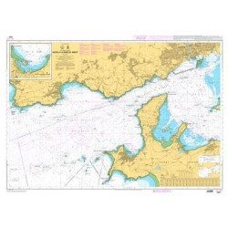
<p>Marine chart for coastal navigation. SHOM 7401 L - Access to the Rade de Brest - Scale 1:22500</p>
available
-
<p>Marine chart SHOM 7135 L. From the point of Saint Jacques to Damgan. Scale 1:15000.</p>
available
-
<h2>Waterproof nautical charts of the Mediterranean (France)</h2>
<p style="text-align:justify;">Waterproof nautical charts of the French Mediterranean coast that you can take out in the cockpit because they are waterproof. A3 format with a scale adapted to each sailing basin. Ideal for cruising or coastal regattas. Less cumbersome than traditional charts and very well thought out visually. Longer lasting for outdoor use in all conditions.</p>
<h2>Detailed characteristics of the charts</h2>
available
-
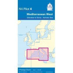
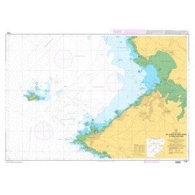
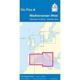
<h2>West Mediterranean Offshore Marine Chart</h2>
<p><span>The NV Pilot 4 offshore chart covers the western Mediterranean: the front side covers the Tyrrhenian Sea, the Adriatic Sea, the Ionian Sea and the region from Sicily to the coast of Tunisia. The reverse side covers the Mediterranean from Gibraltar to Palermo (Sicily)</span></p>
<h2>Details on the NV Pilot 4 map - West Mediterranean</h2>
available
-
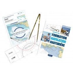
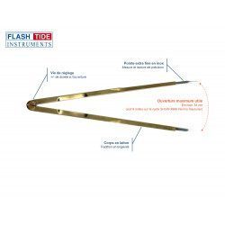
<h2><strong>The essential pack to prepare your offshore licence</strong></h2>
<p style="text-align:justify;">A set of quality tools to pass your offshore licence! Picksea is the owner of the Flash-Tide Instruments brand and our teams manufacture in France, in Lorient, all models of <a href="https://www.picksea.com/en/106806-cras-navigation-rules">rules cras</a> or Breton. Picksea is also a SHOM agent. We are therefore the best able to provide you with a pack composed of the best products at the best price.</p>
<h2>Composition of the offshore licence pack</h2>
available
-
<p style="text-align:justify;">Shom 6857 marine chart for your cruising or racing in the Bay of Seine. From Cap de la Hague to Fécamp. Scale 1:150 000</p>
available
-
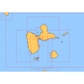
<div class="fiche-txt">
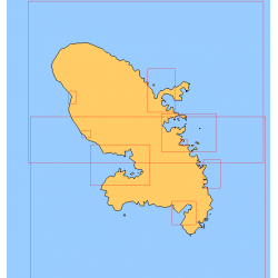
<h2>Choose in the list below a marine map of Martinique's surroundings</h2>
<p>This set of charts covers all the sailing areas of the island of Martinique in Shom marine charts of type L more adapted to the yachtsman because they are folded in A4 format, easier to store in a pleasure chart table. These maps detail precisely the navigation areas of the islands. Choose from the list below the area you wish to explore by referring to the chart number associated with the desired sailing area. Indicate the map number you have chosen in the comments of your order.</p>
<h2>List of chart references and areas covered:</h2>
</div>
available
-
<p>Shom 7069 marine chart for cruising around Yeu, Ré and Oléron. Scale: 1:164800.</p>
available
-
<p>Shom marine chart 7663. From Barcelona to Cape Cerbere. Scale 1:175000.</p>
available
-
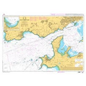
<p>Marine chart for coastal navigation. SHOM 7400 L - Rade de Brest - Scale 1:22500</p>
available
-
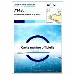
<p>SHOM marine chart 7143 L. Approaches to the islands of Houat and Hoëdic. Scale 1:20000</p>
available
-
<h2>Waterproof nautical charts of Italy</h2>
<p style="text-align:justify;">Waterproof nautical charts of the Italian Mediterranean coast that you can take out in the cockpit because they are waterproof. A3 format with a scale adapted to each navigation basin. Ideal for cruising or coastal regattas. Less cumbersome than traditional charts and very well thought out visually. Longer lasting for outdoor use in all conditions.</p>
<h2>Detailed characteristics of the charts</h2>
available

-
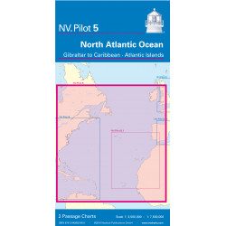
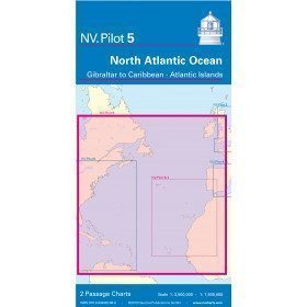
<h2>North Atlantic Offshore Marine Chart | Transatlantic</h2>
<p><span>The NV Pilot 5 offshore chart covers the North Atlantic from Europe to the Caribbean and on the reverse side, an area covering the Atlantic islands: Cape Verde Islands, Canary Islands, Madeira and Azores. The ideal map to prepare a transatlantic voyage.</span></p>
<h2>Details on the NV Pilot 5 map - North Atlantic | Transatlantic</h2>
available
-
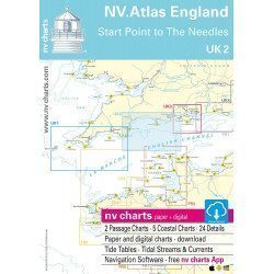
<h2>NV-CHARTS FR1 - 48 Channel Charts (Oostende to Cherbourg) + the 3 regulatory adhesive sheets</h2>
<p style="text-align:justify;"><span style="font-size:10pt;">In this NV-Charts FR1 pack, you will find an Atlas of 48 nautical charts from Oostende to Cherbourg including 4 offshore charts, 15 coastal charts and 29 detailed charts. Thanks to a personal download code, you will have access to all the charts in digital format as well as to the <strong>NV Graphical Navigator light navigation software</strong> both freely usable on PC, tablets or smartphone!</span></p>
<p style="text-align:justify;"><span style="font-size:10pt;">The area represents the Channel (FRANCE), and more precisely the following areas: <strong>Normandy - Zeebrugge, Dunkirk, Calais, Le Havre, Cherbourg.</strong></span></p>
<p style="text-align:justify;"><span style="font-size:10pt;"><span style="color:#ff0000;background-color:#ffffff;"><strong>Free with your FR1 pack:</strong></span> 3 adhesive sheets containing the mandatory regulatory documentation (RIPAM, buoys and flags) for navigation in coastal areas (art 242-2.04 of Division 240). <span style="color:#ff0000;"><strong>When you buy your pack, you have all the regulatory documentation for sailing within 6 miles of a shelter.</strong></span></span></p>
<h2>Description of the FR1 card pack</h2>
available
-
<h2><strong>The offshore licence pack with Breton plotter !</strong></h2>
<p>Pack of material to prepare the offshore licence including the official chart 9999, a plotter (Flash-Tide) and a one hand divider (Flash-Tide)</p>
<h2>Features of the Offshore Plus Pack</h2>
available
-
<div class="fiche-txt">
<h2>Choose in the list below a marine map of the surroundings of Guadeloupe</h2>
<p style="text-align:justify;">These SHOM charts cover all the navigation areas around Guadeloupe: from the Saintes to Marie-Galante and la Désirade as well as the Petit and Grand Cul de Sac Marin and the leeward coast, Saint François and Sainte Anne. If you need to reach Pointe à Pitre and the Gosier marina, you should choose the map of the Pointe a Pitre roadstead and the salt river. The Shom L type charts are more adapted to the yachtsman because they are folded in A4 format and thus easier to store in a chart table. They detail precisely the navigation areas of the coasts and islands surrounding Guadeloupe. To order, choose from the list below the area you wish to explore by referring to the map number associated with the desired navigation area. Indicate the map number you have chosen and the option "folded" or "flat".</p>
<h2>List of chart references and areas covered:</h2>
</div>
available
-
<p style="text-align:justify;">Shom 7068 navigation chart for cruising between Quiberon and Les Sables d'Olonne. Scale: 1:162400</p>
available
-
<p>Marine chart for coastal navigation. SHOM 7123 L - Molène Island - Ushant Island - Fromveur Passage - Scale 1:20000</p>
available

-
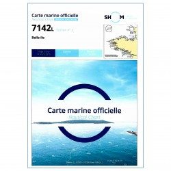
<p>SHOM marine chart 7142 L. Belle-Île. Scale 1:25000</p>
available
-
<h2>Waterproof nautical charts of Spain</h2>
<p style="text-align:justify;">Waterproof nautical charts of the Spanish Mediterranean coast that can be taken out in the cockpit because they are waterproof. A3 format with a scale adapted to each sailing basin. Ideal for cruising or coastal regattas. Less cumbersome than traditional charts and very well thought out visually. Longer lasting for outdoor use in all conditions.</p>
<h2>Detailed characteristics of the charts</h2>
available

-
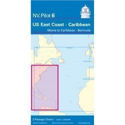
<h2>Offshore Caribbean and East Coast of America Marine Chart</h2>
<p style="text-align:justify;">The NV Pilot 6 offshore chart covers: on the front, the Caribbean with the Bahamas, the Caribbean, the North Coast of South America, Panama, the East Coast of the USA and on the back, the East Coast of the USA from Nova Scotia to Florida and Bermuda.</p>
<h2>NV Pilot 6 Map Details - Caribbean and Eastern Seaboard</h2>
available
-
<h2>NV-CHARTS FR2 - 25 Western Channel Charts (from Cherbourg to St Malo) + the 3 regulatory adhesive sheets</h2>
<p><span style="font-size:10pt;">In this NV-Charts FR2 pack, you will find an atlas of 25 nautical charts from Cherbourg to St Malo, including 2 deep-sea charts, 14 coastal charts and 9 detailed charts. Thanks to a personal download code, you will have access to all the charts in digital format as well as to the <strong>NV Graphical Navigator light navigation software</strong> both freely usable on PC, tablets or smartphone!</span></p>
<p><span style="font-size:10pt;">The area represents the Channel (FRANCE), and more precisely the following areas: <strong>Channel Islands - Cherbourg, Granville, Chausey, Jersey, Guernsey, Cancale, Saint Malo.</strong></span></p>
<p><span style="font-size:10pt;"><span style="color:#ff0000;"><strong>Free with your FR2 pack:</strong></span> 3 adhesive sheets containing the mandatory regulatory documentation (RIPAM, buoys and flags) for navigation in coastal areas (art 242-2.04 of Division 240). <span style="color:#ff0000;"><strong>When you buy your pack, you have all the regulatory documentation for sailing within 6 miles of a shelter.</strong></span></span></p>
<h2>Description of the FR2 card pack</h2>
available
-
<h2><strong>Everything you need to prepare and pass your offshore licence!</strong></h2>
<p>Everything you need to prepare and pass your offshore licence: complete pack of materials, map and book</p>
<h2>Features of the Complete Offshore Pack</h2>
available
-
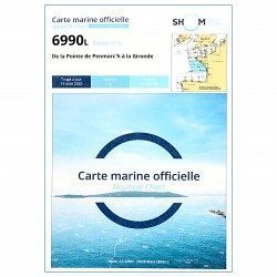
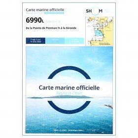
<p style="text-align:justify;">Shom 6990 marine chart for your navigations between Penmarc'h and the Gironde estuary. Scale: 1:355000</p>
available
-
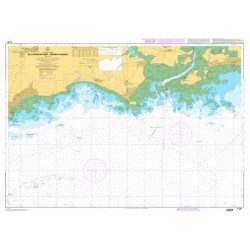
<p>Marine chart for coastal navigation. SHOM 7094 L - From the Four lighthouse to the Virgin Island - Aber Wrac'h Port - Scale 1:25000</p>
available
-
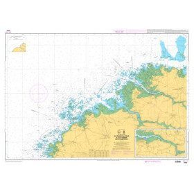
<p>SHOM marine chart 7141 L. Quiberon Bay. Scale 1:20000</p>
available

-
<h2>North Sea Zone Sea Card Packs</h2>
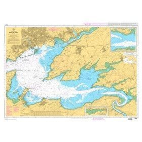
<p>The nv-charts are characterized by fine contours and easy to distinguish colour graduations of the depth lines: turquoise for coral reefs, red for the 2-metre line and blue for the 5-metre zones. Presented in a practical and user-friendly format (A3 closed and A2 open), a thick plastic envelope protects the charts, making them easy to store. The importance of a good graphic representation of the topography when navigating the North Sea is essential.<br /><br />Well-marked rivers, towns and street maps all contribute to a clear overview of the islands' waterfront facilities. Red numbered waypoints with coordinates based on WGS 84 allow mariners to navigate with their GPS instruments. Heights and depths are shown in the internationally recognized metre format. Large-scale approaches and land contour markings simplify entry into anchorages.</p>
<h2><span style="color:#ff0000;">Picksea is Premium Reseller of NV-Charts</span></h2>
<h2>NV-Charts North Sea Zone Marine Card Packs Features</h2>
available
-
<h2><strong>The essential pack for passing professional maritime exams</strong></h2>
<p style="text-align:justify;">A set of quality tools to pass your professional maritime exams! Picksea is the owner of the Flash-Tide Instruments brand and our teams manufacture in France, in Lorient, all the models of cras or breton rulers. Picksea is also a SHOM agent. We are therefore the best able to provide you with a pack composed of the best products at the best price.</p>
<h2>Composition of the maritime exam pro pack</h2>
available


Showing 1-48 of 138 item(s)
Learn more about the navigation chart
A navigational chart is a graphical representation of a sea area or the coastal regions that border it. Depending on the scale of the chart, it shows the depths of water called "soundings" and the elevations of notable points on land. It also shows the nature of the seabed, details of the coastline, hazards to navigation (rocks, wrecks, sandbanks), the location of natural and artificial aids to navigation (maritime buoyage), information on tides and currents, local details of the earth's magnetic field and structures such as ports, buildings and bridges.
Learn more by reading our "How to read and use a nautical chart" tip page
Why is a nautical chart necessary on board?
A nautical chart is an essential tool for both professional and recreational navigation. Many countries require ships to be equipped with them. It is necessary because once out of the harbour, there is no defined and safe route to navigate: each skipper must determine his or her route, avoiding all dangers while taking into account the weather and tide information.
What type of charts can be used?
Nautical charts can be printed on paper or computerized electronic navigational charts. Under French boating regulations, it is mandatory to have at least one chart covering the area of navigation either on paper or electronically. In the latter case, the reading device allowing the use of the chart must be operational. It is also necessary to ensure that the charts are recent or that they have been properly and regularly updated