unavailable


€249.00 Tax included
clear
Please call us +33 297 11 80 95
-
Livraison à domicile : Gratuit
Une question ?
+33 2 97 11 80 95
Detailed features
Marine cartography on SD/MicroSD card compatible with all Garmin portable GPS with mapping. Local delimitation centred on South Brittany.
- Detailed navigation maps
- 2D or 3D flat display
- Navigation aids (wrecks, obstacles, regulated anchorages...)
- Customisable display of depth contours
- Port plans, intertidal zones
- Sounding points
- Tide stations (tide directory and charts)
- Detailed fishing maps
- Marine points of interest (marinas, harbours, boat ramps) Tide stations (tidal directory and graphics)
Download
-
Traceurs Garmin Compatibles - Liste des Traceurs Garmin Compatibles avec cette carte
In the same category
4 other products seleted for you-
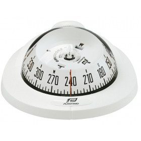
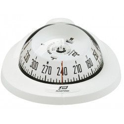
<h2>Offshore compass 75 flush mounted or on bracket</h2>
<p>Whether mounted on the horizontal plane or on a bracket, the offshore compass 75 is very compact, solid and easy to install thanks to its screw fastenings. A magnetic compass is<span class="apple-converted-space"> </span>MANDATORY in coastal navigation from 2 MN from a shelter<span class="apple-converted-space"> </span>(<a href="https://www.picksea.com/en/content/182-choose-and-check-your-safety-material">Division 240</a>)</p>
<h2><span>Characteristics of the Offshore 75 compass</span></h2>
available

-
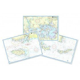
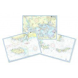
<h2>Waterproof nautical charts of the Mediterranean (France)</h2>
<p style="text-align:justify;">Waterproof nautical charts of the French Mediterranean coast that you can take out in the cockpit because they are waterproof. A3 format with a scale adapted to each sailing basin. Ideal for cruising or coastal regattas. Less cumbersome than traditional charts and very well thought out visually. Longer lasting for outdoor use in all conditions.</p>
<h2>Detailed characteristics of the charts</h2>
available
-
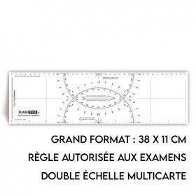
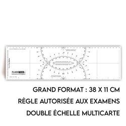
<h2>Standard Cras Rule</h2>
<p style="text-align:justify;"><span>This black ruler is very popular with boaters and boat license applicants because it is more practical and easier to read than other brands of rulers.</span></p>
<h2><span>Features of the Standard Cras rule</span></h2>
available
-
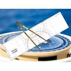
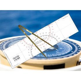
<h2 id="prod-h1" class="prod-name">Ruler and Compass Dry Point Kit</h2>
<p style="text-align:justify;"><span>Set of equipment to prepare for the offshore licence or to equip your boat, including a cras 2000 ruler (Flash-Tide) and a dry point compass (Flash-Tide)</span></p>
<h2 style="text-align:justify;"><span>Features of the Ruler and Compass Kit</span></h2>
available