

Nautical Charts
There are 138 products.
-
<div class="fiche-txt">
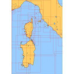
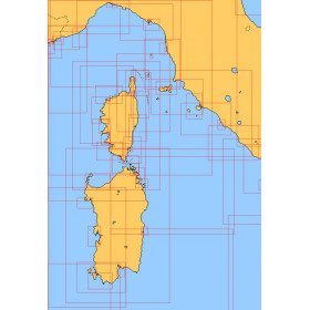
<h2>Choose from the list below a chart covering the Mediterranean</h2>
<p style="text-align:justify;">This set of charts covers all the navigation areas in the Mediterranean, with different scales allowing to cover either a large navigation area or to zoom in on a specific port or area. These Shom Marine charts are available in flat or folded format. The L type charts are more suitable for the yachtsman as they are folded to A4 size, easier to store in a chart table. These charts detail the navigation zones of all the sailing areas around Corsica, Sardinia and Italy. Choose from the list below the area you wish to explore by referring to the map number associated with the desired navigation area. Indicate the map number you have chosen and whether you want to sail folded or flat.</p>
<h2>List of chart references and areas covered</h2>
</div>
available

-
<div class="fiche-txt">
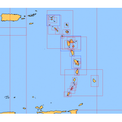
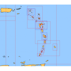
<h2>Choose from the list below a chart covering the sailing areas around the Caribbean Arc and the Caribbean Sea</h2>
<p>This set of charts covers all the sailing areas from Venezuela to Cuba, including all the islands of the Caribbean Arc. These Shom marine charts type L are more adapted to the yachtsman because they are folded in A4 format, easier to store in a yachting chart table. These charts detail precisely the sailing areas of the surrounding islands of the West Indies. Choose from the list below the area you wish to explore by referring to the chart number associated with the desired sailing area. Indicate the map number you have chosen and whether you want to sail flat or folded.</p>
<h2>List of chart references and areas covered:</h2>
</div>
available
-
<p style="text-align:justify;">Shom 7076 marine chart for cruising or racing from Saint Nazaire to Saint Malo. Scale: 1:350000</p>
available
-
<p>Marine chart for coastal navigation. SHOM 7122 L - from Pointe Saint Mathieu to Four lighthouse - Scale 1:25000</p>
available

-
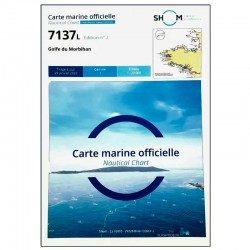
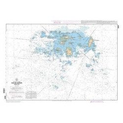
<p>SHOM marine chart 7137 L. Gulf of Morbihan. Scale 1:20000</p>
available
-
available
-
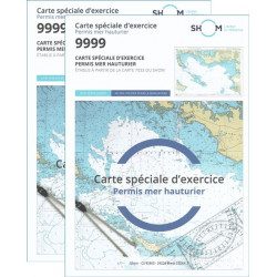
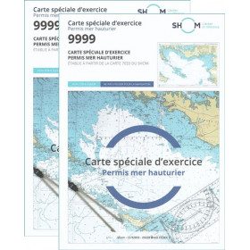
<h2>Pack of 2 official 9999 marine charts from SHOM</h2>
<p style="text-align:justify;"><span>The nautical chart of SHOM 9999 is the official chart of the exam of the <strong>offshore sea permit</strong> which allows to navigate beyond 6 miles from a shelter. It is also on this chart that you will do all the exercises to prepare you for the exam </span></p>
<h2 style="text-align:justify;"><em>Why buy 2 charts?</em></h2>
<p style="text-align:justify;">The fact of doing many exercises on the chart (with a lot of deletion) often makes it unusable for the exam and this is why many exam centers require a new chart for the exam. It should be noted that the organising administration keeps the card as a copy of the exam (except in the case of failure).</p>
<h2>Training and preparation for the offshore licence (theoretical test)</h2>
<p style="text-align:justify;">After passing the coastal licence (and perhaps also the inland waterways licence), you wish to extend your navigation area to the "high seas"! To do this, you need to obtain a deep-sea licence to sail motor yachts beyond 6 miles from a shelter (but it is also very useful for sailing). Read our<a title="Tout savoir pour passer le permis hauturier" href="https://blog.picksea.com/tout-savoir-passer-permis-hauturier/" target="_blank" rel="noreferrer noopener"> article "Everything you need to know about the offshore licence"</a> to find out more.</p>
<p style="text-align:justify;">The chart SHOM 9999 is a special marine chart but it contains all the information of a real navigation chart (scale of latitudes and longitudes, coasts, probes, dangers, beacons, lighthouses, currents, ...). You can plot routes and bearings as well as position points, or measure distances as on a real chart <a title="Déterminer une route sur le carte marine" href="https://blog.picksea.com/determiner-route-direction-distance/" target="_blank" rel="noreferrer noopener">See the article "Determining a route in direction and distance" on our blog </a></p>
<h2 style="text-align:justify;">Characteristics of the Marine Chart 9999 from SHOM for the Offshore Permit</h2>
available
-
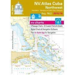
<h2>Marine Card Packs for the Caribbean and West Indies Zone</h2>
<p style="text-align:justify;"><span>The nv-charts are characterized by fine contours and easily distinguishable colour graduations of the depth lines: turquoise for coral reefs, red for the 2-metre line and blue for the 5-metre zones. </span><span>Presented in a practical and user-friendly format (A3 closed and A2 open), a thick plastic envelope protects the cards, making them easy to store. </span><span>The importance of a good graphic representation of the topography when navigating in the Caribbean is essential.</span><br /><br /><span>Well-marked rivers, towns and street maps all contribute to a clear overview of the islands' waterfront facilities. Red numbered waypoints with coordinates based on WGS 84 allow mariners to navigate with their GPS instruments. Heights and depths are shown in the internationally recognized metre format. Large-scale approaches and land contour markings simplify entry into anchorages.</span></p>
<h2 style="text-align:justify;"><span style="color:#ff0000;">Picksea is Premium Reseller of NV-Charts</span></h2>
<h2><span>Features of NV-Charts Caribbean Zone Packs</span></h2>
available
-
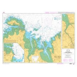
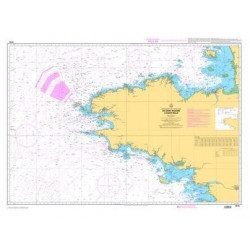
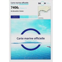
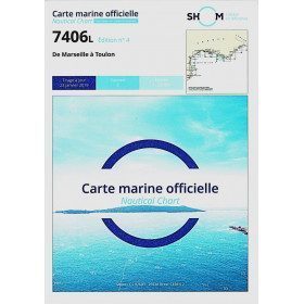
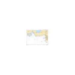
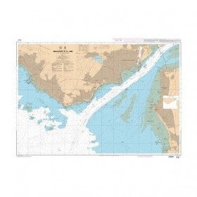
<h2>The SHOM 7406 L chart is the marine chart from Marseille to Toulon.</h2>
<p>Area covered: Marseille South, Cassis, Archipelago of Riou, La Ciotat, Bandol, Toulon. Scale 1/50000.</p>
<h2>Characteristics of the SHOM 7406L chart (folded version)</h2>
available
-
<p>Shom marine chart 6821L. Nice to Piombino. Scale: 1:250000.</p>
available
-
<p>Marine chart for coastal navigation. SHOM 7124 L - Bay of Lannion - from Pointe de Primel to Ile Grande - Scale 1:20000</p>
available
-
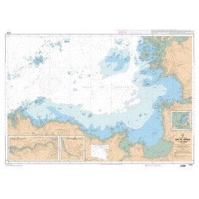
<p>SHOM marine chart 7139 L. Groix Island and Lorient roadstead. Scale 1:20000</p>
available
-
<p class="t12px">Marine chart shom <span class="searchproduct-list-item-name">6767 </span>for navigations along the blue coast and in the roadstead of Marseille until the calanques<span class="t12px">. Nautical chart SHOM type Carte L folded in A4 format <span class="t12px">or flat</span> </span>, for pleasure boating. Up to date printing Scale <strong><strong>1 : 50 000</strong><br /></strong></p>
available
-
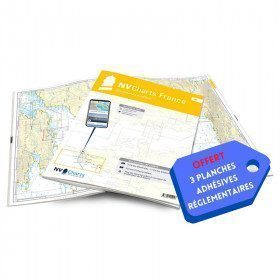
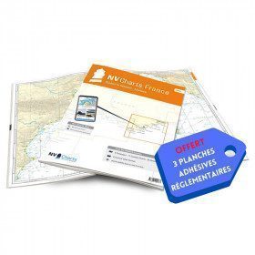
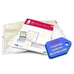
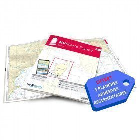
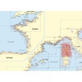
<h2>NV-CHARTS FR9 - 70 Mediterranean Sea charts (from Cap Creus to Toulon) + the 3 regulatory adhesive sheets</h2>
<p><span style="font-size:10pt;">In this NV-Charts FR9 pack, you will find an Atlas of <span>70 Mediterranean charts from Cap Creus to Toulon including 3 offshore charts, 14 coastal charts and 53 detailed charts</span>. With a personal download code, you will have access to all the maps in digital format as well as the <strong>NV Graphical Navigator light navigation software</strong> both freely usable on PC, tablets or smartphone!</span></p>
<p><span style="font-size:10pt;">The areas represented are: <strong>Mediterranean - Port Vendres, Leucate, Canet, Port La Nouvelle, Gruissan, Cap d'Agde, Palavas, Port Camargue, La Grande Motte, Martigue, Carry, Marseille, Calanques, Cassis, La Ciotat, Saint Cyr, Bandol, Toulon (FRANCE)</strong></span></p>
<p><span style="font-size:10pt;"><span style="color:#ff0000;"><strong>Free with your FR9 pack:</strong></span> 3 adhesive sheets containing the mandatory regulatory documentation (RIPAM, buoys and flags) for navigation in coastal areas (art 242-2.04 of Division 240). <span style="color:#ff0000;"><strong>When you buy your pack, you have all the regulatory documentation for sailing within 6 miles of a shelter.</strong></span></span></p>
<h2>Description of the FR9 card pack</h2>
available
-
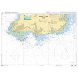
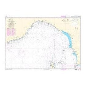
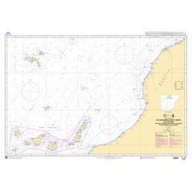
<p>Official SHOM chart - 7212 L - Cape Finisterre to Casablanca - Scale 1: 100000</p>
available
-
<p>Marine chart for coastal navigation. SHOM 7095 L - Morlaix Bay - from Batz Island to Primel Point - Scale 1:20000</p>
available
-
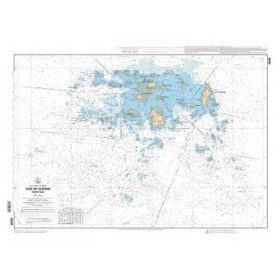
<p>SHOM marine chart 7252L. Les Glénans. Scale 1:20000</p>
available
-
available
-
<h2>NV-CHARTS FR10 - 45 Côte d'Azur Nautical Charts (from Toulon to Menton) + the 3 regulatory adhesive boards</h2>
<p><span style="font-size:10pt;">In this NV-Charts FR10 pack, you will find an Atlas of <span>45 Mediterranean Riviera charts from Toulon to Menton and Monaco including 2 offshore charts, 11 coastal charts and 32 detailed charts.</span> With a personal download code, you will have access to all the maps in digital format as well as the <strong>NV Graphical Navigator light navigation software</strong> both freely usable on PC, tablets or smartphone!</span></p>
<p><span style="font-size:10pt;">The areas represented are: <strong>Mediterranean Riviera - Toulon, Hyères, Port Cros, Porquerolles, Fréjus, Saint Raphaël, Cannes, Antibes, Nice, Monaco, Menton (FRANCE).</strong></span></p>
<p><span style="font-size:10pt;"><span style="color:#ff0000;"><strong>Free with your FR10 pack:</strong></span> 3 adhesive sheets containing the mandatory regulatory documentation (RIPAM, buoys and flags) for navigation in coastal areas (art 242-2.04 of Division 240). <span style="color:#ff0000;"><strong>When you buy your pack, you have all the regulatory documentation for sailing within 6 miles of a shelter.</strong></span></span></p>
<h2>Description of the FR10 card pack</h2>
available
-
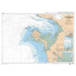
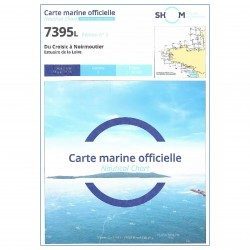
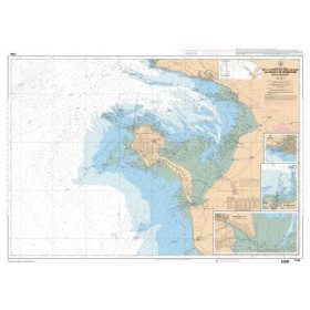
<h2 style="text-align:justify;">The SHOM 7395 L chart is the folded version of the chart for Le Croisic to Noirmoutier and the Loire Estuary.</h2>
<p style="text-align:justify;">Area covered: Le Croisic, Le Pouliguen, Pornichet, La Baule, Saint Nazaire, Saint Brévin, baie de Bourgneuf, L'Herbaudière. Scale 1:50300.</p>
available
-
<p style="text-align:justify;">Shom marine chart essential to make a perfect transatlantic by following the great circle.</p>
available

-
<p>Marine chart for coastal navigation. SHOM 7127 L - Bréhat Island - Paimpol Cove - Trieux Entrance. Scale 1:20000</p>
available
-
<p>SHOM marine chart 7251 L. From Loctudy to Concarneau. Scale 1:20 00.</p>
available
-
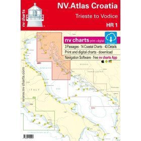
<h2>NV-CHARTS FR11 - 42 nautical charts of Corsica + the 3 regulatory adhesive boards</h2>
<p><span style="font-size:10pt;">In this NV-Charts FR11 pack, you will find an Atlas of <span>42 nautical charts of the whole of Corsica including 2 deep-sea charts, 19 coastal charts and 21 detailed charts</span>. With a personal download code, you will have access to all the maps in digital format as well as the <strong>NV Graphical Navigator light navigation software</strong> both freely usable on PC, tablets or smartphone!</span></p>
<p><span style="font-size:10pt;">The areas represented are: <strong>Corsica - Ajaccio, Calvi, Ile Rousse, Bastia, Porto Vecchio, Bonifacio, Lavezzi, Propriano (FRANCE)</strong></span></p>
<p><span style="font-size:10pt;"><span style="color:#ff0000;"><strong>Free with your FR11 pack:</strong></span> 3 adhesive sheets containing the mandatory regulatory documentation (RIPAM, buoys and flags) for navigation in coastal areas (art 242-2.04 of Division 240). <span style="color:#ff0000;"><strong>When you buy your pack, you have all the regulatory documentation for sailing within 6 miles of a shelter.</strong></span></span></p>
<h2>Description of the FR11 card pack</h2>
available
-
<div class="fiche-txt">
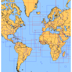
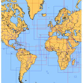
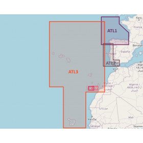
<h2>Choose from the list below an unfolded chart covering the sailing areas around the North and South Atlantic and the Indian Ocean</h2>
<p>These charts detail the sailing areas centered on the North and South Atlantic, the macro sailing areas of North and South America, Western Europe, Western Africa and the Indian Ocean. Delivered unfolded in a transport tube, these charts will serve as a support to trace your journey between continents. Choose from the list below the area you wish to explore by referring to the map number associated with the desired navigation area. Indicate the map number you have chosen in the comments of your order.</p>
<h2>List of chart references and areas covered:</h2>
</div>
available
-
<p style="text-align:justify;">Shom 7394 marine chart for cruising around Noirmoutier. Scale: 1:50000.</p>
available
-
<p style="text-align:justify;">Shom 6624 nautical chart for sailing along the Portuguese and African coasts. Ideal for the sailor who wishes to make a transatlantic crossing.</p>
available
-
<p>Marine chart for coastal navigation. SHOM 7125 L - Approaches to Perros-Guirec - Scale 1:20000</p>
available
-
<h2>Atlantic Zone Sea Card Packs</h2>
<p>The nv-charts are characterized by fine contours and easy to distinguish colour graduations of the depth lines: turquoise for coral reefs, red for the 2-metre line and blue for the 5-metre zones. Presented in a practical and user-friendly format (A3 closed and A2 open), a thick plastic envelope protects the charts, making them easy to store. The importance of a good graphic representation of the topography when navigating the Atlantic is essential.<br /><br />Well-marked rivers, towns and street maps all contribute to a clear overview of the islands' waterfront facilities. Red numbered waypoints with coordinates based on WGS 84 allow mariners to navigate with their GPS instruments. Heights and depths are shown in the internationally recognized metre format. Large-scale approaches and land contour markings simplify entry into anchorages.</p>
<h2><span style="color:#ff0000;">Picksea is Premium Reseller of NV-Charts</span></h2>
<h2>NV-Charts Atlantic Zone Marine Card Packs Features</h2>
available

-
<p>Marine chart for coastal navigation. SHOM 7310 L - Bay of Saint Brieuc (eastern part) - from Dahouët to Cap Fréhel. Scale 1:25000.</p>
available
-
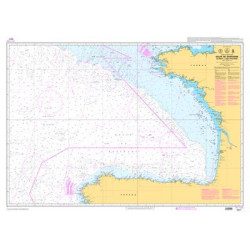
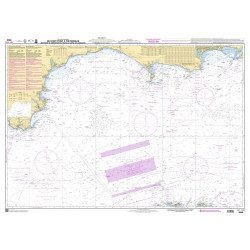
<p>Official SHOM chart - 7211 L - Bay of Biscay - from Brest to Cabo Finisterre.</p>
available
-
<p>Marine chart for coastal navigation. SHOM 7128 L - Bay of Saint Brieuc - from Pointe de la Tour to Yffiniac Cove. Scale 1:25000</p>
available
-
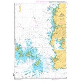
<h2>SHOM Marine Chart 7250 - From Pointe de la Torche to Loctudy</h2>
<ul>
<li>Scale 1:20000</li>
<li>Flat chart</li>
</ul>
available
-
<h2>Marine Card Packs for the Caribbean and West Indies Zone</h2>
<p style="text-align:justify;"><span>The nv-charts are characterized by fine contours and easily distinguishable colour graduations of the depth lines: turquoise for coral reefs, red for the 2-metre line and blue for the 5-metre zones. </span><span>Presented in a practical and user-friendly format (A3 closed and A2 open), a thick plastic envelope protects the cards, making them easy to store. </span><span>The importance of a good graphic representation of the topography when navigating in the Caribbean is essential.</span><br /><br /><span>Well-marked rivers, towns and street maps all contribute to a clear overview of the islands' waterfront facilities. Red numbered waypoints with coordinates based on WGS 84 allow mariners to navigate with their GPS instruments. Heights and depths are shown in the internationally recognized metre format. Large-scale approaches and land contour markings simplify entry into anchorages.</span></p>
<h2 style="text-align:justify;"><span style="color:#ff0000;">Picksea is Premium Reseller of NV-Charts</span></h2>
<h2><span>Features of NV-Charts Caribbean Zone Packs</span></h2>
available
-
<p>Marine chart for coastal navigation. SHOM 7129 L - from Cap Fréhel to Saint Briac-sur-Mer - Scale 1:20000.</p>
available
-
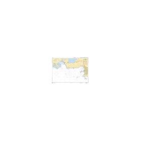
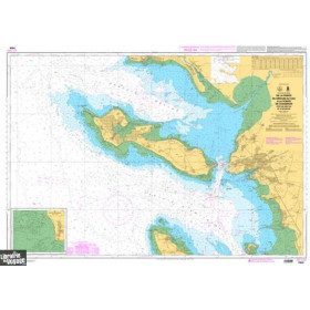
<h2>SHOM chart 7407 L is the nautical chart of Toulon Cavalaire sur Mer</h2>
<p>Area covered: Toulon, Saint Mandrier, Le Pradet, Port Cros, Porquerolles, Hyères, Le Lavandou. Scale 1/50200.</p>
<h2>Characteristics of the map 7407L (folded version) </h2>
available
-
<p style="text-align:justify;">Marine chart shom 7270 for navigations between Casablanca and Cape Jubi, and in the Madeira and Canary Islands area. Ideal for the sailor who wishes to make a transatlantic crossing.</p>
available
-
<p>Marine chart for coastal navigation. SHOM 7130 L - Approaches to Saint Malo - from Hebihens Island to Pointe de la Varde - Scale 1:15000.</p>
available
-
<h2>Sea Cards Packs for the Mediterranean Area</h2>
<p>The nv-charts are characterized by fine contours and easy to distinguish colour graduations of the depth lines: turquoise for coral reefs, red for the 2-metre line and blue for the 5-metre zones. Presented in a practical and user-friendly format (A3 closed and A2 open), a thick plastic envelope protects the charts, making them easy to store. The importance of a good graphic representation of the topography when navigating the Mediterranean is essential.<br /><br />Well-marked rivers, towns and street maps all contribute to a clear overview of the islands' waterfront facilities. Red numbered waypoints with coordinates based on WGS 84 allow mariners to navigate with their GPS instruments. Heights and depths are shown in the internationally recognized metre format. Large-scale approaches and land contour markings simplify entry into anchorages.</p>
<h2><span style="color:#ff0000;">Picksea is Premium Reseller of NV-Charts</span></h2>
<h2>Features of NV-Charts Packs - Mediterranean Zone</h2>
available
-
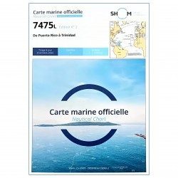
<p style="text-align:justify;">SHOM 7475L folded nautical chart. Centered on the Caribbean Arc area from Puerto Rico to Trinidad. Scale : 1:1000000</p>
available
-
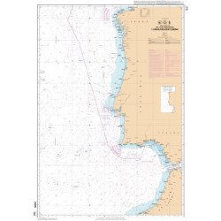
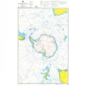
<h2 style="text-align:justify;">Admiralty Marine Map of the Antarctic Region</h2>
<p style="text-align:justify;">One of the only nautical chart references including the entire Antarctic. It will appeal to Vendée Globe fans who will be able to follow their favourite candidates around the Antarctic continent with a gnomonic projection instead of the classic Mercator projection which cannot be used in latitudes above 70° N or S.</p>
<h2 style="text-align:justify;">Characteristics of the Admiralty map of Antarctica</h2>
available

-
<p>Marine chart for navigations around the Ile de Ré. SHOM 7404 L - From the Pointe du Grouin du Cou to the Pointe de Chassiron</p>
available
-
available
-
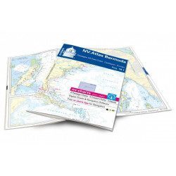
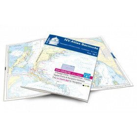
<h2>Atlas of Bermuda and Transatlantic charts return</h2>
<p style="text-align:justify;">Discover the pink beaches of Bermuda and prepare your transatlantic return with this atlas! Nautical charts for Bermuda and transatlantic sailing to Europe. 4 general charts, 4 coastal charts and 4 detailed charts are included. Size 30x42cm, bound in atlas form. In English language. The set includes a download code for all digital maps of the region. The digital maps can be used on our NV Charts app with a smartphone and tablet (Apple, iOS/MacOSX, Android, Windows 7/8).</p>
<h2 style="text-align:justify;">Features of the NV-Charts 16.1 Atlas</h2>
available
-
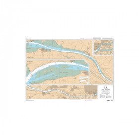
<p style="text-align:justify;">SHOM chart 7396 for navigation up the Loire River from St Nazaire bridge to Nantes. SHOM marine chart type Carte L folded to A4 format or flat, for pleasure boating. Scale: 1 : 20 000 to 1 : 15 000</p>
available
-
available
-
<h2>NV-CHARTS FR5 - 29 South West Brittany nautical charts (from Douarnenez to Lorient) + the 3 statutory adhesive sheets</h2>
<p><span style="font-size:10pt;">In this NV-Charts FR5 pack, you will find an Atlas of <span>29 charts of South-West Brittany, from Douarnenez to Lorient, including 2 deep-sea charts, 11 coastal charts and 16 detailed charts</span>. With a personal download code, you will have access to all the maps in digital format as well as the <strong>NV Graphical Navigator light navigation software</strong> both freely usable on PC, tablets or smartphone!</span></p>
<p><span style="font-size:10pt;">The areas represented are: <strong>South West Brittany Douarnenez, Sein, Audierne, Guilvinec, Loctudy, Bénodet, Port La Forêt, Concarneau, Les Glénan, Aven Belon, Doëlan, Groix, Lorient(FRANCE).</strong></span></p>
<p><span style="font-size:10pt;"><span style="color:#ff0000;"><strong>Free with your FR5 pack:</strong></span> 3 adhesive sheets containing the mandatory regulatory documentation (RIPAM, buoys and flags) for navigation in coastal areas (art 242-2.04 of Division 240). <span style="color:#ff0000;"><strong>When you buy your pack, you have all the regulatory documentation for sailing within 6 miles of a shelter.</strong></span></span></p>
<h2>Description of the FR5 card pack</h2>
available
-
<p style="text-align:justify;">SHOM marine chart 6797 for navigation in the mouth of the Loire up to the bridge of St Nazaire. SHOM marine chart type L folded to A4 format or flat, for pleasure boating. Up to date edition Scale: 1 : 15 000</p>
available


Showing 49-96 of 138 item(s)