+ 3 regulatory adhesive sheets")
 + 3 regulatory adhesive sheets")
 + 3 regulatory adhesive sheets")
 + 3 regulatory adhesive sheets")
 + 3 regulatory adhesive sheets")
 + 3 regulatory adhesive sheets")
 + 3 regulatory adhesive sheets")
 + 3 regulatory adhesive sheets")
 + 3 regulatory adhesive sheets")
 + 3 regulatory adhesive sheets")
 + 3 regulatory adhesive sheets")
 + 3 regulatory adhesive sheets")
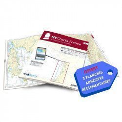
NV-CHARTS FR9 - 70 Mediterranean Sea Charts (from Cap Creus to Toulon) + 3 regulatory adhesive sheets

€64.90 Tax included
Detailed features
NV-CHARTS FR9 - 70 Mediterranean Sea charts (from Cap Creus to Toulon) + the 3 regulatory adhesive sheets
In this NV-Charts FR9 pack, you will find an Atlas of 70 Mediterranean charts from Cap Creus to Toulon including 3 offshore charts, 14 coastal charts and 53 detailed charts. With a personal download code, you will have access to all the maps in digital format as well as the NV Graphical Navigator light navigation software both freely usable on PC, tablets or smartphone!
The areas represented are: Mediterranean - Port Vendres, Leucate, Canet, Port La Nouvelle, Gruissan, Cap d'Agde, Palavas, Port Camargue, La Grande Motte, Martigue, Carry, Marseille, Calanques, Cassis, La Ciotat, Saint Cyr, Bandol, Toulon (FRANCE)
Free with your FR9 pack: 3 adhesive sheets containing the mandatory regulatory documentation (RIPAM, buoys and flags) for navigation in coastal areas (art 242-2.04 of Division 240). When you buy your pack, you have all the regulatory documentation for sailing within 6 miles of a shelter.
Description of the FR9 card pack
- Bound with staples and in a sturdy transparent pocket (A3/A2 format).
- 3 adhesive boards (A5 format)
- Free download of NV Navigator Light software
NV-Charts is a German publisher that has designed and developed a card pack concept that combines the traditional paper form with modern electronics.
The concept is to propose for the navigation area from Port Vendres to Toulon in the same pack paper charts at different scales (from the map of the area covered to the detailed maps of the ports) and the same charts in electronic format that can be used with the NVapp application, that is to say the navigation software of NV-Charts whose standard version (sufficient for pleasure boating) is free and usable on any support (Windows, Android, MacOS or Iphone).
In the same category
4 other products seleted for you-
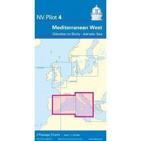
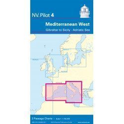
<h2>West Mediterranean Offshore Marine Chart</h2>
<p><span>The NV Pilot 4 offshore chart covers the western Mediterranean: the front side covers the Tyrrhenian Sea, the Adriatic Sea, the Ionian Sea and the region from Sicily to the coast of Tunisia. The reverse side covers the Mediterranean from Gibraltar to Palermo (Sicily)</span></p>
<h2>Details on the NV Pilot 4 map - West Mediterranean</h2>
available

-
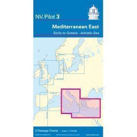
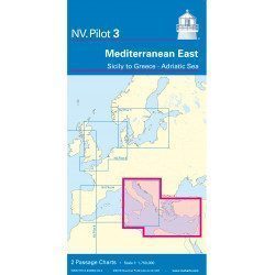
<h2>East Mediterranean Offshore Marine Chart</h2>
<p><span>The NV Pilot 3 offshore chart covers the Eastern Mediterranean: on the front side the Tyrrhenian Sea, the Adriatic Sea, the Ionian Sea and the region of Sicily up to the coast of Tunisia. The reverse side covers the Mediterranean Sea up to longitude 17°E</span></p>
<h2>Details on the NV Pilot 3 map - East Mediterranean</h2>
available
-
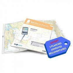
<h2>NV-CHARTS FR8 - 33 Aquitaine Marine Charts (from La Rochelle to San Sebastian) + the 3 regulatory adhesive sheets</h2>
<p><span style="font-size:10pt;">In this NV-Charts FR8 pack, you will find an Atlas of <span>33 Aquitaine charts from La Rochelle to San Sebastian including 3 offshore charts, 15 coastal charts and 15 detailed charts</span>. With a personal download code, you will have access to all the maps in digital format as well as the <strong>NV Graphical Navigator light navigation software</strong> both freely usable on PC, tablets or smartphone!</span></p>
<p><span style="font-size:10pt;">The areas represented are: <strong>Aquitaine - La Rochelle, Ré, Oléron, Rochefort, Royan, Gironde, Bordeaux, Arcachon, Bayonne, Biarritz, Saint Jean de Luz, San Sebastian (FRANCE)</strong></span></p>
<p><span style="font-size:10pt;"><span style="color:#ff0000;"><strong>Free with your FR8 pack:</strong> </span>3 adhesive sheets containing the mandatory regulatory documentation (RIPAM, buoys and flags) for navigation in coastal areas (art 242-2.04 of Division 240). <span style="color:#ff0000;"><strong>When you buy your pack, you have all the regulatory documentation for sailing within 6 miles of a shelter.</strong></span></span></p>
<h2>Description of the FR8 card pack</h2>
available
-
<h2>NV-CHARTS FR4 - 33 West Brittany Marine Charts (from the Seven Islands to Douarnenez) + the 3 regulatory adhesive sheets</h2>
<p><span style="font-size:10pt;">In this pack NV-Charts FR4, you will find an Atlas of 33 nautical charts from the Seven Islands to Douarnenez<span> including 2 offshore maps, 13 coastal maps and 18 detailed maps</span>. With a personal download code, you will have access to all the maps in digital format as well as the <strong>NV Graphical Navigator light navigation software</strong> both freely usable on PC, tablets or smartphone!</span></p>
<p><span style="font-size:10pt;">The areas represented are: <strong>Western Brittany - Roscoff, Morlaix, Ouessant, Molène, Brest, Camaret, Crozon, Morgat, Douarnenez, Sein (FRANCE).</strong></span></p>
<p><span style="font-size:10pt;"><span style="color:#ff0000;"><strong>Free with your FR4 pack:</strong></span> 3 adhesive sheets containing the mandatory regulatory documentation (RIPAM, buoys and flags) for navigation in coastal areas (art 242-2.04 of Division 240). <span style="color:#ff0000;"><strong>When you buy your pack, you have all the regulatory documentation for sailing within 6 miles of a shelter.</strong></span></span></p>
<h2>Description of the FR4 card pack</h2>
available