available


€69.80 Tax included
check_circle
In stock
-
Livraison en points relais : Gratuit
Une question ?
+33 2 97 11 80 95
Detailed features
Atlas of Bermuda and Transatlantic charts return
Discover the pink beaches of Bermuda and prepare your transatlantic return with this atlas! Nautical charts for Bermuda and transatlantic sailing to Europe. 4 general charts, 4 coastal charts and 4 detailed charts are included. Size 30x42cm, bound in atlas form. In English language. The set includes a download code for all digital maps of the region. The digital maps can be used on our NV Charts app with a smartphone and tablet (Apple, iOS/MacOSX, Android, Windows 7/8).
Features of the NV-Charts 16.1 Atlas
- Closed size: A3
- Open dimension: A2
You might also like 4 other products seleted for you
-
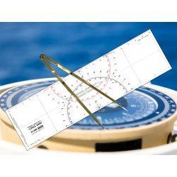
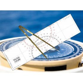
<h2 id="prod-h1" class="prod-name">Ruler and Compass Dry Point Kit</h2>
<p style="text-align:justify;"><span>Set of equipment to prepare for the offshore licence or to equip your boat, including a cras 2000 ruler (Flash-Tide) and a dry point compass (Flash-Tide)</span></p>
<h2 style="text-align:justify;"><span>Features of the Ruler and Compass Kit</span></h2>
available

-
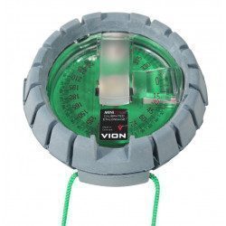
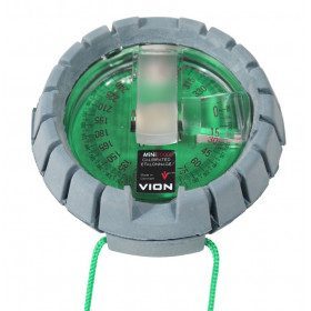
<h2>The VION Mini 2000 - "Mini Morin" bearing compass</h2>
<p style="text-align:justify;">This Vion Mini 2000 bearing compass is the famous "Mini Morin" famous in all cruising schools. Renowned for its solidity and reliability, it will find its place in your chart table and will assist you efficiently in your coastal courses.</p>
<h2>Features of the VION Mini 2000 bearing compass</h2>
available
-
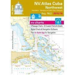
<h2>Marine Card Packs for the Caribbean and West Indies Zone</h2>
<p style="text-align:justify;"><span>The nv-charts are characterized by fine contours and easily distinguishable colour graduations of the depth lines: turquoise for coral reefs, red for the 2-metre line and blue for the 5-metre zones. </span><span>Presented in a practical and user-friendly format (A3 closed and A2 open), a thick plastic envelope protects the cards, making them easy to store. </span><span>The importance of a good graphic representation of the topography when navigating in the Caribbean is essential.</span><br /><br /><span>Well-marked rivers, towns and street maps all contribute to a clear overview of the islands' waterfront facilities. Red numbered waypoints with coordinates based on WGS 84 allow mariners to navigate with their GPS instruments. Heights and depths are shown in the internationally recognized metre format. Large-scale approaches and land contour markings simplify entry into anchorages.</span></p>
<h2 style="text-align:justify;"><span style="color:#ff0000;">Picksea is Premium Reseller of NV-Charts</span></h2>
<h2><span>Features of NV-Charts Caribbean Zone Packs</span></h2>
available
-
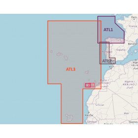
<h2>Atlantic Zone Sea Card Packs</h2>
<p>The nv-charts are characterized by fine contours and easy to distinguish colour graduations of the depth lines: turquoise for coral reefs, red for the 2-metre line and blue for the 5-metre zones. Presented in a practical and user-friendly format (A3 closed and A2 open), a thick plastic envelope protects the charts, making them easy to store. The importance of a good graphic representation of the topography when navigating the Atlantic is essential.<br /><br />Well-marked rivers, towns and street maps all contribute to a clear overview of the islands' waterfront facilities. Red numbered waypoints with coordinates based on WGS 84 allow mariners to navigate with their GPS instruments. Heights and depths are shown in the internationally recognized metre format. Large-scale approaches and land contour markings simplify entry into anchorages.</p>
<h2><span style="color:#ff0000;">Picksea is Premium Reseller of NV-Charts</span></h2>
<h2>NV-Charts Atlantic Zone Marine Card Packs Features</h2>
available

In the same category
4 other products seleted for you-
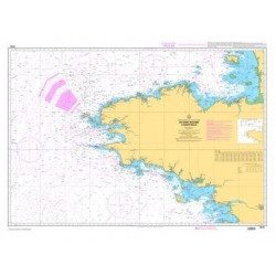
<p style="text-align:justify;">Shom 7076 marine chart for cruising or racing from Saint Nazaire to Saint Malo. Scale: 1:350000</p>
available
-
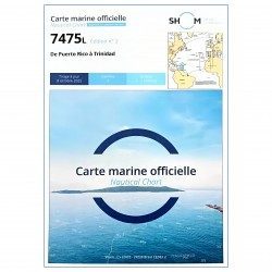
<p style="text-align:justify;">SHOM 7475L folded nautical chart. Centered on the Caribbean Arc area from Puerto Rico to Trinidad. Scale : 1:1000000</p>
available
-
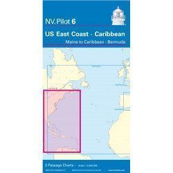
<h2>Offshore Caribbean and East Coast of America Marine Chart</h2>
<p style="text-align:justify;">The NV Pilot 6 offshore chart covers: on the front, the Caribbean with the Bahamas, the Caribbean, the North Coast of South America, Panama, the East Coast of the USA and on the back, the East Coast of the USA from Nova Scotia to Florida and Bermuda.</p>
<h2>NV Pilot 6 Map Details - Caribbean and Eastern Seaboard</h2>
available
-
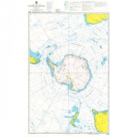
<h2 style="text-align:justify;">Admiralty Marine Map of the Antarctic Region</h2>
<p style="text-align:justify;">One of the only nautical chart references including the entire Antarctic. It will appeal to Vendée Globe fans who will be able to follow their favourite candidates around the Antarctic continent with a gnomonic projection instead of the classic Mercator projection which cannot be used in latitudes above 70° N or S.</p>
<h2 style="text-align:justify;">Characteristics of the Admiralty map of Antarctica</h2>
available