available


Detailed features

The practical guide to setting sail with your family!
A very complete illustrated guide which gives all the essential keys to succeed in this great adventure of leaving around the world, with your family, by boat.
Choice, preparation and equipment of the boat, logistics, the basics of life on board with children, psychological management, health, stopovers, etc... so many subjects to prepare before the big departure. An ideal guide to make the complete turn of the question, and to benefit as well as possible from this experience of life
- 271 pages
- Format : 24 cm X 19.5 cm
- Author: Gilles Ruffet
- Publication date: September 2021
In the same category
4 other products seleted for you-
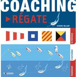
<h2>Regatta coaching to prepare, train and progress</h2>
<p>This manual Coaching regatta of <strong>Vagnon</strong> proposes a learning method thanks to a very visual, well explained and easy to understand guide to progress during regattas. In three major stages: getting ready (the right gestures), training (taking your first steps) and progressing (becoming an expert), you will know how to define the type of race you want to practice, choose your equipment, your boat and your course, learn the essential rules, refine your tactics and strategy by following the weather and currents, improve your driving and manoeuvres...</p>
<div class="productStrates__column productStrates__column--fixed">
<div class="productStrate advertisingStrate">
<div id="ad_9d1d5e22f27440" class="js-ad-slot f-ad"></div>
</div>
</div>
<h2>Characteristics of the Regatta Coaching</h2>
available

-
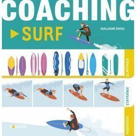
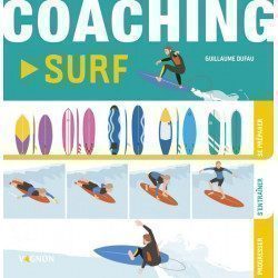
<h2 style="text-align:justify;">Vagnon Surfing Coaching</h2>
<p style="text-align:justify;">Are you ready to take the plunge and start surfing? You surf but you need to evolve in your learning ? Here is a simple and easy method, organized in three essential steps.</p>
<ul style="text-align:justify;"><li>Prepare for the right gestures to master the weather tools and the evolution of the forecasts, choose your surf spot, face the waves in a good physical condition and serenely.</li>
<li>Train with the different basic manoeuvres, from the first "foam" to the ducking technique, including paddling on the open sea, the take-off, the bottom-turn, and the roller.</li>
<li>Progress by experimenting with advanced maneuvers such as the late take-off, carving, tail-slide, cut-back, re-entry, floater, and sliding inside the tube, the queen of surfing.</li>
</ul><p style="text-align:justify;">And to go further, find out everything you need to know about surfing practices, equipment and material, regulations and priority rules, surfing ethics and eco-actions. Dare to go for it! Surf the wave!</p>
<h2 style="text-align:justify;">Details about the book Coaching surfing from Vagnon</h2>
available
-
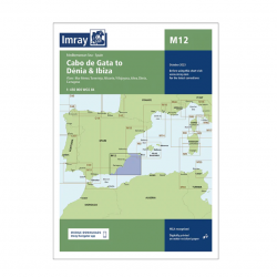
<h2>Imray Marine Chart M12 Cabo de Gata to Denia and Ibiza</h2>
<p>Plans included: Mar Menor (1:75 000) Torrevieja (1:20 000) Alicante (1:30 000) Villajoyosa (1:15 000) Altea (1:15 000) Dénia (1:25 000) Cartagena (1:15 000) This edition includes the latest official Instituto Hidrográfico de la Marina Digital, combined with additional information sourced from Imray's network to make it ideal for small craft. The chart has been fully revised throughout. The main panel has been rescaled to 1:450,000 for consistency with other M-Series charts in Mediterranean Spain. The plan of Mar Menor now provides coverage at an improved larger scale. A new plan of Cartagena has been added.</p>
<h2>Specifications of the Imray Marine Chart M12 Cabo de Gata to Denia and Ibiza</h2>
available
-
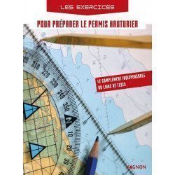
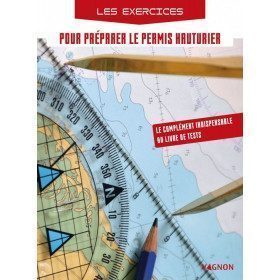
<h2>Exercises to prepare for the offshore licence</h2>
<p>This exercise book allows candidates to practice on exam subjects in accordance with the training program. This workbook is a must for anyone who wants to pass the offshore licence and be ready on D-day!</p>
<h2>Characteristics of the exercise book to prepare for the offshore licence</h2>
available