

Boat equipment
There are 859 products.
-
<p>Marine chart for coastal navigation. SHOM 7123 L - Molène Island - Ushant Island - Fromveur Passage - Scale 1:20000</p>
available


-
<p>Marine chart for coastal navigation. SHOM 7122 L - from Pointe Saint Mathieu to Four lighthouse - Scale 1:25000</p>
available

-
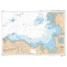
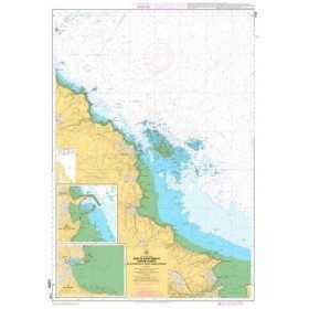
<p>Marine chart for coastal navigation. SHOM 7124 L - Bay of Lannion - from Pointe de Primel to Ile Grande - Scale 1:20000</p>
available
-
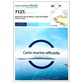
<p>Marine chart for coastal navigation. SHOM 7127 L - Bréhat Island - Paimpol Cove - Trieux Entrance. Scale 1:20000</p>
available
-
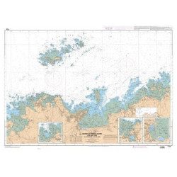
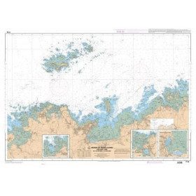
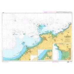
<p>Marine chart for coastal navigation. SHOM 7125 L - Approaches to Perros-Guirec - Scale 1:20000</p>
available
-
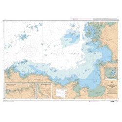
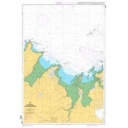
<p>Marine chart for coastal navigation. SHOM 7128 L - Bay of Saint Brieuc - from Pointe de la Tour to Yffiniac Cove. Scale 1:25000</p>
available
-
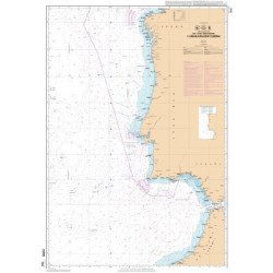
<p>Marine chart for coastal navigation. SHOM 7310 L - Bay of Saint Brieuc (eastern part) - from Dahouët to Cap Fréhel. Scale 1:25000.</p>
available
-
<p>Marine chart for coastal navigation. SHOM 7129 L - from Cap Fréhel to Saint Briac-sur-Mer - Scale 1:20000.</p>
available
-
<p>Marine chart for coastal navigation. SHOM 7130 L - Approaches to Saint Malo - from Hebihens Island to Pointe de la Varde - Scale 1:15000.</p>
available
-
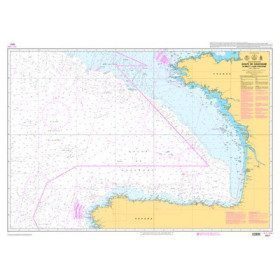
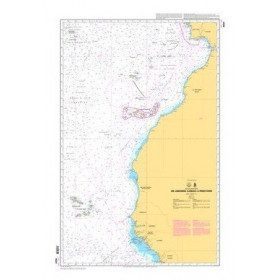
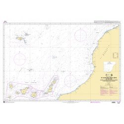
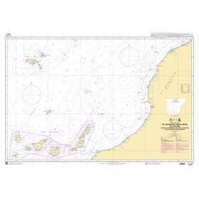
<p>Official SHOM chart - 7212 L - Cape Finisterre to Casablanca - Scale 1: 100000</p>
available
-
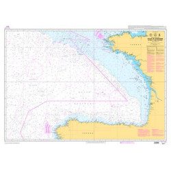
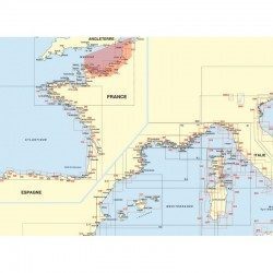
<p>Official SHOM chart - 7211 L - Bay of Biscay - from Brest to Cabo Finisterre.</p>
available
-
<p style="text-align:justify;">Marine map 7428L for your coasters and your discoveries of the Arcachon basin.</p>
available
-
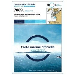
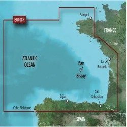
<p>Shom 7069 marine chart for cruising around Yeu, Ré and Oléron. Scale: 1:164800.</p>
available
-
<p style="text-align:justify;">Shom 7068 navigation chart for cruising between Quiberon and Les Sables d'Olonne. Scale: 1:162400</p>
available
-
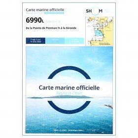
<p style="text-align:justify;">Shom 6990 marine chart for your navigations between Penmarc'h and the Gironde estuary. Scale: 1:355000</p>
available
-
<p style="text-align:justify;">Shom 7076 marine chart for cruising or racing from Saint Nazaire to Saint Malo. Scale: 1:350000</p>
available
-
<p style="text-align:justify;">Shom 7312 marine chart for your cruising or racing in the Eastern Channel. From Casquets to Pas-de-Calais. Scale 1:375000</p>
available

-
<p style="text-align:justify;">Shom marine chart essential to make a perfect transatlantic by following the great circle.</p>
available

-
<p style="text-align:justify;">Shom 6624 nautical chart for sailing along the Portuguese and African coasts. Ideal for the sailor who wishes to make a transatlantic crossing.</p>
available
-
<p style="text-align:justify;">Marine chart shom 7270 for navigations between Casablanca and Cape Jubi, and in the Madeira and Canary Islands area. Ideal for the sailor who wishes to make a transatlantic crossing.</p>
available
-
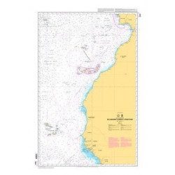
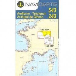
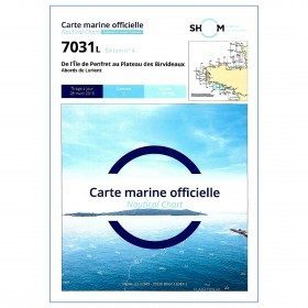
<p style="text-align:justify;">Shom marine chart for your cruises or regattas in Brittany. From Penfret island to the Birvideaux plateau via the outskirts of Lorient. Shom 7031. Scale: 1:50000.</p>
available
-
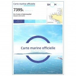
<h2 style="text-align:justify;">The SHOM 7395 L chart is the folded version of the chart for Le Croisic to Noirmoutier and the Loire Estuary.</h2>
<p style="text-align:justify;">Area covered: Le Croisic, Le Pouliguen, Pornichet, La Baule, Saint Nazaire, Saint Brévin, baie de Bourgneuf, L'Herbaudière. Scale 1:50300.</p>
available
-
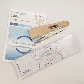
<h2><strong>The essential pack for passing professional maritime exams</strong></h2>
<p style="text-align:justify;">A set of quality tools to pass your professional maritime exams! Picksea is the owner of the Flash-Tide Instruments brand and our teams manufacture in France, in Lorient, all the models of cras or breton rulers. Picksea is also a SHOM agent. We are therefore the best able to provide you with a pack composed of the best products at the best price.</p>
<h2>Composition of the maritime exam pro pack</h2>
available

-
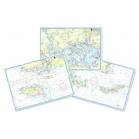
<h2 style="text-align:justify;">Waterproof nautical charts</h2>
<p style="text-align:justify;">Waterproof laminated nautical charts of the Atlantic that can be taken out in the cockpit. A3 format with a scale adapted to each sailing basin. Ideal for cruising or coastal regattas. Less cumbersome than traditional charts and very well thought out visually. Longer lasting for outdoor use in all conditions.</p>
<h2 style="text-align:justify;">Detailed characteristics of the charts</h2>
available

-
<h2>Waterproof nautical charts of the Mediterranean (France)</h2>
<p style="text-align:justify;">Waterproof nautical charts of the French Mediterranean coast that you can take out in the cockpit because they are waterproof. A3 format with a scale adapted to each sailing basin. Ideal for cruising or coastal regattas. Less cumbersome than traditional charts and very well thought out visually. Longer lasting for outdoor use in all conditions.</p>
<h2>Detailed characteristics of the charts</h2>
available
-
<h2>Waterproof nautical charts of Italy</h2>
<p style="text-align:justify;">Waterproof nautical charts of the Italian Mediterranean coast that you can take out in the cockpit because they are waterproof. A3 format with a scale adapted to each navigation basin. Ideal for cruising or coastal regattas. Less cumbersome than traditional charts and very well thought out visually. Longer lasting for outdoor use in all conditions.</p>
<h2>Detailed characteristics of the charts</h2>
available

-
<h2>Waterproof nautical charts of Spain</h2>
<p style="text-align:justify;">Waterproof nautical charts of the Spanish Mediterranean coast that can be taken out in the cockpit because they are waterproof. A3 format with a scale adapted to each sailing basin. Ideal for cruising or coastal regattas. Less cumbersome than traditional charts and very well thought out visually. Longer lasting for outdoor use in all conditions.</p>
<h2>Detailed characteristics of the charts</h2>
available

-
available
-
available

-
available
-
available
-
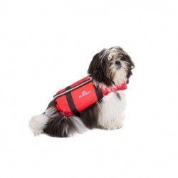
<p><span>Life vest for dogs</span></p>
<h2><span>Features of the dog vest</span></h2>
available
-
<div class="fiche-txt">
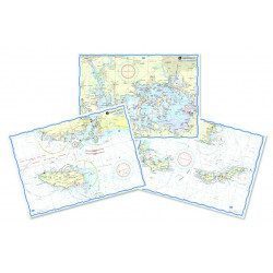
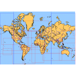
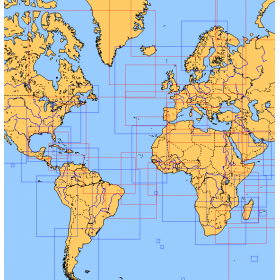
<h2>Choose from the list below an unfolded nautical chart covering the major sailing areas of the world</h2>
<p>These maps covering huge areas of navigation are frequently used as a decorative element or as a support to retrace a journey between continents. Choose in the list below the area you wish to explore by referring to the map number associated with the desired navigation area. Indicate the map number you have chosen in the comments of your order.</p>
<h2>List of references for charts and areas covered:</h2>
</div>
available
-
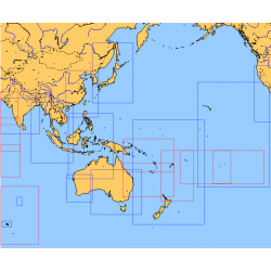
<div class="fiche-txt">
<h2>Choose from the list below an unfolded chart covering the sailing areas around Australia and South East Asia</h2>
<p>These maps detail the sailing areas of Australia, Oceania, and South East Asia. Frequently used as a decorative element or as a support to retrace a journey between continents. Choose from the list below the area you wish to explore by referring to the map number associated with the desired navigation area. Indicate the number of the map you have chosen in the comments of your order.</p>
<h2>List of chart references and areas covered:</h2>
</div>
available
-
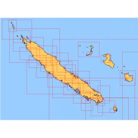
<div class="fiche-txt">
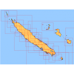
<h2>Choose from the list below an unfolded nautical chart covering the navigation areas around New Caledonia</h2>
<p>This set of charts covers the entire coastline of New Caledonia in unfolded Shom marine charts delivered in a tube. These maps detail precisely the navigation areas of the island. Choose in the list below the area you wish to explore by referring to the chart number associated with the desired navigation area. Indicate the map number you have chosen in the commentary of your order.</p>
<h2>List of chart references and areas covered:</h2>
</div>
available
-
<div class="fiche-txt">
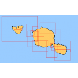
<h2>Choose from the list below an unfolded nautical chart of the sailing areas around Tahiti and the Society Islands</h2>
<p>This set of charts covers the whole of the Society Islands in unfolded Shom marine charts delivered in a tube. These charts detail the exact navigation areas of the islands. Choose from the list below the area you wish to explore by referring to the chart number associated with the desired navigation area. Indicate the map number you have chosen in the comments of your order.</p>
<h2>List of chart references and areas covered:</h2>
</div>
available
-
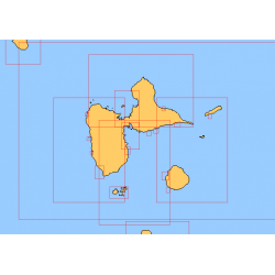
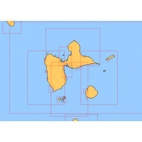
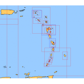
<div class="fiche-txt">
<h2>Choose in the list below a marine map of the surroundings of Guadeloupe</h2>
<p style="text-align:justify;">These SHOM charts cover all the navigation areas around Guadeloupe: from the Saintes to Marie-Galante and la Désirade as well as the Petit and Grand Cul de Sac Marin and the leeward coast, Saint François and Sainte Anne. If you need to reach Pointe à Pitre and the Gosier marina, you should choose the map of the Pointe a Pitre roadstead and the salt river. The Shom L type charts are more adapted to the yachtsman because they are folded in A4 format and thus easier to store in a chart table. They detail precisely the navigation areas of the coasts and islands surrounding Guadeloupe. To order, choose from the list below the area you wish to explore by referring to the map number associated with the desired navigation area. Indicate the map number you have chosen and the option "folded" or "flat".</p>
<h2>List of chart references and areas covered:</h2>
</div>
available
-
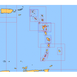
<div class="fiche-txt">
<h2>Choose from the list below a chart covering the sailing areas around the Caribbean Arc and the Caribbean Sea</h2>
<p>This set of charts covers all the sailing areas from Venezuela to Cuba, including all the islands of the Caribbean Arc. These Shom marine charts type L are more adapted to the yachtsman because they are folded in A4 format, easier to store in a yachting chart table. These charts detail precisely the sailing areas of the surrounding islands of the West Indies. Choose from the list below the area you wish to explore by referring to the chart number associated with the desired sailing area. Indicate the map number you have chosen and whether you want to sail flat or folded.</p>
<h2>List of chart references and areas covered:</h2>
</div>
available
-
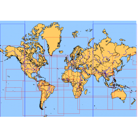
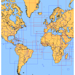
<div class="fiche-txt">
<h2>Choose from the list below an unfolded chart covering the sailing areas around the North and South Atlantic and the Indian Ocean</h2>
<p>These charts detail the sailing areas centered on the North and South Atlantic, the macro sailing areas of North and South America, Western Europe, Western Africa and the Indian Ocean. Delivered unfolded in a transport tube, these charts will serve as a support to trace your journey between continents. Choose from the list below the area you wish to explore by referring to the map number associated with the desired navigation area. Indicate the map number you have chosen in the comments of your order.</p>
<h2>List of chart references and areas covered:</h2>
</div>
available
-
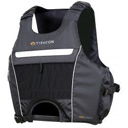
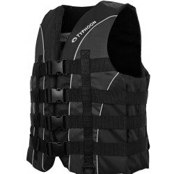
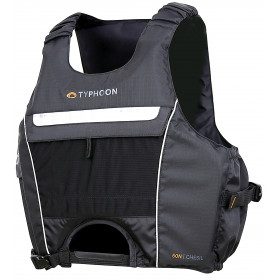
<h2>Chesil 50 newtons vest by Typhoon</h2>
<p>50N buoyancy aid vest, specially designed by Typhoon for active, speed practices, such as dinghy, catamaran, kitesurf. The Chesil vest combines a short, ergonomic cut with an optimal design in terms of safety. Its wide armholes allow you to keep all your freedom of movement. Its soft, high-performance PVC foam and ripstop fabric make it comfortable and easy to wear throughout your water sports session. Its front opening is designed for trapeze belts or kite or surf harnesses.</p>
<h2>Characteristics of the Chesil 50 N vest</h2>
available
-
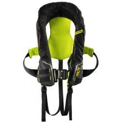
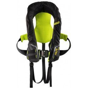
<h2>Automatic lifejacket SLR 196 with harness :</h2>
<p><span style="color:#58585a;font-family:Montserrat, sans-serif;font-size:14px;background-color:#ffffff;">Lightweight, comfortable, and high performance, the SLR 196 Newtons, with harness and double crutchstrap, has all the assets to be chosen by Sailors or the sailing elite.</span></p>
<h2><span style="color:#58585a;font-family:Montserrat, sans-serif;font-size:14px;background-color:#ffffff;">Caracteristics of the Automatic lSLR196 lifejacket :</span></h2>
available
-
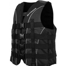
<h2>Vest SOLVA 50N, from Typhoon, designed for ski, wakeboard, jet-ski</h2>
<p>The SOLVA 50N vest is specially designed by Plastimo and Typhoon for towed sports or jet-skiing. Its high impact resistance foam, its 4 buckles closure with adjustment, its ring to attach the circuit breaker, make it a practical, reliable vest, while remaining comfortable and easy to put on and take off. Its fabric is soft but very resistant. The Solva vest is the vest that offers excellent value for money, comfort, reliability and safety.</p>
<h2>Features of the SOLVA 50N Ski vest</h2>
available
-
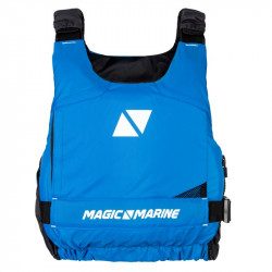
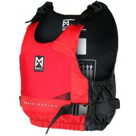
<div class="fiche-txt">
<h2>A buoyancy aid vest without zip to put on</h2>
<p>This lifejacket meets the requirements of the CE ISO 12402-5 standard. It does not have a zip and is easy to put on.</p>
<h2>Discover the Magic Marine 2018 range without further ado</h2>
<p>Do not hesitate to discover all our models of wetsuits, jackets, bags and accessories Magic Marine which works for the comfort and the performance of the sportsmen, professionals and amateurs by proposing them highly qualitative products.</p>
<h2>Characteristics of the Magic Marine Wave Szip buoyancy aid vest</h2>
</div>
available
-
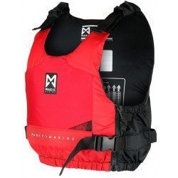
<div class="fiche-txt">
<h2>A buoyancy aid vest without zip to put on</h2>
<p>This lifejacket meets the requirements of the CE ISO 12402-5 standard. It does not have a zip and is easy to put on.</p>
<h2>Characteristics of the Magic Marine Wave Szip buoyancy aid vest</h2>
</div>
available
-
available
-
available
-
available

-
available


Showing 769-816 of 859 item(s)