available


Detailed features

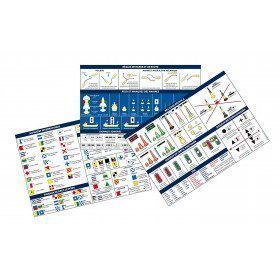
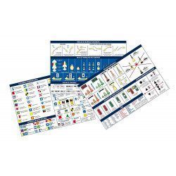
Adhesive Marine Code A5 Maritime Flags and Regattas
The flags for boats adhesive sheet displays the essential international maritime flag signage in the rules of navigation. It also contains all the official flags used in regattas.
Characteristics of the Maritime Flags and Regattas Code
The Adhesive board for Maritime flags and regattas for boat displays most of the international maritime flag signage in the sailing rules. It also contains all the official flags used in regattas.
The stickers are printed on a very strong and flexible substrate.
- Size of each sheet: A5 (21 x 15 mm)
- MYLAR support
- Quadricolour Edition
In the same category
4 other products seleted for you-
<h2>Code Marin réglementaire bateau : Pack of 3 A5 adhesive sheets</h2>
<p>The regulatory marine code in 3 self-adhesive sheets RIPAM / Buoyage / Flags gathers the essential of the international maritime regulations for pleasure boating. A5 format, easier to put on board. <span style="color:#ff0000;"><strong>CONFORMS TO D240</strong></span></p>
<h2>Characteristics of the Marine Code in a pack of 3 A5 sheets</h2>
available

-
<div class="fiche-txt">
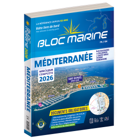
<h2>Indispensable on board : Bloc Marine Méditerranée 2025</h2>
<p style="text-align:justify;">Truly the bible of any sailor, the Mediterranean Marine Block 2025 edition allows you to have all the regulatory documents for the safety of the boat essential on board. A complete update of the mandatory 2025 regulations has been made. In this edition, you will also find <span>a special section devoted to new technologies: "electronics - equipment - home automation".</span>. The descriptions of the ports in WGS84 and the maps are updated every year and allow you to save precious time to reach the port safely. A complete atlas is also included in this Mediterranean 2025 Marine block. The marine and coastal blocks offer a real documentation for your sea excursions. So, find the whole collection of regulatory boat equipment on Picksea, your online shop for marine books.</p>
<h2>Detailed summary of the Mediterranean Sea Block 2025</h2>
</div>
available

-
<div class="fiche-txt">
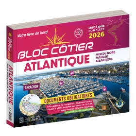
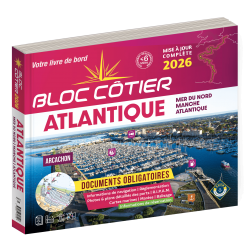
<h2>Indispensable for sailing within 6 miles from a shelter: the Atlantic 2025 Bloc Cotier !</h2>
<p style="text-align:justify;">The Atlantic 2025 bloc cotier is a smaller work than the Marine block, bringing together all the compulsory and regulatory elements on board a boat for coastal sailing, i.e. within 6 miles of a shelter according to the regulations in force. It also offers you access to all the essential documents on board, such as port descriptions and updated maps. With even more photos, the coastal block also includes a complete atlas. The mandatory regulations for 2025 have also been completely updated.</p>
<h2>Detailed summary of the Atlantic Bloc Cotier 2025</h2>
</div>
available
-
<div class="fiche-txt">
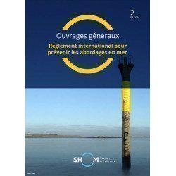
<h2>The International Regulations for Preventing Collisions at Sea. </h2>
<p>This book will help you to know the international regulations to prevent collisions at sea (or RIPAM in french). <span>This document contains all the rules set out in the International Regulations for Preventing Collisions at Sea, 1972, as amended from time to time.</span></p>
<h2>All the Shom's regulatory works on our website</h2>
You can find on Picksea.com all the regulatory books of the Shom, like the good uses of the nautical documents 1F, or the book on the maritime signalling 3C.</div>
available