")
")
")
Detailed features

A5 adhesive marine code Maritime buoyage
The A5 sticky marine code for ships Buoyage region A (Europe, Africa, Asia, Oceania) displays the essential navigation rules concerning the buoys in maritime navigation. It can replace the compulsory document on Buoyage. CONFORMS TO D240
Characteristics of the Marine Code Maritime buoyage
The adhesive marine code for boats Beaconing region A (Europe, Africa, Asia, Oceania) displays the essential navigation rules concerning beacons in maritime navigation. It can replace the mandatory document on the RIPAM on board in basic or coastal navigation (according to the provisions of division 240*).
The A5 format of the adhesive allows it to be easily placed on board the boat outside or in the cabin.
Extract from Division 240 (version applicable on June 1, 2019) - Article 240-2.04: coastal armament and safety equipment for recreational vessels sailing from 2 to less than 6 miles from a shelter.
.../...
8. A document describing the marking system of the area frequented, possibly in the form of self-adhesive plates ...
- Size of each sheet: A5 (21 x 15 mm)
- MYLAR support
- Quadricolour Edition
In the same category
4 other products seleted for you-
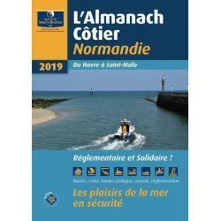
<div class="fiche-txt"><h2>The indispensable tool for the Breton sailor: The Normandy Coastal Almanac 2019</h2><p style="text-align: justify;">A true bible or Swiss Army knife for professional and amateur sailors. The Normandy Coastal Almanac contains all the necessary and indispensable information for the smooth running of your trips in this region. This reference book is very complete since it contains information on many ports <span>of the English Channel as well as meteorological information such as tide times. Much more than a simple navigation guide, this almanac has for main objective to help the families of sailors in need.</span></p><h2>Detailed features of the Normandy coastal almanac</h2></div>
available
-
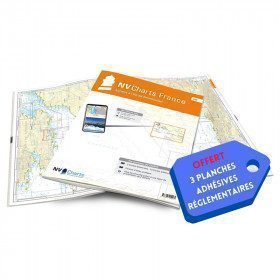
<h2>NV-CHARTS FR6 - 36 charts of South East Brittany (from Lorient to Noirmoutier) + the 3 regulatory adhesive sheets</h2>
<p><span style="font-size:10pt;">In this NV-Charts FR6 pack, you will find an Atlas of <span>36 charts of South Brittany from Lorient to Noirmoutier including 3 offshore charts, 13 coastal charts and 20 detailed charts</span>. With a personal download code, you will have access to all the maps in digital format as well as the <strong>NV Graphical Navigator light navigation software</strong> both freely usable on PC, tablets or smartphone!</span></p>
<p><span style="font-size:10pt;">The areas represented are: <strong>South Brittany - Lorient, Etel, Belle-Île, Baie de Quiberon, La Trinité, Golfe du Morbihan, Vannes, Auray, Houat, Hoedic, La Vilaine, Piriac, La Turballe, Le Croisic, La Baule, Pornichet, Saint Nazaire, Nantes, Pornic, Noirmoutier (FRANCE)</strong></span></p>
<p><strong><span style="font-size:10pt;"><span style="color:#ff0000;">Free with your FR6 pack:</span> 3 adhesive sheets containing the mandatory regulatory documentation (RIPAM, buoys and flags) for navigation in coastal areas (art 242-2.04 of Division 240). <span style="color:#ff0000;">When you buy your pack, you have all the regulatory documentation for sailing within 6 miles of a shelter.</span></span></strong></p>
<h2>Description of the FR6 card pack</h2>
available
-
<div class="fiche-txt">
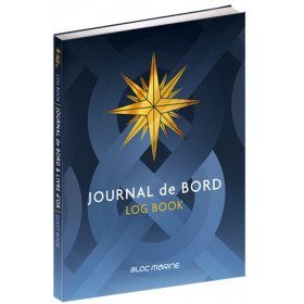
<h2>The logbook for your boat!</h2>
<p style="text-align:justify;">Here is the logbook / guestbook of the Bloc Marine brand, a luxury bound edition of 128 pages, printed in four-colour process on high quality paper. This logbook, which is compulsory on board for voyages beyond 6 miles from a shelter, is the essential element for noting and relating all the events of your navigation: safety, weather observations, route information, ship's conduct, positions and technical remarks, life on board. It also contains 12 pages of information and advice on navigation and weather.</p>
<p style="text-align:justify;">Its guest book allows you to keep all the memories of your navigations.</p>
<h2>Characteristic of the logbook of BLOC MARINE:</h2>
</div>
available
-
<div class="fiche-txt">
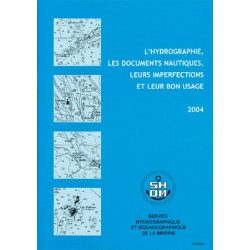
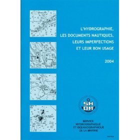
<h2>All the good uses of nautical documents in a dedicated book</h2>
<p>This book will give you a complete overview of hydrography and nautical records with their imperfections and proper use.</p>
<h2>All Shom's regulatory books on Picksea.com</h2>
You can find on our site all the regulatory works of the Shom, such as the International Regulations for Preventing Collisions at Sea 2A and 2B, or the work 3C on maritime signalling.</div>
available