

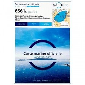
Offshore charts
Offshore charts allow you to plan, prepare and follow an offshore navigation or a crossing. They are represented by folded or rolled paper charts at scales ranging from 1:1,150,000 to 1:750,000. Road charts cover a large area and do not contain detailed symbols. Offshore charts allow you to choose your routes and consider your options. They contain important traffic lights as well as distances between potential ports of call. The charts are in A1 format and can be folded to 15 x 30 cm. Discover our selection!
WHY SHOULD YOU PLAN AN OFFSHORE ROUTE?
Planning an offshore or deep-sea voyage is above all a way of anticipating hazards, in particular those linked to future weather conditions, and of forecasting the boat's route according to the direction of the wind and the swell: this is called 'routing'. The fact of studying and planning it for a 24 to 72 hour sail is called "passage planning". It also allows you to plan the shelters and ports of diversion and to prepare detailed maps of the approaches to these ports. The use of a paper chart, such as the NV-Pilot marine charts, has the advantage of allowing a global vision of the route during the preparation. Preparing for offshore sailing therefore requires knowing how to use your marine chart. To do this, our teams reveal all their advice for how to read your chart
FOR ASTRONOMICAL NAVIGATION
If you are interested in traditional navigation and in particular in astronomical navigation, the nV-Pilot charts are particularly well suited to transferring your points calculated from measurements on your sextant whether it is a point on the sun or a star point. As a reminder, the knowledge of the realization of a point with the sun is particularly useful when you do not have on board alternative electronic positioning means to the main means.
PICKSEA AGENT AGRÉE PAR LE SHOM
The SHOM (Service Hydrigraphique et Océanographique de la Marine) is a specific establishment of the French Navy. Its main mission is to measure bathymetry and to design nautical charts. The establishment also distributes a certain number of nautical documents useful in navigation such as the buoys, the current charts or the RIPAM... Picksea is an Authorized Agent of SHOM. Therefore we can offer you all the publications of the latter. In order to navigate safely, it is necessary to have the best information in order to repair yourself in the maritime space and to choose your route. Find the complete range of nautical charts SHOM dedicated to the exams (offshore licence) or merchant marine. Also very appreciated by the sailors, we propose you a selection of laminated navigation charts. These nautical charts can be taken out at any time, not fearing the water. With a scale adapted to each navigation basin, they are ideal for cruising or coastal regattas. Less cumbersome than traditional charts, they are also very well thought out visually
CHARTS FROM ALL OVER THE WORLD ON DEMAND ON PICKSEA.COM
Discover and plan your next sailings with a wide choice of charts on areas all over the world . From the North Sea to the Mediterranean Seato the North Brittany and South, find more than 100 navigation charts on our online shop. The Azores, Madeira or the Cape Verde Islands... Go for it! atlantic crossing ! If you are looking for a nautical chart of SHOM or a chart of a particular navigation area, contact us. Let us know the chart(s) of your choice and we will order it for you!
Read more
There are 17 products.
-
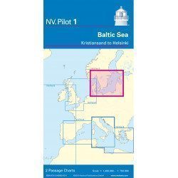
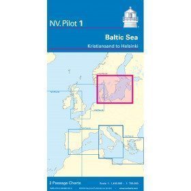
<h2>Baltic Sea Offshore Marine Chart</h2>
<p>The NV Pilot 1 offshore chart covers the Baltic Sea area from Kiel to Oslo on the front and the area from Skagerak (Flekkefjord) to Helsinki on the back.</p>
<h2>Details on the NV Pilot 1 - Baltic Sea map</h2>
available

-
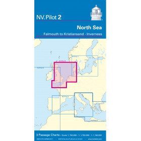
<h2>North Sea Offshore Marine Chart</h2>
<p><span>The NV Pilot 2 offshore chart covers the North Sea from Dover to Helgoland and Doggerbank in the North and the English Channel from Falmouth/Ushant to Dover on the front. On the reverse side, the area covers Great Yarmouth to Skagen, Inverness and the southern coast of Norway.</span></p>
<h2>Details on the NV Pilot 2 - North Sea map</h2>
available

-
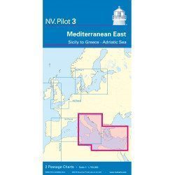
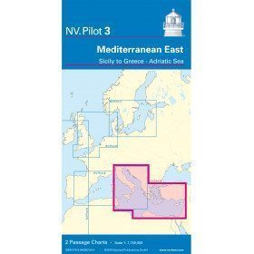
<h2>East Mediterranean Offshore Marine Chart</h2>
<p><span>The NV Pilot 3 offshore chart covers the Eastern Mediterranean: on the front side the Tyrrhenian Sea, the Adriatic Sea, the Ionian Sea and the region of Sicily up to the coast of Tunisia. The reverse side covers the Mediterranean Sea up to longitude 17°E</span></p>
<h2>Details on the NV Pilot 3 map - East Mediterranean</h2>
available
-
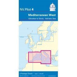
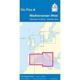
<h2>West Mediterranean Offshore Marine Chart</h2>
<p><span>The NV Pilot 4 offshore chart covers the western Mediterranean: the front side covers the Tyrrhenian Sea, the Adriatic Sea, the Ionian Sea and the region from Sicily to the coast of Tunisia. The reverse side covers the Mediterranean from Gibraltar to Palermo (Sicily)</span></p>
<h2>Details on the NV Pilot 4 map - West Mediterranean</h2>
available
-
<p style="text-align:justify;">Shom 7076 marine chart for cruising or racing from Saint Nazaire to Saint Malo. Scale: 1:350000</p>
available
-
<p>Shom marine chart 6821L. Nice to Piombino. Scale: 1:250000.</p>
available
-
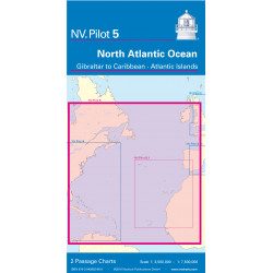
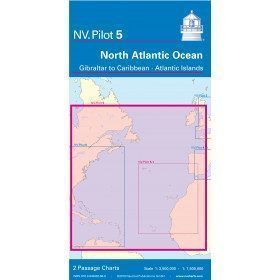
<h2>North Atlantic Offshore Marine Chart | Transatlantic</h2>
<p><span>The NV Pilot 5 offshore chart covers the North Atlantic from Europe to the Caribbean and on the reverse side, an area covering the Atlantic islands: Cape Verde Islands, Canary Islands, Madeira and Azores. The ideal map to prepare a transatlantic voyage.</span></p>
<h2>Details on the NV Pilot 5 map - North Atlantic | Transatlantic</h2>
available
-
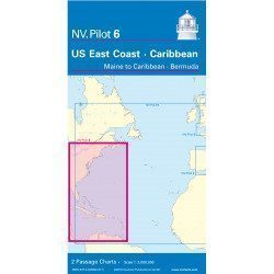
<h2>Offshore Caribbean and East Coast of America Marine Chart</h2>
<p style="text-align:justify;">The NV Pilot 6 offshore chart covers: on the front, the Caribbean with the Bahamas, the Caribbean, the North Coast of South America, Panama, the East Coast of the USA and on the back, the East Coast of the USA from Nova Scotia to Florida and Bermuda.</p>
<h2>NV Pilot 6 Map Details - Caribbean and Eastern Seaboard</h2>
available
-
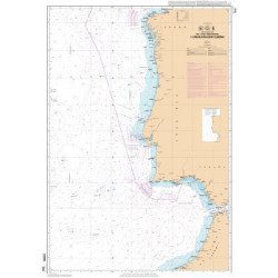
<p>Official SHOM chart - 7212 L - Cape Finisterre to Casablanca - Scale 1: 100000</p>
available
-
<p style="text-align:justify;">Shom marine chart essential to make a perfect transatlantic by following the great circle.</p>
available

-
<p style="text-align:justify;">Shom 6624 nautical chart for sailing along the Portuguese and African coasts. Ideal for the sailor who wishes to make a transatlantic crossing.</p>
available
-
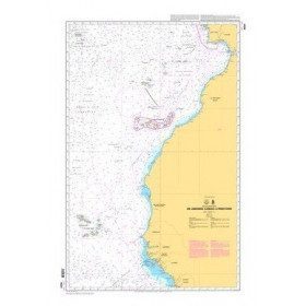
<p>Official SHOM chart - 7211 L - Bay of Biscay - from Brest to Cabo Finisterre.</p>
available
-
<h2>Atlantic Zone Sea Card Packs</h2>
<p>The nv-charts are characterized by fine contours and easy to distinguish colour graduations of the depth lines: turquoise for coral reefs, red for the 2-metre line and blue for the 5-metre zones. Presented in a practical and user-friendly format (A3 closed and A2 open), a thick plastic envelope protects the charts, making them easy to store. The importance of a good graphic representation of the topography when navigating the Atlantic is essential.<br /><br />Well-marked rivers, towns and street maps all contribute to a clear overview of the islands' waterfront facilities. Red numbered waypoints with coordinates based on WGS 84 allow mariners to navigate with their GPS instruments. Heights and depths are shown in the internationally recognized metre format. Large-scale approaches and land contour markings simplify entry into anchorages.</p>
<h2><span style="color:#ff0000;">Picksea is Premium Reseller of NV-Charts</span></h2>
<h2>NV-Charts Atlantic Zone Marine Card Packs Features</h2>
available

-
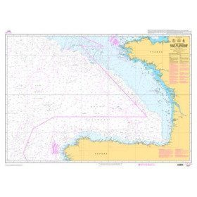
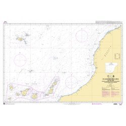
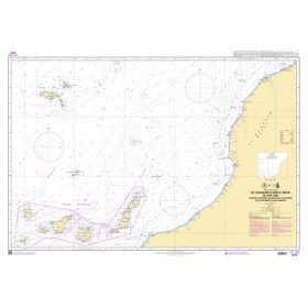
<p style="text-align:justify;">Marine chart shom 7270 for navigations between Casablanca and Cape Jubi, and in the Madeira and Canary Islands area. Ideal for the sailor who wishes to make a transatlantic crossing.</p>
available
-
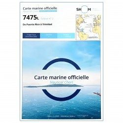
<p style="text-align:justify;">SHOM 7475L folded nautical chart. Centered on the Caribbean Arc area from Puerto Rico to Trinidad. Scale : 1:1000000</p>
available
-
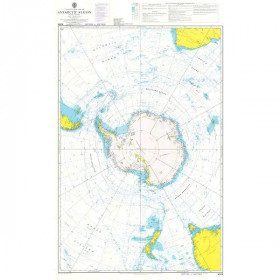
<h2 style="text-align:justify;">Admiralty Marine Map of the Antarctic Region</h2>
<p style="text-align:justify;">One of the only nautical chart references including the entire Antarctic. It will appeal to Vendée Globe fans who will be able to follow their favourite candidates around the Antarctic continent with a gnomonic projection instead of the classic Mercator projection which cannot be used in latitudes above 70° N or S.</p>
<h2 style="text-align:justify;">Characteristics of the Admiralty map of Antarctica</h2>
available

-
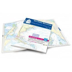
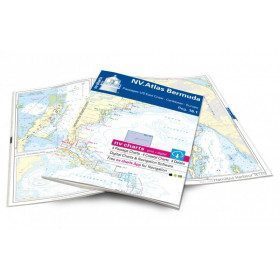
<h2>Atlas of Bermuda and Transatlantic charts return</h2>
<p style="text-align:justify;">Discover the pink beaches of Bermuda and prepare your transatlantic return with this atlas! Nautical charts for Bermuda and transatlantic sailing to Europe. 4 general charts, 4 coastal charts and 4 detailed charts are included. Size 30x42cm, bound in atlas form. In English language. The set includes a download code for all digital maps of the region. The digital maps can be used on our NV Charts app with a smartphone and tablet (Apple, iOS/MacOSX, Android, Windows 7/8).</p>
<h2 style="text-align:justify;">Features of the NV-Charts 16.1 Atlas</h2>
available


Showing 1-17 of 17 item(s)