


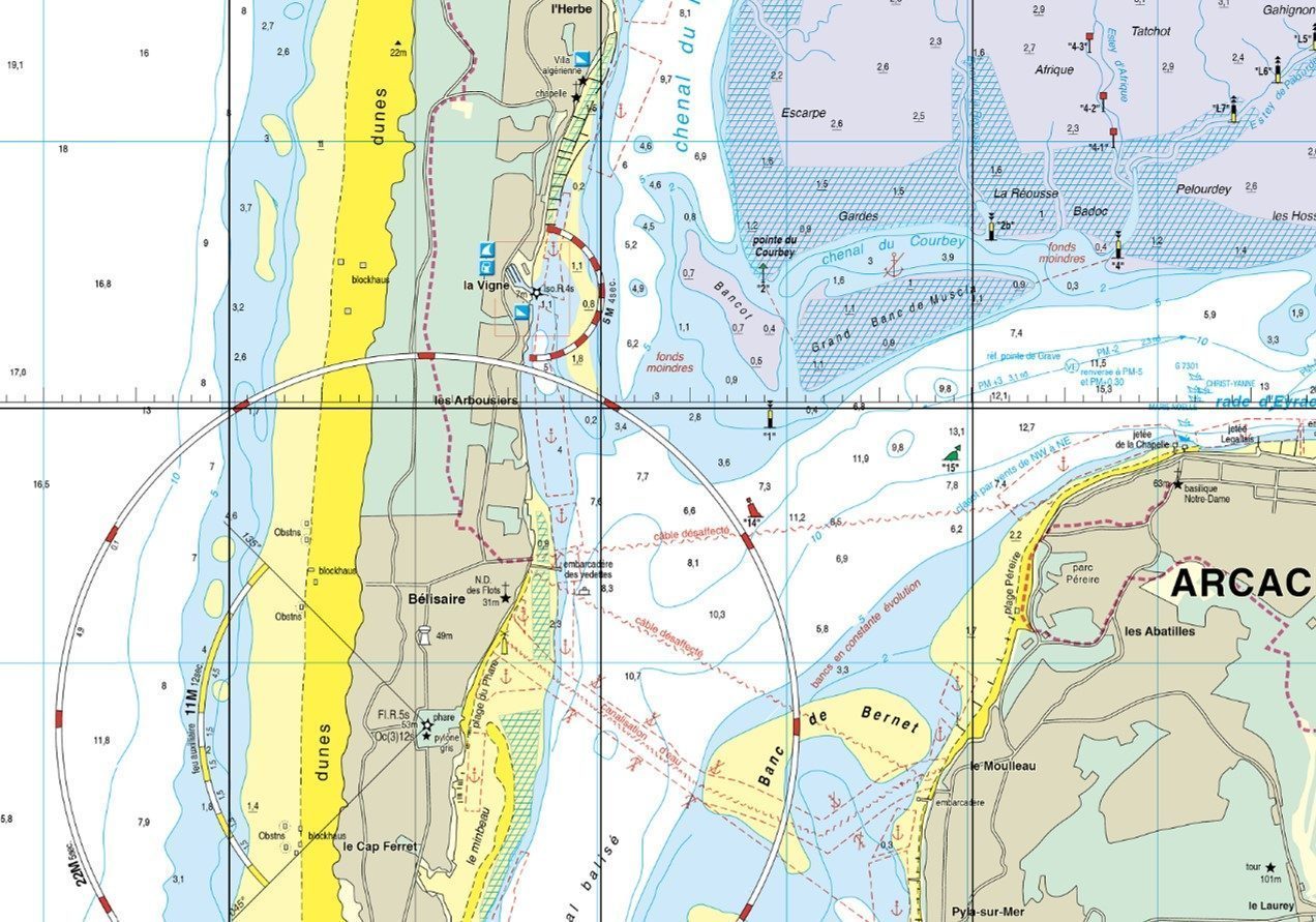
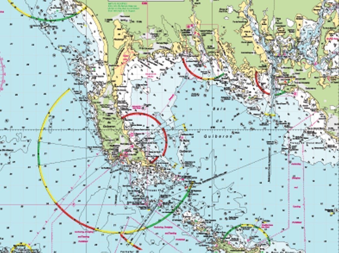
Sea Map: Understanding the colours of the sea floor

The three zones of the nautical chart in three colours:
Land
The land has a light brown/beige colour: it is represented up to the limit of the high tide.

Foreshore
The foreshore is green: the foreshore is the part that covers and uncovers with the tide. It is represented up to the limit of the low water of spring t ides, also called Hydrographic Zero*
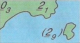
Sea
The sea is represented in a gradient of blue to white going from the darkest shallowest depths to the lightest or whitest deepest depths

The colors defined above are those of the international standards defined in particular in the 1D Book of SHOM on the symbols of marine charts. However, some publishers offer variations:
The SHOMAs the National Hydrographic Service, the colour standards described above are strictly adhered to.
NV-Charts also follows the same colour standards
Navicarte, on the other hand, uses many more colours: for example, on land, wooded areas are green and inhabited areas are grey-green. On the foreshore: muddy areas are pinkish grey while sandbanks are yellow.
Imray has also defined a different colour range: this land is green, the foreshore is yellow and the sea colours go from white in the shallowest depths to blue in the deepest depths (inverse of the SHOM and NV-Charts)
* The chart datum (or chart datum) is the reference level for reference level for nautical charts and tide books. Chart datum is close to the lowest water level (coefficient 120). This choice is convenient, because the navigator is assured of having at least as much water as indicated on the chart, regardless of the tidal range (except for meteorological effects).
Linked products