

IMRAY Guides
Find in this category a selection of IMRAY guides proposed by the prestigious English publishing house IMRAY. You will surely find what you are looking for among the proposed books: Turkey and Cypruss, the Channel Islands, Spain and Portugal, the Channel or the Corsica and Sardinia !
There are 14 products.
-
<p>Guide from the prestigious English publishing house IMRAY, world reference in the field of marine cartography. This guide covers the areas of Greece and the Ionian Sea, Ionian Islands, Peloponnese, Gulf of Corinth, Crete, Athens. Edition of 23/04/2012</p>
available

-
<p>A guide from the prestigious English publishing house IMRAY, a world reference in the field of marine cartography. This guide covers the areas of Turkey and Cyprus, from the Black Sea to the Syrian border. </p>
available
-
<h2>Prepare your navigation with this navigation guide!</h2>
<p>This navigation guide: "<strong>Grenada to the virgin islands</strong>" is the English edition of Jacques Patuelli's "Guide to the Lesser Antilles". It is a reference book for those who wish to discover the West Indies by boat. It describes with detail and precision the ports, marinas and numerous anchorages. The presentation of this navigation guide is clear and detailed, there are many photos that complement the maps and plans.</p>
<p>For each port, island or bay: description (location with waypoint, hazards, lights, maps, radio contacts, harbour master's office), cartography, approach (day and night), mooring and anchorage, equipment and services, shore visits, history.</p>
<h2>Detailed features of the "Grenada to the virgin islands" navigation guide</h2>
available
-
<p>Guide from the prestigious English publishing house IMRAY, a world reference in the field of marine cartography. This guide covers Morocco, Algeria, Tunisia, Gibraltar, Libya, Pantelleria, the Pelagie Islands and Malta. Edition of 03/12/2012</p>
available

-
<h2>Prepare your navigation with this navigation guide!</h2>
<p>This navigation guide: "Adriatic Sea - Albania, Montenegro, Bosnia, Croatia, Slovenia, Italy" describes the ports, marinas and numerous anchorages in detail. The presentation of this navigation guide is clear and detailed, with many photos to complement the maps and plans.</p>
<p>For each port, island or bay: description (location with waypoint, hazards, lights, maps, radio contacts, harbourmaster's office), cartography, approach (day and night), mooring and anchorage, equipment and services, shore visits, history.</p>
<p>The guide covers the coasts of Albania, the Dalmatian coast, the coasts of Montenegro, Croatia and Slovenia, and the east coast of Italy from the Slovenian border to Santa Marica di Leuca.</p>
<h2>Detailed features of the Channel Islands Sailing Guide</h2>
available
-
<p>Guide from the prestigious English publishing house IMRAY, a world reference in the field of marine cartography. This guide covers the areas of Italy: From San Remo to Brindisi, Sicily and Malta. Edition of 03/12/2012</p>
available

-
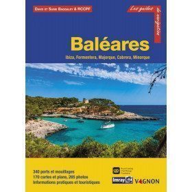
<h2>Prepare your navigation with this navigation guide!</h2>
<p>This sailing guide: "Balearic Islands - Ibiza, Formentera, Mallorca, Cabrera, Menorca" describes the ports, marinas and numerous anchorages in detail and with precision. The presentation of this navigation guide is clear and detailed, with many photos to complement the maps and plans.</p>
<p>For each port, island or bay: description (location with waypoint, hazards, lights, maps, radio contacts, harbour master's office), cartography, approach (day and night), mooring and anchorage, equipment and services, visits on land, history.</p>
<p>This guide covers the coasts of Ibiza, Formentera, Majorca, Cabrera and Menorca.</p>
<h2>Detailed features of the Balearic Sailing Guide</h2>
available

-
<p>Guide from the prestigious English publishing house IMRAY, world reference in the field of marine cartography. This guide covers the areas from Brest to Hendaye. </p>
unavailable
-
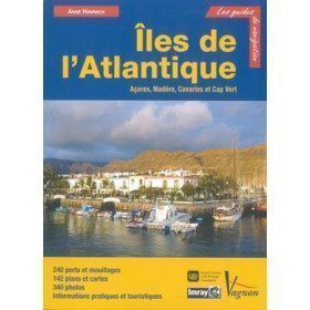
<p>Guide from the prestigious English publishing house IMRAY, a world reference in the field of marine cartography. This guide covers the Azores, Madeira, the Canaries and Cape Verde.</p>
unavailable
-
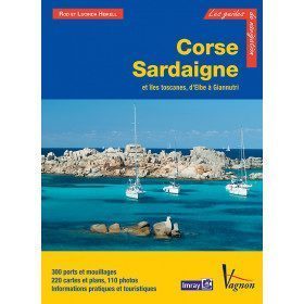
<p>Guide from the prestigious English publishing house IMRAY, world reference in the field of marine cartography. This guide covers the areas of Corsica, Sardinia, the Tuscan Islands, from Elba to Giannutri. Edition of 23/04/2012</p>
available
-
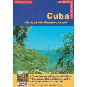
<p>Guide from the prestigious English publishing house IMRAY, a world reference in the field of marine cartography. This guide covers the Cuba areas. Edition of 01/01/2001</p>
available
-
<p>New edition of the famous IMRAY Guide to the Mediterranean coast. This guide covers the areas from Cerbére to Menton. July 2013 edition</p>
unavailable
-
<div class="fiche-txt">
<h2>The famous Imray work along the Cantabrian coast</h2>
<p>A guide from the prestigious English publishing house IMRAY, a world reference in the field of marine cartography. This guide covers the areas from the south-west of France to the north Spanish coast. You can only be amazed by the beauty of the photos and the accuracy of the information given.</p>
<h2>Detailed features of the Imray Cantabrian Coast Guide</h2>
</div>
available
-
<h2>Prepare your navigation with this navigation guide!</h2>
<p>This sailing guide: "The Scilly Islands - Pearls of Cornwall" describes in detail the ports, marinas and numerous anchorages. The presentation of this sailing guide is clear and detailed, with many photos to complement the maps and charts.</p>
<p>For each port, island or bay: description (location with waypoint, hazards, lights, maps, radio contacts, harbour master's office), cartography, approach (day and night), mooring and anchorage, equipment and services, shore visits, history.</p>
<h2>Detailed features of the Isles of Scilly Navigation Guide</h2>
available


Showing 1-14 of 14 item(s)