

available


In the same category
4 other products seleted for you-
available

-
<div class="fiche-txt">
<h2>An offshore life raft adapted to OSR requirements</h2>
Be aware that it is mandatory to have a liferaft when sailing beyond 6 miles from a shelter. This liferaft meets the required specifications of the "offshore" category of the Division 240 of May 1st 2019. This model meets the requirements of the ISAF racing regulations categories 1&2, OSR 4.20.2 (d) i-iv, and the ISO 9650-1A standard. <br />
<div class="fiche-txt">The raft has a boarding ramp with a handle inside to make access easier. A large surface floating anchor is included, inflation is possible at -15°, the bottom is double and insulating. For good visibility, an external lamp and retro-reflective strips are placed on the raft.</div>
<div class="fiche-txt"></div>
<div class="fiche-txt">The armament included is the FULL armament (+ 24h). For the revision of your raft, we can take care of it, you will just have to bring it to us.</div>
<div class="fiche-txt"></div>
<h2>The characteristics of the Plastimo Transocean OSR raft</h2>
</div>
available

-
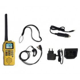
<h2>RT411 Portable VHF PACK with charger, cable and headset</h2>
<p>The Navicom RT411 Portable VHF Pack comes with a 220V charger, USB charger and a headset. This VHF is very easy to use, compact, robust and reliable. Waterproof IPX6 and floating, it has a battery life of about 6 hours. It will accompany you in all your navigations!</p>
<h2>Features of the VHF RT411 Navicom pack</h2>
available

-
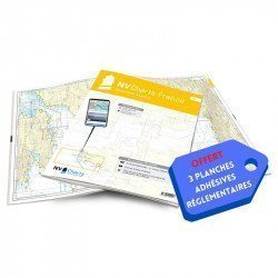
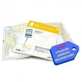
<h2>NV-CHARTS FR9 - 70 Mediterranean Sea charts (from Cap Creus to Toulon) + the 3 regulatory adhesive sheets</h2>
<p><span style="font-size:10pt;">In this NV-Charts FR9 pack, you will find an Atlas of <span>70 Mediterranean charts from Cap Creus to Toulon including 3 offshore charts, 14 coastal charts and 53 detailed charts</span>. With a personal download code, you will have access to all the maps in digital format as well as the <strong>NV Graphical Navigator light navigation software</strong> both freely usable on PC, tablets or smartphone!</span></p>
<p><span style="font-size:10pt;">The areas represented are: <strong>Mediterranean - Port Vendres, Leucate, Canet, Port La Nouvelle, Gruissan, Cap d'Agde, Palavas, Port Camargue, La Grande Motte, Martigue, Carry, Marseille, Calanques, Cassis, La Ciotat, Saint Cyr, Bandol, Toulon (FRANCE)</strong></span></p>
<p><span style="font-size:10pt;"><span style="color:#ff0000;"><strong>Free with your FR9 pack:</strong></span> 3 adhesive sheets containing the mandatory regulatory documentation (RIPAM, buoys and flags) for navigation in coastal areas (art 242-2.04 of Division 240). <span style="color:#ff0000;"><strong>When you buy your pack, you have all the regulatory documentation for sailing within 6 miles of a shelter.</strong></span></span></p>
<h2>Description of the FR9 card pack</h2>
available



 •


