available


Detailed features

SHOM 7475L folded nautical chart. Centered on the Caribbean Arc area from Puerto Rico to Trinidad. Scale : 1:1000000
- Geodetic system WGS84
- International standards
- Printed on a water-resistant substrate
- With legend and abbreviations
- Issue No. 2, 2012 print run
In the same category
4 other products seleted for you-
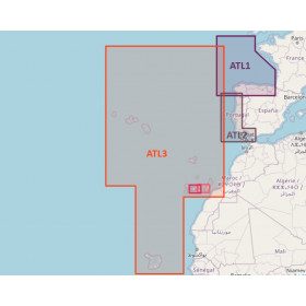
<h2>Atlantic Zone Sea Card Packs</h2>
<p>The nv-charts are characterized by fine contours and easy to distinguish colour graduations of the depth lines: turquoise for coral reefs, red for the 2-metre line and blue for the 5-metre zones. Presented in a practical and user-friendly format (A3 closed and A2 open), a thick plastic envelope protects the charts, making them easy to store. The importance of a good graphic representation of the topography when navigating the Atlantic is essential.<br /><br />Well-marked rivers, towns and street maps all contribute to a clear overview of the islands' waterfront facilities. Red numbered waypoints with coordinates based on WGS 84 allow mariners to navigate with their GPS instruments. Heights and depths are shown in the internationally recognized metre format. Large-scale approaches and land contour markings simplify entry into anchorages.</p>
<h2><span style="color:#ff0000;">Picksea is Premium Reseller of NV-Charts</span></h2>
<h2>NV-Charts Atlantic Zone Marine Card Packs Features</h2>
available


-
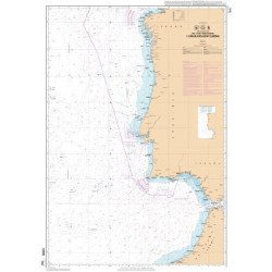
<p style="text-align:justify;">Shom 6624 nautical chart for sailing along the Portuguese and African coasts. Ideal for the sailor who wishes to make a transatlantic crossing.</p>
available
-
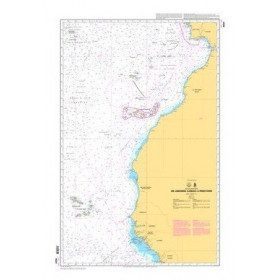
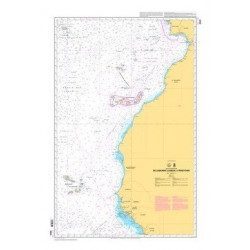
<p>Official SHOM chart - 7212 L - Cape Finisterre to Casablanca - Scale 1: 100000</p>
available
-
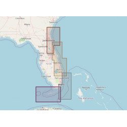
<h2>Marine Card Packs for the Caribbean and West Indies Zone</h2>
<p style="text-align:justify;"><span>The nv-charts are characterized by fine contours and easily distinguishable colour graduations of the depth lines: turquoise for coral reefs, red for the 2-metre line and blue for the 5-metre zones. </span><span>Presented in a practical and user-friendly format (A3 closed and A2 open), a thick plastic envelope protects the cards, making them easy to store. </span><span>The importance of a good graphic representation of the topography when navigating in the Caribbean is essential.</span><br /><br /><span>Well-marked rivers, towns and street maps all contribute to a clear overview of the islands' waterfront facilities. Red numbered waypoints with coordinates based on WGS 84 allow mariners to navigate with their GPS instruments. Heights and depths are shown in the internationally recognized metre format. Large-scale approaches and land contour markings simplify entry into anchorages.</span></p>
<h2 style="text-align:justify;"><span style="color:#ff0000;">Picksea is Premium Reseller of NV-Charts</span></h2>
<h2><span>Features of NV-Charts Caribbean Zone Packs</span></h2>
available