available


Detailed features

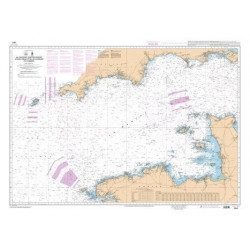
Imray Marine Chart M12 Cabo de Gata to Denia and Ibiza
Plans included: Mar Menor (1:75 000) Torrevieja (1:20 000) Alicante (1:30 000) Villajoyosa (1:15 000) Altea (1:15 000) Dénia (1:25 000) Cartagena (1:15 000) This edition includes the latest official Instituto Hidrográfico de la Marina Digital, combined with additional information sourced from Imray's network to make it ideal for small craft. The chart has been fully revised throughout. The main panel has been rescaled to 1:450,000 for consistency with other M-Series charts in Mediterranean Spain. The plan of Mar Menor now provides coverage at an improved larger scale. A new plan of Cartagena has been added.
Specifications of the Imray Marine Chart M12 Cabo de Gata to Denia and Ibiza
- Author: Imray M Series
- Publication details: 640 x 900mm folded to A4, Water-resistant paper chart in plastic wallet or flat on request
- Edition date: 2023
In the same category
4 other products seleted for you-
available

-
<p style="text-align:justify;">Shom 7311 nautical chart for cruising in the Channel : Scilly, Ouessant, Jersay, Guernsey, everything is there.</p>
available
-
<div class="fiche-txt">
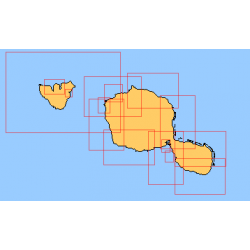
<h2>Choose from the list below an unfolded nautical chart of the sailing areas around Tahiti and the Society Islands</h2>
<p>This set of charts covers the whole of the Society Islands in unfolded Shom marine charts delivered in a tube. These charts detail the exact navigation areas of the islands. Choose from the list below the area you wish to explore by referring to the chart number associated with the desired navigation area. Indicate the map number you have chosen in the comments of your order.</p>
<h2>List of chart references and areas covered:</h2>
</div>
available
-
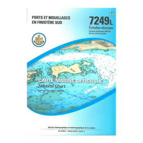
<p>Nautical chart SHOM 7249L. Ports and anchorages in South Finistère. Scale: 1:20000.</p>
available