")
")
")
Detailed features

A5 adhesive marine code Region B
The A5 sticky marine code for boats in Region B (Americas, Japan, Korea) displays the essential navigation rules concerning the beacons in maritime navigation. It can replace the mandatory document on buoyage. CONFORMS TO D240
Characteristics of the Marine Code Maritime buoyage Region B
The adhesive marine code for boats Beaconing region B (Americas, Japan, Korea) displays the essential navigation rules concerning beacons in maritime navigation. It can replace the mandatory document on the RIPAM on board in basic or coastal navigation (according to the provisions of division 240*).
The A5 format of the adhesive allows it to be easily placed on board the boat outside or in the cabin.
Extract from Division 240 (version applicable on June 1, 2019) - Article 240-2.04: coastal armament and safety equipment for recreational vessels sailing from 2 to less than 6 miles from a shelter.
.../...
8. A document describing the marking system of the area frequented, possibly in the form of self-adhesive plates ...
.../...
7. The International Regulations for Preventing Collisions at Sea (RIPAM), or a textual and graphic summary, possibly in the form of self-adhesive leaflets ...
- Size of each sheet: A5 (21 x 15 mm)
- MYLAR support
- Quadricolour Edition
In the same category
4 other products seleted for you-
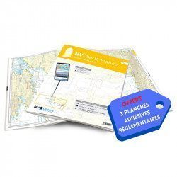
<h2>NV-CHARTS FR9 - 70 Mediterranean Sea charts (from Cap Creus to Toulon) + the 3 regulatory adhesive sheets</h2>
<p><span style="font-size:10pt;">In this NV-Charts FR9 pack, you will find an Atlas of <span>70 Mediterranean charts from Cap Creus to Toulon including 3 offshore charts, 14 coastal charts and 53 detailed charts</span>. With a personal download code, you will have access to all the maps in digital format as well as the <strong>NV Graphical Navigator light navigation software</strong> both freely usable on PC, tablets or smartphone!</span></p>
<p><span style="font-size:10pt;">The areas represented are: <strong>Mediterranean - Port Vendres, Leucate, Canet, Port La Nouvelle, Gruissan, Cap d'Agde, Palavas, Port Camargue, La Grande Motte, Martigue, Carry, Marseille, Calanques, Cassis, La Ciotat, Saint Cyr, Bandol, Toulon (FRANCE)</strong></span></p>
<p><span style="font-size:10pt;"><span style="color:#ff0000;"><strong>Free with your FR9 pack:</strong></span> 3 adhesive sheets containing the mandatory regulatory documentation (RIPAM, buoys and flags) for navigation in coastal areas (art 242-2.04 of Division 240). <span style="color:#ff0000;"><strong>When you buy your pack, you have all the regulatory documentation for sailing within 6 miles of a shelter.</strong></span></span></p>
<h2>Description of the FR9 card pack</h2>
available
-
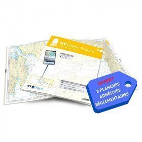
<h2>NV-CHARTS FR3 - 28 North Brittany Nautical Charts (Saint Malo aux Sept Îles) + the 3 regulatory adhesive sheets</h2>
<p><span style="font-size:10pt;">In this pack NV-Charts FR3, you will find an Atlas of 28 marine maps of <span>Saint Malo aux Sept Îles </span>including 3 offshore charts, 10 coastal charts and 15 detailed charts. With a personal download code, you will have access to all the maps in digital format as well as the <strong>NV Graphical Navigator light navigation software</strong> both freely usable on PC, tablets or smartphone!</span></p>
<p><span style="font-size:10pt;">The area represents the Channel (FRANCE), and more precisely the following areas: <strong>North Brittany - Saint Malo, Saint Cast, Baie de Saint Brieuc, Paimpol, Saint Quay, Perros Guirec, Trébeurden.</strong></span></p>
<p><span><span style="font-size:10pt;"><span style="color:#ff0000;"><strong>Free with your FR3 pack:</strong></span> 3 adhesive sheets containing the mandatory regulatory documentation (RIPAM, buoys and flags) for navigation in coastal areas (art 242-2.04 of Division 240). </span><span style="color:#ff0000;"><strong><span style="font-size:10pt;">When you buy your pack, you have all the regulatory documentation for sailing within 6 miles of a shelter</span>.</strong></span></span></p>
<h2>Description of the FR3 card pack</h2>
available
-
<div class="fiche-txt">
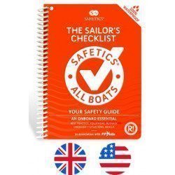
<h2>The Safetics safety guide english version : Sailboats and Motors</h2>
<p style="text-align:justify;">Safetics® The Sailor’s Checklist is the first English-language navigation guide written in the form of aviation-style check-lists. Recommended by Coast guards and translated and adapted by English skipper Pip Hare, it compiles all major navigation rules as well as procedures validated by sea safety experts. Its universal and practical content has been designed for both skippers and crew members, and is suitable for sailboats and powerboats. Its waterproof and tear proof format allows an unrivalled durability.</p>
<p style="text-align:justify;">This guide is the result of the work of enthusiasts who decided to create a simple and intuitive memo for pleasure boating. Its content is based on official recommendations, as well as on numerous feedbacks and experts' opinions, including in particular that of <strong>Armel Le Cléac'h </strong>a skipper and professional sailor. A real Sailor's Checklist for sailing and motor boats.</p>
<h2>Features of the Safetics Sailing Guide: Sailor's Checklist</h2>
</div>
available

-
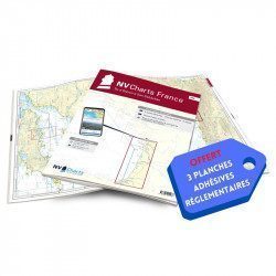
<h2>NV-CHARTS FR8 - 33 Aquitaine Marine Charts (from La Rochelle to San Sebastian) + the 3 regulatory adhesive sheets</h2>
<p><span style="font-size:10pt;">In this NV-Charts FR8 pack, you will find an Atlas of <span>33 Aquitaine charts from La Rochelle to San Sebastian including 3 offshore charts, 15 coastal charts and 15 detailed charts</span>. With a personal download code, you will have access to all the maps in digital format as well as the <strong>NV Graphical Navigator light navigation software</strong> both freely usable on PC, tablets or smartphone!</span></p>
<p><span style="font-size:10pt;">The areas represented are: <strong>Aquitaine - La Rochelle, Ré, Oléron, Rochefort, Royan, Gironde, Bordeaux, Arcachon, Bayonne, Biarritz, Saint Jean de Luz, San Sebastian (FRANCE)</strong></span></p>
<p><span style="font-size:10pt;"><span style="color:#ff0000;"><strong>Free with your FR8 pack:</strong> </span>3 adhesive sheets containing the mandatory regulatory documentation (RIPAM, buoys and flags) for navigation in coastal areas (art 242-2.04 of Division 240). <span style="color:#ff0000;"><strong>When you buy your pack, you have all the regulatory documentation for sailing within 6 miles of a shelter.</strong></span></span></p>
<h2>Description of the FR8 card pack</h2>
available