")
")
")
Detailed features

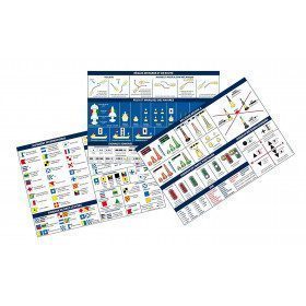
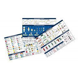
Adhesive Marine Code A5 Rules of Navigation (RIPAM)
This A5 sticker marine code for ships displays the essential international maritime regulations on the rules of the road and helm in navigation. It can replace the mandatory document (Division 240) on the RIPAM in navigation. CONFORMS TO D240
Features of the RIPAM Marine Code
The RIPAM adhesive marine code for boats displays the essentials of the international maritime regulations on the rules of the road and helm in navigation. It can replace the mandatory RIPAM document on board in basic or coastal navigation (as per the provisions of Division 240*).
The A5 format of the adhesive allows it to be easily placed on board the boat outside or in the cabin.
Extract from Division 240 (version applicable on June 1, 2019) - Article 240-2.04: coastal armament and safety equipment for recreational vessels sailing from 2 to less than 6 miles from a shelter.
.../...
7. The International Regulations for Preventing Collisions at Sea (RIPAM), or a textual and graphic summary, possibly in the form of self-adhesive leaflets ...
- Size of each sheet: A5 (21 x 15 mm)
- MYLAR support
- Quadricolour Edition
In the same category
4 other products seleted for you-
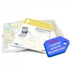
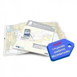
<h2>NV-CHARTS FR3 - 28 North Brittany Nautical Charts (Saint Malo aux Sept Îles) + the 3 regulatory adhesive sheets</h2>
<p><span style="font-size:10pt;">In this pack NV-Charts FR3, you will find an Atlas of 28 marine maps of <span>Saint Malo aux Sept Îles </span>including 3 offshore charts, 10 coastal charts and 15 detailed charts. With a personal download code, you will have access to all the maps in digital format as well as the <strong>NV Graphical Navigator light navigation software</strong> both freely usable on PC, tablets or smartphone!</span></p>
<p><span style="font-size:10pt;">The area represents the Channel (FRANCE), and more precisely the following areas: <strong>North Brittany - Saint Malo, Saint Cast, Baie de Saint Brieuc, Paimpol, Saint Quay, Perros Guirec, Trébeurden.</strong></span></p>
<p><span><span style="font-size:10pt;"><span style="color:#ff0000;"><strong>Free with your FR3 pack:</strong></span> 3 adhesive sheets containing the mandatory regulatory documentation (RIPAM, buoys and flags) for navigation in coastal areas (art 242-2.04 of Division 240). </span><span style="color:#ff0000;"><strong><span style="font-size:10pt;">When you buy your pack, you have all the regulatory documentation for sailing within 6 miles of a shelter</span>.</strong></span></span></p>
<h2>Description of the FR3 card pack</h2>
available
-
<div class="fiche-txt">
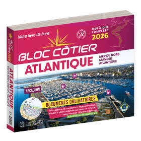
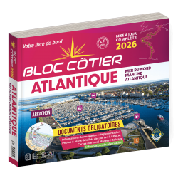
<h2>Indispensable for sailing within 6 miles from a shelter: the Atlantic 2025 Bloc Cotier !</h2>
<p style="text-align:justify;">The Atlantic 2025 bloc cotier is a smaller work than the Marine block, bringing together all the compulsory and regulatory elements on board a boat for coastal sailing, i.e. within 6 miles of a shelter according to the regulations in force. It also offers you access to all the essential documents on board, such as port descriptions and updated maps. With even more photos, the coastal block also includes a complete atlas. The mandatory regulations for 2025 have also been completely updated.</p>
<h2>Detailed summary of the Atlantic Bloc Cotier 2025</h2>
</div>
available

-
<h2>Code Marin réglementaire bateau : Pack of 3 A5 adhesive sheets</h2>
<p>The regulatory marine code in 3 self-adhesive sheets RIPAM / Buoyage / Flags gathers the essential of the international maritime regulations for pleasure boating. A5 format, easier to put on board. <span style="color:#ff0000;"><strong>CONFORMS TO D240</strong></span></p>
<h2>Characteristics of the Marine Code in a pack of 3 A5 sheets</h2>
available
-
<h2>NV-CHARTS FR1 - 48 Channel Charts (Oostende to Cherbourg) + the 3 regulatory adhesive sheets</h2>
<p style="text-align:justify;"><span style="font-size:10pt;">In this NV-Charts FR1 pack, you will find an Atlas of 48 nautical charts from Oostende to Cherbourg including 4 offshore charts, 15 coastal charts and 29 detailed charts. Thanks to a personal download code, you will have access to all the charts in digital format as well as to the <strong>NV Graphical Navigator light navigation software</strong> both freely usable on PC, tablets or smartphone!</span></p>
<p style="text-align:justify;"><span style="font-size:10pt;">The area represents the Channel (FRANCE), and more precisely the following areas: <strong>Normandy - Zeebrugge, Dunkirk, Calais, Le Havre, Cherbourg.</strong></span></p>
<p style="text-align:justify;"><span style="font-size:10pt;"><span style="color:#ff0000;background-color:#ffffff;"><strong>Free with your FR1 pack:</strong></span> 3 adhesive sheets containing the mandatory regulatory documentation (RIPAM, buoys and flags) for navigation in coastal areas (art 242-2.04 of Division 240). <span style="color:#ff0000;"><strong>When you buy your pack, you have all the regulatory documentation for sailing within 6 miles of a shelter.</strong></span></span></p>
<h2>Description of the FR1 card pack</h2>
available