available


Detailed features

Adjustable telescopic spare paddle in sizes 55 cm to 107 cm
This telescopic aluminium paddle is adjustable in length. Compact, it measures 55cm when folded, 107cm when unfolded. Practical, it could be useful in case of a hard blow in a boat or lack of wind in a dinghy! Sold by 2, easy to store in a trunk or even in a bag.
Characteristics of Plastimo telescopic spare paddles
- In anodized aluminium
- Diameter: 25 / 30 mm
- Finish: anodized aluminum
- Length : 55 to 107cm
- Sold by 2
In the same category
4 other products seleted for you-
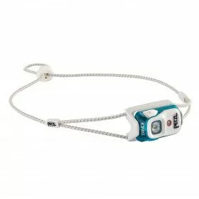
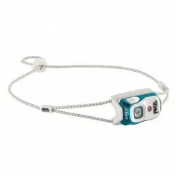
<h2><span>Ultra-lightweight, rechargeable headlamp for everyday use</span></h2>
<p>The ultra-lightweight, rechargeable BINDI daily-use headlamp by Petzl provides 200 lumens of maximum power for 50 hours (at lowest light setting). <span>Ultra-light with a weight of 35 g, the BINDI lamp fits in the palm of your hand. It is ideal for regular training, in town or in the mountains. Practical, it can be recharged directly by USB cable. The headband, thin and quickly adjustable, also allows to wear it easily around the neck.</span></p>
<h2>Detailed characteristics of the headlamp PETZL BINDI</h2>
available

-
<div class="fiche-txt">
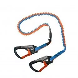
<h2>Elastic lifeline - 2 meters - 2 carabiners, Racing version</h2>
<p>This lanyard is a high performance lanyard. This new model has lighter safety lines with a custom clip. It is up to 50% lighter and much more compact than conventional safety lines. Innovation also of the straps thanks to the Dry Coated which allows to reduce the absorption and to remain lighter for longer.</p>
<h2>The detailed characteristics of this Racing life span</h2>
</div>
available
-
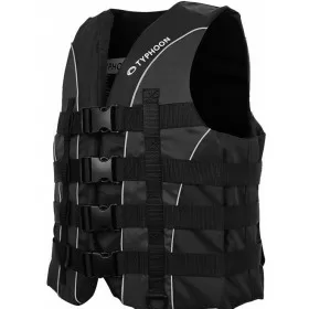
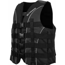
<h2>Vest SOLVA 50N, from Typhoon, designed for ski, wakeboard, jet-ski</h2>
<p>The SOLVA 50N vest is specially designed by Plastimo and Typhoon for towed sports or jet-skiing. Its high impact resistance foam, its 4 buckles closure with adjustment, its ring to attach the circuit breaker, make it a practical, reliable vest, while remaining comfortable and easy to put on and take off. Its fabric is soft but very resistant. The Solva vest is the vest that offers excellent value for money, comfort, reliability and safety.</p>
<h2>Features of the SOLVA 50N Ski vest</h2>
available
-
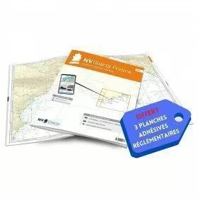
<h2>NV-CHARTS FR10 - 45 Côte d'Azur Nautical Charts (from Toulon to Menton) + the 3 regulatory adhesive boards</h2>
<p><span style="font-size:10pt;">In this NV-Charts FR10 pack, you will find an Atlas of <span>45 Mediterranean Riviera charts from Toulon to Menton and Monaco including 2 offshore charts, 11 coastal charts and 32 detailed charts.</span> With a personal download code, you will have access to all the maps in digital format as well as the <strong>NV Graphical Navigator light navigation software</strong> both freely usable on PC, tablets or smartphone!</span></p>
<p><span style="font-size:10pt;">The areas represented are: <strong>Mediterranean Riviera - Toulon, Hyères, Port Cros, Porquerolles, Fréjus, Saint Raphaël, Cannes, Antibes, Nice, Monaco, Menton (FRANCE).</strong></span></p>
<p><span style="font-size:10pt;"><span style="color:#ff0000;"><strong>Free with your FR10 pack:</strong></span> 3 adhesive sheets containing the mandatory regulatory documentation (RIPAM, buoys and flags) for navigation in coastal areas (art 242-2.04 of Division 240). <span style="color:#ff0000;"><strong>When you buy your pack, you have all the regulatory documentation for sailing within 6 miles of a shelter.</strong></span></span></p>
<h2>Description of the FR10 card pack</h2>
available