unavailable


€85.00 Tax included
clear
Please call us +33 297 11 80 95
-
Livraison en points relais : Gratuit
Une question ?
+33 2 97 11 80 95
Detailed features
A support for your SpeedPuck GPS to be fixed on your catamaran pole
Ingenious and practical, this bracket designed for the SpeedPuck GPS is to be fixed on your catamaran pole!
The characteristics of the Velocitek SpeedPuck GPS holder for catamarans
- Stand for SpeedPuck
- Designed for catamarans
- Made of epoxy resin
- Weight : 70g
In the same category
4 other products seleted for you-
<div class="fiche-txt">
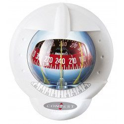
<h2>The famous Contest 101 compass to help you stay on course!</h2>
<p>This Contest 101 compass, for sailboats of 9 meters and more, is very practical with its possibility of double reading from the cockpit or the cabin. It can be mounted on any type of bulkhead and is compatible with the drilling of its predecessor, the Contest 100 compass.<br />It has some very interesting technical features: an integrated bulb to light up the rose, absolute waterproofness with its Vuiton membrane, anti-UV treated parts, 3 aliads and finally, an anti-theft system!</p>
<h2>Features of the Plastimo Contest 101 Compass</h2>
</div>
available

-
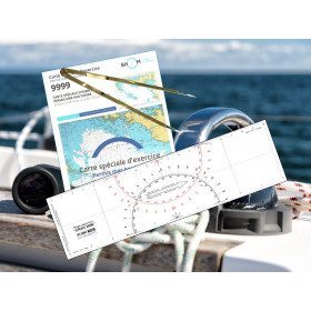
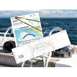
<h2><strong>The essential pack to prepare your offshore licence</strong></h2>
<p style="text-align:justify;">A set of quality tools to pass your offshore licence! Picksea is the owner of the Flash-Tide Instruments brand and our teams manufacture in France, in Lorient, all models of <a href="https://www.picksea.com/en/106806-cras-navigation-rules">rules cras</a> or Breton. Picksea is also a SHOM agent. We are therefore the best able to provide you with a pack composed of the best products at the best price.</p>
<h2>Composition of the offshore licence pack</h2>
available
-
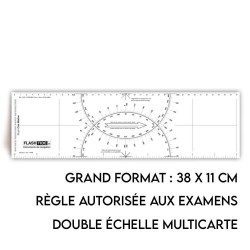
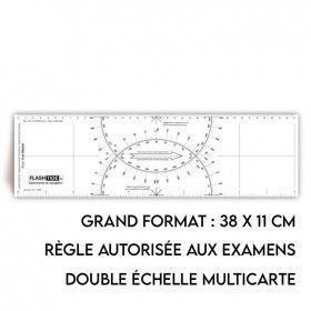
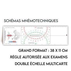
<h2>Polaris Tricolour Ruler</h2>
<p style="text-align:justify;">The three-colour red, green and black cras ruler is very popular with boaters and boat licence applicants because it is more practical and easier to read than traditional cras rulers.</p>
<h2>Features of the Polaris Ruler</h2>
available
-
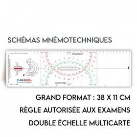
<h2>Standard Cras Rule</h2>
<p style="text-align:justify;"><span>This black ruler is very popular with boaters and boat license applicants because it is more practical and easier to read than other brands of rulers.</span></p>
<h2><span>Features of the Standard Cras rule</span></h2>
available