available


In the same category
4 other products seleted for you-
<h2>Make your sea fishing trips a success</h2>
<p><span>This manual is written by Guillaume Fourrier, holder of 19 fishing records. He explains to us <span>all the modern techniques of sea fishing, the necessary equipment and the assemblies through diagrams and photographs. </span></span></p>
<h2>Characteristics of the manual : The sea fishing guide</h2>
available

-
available

-
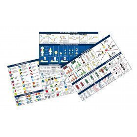
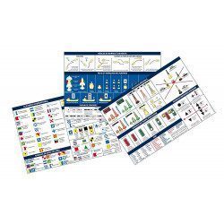
<h2>Code Marin réglementaire bateau : Pack of 3 A5 adhesive sheets</h2>
<p>The regulatory marine code in 3 self-adhesive sheets RIPAM / Buoyage / Flags gathers the essential of the international maritime regulations for pleasure boating. A5 format, easier to put on board. <span style="color:#ff0000;"><strong>CONFORMS TO D240</strong></span></p>
<h2>Characteristics of the Marine Code in a pack of 3 A5 sheets</h2>
available
-
<div class="fiche-txt">
<h2>Underwater life by Vagnon</h2>
<p><strong>Patrick Louisy</strong> and <strong>Jean Attard</strong> have the ambition to offer you the keys of the <strong>underwater world</strong>. They did not want to make another book describing the fauna and flora, but an innovative work that accompanies you in your discovery and answers your questions. How does life at sea work and how is it organised? How do you find your way through the amazing diversity of marine organisms? What to see and do when you are curious about underwater life?</p>
<h2>Picksea specialist of the sea and its seabed!</h2>
<p>Picksea has established itself as a leader in nautical equipment but also in documentation, with specialized books according to your desires and passions. Boating, scuba diving, or even boating licenses.</p>
<h2>Features</h2>
</div>
unavailable