available


In the same category
4 other products seleted for you-
<p>Marine chart for coastal navigation. SHOM 7128 L - Bay of Saint Brieuc - from Pointe de la Tour to Yffiniac Cove. Scale 1:25000</p>
available
-
<h2>NV-CHARTS FR5 - 29 South West Brittany nautical charts (from Douarnenez to Lorient) + the 3 statutory adhesive sheets</h2>
<p><span style="font-size:10pt;">In this NV-Charts FR5 pack, you will find an Atlas of <span>29 charts of South-West Brittany, from Douarnenez to Lorient, including 2 deep-sea charts, 11 coastal charts and 16 detailed charts</span>. With a personal download code, you will have access to all the maps in digital format as well as the <strong>NV Graphical Navigator light navigation software</strong> both freely usable on PC, tablets or smartphone!</span></p>
<p><span style="font-size:10pt;">The areas represented are: <strong>South West Brittany Douarnenez, Sein, Audierne, Guilvinec, Loctudy, Bénodet, Port La Forêt, Concarneau, Les Glénan, Aven Belon, Doëlan, Groix, Lorient(FRANCE).</strong></span></p>
<p><span style="font-size:10pt;"><span style="color:#ff0000;"><strong>Free with your FR5 pack:</strong></span> 3 adhesive sheets containing the mandatory regulatory documentation (RIPAM, buoys and flags) for navigation in coastal areas (art 242-2.04 of Division 240). <span style="color:#ff0000;"><strong>When you buy your pack, you have all the regulatory documentation for sailing within 6 miles of a shelter.</strong></span></span></p>
<h2>Description of the FR5 card pack</h2>
available
-
<p>Marine chart SHOM 7135 L. From the point of Saint Jacques to Damgan. Scale 1:15000.</p>
available
-
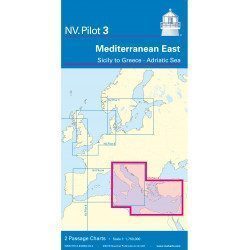
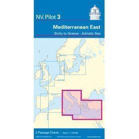
<h2>East Mediterranean Offshore Marine Chart</h2>
<p><span>The NV Pilot 3 offshore chart covers the Eastern Mediterranean: on the front side the Tyrrhenian Sea, the Adriatic Sea, the Ionian Sea and the region of Sicily up to the coast of Tunisia. The reverse side covers the Mediterranean Sea up to longitude 17°E</span></p>
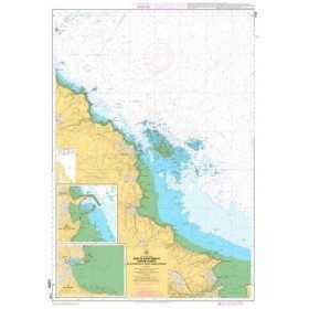
<h2>Details on the NV Pilot 3 map - East Mediterranean</h2>
available